Cote Hill
Hill, Mountain in Yorkshire Harrogate
England
Cote Hill

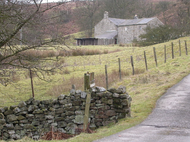
Cote Hill is a picturesque hill located in the county of Yorkshire, England. Situated in the western part of the county, it is a prominent feature of the Yorkshire Dales National Park. Cote Hill is part of a range of hills known as the Pennines, which stretch across northern England.
Rising to an elevation of approximately 564 meters (1,850 feet), Cote Hill offers stunning panoramic views of the surrounding countryside. The hill is characterized by its gentle slopes and lush green meadows, which are dotted with sheep grazing peacefully. The area is renowned for its natural beauty, attracting hikers, nature enthusiasts, and photographers throughout the year.
Cote Hill is home to a variety of flora and fauna, including heather, bilberry, and numerous bird species. The hillside is crisscrossed with footpaths and bridleways, allowing visitors to explore its scenic beauty and discover hidden gems along the way.
The hill is also steeped in history, with evidence of ancient settlements and farming practices dating back thousands of years. The nearby villages and towns offer a glimpse into the region's rich cultural heritage, with traditional stone-built houses and charming village pubs.
Cote Hill is a popular destination for outdoor activities such as hiking, cycling, and birdwatching. Its serene and tranquil atmosphere provides a perfect escape from the hustle and bustle of city life, offering visitors a chance to reconnect with nature and enjoy the beauty of the Yorkshire countryside.
If you have any feedback on the listing, please let us know in the comments section below.
Cote Hill Images
Images are sourced within 2km of 53.985192/-1.7578127 or Grid Reference SE1554. Thanks to Geograph Open Source API. All images are credited.


Cote Hill is located at Grid Ref: SE1554 (Lat: 53.985192, Lng: -1.7578127)
Division: West Riding
Administrative County: North Yorkshire
District: Harrogate
Police Authority: North Yorkshire
What 3 Words
///relaxing.unpainted.shun. Near Ilkley, West Yorkshire
Nearby Locations
Related Wikis

Blubberhouses
Blubberhouses is a small village and civil parish in the Washburn Valley in North Yorkshire, England. The population as at the 2011 Census was less than...

Kex Gill Bypass
The Kex Gill Bypass is a future stretch of A-road across Kex Gill Moor to Blubberhouses in North Yorkshire, England. The route is part of the A59 road...

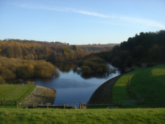
Fewston Reservoir
Fewston Reservoir is located in the Washburn valley north of Otley and west of Harrogate in Yorkshire, England. It was built in 1879. The capacity is about...

Fewston
Fewston is a village and civil parish in the Harrogate district of North Yorkshire, England. It is situated north of Otley and close to Swinsty and Fewston...

Timble
Timble is a village in the Harrogate district of North Yorkshire, England. It is situated on the slopes of the Washburn valley, north of Otley and close...

Thruscross Reservoir
Thruscross Reservoir is the northernmost of four reservoirs in the Washburn valley, lying north of Otley and west of Harrogate in North Yorkshire, England...

HMS Forest Moor
HMS Forest Moor was a Royal Navy land base located in Nidderdale in the borough of Harrogate, North Yorkshire, England. == History == The establishment...
Swinsty Reservoir
Swinsty Reservoir is a reservoir in the Washburn valley north of Otley and west of Harrogate in Yorkshire, England. Construction began in 1871 and was...
Nearby Amenities
Located within 500m of 53.985192,-1.7578127Have you been to Cote Hill?
Leave your review of Cote Hill below (or comments, questions and feedback).