Black Hill

Hill, Mountain in Yorkshire Harrogate

England

Black Hill

Blubberhouses Early Sunday morning at Blubberhouses Cricket club, locals prepare for a Duck race and Country fair in aid of Motor Neurone Disease Association
Blubberhouses Credit: Mick Melvin

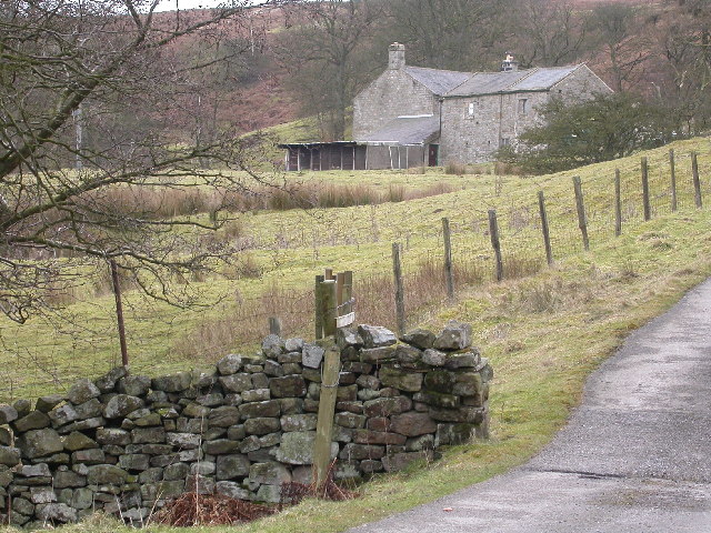
Black Hill is a prominent peak located in the Pennines, a mountain range in northern England. Situated in the county of Yorkshire, specifically in the South Pennines region, it stands at an elevation of 582 meters (1,909 feet) above sea level. Although it is not the highest peak in the area, it is recognized for its outstanding beauty and popular among hikers, walkers, and outdoor enthusiasts.

The hill is composed mainly of millstone grit, a coarse sandstone that forms the rugged terrain and gives Black Hill its distinct appearance. The summit offers breathtaking panoramic views of the surrounding countryside, including the rolling hills, moorlands, and valleys that characterize the Yorkshire landscape. On clear days, it is possible to see as far as the cities of Manchester and Leeds.

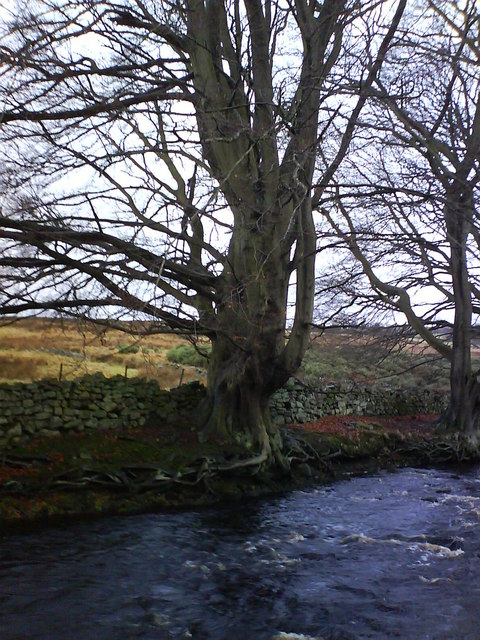
The area surrounding Black Hill is designated as a Site of Special Scientific Interest (SSSI) due to its diverse and unique flora and fauna. Heather moorland dominates the landscape, providing a habitat for various bird species, including the elusive golden plover and merlin. The hill is also home to a wide range of plant species, such as bilberry, cotton grass, and cloudberry.

Access to Black Hill is provided by well-maintained footpaths, making it a popular destination for walkers and hikers of all abilities. The Pennine Way, a long-distance trail that stretches over 400 kilometers (248 miles), passes near the hill, attracting many visitors who choose to include Black Hill in their hiking itineraries.

Overall, Black Hill in Yorkshire offers a captivating natural setting and recreational opportunities that make it a cherished destination for outdoor enthusiasts and nature lovers alike.

If you have any feedback on the listing, please let us know in the comments section below.

Black Hill Images

Images are sourced within 2km of 53.986246/-1.7679632 or Grid Reference SE1554. Thanks to Geograph Open Source API. All images are credited.

Blubberhouses Early Sunday morning at Blubberhouses Cricket club, locals prepare for a Duck race and Country fair in aid of Motor Neurone Disease Association
Blubberhouses
Early Sunday morning at Blubberhouses Cricket club, locals prepare for a Duck race and Country fair in aid of Motor Neurone Disease Association
Blubberhouses Quarry Processing Plant. This quarry opened in the mid 1980's and less than 20 years later it is closed.
Blubberhouses Quarry
Processing Plant. This quarry opened in the mid 1980's and less than 20 years later it is closed.
Blubberhouses Quarry The quarry itself. This quarry opened in the mid 1980's and less than 20 years later it is closed.
Blubberhouses Quarry
The quarry itself. This quarry opened in the mid 1980's and less than 20 years later it is closed.
Bothams Farm Bothams Farm faces North-East and looks across the valley towards Blubberhouses on the opposite side of the A59. The track leading up to the farm is marked "Private" and barking dogs reinforce the fact!
Bothams Farm
Bothams Farm faces North-East and looks across the valley towards Blubberhouses on the opposite side of the A59. The track leading up to the farm is marked "Private" and barking dogs reinforce the fact!
Looking East from Shepherd Hill These fields now cover the course of a Roman Road which traversed the Washburn Valley. Fewston Reservoir (SE1754) is seen in the distance. The moles seem to prefer the field to the south of the wall!
Looking East from Shepherd Hill
These fields now cover the course of a Roman Road which traversed the Washburn Valley. Fewston Reservoir (SE1754) is seen in the distance. The moles seem to prefer the field to the south of the wall!
Roman Road, Blubberhouses Moor This footpath follows the course of a Roman Road across the wilderness of Blubberhouses Moor
Roman Road, Blubberhouses Moor
This footpath follows the course of a Roman Road across the wilderness of Blubberhouses Moor
Plantation on Back Allotment Large Plantation seen from Blubberhouses Moor
Plantation on Back Allotment
Large Plantation seen from Blubberhouses Moor
Part of Blubberhouses Moor A corner of a large tract of wilderness south of the A59 and north of Ilkley
Part of Blubberhouses Moor
A corner of a large tract of wilderness south of the A59 and north of Ilkley
Sun Bank Gill Walking along the course of the Roman Road to cross this small watercourse on Blubberhouses Moor
Sun Bank Gill
Walking along the course of the Roman Road to cross this small watercourse on Blubberhouses Moor
Sug Marsh Perhaps more appropriately should have been christened "Suck Marsh".  This is particularly juicy portion of Blubberhouses Moor
Sug Marsh
Perhaps more appropriately should have been christened "Suck Marsh". This is particularly juicy portion of Blubberhouses Moor
Blubberhouses, St Andrew's Church This Church is on the south side of the A59 at the junction with Shepherds Hill
Blubberhouses, St Andrew's Church
This Church is on the south side of the A59 at the junction with Shepherds Hill
North of Blubberhouses Fields of sheep on a summer's evening alongside the Washburn.
North of Blubberhouses
Fields of sheep on a summer's evening alongside the Washburn.
Cricket at Blubberhouses An evening match during the summer at Blubberhouses.
Cricket at Blubberhouses
An evening match during the summer at Blubberhouses.
Blubberhouses Church St. Andrew's Church, Blubberhouses. Viewed from the Fewston reservoir carpark.
Blubberhouses Church
St. Andrew's Church, Blubberhouses. Viewed from the Fewston reservoir carpark.
Blubberhouses: church of St. Andrew
Footpath and Gate from Timble Ings to Denton Moor
River Washburn The river Washburn has cut through the layers of sandstone here abouts as is flows south towards the r. Wharfe.
River Washburn
The river Washburn has cut through the layers of sandstone here abouts as is flows south towards the r. Wharfe.
An ancient beech There are many fine beech trees along the Washburn in this area, but none quite as large as this one.
An ancient beech
There are many fine beech trees along the Washburn in this area, but none quite as large as this one.
Show me another place!

Black Hill is located at Grid Ref: SE1554 (Lat: 53.986246, Lng: -1.7679632)

Division: West Riding

Administrative County: North Yorkshire

District: Harrogate

Police Authority: North Yorkshire

What 3 Words

///bond.soup.corrode. Near Ilkley, West Yorkshire

Related Wikis

Kex Gill Bypass

The Kex Gill Bypass is a future stretch of A-road across Kex Gill Moor to Blubberhouses in North Yorkshire, England. The route is part of the A59 road...

Blubberhouses

Blubberhouses is a small village and civil parish in the Washburn Valley in North Yorkshire, England. The population as at the 2011 Census was less than...

Fewston Reservoir

Fewston Reservoir is located in the Washburn valley north of Otley and west of Harrogate in Yorkshire, England. It was built in 1879. The capacity is about...

Fewston

Fewston is a village and civil parish in the Harrogate district of North Yorkshire, England. It is situated north of Otley and close to Swinsty and Fewston...

Timble

Timble is a village in the Harrogate district of North Yorkshire, England. It is situated on the slopes of the Washburn valley, north of Otley and close...

Thruscross Reservoir

Thruscross Reservoir is the northernmost of four reservoirs in the Washburn valley, lying north of Otley and west of Harrogate in North Yorkshire, England...

Thruscross

Thruscross is a small settlement and civil parish in the Harrogate district of North Yorkshire, England. It lies in the Washburn Valley, 11 miles (18...

HMS Forest Moor

HMS Forest Moor was a Royal Navy land base located in Nidderdale in the borough of Harrogate, North Yorkshire, England. == History == The establishment...

Nearby Amenities

Located within 500m of 53.986246,-1.7679632
Black Hill
Natural: peak
Source: OS OpenData StreetView
Lat/Long: 53.986618/-1.7677686
Flout Hill
Natural: peak
Source: OS OpenData StreetView
Lat/Long: 53.9879175/-1.7625758
Bothams Brow
Place: locality
Source: OS-OpenData_StreetView_2016_04
Lat/Long: 53.990054/-1.7679234
The data included in this document is from www.openstreetmap.org. The data is made available under ODbL.

Have you been to Black Hill?

Leave your review of Black Hill below (or comments, questions and feedback).