Barland Common

Settlement in Glamorgan

Wales

Barland Common

Pasture land in eastern Gower Hams Wood is in the distance, right.
Pasture land in eastern Gower Credit: Jonathan Billinger

Barland Common is a small village located in the county of Glamorgan, Wales. Situated in the southern part of the country, it is nestled amidst the picturesque rolling hills and lush green landscapes that characterize the region. The village itself is relatively small, with a population of around 500 residents.

Barland Common is known for its tranquil and rural atmosphere, making it an ideal destination for those seeking peace and quiet away from the bustling city. The village is primarily residential, with a scattering of quaint cottages and a few local businesses.

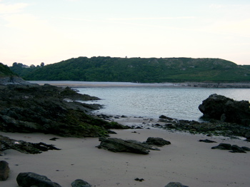
Surrounded by natural beauty, Barland Common offers ample opportunities for outdoor activities and exploration. The nearby countryside provides idyllic walking trails, perfect for those who enjoy hiking and nature walks. Additionally, the village is in close proximity to several notable attractions, including the stunning Glamorgan Heritage Coastline, which offers breathtaking seaside views and sandy beaches.

Despite its small size, Barland Common has a strong sense of community. The local residents are friendly and welcoming, and the village hosts a variety of events throughout the year, including village fairs and community gatherings. The village also has a primary school, a church, and a pub, which serves as a social hub for locals and visitors alike.

In summary, Barland Common is a charming village in Glamorgan, Wales, offering a peaceful and rural lifestyle in a beautiful natural setting. It is a place where residents and visitors can enjoy the tranquility of the countryside while still being within reach of nearby attractions and amenities.

If you have any feedback on the listing, please let us know in the comments section below.

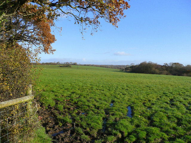
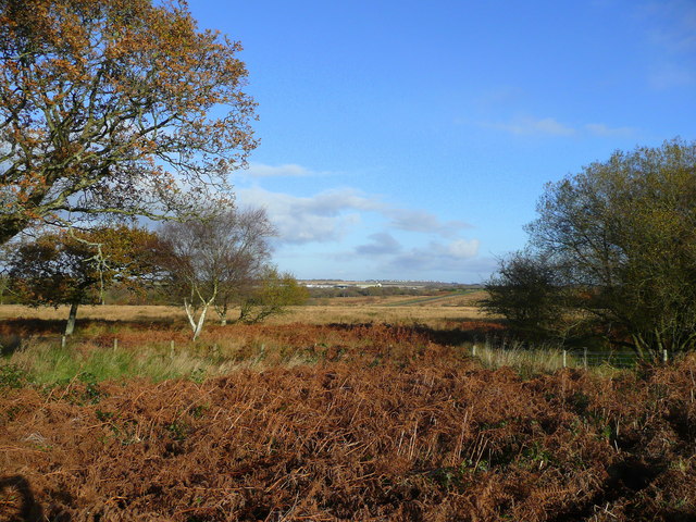
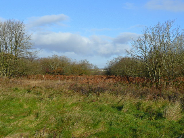
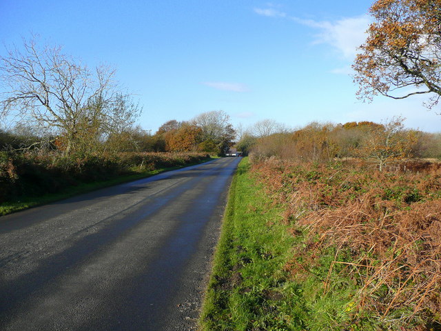
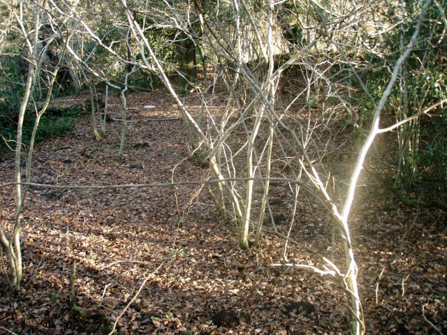
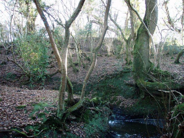
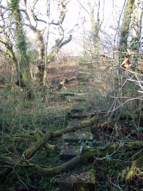
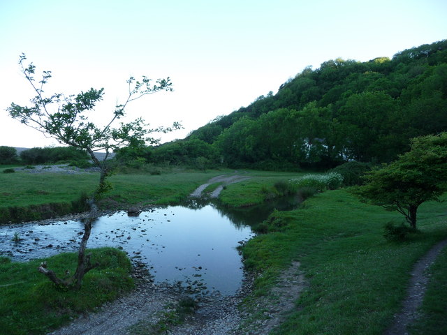
Barland Common Images

Images are sourced within 2km of 51.581919/-4.0508445 or Grid Reference SS5889. Thanks to Geograph Open Source API. All images are credited.

Pasture land in eastern Gower Hams Wood is in the distance, right.
Pasture land in eastern Gower
Hams Wood is in the distance, right.
Gower moorland View north from north of Kittle near Swansea Airport.
Gower moorland
View north from north of Kittle near Swansea Airport.
Edge of moorland Looking north from the Kittle Road.
Edge of moorland
Looking north from the Kittle Road.
Kittle Road Looking west towards the A4118 and Ilston.
Kittle Road
Looking west towards the A4118 and Ilston.
Inside the Motte This ancient and overgrown Motte lies on the southern edge of this square.  It was difficult to photograph in the strong low sunlight on Boxing Day afternoon but the low boundary walls can be seen over the other side - the walls formed an almost perfect circle - even now after so many years.  The over-exposed sunlit saplings in the foreground add to the magic of this hidden gem.
Inside the Motte
This ancient and overgrown Motte lies on the southern edge of this square. It was difficult to photograph in the strong low sunlight on Boxing Day afternoon but the low boundary walls can be seen over the other side - the walls formed an almost perfect circle - even now after so many years. The over-exposed sunlit saplings in the foreground add to the magic of this hidden gem.
Looking south towards the Motte Finding the Motte which is marked on the OS map is quite difficult.  But the stream and steep banks around its northern flank form a natural barrier around the bluff.
Looking south towards the Motte
Finding the Motte which is marked on the OS map is quite difficult. But the stream and steep banks around its northern flank form a natural barrier around the bluff.
Nature trail boardwalk The approach to the Motte is naturally guarded by streams and boggy ground.  In the recent past a permissive footpath has been established to allow walkers to enjoy this unspoilt corner of Bishopston Valley.  This photograph shows how nature works to reclaim the ground.
Nature trail boardwalk
The approach to the Motte is naturally guarded by streams and boggy ground. In the recent past a permissive footpath has been established to allow walkers to enjoy this unspoilt corner of Bishopston Valley. This photograph shows how nature works to reclaim the ground.
Footpath near the Bishopston Valley The waymarker directs to Southgate village (behind me) or Pwll Du Bay (to the right) but I am off to the left and the deep Bishopston Valley. A nice ford here often used by cattle (to drink at) and horse riders (to ride through).
Footpath near the Bishopston Valley
The waymarker directs to Southgate village (behind me) or Pwll Du Bay (to the right) but I am off to the left and the deep Bishopston Valley. A nice ford here often used by cattle (to drink at) and horse riders (to ride through).
Footbridge near the Bishopston Valley A footbridge crosses the stream here as the footpath passes through pretty woodland.
Footbridge near the Bishopston Valley
A footbridge crosses the stream here as the footpath passes through pretty woodland.
A June evening at Brandy Cove Brandy Cove is a small sandy cove with rocky sides and a quiet spot to spend some time on a sunny June evening. Apparently its name derives from the fact that it was an ideal landing point for smugglers bringing in contraband French Brandy in the 1700's.
A June evening at Brandy Cove
Brandy Cove is a small sandy cove with rocky sides and a quiet spot to spend some time on a sunny June evening. Apparently its name derives from the fact that it was an ideal landing point for smugglers bringing in contraband French Brandy in the 1700's.
The Gower coastline near Brandy Cove Whiteshell Point is the prominent headland beyond Caswell Bay.
The Gower coastline near Brandy Cove
Whiteshell Point is the prominent headland beyond Caswell Bay.
Pwlldu Bay, Gower What an impressive bay; sloping golden sands, high storm beach of bluey-white pebbles, almost a lagoon behind the storm beach, thickly wooded cliffs and valley and a few small cottages. A peaceful haven. But in the 19th century this spot was a hive of industry; the cliffs were quarried for limestone, the limestone was burned and shipped here to North Devon fields to be spread on the land, ships carrying this were beached awaiting their cargoes, and workers and sailors crowded the public houses, which is what these white cottages once were.
Pwlldu Bay, Gower
What an impressive bay; sloping golden sands, high storm beach of bluey-white pebbles, almost a lagoon behind the storm beach, thickly wooded cliffs and valley and a few small cottages. A peaceful haven. But in the 19th century this spot was a hive of industry; the cliffs were quarried for limestone, the limestone was burned and shipped here to North Devon fields to be spread on the land, ships carrying this were beached awaiting their cargoes, and workers and sailors crowded the public houses, which is what these white cottages once were.
Oh! The hand is out again... The NT have obviously employed the services of a donation operative who is housed in here to ensure that passing walkers cough up. A bit direct though. Almost pushy.
Oh! The hand is out again...
The NT have obviously employed the services of a donation operative who is housed in here to ensure that passing walkers cough up. A bit direct though. Almost pushy.
Ford behind Pwlldu Bay The cottages here are accessed in a vehicle through this picturesque ford.
Ford behind Pwlldu Bay
The cottages here are accessed in a vehicle through this picturesque ford.
St Teilo's Church, Bishopston This ancient church on the Gower peninsula has a public footpath running right through its churchyard. See <span class="nowrap"><a title="http://www.stteilosbishopston.co.uk/" rel="nofollow ugc noopener" href="http://www.stteilosbishopston.co.uk/">Link</a><img style="margin-left:2px;" alt="External link" title="External link - shift click to open in new window" src="https://s1.geograph.org.uk/img/external.png" width="10" height="10"/></span> for some history.
St Teilo's Church, Bishopston
This ancient church on the Gower peninsula has a public footpath running right through its churchyard. See LinkExternal link for some history.
Footbridge over the Bishopston Stream Bishopston Stream has disappeared down sink holes and reappeared in various different places at different times. 
Despite it not appearing on current maps it is now present above ground, here next to Church Lane. At the corner of Church Lane and Old Kittle Road if crosses the tarmac forming a shallow ford. This not entirely adjacent footbridge has been built to allow dry passage around the ford.
Footbridge over the Bishopston Stream
Bishopston Stream has disappeared down sink holes and reappeared in various different places at different times. Despite it not appearing on current maps it is now present above ground, here next to Church Lane. At the corner of Church Lane and Old Kittle Road if crosses the tarmac forming a shallow ford. This not entirely adjacent footbridge has been built to allow dry passage around the ford.
Bishopston Stream descends into a sink hole The Bishopston stream fords Church Lane / Old Kittle Road just a few yards upstream from here, visible in the background. After just a short run it disappears down a small sink hole and isn't seen again for another kilometre. The riverbed immediately downstream from here is dry but devoid of mulch or vegetation, hinting that this small sink hole lacks the capacity to devour the stream during greater flows.
See also <a href="https://www.geograph.org.uk/photo/2685596">SS5789 : Bishopston Stream disappears into a sink hole</a> for a close up of the sink hole.
Bishopston Stream descends into a sink hole
The Bishopston stream fords Church Lane / Old Kittle Road just a few yards upstream from here, visible in the background. After just a short run it disappears down a small sink hole and isn't seen again for another kilometre. The riverbed immediately downstream from here is dry but devoid of mulch or vegetation, hinting that this small sink hole lacks the capacity to devour the stream during greater flows. See also SS5789 : Bishopston Stream disappears into a sink hole for a close up of the sink hole.
Bishopston Stream disappears into a sink hole A close up of the small sink hole shown in <a href="https://www.geograph.org.uk/photo/2685585">SS5789 : Bishopston Stream descends into a sink hole</a>
Bishopston Stream disappears into a sink hole
A close up of the small sink hole shown in SS5789 : Bishopston Stream descends into a sink hole
Show me another place!

Barland Common is located at Grid Ref: SS5889 (Lat: 51.581919, Lng: -4.0508445)

Unitary Authority: Swansea

Police Authority: South Wales

What 3 Words

///beaters.salmon.task. Near Bishopston, Swansea

Related Wikis

Bishopston Comprehensive School

Bishopston Comprehensive School (Welsh: Ysgol Gyfun Llandeilo Ferwallt) is a comprehensive school in Bishopston, Swansea, Wales. It provides education...

Kittle, Swansea

Kittle is a village in the City and County of Swansea, Wales. The village is located on the B4436 road between Pennard and Bishopston, It is part of the...

Bishopston, Swansea

Bishopston (Welsh: Llandeilo Ferwallt, historically also Llanmerwallt and Llancyngur Trosgardi) is a large village and community situated on the Gower...

Pennard

Pennard (previously Llanarthbodu) is a village and community on the south of the Gower Peninsula, about 7 miles south-west of Swansea city centre. It falls...

Nearby Amenities

Located within 500m of 51.581919,-4.0508445
Bishopston
Is In: Swansea
Name Cy: Llandeilo Ferwallt
Place: village
Wikidata: Q4918101
Wikipedia: en:Bishopston, Swansea
Lat/Long: 51.5785703/-4.0531985
Fixme: patch to move from old location - is this actually there?
Ford: yes
Lat/Long: 51.5849657/-4.0548654
Turning Circle
Lat/Long: 51.580798/-4.0548192
Pub
The Joiners
Addr City: Bishopston
Addr Housenumber: 50
Addr Postcode: SA3 3EJ
Addr Street: Bishopston Road
Fhrs Id: 101507
Real Ale: yes
Source Addr: FHRS Open Data
Lat/Long: 51.583128/-4.0525298
Place Of Worship
St Teilo's
Denomination: anglican
Religion: christian
Website: https://www.stteilosbishopston.co.uk/
Wikidata: Q17743635
Lat/Long: 51.5851068/-4.053948
Co-op Food
Addr Housenumber: 51b
Addr Postcode: SA3 3EN
Addr Street: Bishopston Road
Brand: Co-op Food
Brand Wikidata: Q3277439
Fhrs Id: 740873
Old Name: Spar
Operator: The Co-operative Group
Operator Wikidata: Q117202
Shop: convenience
Source Addr: FHRS Open Data
Website: https://www.coop.co.uk/store-finder/SA3-3EN/bishopston-road
Lat/Long: 51.5822398/-4.0518506
Parking
Lat/Long: 51.5840646/-4.0481913
Bus Stop
St Teilo's Court SE
Bench: yes
Bin: yes
Bus: yes
Lit: yes
Naptan AtcoCode: 5810AWC50170
Naptan Bearing: SE
Naptan CommonName: St Teilio`s Court SE
Naptan Crossing: South Close
Naptan NaptanCode: swadamp
Naptan PlusbusZoneRef: SWANSEA
Naptan Street: Bishopston Road
Naptan Verified: no
Public Transport: platform
Shelter: yes
Source: naptan_import
Tactile Paving: yes
Lat/Long: 51.5804505/-4.0511059
Bus Stop
Valley Hotel (N)
Bus: yes
Naptan AtcoCode: 5810AWC50173
Naptan Bearing: N
Naptan CommonName: Valley Hotel (N)
Naptan Landmark: Valley Hotel PH
Naptan NaptanCode: swadamj
Naptan PlusbusZoneRef: SWANSEA
Naptan Street: Bishopston Road
Naptan Verified: no
Public Transport: platform
Source: naptan_import
Lat/Long: 51.5831943/-4.0524367
Bus Stop
Bishopston Comprehensive
Bus: yes
Naptan AtcoCode: 5810AWO27881
Naptan Bearing: S
Naptan CommonName: Bishopston Comprehensive
Naptan Crossing: The Glebe
Naptan Landmark: Bishopston Comprehensive
Naptan NaptanCode: swadamg
Naptan PlusbusZoneRef: SWANSEA
Naptan ShortCommonName: Bishopston Comprehensive School
Naptan Street: Grounds
Naptan Verified: no
Public Transport: platform
Source: naptan_import
Lat/Long: 51.584634/-4.048272
Bench
Jon's Garden
Lat/Long: 51.583275/-4.0502799
Restaurant
Dylan's
Addr: 11 Church Lane
Addr2: Bishopston
Addr3: Swansea
Addr Postcode: SA3 3JT
Fhrs Id: 740895
Note: Restaurant, open to non residents
Real Ale: yes
Source Addr: FHRS Open Data
Lat/Long: 51.5856308/-4.0538884
Pub
Gower Hotel
Addr: 11 Church Lane
Addr2: Bishopston
Addr3: Swansea
Addr Postcode: SA3 3JT
Fhrs Id: 740895
Note: Hotel bar, open to non residents.
Real Ale: yes
Source Addr: FHRS Open Data
Lat/Long: 51.5856444/-4.0539851
Holt Model Railways
Shop: model
Lat/Long: 51.5808873/-4.0516278
Entrance: main
Lat/Long: 51.5856169/-4.0540596
Direction: 185
Generator Method: photovoltaic
Generator Output Electricity: yes
Generator Solar Modules: 16
Generator Source: solar
Generator Type: solar_photovoltaic_panel
Location: roof
Power: generator
Lat/Long: 51.5814307/-4.0439035
Direction: SSE
Generator Method: photovoltaic
Generator Output Electricity: yes
Generator Solar Modules: 8
Generator Source: solar
Generator Type: solar_photovoltaic_panel
Location: roof
Power: generator
Lat/Long: 51.5811882/-4.0538283
Direction: SSE
Generator Method: photovoltaic
Generator Output Electricity: yes
Generator Solar Modules: 12
Generator Source: solar
Generator Type: solar_photovoltaic_panel
Location: roof
Power: generator
Lat/Long: 51.5810609/-4.0531555
Direction: SSE
Generator Method: photovoltaic
Generator Output Electricity: yes
Generator Solar Modules: 10
Generator Source: solar
Generator Type: solar_photovoltaic_panel
Location: roof
Power: generator
Lat/Long: 51.5810961/-4.0518651
Direction: SSE
Generator Method: photovoltaic
Generator Output Electricity: yes
Generator Solar Modules: 18
Generator Source: solar
Generator Type: solar_photovoltaic_panel
Location: roof
Power: generator
Lat/Long: 51.5808074/-4.051124
Direction: WSW
Generator Method: photovoltaic
Generator Output Electricity: yes
Generator Solar Modules: 14
Generator Source: solar
Generator Type: solar_photovoltaic_panel
Location: roof
Power: generator
Lat/Long: 51.5782013/-4.0480174
Direction: WSW
Generator Method: photovoltaic
Generator Output Electricity: yes
Generator Solar Modules: 6
Generator Source: solar
Generator Type: solar_photovoltaic_panel
Location: roof
Power: generator
Lat/Long: 51.5810761/-4.0517883
Direction: SSE
Generator Method: photovoltaic
Generator Output Electricity: yes
Generator Solar Modules: 10
Generator Source: solar
Generator Type: solar_photovoltaic_panel
Location: roof
Power: generator
Lat/Long: 51.5812968/-4.0518402
Direction: WSW
Generator Method: photovoltaic
Generator Output Electricity: yes
Generator Solar Modules: 4
Generator Source: solar
Generator Type: solar_photovoltaic_panel
Location: roof
Power: generator
Lat/Long: 51.5812638/-4.051964
Direction: 190
Generator Method: photovoltaic
Generator Output Electricity: yes
Generator Solar Modules: 10
Generator Source: solar
Generator Type: solar_photovoltaic_panel
Location: roof
Power: generator
Lat/Long: 51.5851402/-4.0528699
Direction: 185
Generator Method: photovoltaic
Generator Output Electricity: yes
Generator Solar Modules: 16
Generator Source: solar
Generator Type: solar_photovoltaic_panel
Location: roof
Power: generator
Lat/Long: 51.5854092/-4.0526932
Direction: WSW
Generator Method: photovoltaic
Generator Output Electricity: yes
Generator Solar Modules: 16
Generator Source: solar
Generator Type: solar_photovoltaic_panel
Location: roof
Power: generator
Lat/Long: 51.5781256/-4.050829
Direction: 175
Generator Method: photovoltaic
Generator Output Electricity: yes
Generator Solar Modules: 13
Generator Source: solar
Generator Type: solar_photovoltaic_panel
Location: roof
Power: generator
Lat/Long: 51.5831224/-4.0447283
Ford: yes
Lat/Long: 51.5839564/-4.0564507
Library
School Learning Hub
Addr Postcode: SA3 3JP
Addr Street: The Glebe
Internet Access: wlan
Name Cy: Hyb Dysgu Ysgol
Opening Hours: Mo-Fr 08:00-16:00
Lat/Long: 51.5840496/-4.0491867
School
P.E. Block
Addr Postcode: SA3 3JP
Addr Street: The Glebe
Name Cy: P.E. Bloc
Lat/Long: 51.5838488/-4.0486723
School
Science & Technology Block
Addr Postcode: SA3 3JP
Addr Street: The Glebe
Internet Access: wlan
Name Cy: Bloc Gwyddoniaeth a Thechnoleg
Lat/Long: 51.5840478/-4.0499688
School
Boys' Gym
Addr Postcode: SA3 3JP
Addr Street: The Glebe
Internet Access: wlan
Name Cy: Campfa Bechgyn
Lat/Long: 51.583715/-4.0488898
School
Admin
Addr Postcode: SA3 3JP
Addr Street: The Glebe
Internet Access: wlan
Name Cy: Gweinyddol
Phone: 01792234121
Website: https://www.bishopstonschool.com/
Lat/Long: 51.5842382/-4.04923
School
Maths Block
Addr Postcode: SA3 3JP
Addr Street: The Glebe
Name Cy: Bloc Mathemateg
Lat/Long: 51.5844416/-4.0492117
School
Art and Science
Addr Postcode: SA3 3JP
Addr Street: The Glebe
Internet Access: wlan
Name Cy: Celf a Gwyddoniaeth
Lat/Long: 51.5838901/-4.0494853
School
Music & Drama Hall
Addr Postcode: SA3 3JP
Addr Street: The Glebe
Internet Access: wlan
Name Cy: Neuadd Cerdd a Drama
Lat/Long: 51.5841724/-4.0494231
School
French and Drama
Addr Postcode: SA3 3JP
Addr Street: The Glebe
Internet Access: wlan
Name Cy: Ffrangeg a Drama
Lat/Long: 51.583674/-4.0479789
School
Girls' Gym
Addr Postcode: SA3 3JP
Addr Street: The Glebe
Internet Access: wlan
Name Cy: Campfa Merched
Lat/Long: 51.5838179/-4.0484885
School
Welsh & Religious Studies
Addr Postcode: SA3 3JP
Addr Street: The Glebe
Internet Access: wlan
Name Cy: Cymraeg ac Astudiaethau Crefyddol
Lat/Long: 51.584116/-4.0488772
School
Cafeteria
Addr Postcode: SA3 3JP
Addr Street: The Glebe
Internet Access: wlan
Name Cy: Caffeteria
Lat/Long: 51.5841185/-4.0491032
School
Geography & History
Addr Postcode: SA3 3JP
Addr Street: The Glebe
Internet Access: wlan
Name Cy: Daearyddiaeth a Hanes
Lat/Long: 51.5840068/-4.0489777
School
Reception
Addr Postcode: SA3 3JP
Addr Street: The Glebe
Internet Access: wlan
Name Cy: Derbynfa
Phone: 01792234121
Website: https://www.bishopstonschool.com/
Lat/Long: 51.5842648/-4.0490173
School
English
Addr Postcode: SA3 3JP
Addr Street: The Glebe
Internet Access: wlan
Name Cy: Saesneg
Lat/Long: 51.5842454/-4.0487013
School
ICT
Addr Postcode: SA3 3JP
Addr Street: The Glebe
Internet Access: wlan
Name Cy: TGC
Lat/Long: 51.5841772/-4.0497755
School
Lat/Long: 51.5832542/-4.0511069
The data included in this document is from www.openstreetmap.org. The data is made available under ODbL.

Have you been to Barland Common?

Leave your review of Barland Common below (or comments, questions and feedback).