Dover's Hill

Hill, Mountain in Gloucestershire Cotswold

England

Dover's Hill

Market Hall, Chipping Campden Dates from 1627 <span class="nowrap"><a title="https://historicengland.org.uk/listing/the-list/list-entry/1078442?section=official-list-entry" rel="nofollow ugc noopener" href="https://historicengland.org.uk/listing/the-list/list-entry/1078442?section=official-list-entry">Link</a><img style="margin-left:2px;" alt="External link" title="External link - shift click to open in new window" src="https://s1.geograph.org.uk/img/external.png" width="10" height="10"/></span>
Market Hall, Chipping Campden Credit: Jonathan Thacker

Dover's Hill is a prominent landmark and natural attraction located in Gloucestershire, England. Situated near the village of Chipping Campden, it is a popular destination for both locals and tourists alike. The hill is part of the Cotswold Escarpment, a range of rolling hills known for their picturesque beauty.

Rising to an elevation of approximately 754 feet (230 meters), Dover's Hill offers breathtaking panoramic views of the surrounding countryside. Its location within the Cotswolds Area of Outstanding Natural Beauty further enhances the scenic experience. The hill is characterized by its lush green slopes, dotted with patches of wildflowers during the warmer months.

Dover's Hill is best known for its historical significance as the birthplace of the Cotswold Olimpick Games. Dating back to the early 17th century, this annual event celebrates traditional sports and activities, including shin-kicking, tug-of-war, and the famous "Cotswold Olympick Scuttle," a race where participants carry a sack of hay uphill.

In addition to its cultural and historical importance, Dover's Hill also offers various recreational opportunities. It is an ideal location for hiking and walking, with well-maintained footpaths that traverse the hill. Visitors can explore the area's natural beauty and enjoy the tranquility of the countryside.

Overall, Dover's Hill in Gloucestershire is a remarkable natural feature, offering stunning views, cultural heritage, and recreational activities for all to enjoy. Whether one seeks a peaceful walk, a glimpse into history, or simply a place to admire the beauty of Gloucestershire, Dover's Hill is a must-visit destination.

If you have any feedback on the listing, please let us know in the comments section below.
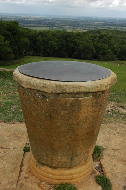
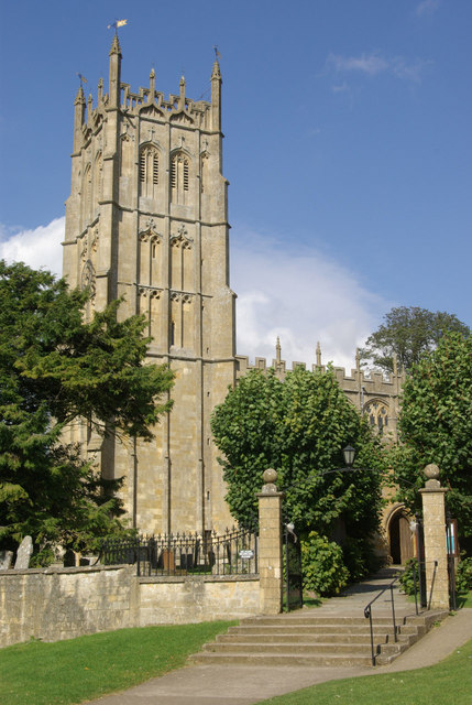
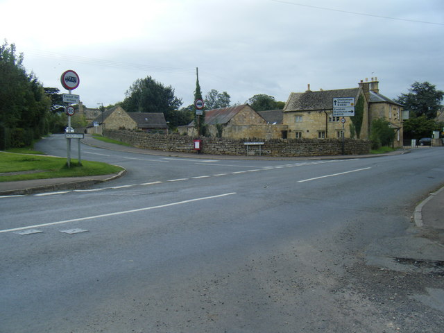
Dover's Hill Images

Images are sourced within 2km of 52.055015/-1.8022827 or Grid Reference SP1339. Thanks to Geograph Open Source API. All images are credited.

Market Hall, Chipping Campden Dates from 1627 <span class="nowrap"><a title="https://historicengland.org.uk/listing/the-list/list-entry/1078442?section=official-list-entry" rel="nofollow ugc noopener" href="https://historicengland.org.uk/listing/the-list/list-entry/1078442?section=official-list-entry">Link</a><img style="margin-left:2px;" alt="External link" title="External link - shift click to open in new window" src="https://s1.geograph.org.uk/img/external.png" width="10" height="10"/></span>
Market Hall, Chipping Campden
Dates from 1627 LinkExternal link
War Memorial, Chipping Campden Designed by F. L. Griggs <span class="nowrap"><a title="https://en.wikipedia.org/wiki/F._L._Griggs" rel="nofollow ugc noopener" href="https://en.wikipedia.org/wiki/F._L._Griggs">Link</a><img style="margin-left:2px;" alt="External link" title="External link - shift click to open in new window" src="https://s1.geograph.org.uk/img/external.png" width="10" height="10"/></span> 1919 <span class="nowrap"><a title="https://historicengland.org.uk/listing/the-list/list-entry/1342012?section=official-list-entry" rel="nofollow ugc noopener" href="https://historicengland.org.uk/listing/the-list/list-entry/1342012?section=official-list-entry">Link</a><img style="margin-left:2px;" alt="External link" title="External link - shift click to open in new window" src="https://s1.geograph.org.uk/img/external.png" width="10" height="10"/></span>
War Memorial, Chipping Campden
Designed by F. L. Griggs LinkExternal link 1919 LinkExternal link
Dovers House, Chipping Campden Dates from the 1720s <span class="nowrap"><a title="https://historicengland.org.uk/listing/the-list/list-entry/1305077?section=official-list-entry" rel="nofollow ugc noopener" href="https://historicengland.org.uk/listing/the-list/list-entry/1305077?section=official-list-entry">Link</a><img style="margin-left:2px;" alt="External link" title="External link - shift click to open in new window" src="https://s1.geograph.org.uk/img/external.png" width="10" height="10"/></span> The home of F. L. Griggs <span class="nowrap"><a title="https://en.wikipedia.org/wiki/F._L._Griggs" rel="nofollow ugc noopener" href="https://en.wikipedia.org/wiki/F._L._Griggs">Link</a><img style="margin-left:2px;" alt="External link" title="External link - shift click to open in new window" src="https://s1.geograph.org.uk/img/external.png" width="10" height="10"/></span>
Dovers House, Chipping Campden
Dates from the 1720s LinkExternal link The home of F. L. Griggs LinkExternal link
The Lanterns, Chipping Campden Date from the early nineteenth century <span class="nowrap"><a title="https://historicengland.org.uk/listing/the-list/list-entry/1078414?section=official-list-entry" rel="nofollow ugc noopener" href="https://historicengland.org.uk/listing/the-list/list-entry/1078414?section=official-list-entry">Link</a><img style="margin-left:2px;" alt="External link" title="External link - shift click to open in new window" src="https://s1.geograph.org.uk/img/external.png" width="10" height="10"/></span>
The Lanterns, Chipping Campden
Date from the early nineteenth century LinkExternal link
Braithwaite House, Chipping Campden Dates from the early eighteenth century <span class="nowrap"><a title="https://historicengland.org.uk/listing/the-list/list-entry/1342036?section=official-list-entry" rel="nofollow ugc noopener" href="https://historicengland.org.uk/listing/the-list/list-entry/1342036?section=official-list-entry">Link</a><img style="margin-left:2px;" alt="External link" title="External link - shift click to open in new window" src="https://s1.geograph.org.uk/img/external.png" width="10" height="10"/></span>
Braithwaite House, Chipping Campden
Dates from the early eighteenth century LinkExternal link
Church Street., Chipping Campden
Former school and church rooms, Chipping Campden Dates 1837 <span class="nowrap"><a title="https://historicengland.org.uk/listing/the-list/list-entry/1171906?section=official-list-entry" rel="nofollow ugc noopener" href="https://historicengland.org.uk/listing/the-list/list-entry/1171906?section=official-list-entry">Link</a><img style="margin-left:2px;" alt="External link" title="External link - shift click to open in new window" src="https://s1.geograph.org.uk/img/external.png" width="10" height="10"/></span>
Former school and church rooms, Chipping Campden
Dates 1837 LinkExternal link
Entrance to Campden House Dates from about 1613 <span class="nowrap"><a title="https://historicengland.org.uk/listing/the-list/list-entry/1341979?section=official-list-entry" rel="nofollow ugc noopener" href="https://historicengland.org.uk/listing/the-list/list-entry/1341979?section=official-list-entry">Link</a><img style="margin-left:2px;" alt="External link" title="External link - shift click to open in new window" src="https://s1.geograph.org.uk/img/external.png" width="10" height="10"/></span> Campden House was burnt down in 1645 and never rebuilt.
Entrance to Campden House
Dates from about 1613 LinkExternal link Campden House was burnt down in 1645 and never rebuilt.
Church of St James, Chipping Campden, east end Predominantly of the fifteenth century though containing earlier fabric <span class="nowrap"><a title="https://historicengland.org.uk/listing/the-list/list-entry/1341977?section=official-list-entry" rel="nofollow ugc noopener" href="https://historicengland.org.uk/listing/the-list/list-entry/1341977?section=official-list-entry">Link</a><img style="margin-left:2px;" alt="External link" title="External link - shift click to open in new window" src="https://s1.geograph.org.uk/img/external.png" width="10" height="10"/></span>
Church of St James, Chipping Campden, east end
Predominantly of the fifteenth century though containing earlier fabric LinkExternal link
Site and remains of Campden House Constructed on a grand scale in the early seventeenth century, the house was burnt down in 1645 and never rebuilt <span class="nowrap"><a title="https://historicengland.org.uk/listing/the-list/list-entry/1013875?section=official-list-entry" rel="nofollow ugc noopener" href="https://historicengland.org.uk/listing/the-list/list-entry/1013875?section=official-list-entry">Link</a><img style="margin-left:2px;" alt="External link" title="External link - shift click to open in new window" src="https://s1.geograph.org.uk/img/external.png" width="10" height="10"/></span>
Site and remains of Campden House
Constructed on a grand scale in the early seventeenth century, the house was burnt down in 1645 and never rebuilt LinkExternal link
Church Cottages, Chipping Campden
Almshouses, Chipping Campden Date from 1612 <span class="nowrap"><a title="https://historicengland.org.uk/listing/the-list/list-entry/1078454?section=official-list-entry" rel="nofollow ugc noopener" href="https://historicengland.org.uk/listing/the-list/list-entry/1078454?section=official-list-entry">Link</a><img style="margin-left:2px;" alt="External link" title="External link - shift click to open in new window" src="https://s1.geograph.org.uk/img/external.png" width="10" height="10"/></span> Contemporary with the Almshouses is the pavement which is also listed <span class="nowrap"><a title="https://historicengland.org.uk/listing/the-list/list-entry/1305520?section=official-list-entry" rel="nofollow ugc noopener" href="https://historicengland.org.uk/listing/the-list/list-entry/1305520?section=official-list-entry">Link</a><img style="margin-left:2px;" alt="External link" title="External link - shift click to open in new window" src="https://s1.geograph.org.uk/img/external.png" width="10" height="10"/></span>
Almshouses, Chipping Campden
Date from 1612 LinkExternal link Contemporary with the Almshouses is the pavement which is also listed LinkExternal link
Mill Cottage, Chipping Campden Eighteenth century cottage <span class="nowrap"><a title="https://historicengland.org.uk/listing/the-list/list-entry/1078450?section=official-list-entry" rel="nofollow ugc noopener" href="https://historicengland.org.uk/listing/the-list/list-entry/1078450?section=official-list-entry">Link</a><img style="margin-left:2px;" alt="External link" title="External link - shift click to open in new window" src="https://s1.geograph.org.uk/img/external.png" width="10" height="10"/></span>
Mill Cottage, Chipping Campden
Eighteenth century cottage LinkExternal link
Outbuilding to Court House, Chipping Campden Dates from abut 1612 <span class="nowrap"><a title="https://historicengland.org.uk/listing/the-list/list-entry/1305564?section=official-list-entry" rel="nofollow ugc noopener" href="https://historicengland.org.uk/listing/the-list/list-entry/1305564?section=official-list-entry">Link</a><img style="margin-left:2px;" alt="External link" title="External link - shift click to open in new window" src="https://s1.geograph.org.uk/img/external.png" width="10" height="10"/></span>
Outbuilding to Court House, Chipping Campden
Dates from abut 1612 LinkExternal link
Grassland of Calf's Lane, Chipping Campden Part of the grounds of the long-lost Campden House <span class="nowrap"><a title="https://historicengland.org.uk/listing/the-list/list-entry/1013875?section=official-list-entry" rel="nofollow ugc noopener" href="https://historicengland.org.uk/listing/the-list/list-entry/1013875?section=official-list-entry">Link</a><img style="margin-left:2px;" alt="External link" title="External link - shift click to open in new window" src="https://s1.geograph.org.uk/img/external.png" width="10" height="10"/></span> On the right is a pond which was part of the landscaped gardens.
Grassland of Calf's Lane, Chipping Campden
Part of the grounds of the long-lost Campden House LinkExternal link On the right is a pond which was part of the landscaped gardens.
Line of trees of Calf's Lane The roadway on the right is a public footpath.
Line of trees of Calf's Lane
The roadway on the right is a public footpath.
Grounds of the forner Campden House An overgrown water feature of the lost gardens of Campden House <span class="nowrap"><a title="https://historicengland.org.uk/listing/the-list/list-entry/1013875?section=official-list-entry" rel="nofollow ugc noopener" href="https://historicengland.org.uk/listing/the-list/list-entry/1013875?section=official-list-entry">Link</a><img style="margin-left:2px;" alt="External link" title="External link - shift click to open in new window" src="https://s1.geograph.org.uk/img/external.png" width="10" height="10"/></span>
Grounds of the forner Campden House
An overgrown water feature of the lost gardens of Campden House LinkExternal link
Show me another place!

Dover's Hill is located at Grid Ref: SP1339 (Lat: 52.055015, Lng: -1.8022827)

Administrative County: Gloucestershire

District: Cotswold

Police Authority: Gloucestershire

What 3 Words

///overlaid.humble.suckle. Near Chipping Campden, Gloucestershire

Related Wikis

Dover's Hill

Dover's Hill is a 754 feet (230 metres) hill in the Cotswolds area of central England. The hill is 1 mile (1.6 km) north-west of Chipping Campden in Gloucestershire...

Guild and School of Handicraft

The Guild and School of Handicraft was established in 1888 in London, later moving to Chipping Campden in Gloucestershire, England, as a community of artists...

Chipping Campden Town Hall

Chipping Campden Town Hall is a municipal building in the High Street, Chipping Campden, Gloucestershire, England. The building, which is the meeting place...

Chipping Campden

Chipping Campden is a market town in the Cotswold district of Gloucestershire, England. It is notable for its terraced High Street, dating from the 14th...

North Cotswold Community Radio

North Cotswold Community Radio is a non-profit community internet radio station serving primarily the North Cotswolds and the surrounding area in west...

Weston-sub-Edge

Weston-sub-Edge (also known as Weston Subedge) is a village in Gloucestershire, England. == History == This Cotswold village, recorded in the Domesday...

Chipping Campden School

Chipping Campden School is a non-selective secondary school and sixth form with academy status located in Chipping Campden, in the English county of Gloucestershire...

Church of St James, Chipping Campden

The Anglican Church of St James at Chipping Campden in the Cotswold District of Gloucestershire, England was built in the 15th century incorporating an...

Nearby Amenities

Located within 500m of 52.055015,-1.8022827
Crossing
Lat/Long: 52.0538647/-1.8022099
Dover's Hill
Created By: Potlatch 0.10f
Tourism: viewpoint
Lat/Long: 52.0551182/-1.8021562
Post Box
Brand: Royal Mail
Brand Wikidata: Q638098
Operator: Royal Mail
Operator Wikidata: Q638098
Post Box Mounting: pier
Post Box Type: lamp
Postal Code: GL55
Ref: GL55 125
Source: survey
Lat/Long: 52.052071/-1.801024
Crossing: informal
Lat/Long: 52.0565474/-1.8056744
Dover's Hill
Place: locality
Lat/Long: 52.05679/-1.7985158
Barrier: kissing_gate
Description: This is the preferable entry / access point
Foot: permissive
Note: limit of access land
Lat/Long: 52.0566003/-1.8055932
Dover's Hill
Ele: 225
Natural: peak
Wikidata: Q20878130
Lat/Long: 52.054904/-1.8019495
Barrier: kissing_gate
Lat/Long: 52.0562024/-1.8066977
Man Made: survey_point
Ref: OS S5105
Lat/Long: 52.0571445/-1.7971603
Barrier: stile
Note: limit of access land
Lat/Long: 52.0549589/-1.801187
Barrier: kissing_gate
Note: limit of access land
Note2: kissing gate
Lat/Long: 52.0553589/-1.8038308
Bicycle Parking
Bicycle Parking: stands
Capacity: 8
Lat/Long: 52.0541827/-1.8025418
Barrier: kissing_gate
Lat/Long: 52.0566654/-1.8059631
Barrier: kissing_gate
Lat/Long: 52.0563636/-1.8069877
Barrier: kissing_gate
Lat/Long: 52.0564017/-1.8070607
Bench
Source: survey
Lat/Long: 52.055172/-1.8014752
Information: map
Map Type: toposcope
Source: survey;gps
Tourism: information
Lat/Long: 52.0551308/-1.8022195
Bench
Lat/Long: 52.0571703/-1.7973561
Ford: yes
Lat/Long: 52.0571905/-1.8025539
Dover's Hill
Power: pole
Transformer: distribution
Voltage Primary: 11000
Lat/Long: 52.053135/-1.8038157
Location Transition: yes
Power: pole
Lat/Long: 52.0548932/-1.8064094
Foxborough
Power: pole
Transformer: distribution
Voltage Primary: 11000
Lat/Long: 52.0549257/-1.8068902
Power: pole
Lat/Long: 52.0551764/-1.8078243
Power: pole
Lat/Long: 52.0553245/-1.8083882
Power: pole
Lat/Long: 52.0554721/-1.8089669
The data included in this document is from www.openstreetmap.org. The data is made available under ODbL.

Have you been to Dover's Hill?

Leave your review of Dover's Hill below (or comments, questions and feedback).