Cliff Top

Hill, Mountain in Staffordshire Staffordshire Moorlands

England

Cliff Top

Autumn view from Blore Pastures  Taken from Blore Pastures Picnic site looking across towards Bunster Hill and the mouth of Dovedale.
Autumn view from Blore Pastures Credit: Trevor Harris

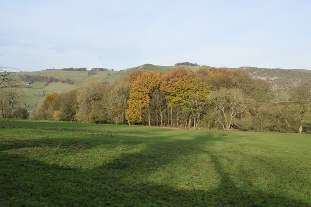
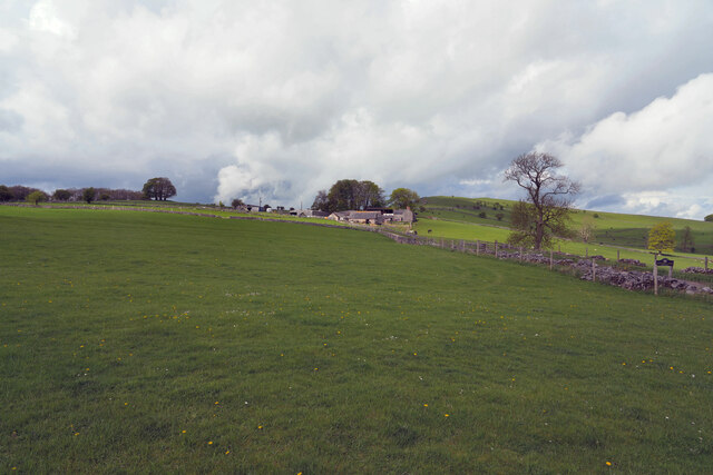
Cliff Top is a prominent hill located in the county of Staffordshire, England. Rising to an elevation of approximately 300 meters (984 feet), it offers stunning panoramic views of the surrounding countryside. Situated in the heart of the Peak District National Park, Cliff Top is a popular destination for outdoor enthusiasts and nature lovers alike.

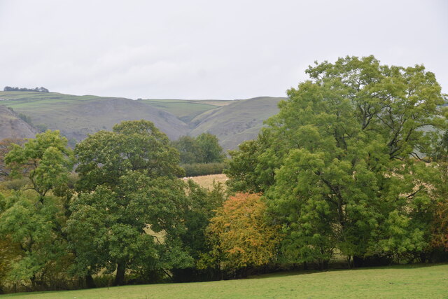
The hill is characterized by its rugged terrain, featuring steep slopes and rocky outcrops. Its name is derived from the sheer cliffs that line its uppermost section, providing a dramatic backdrop to the landscape. Visitors can embark on various walking trails that wind their way up the hill, offering opportunities to explore its diverse flora and fauna.

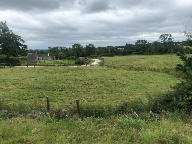
At the summit of Cliff Top, visitors are rewarded with breathtaking vistas of the Staffordshire Moorlands and the nearby countryside. On clear days, it is even possible to catch a glimpse of the distant Manchester skyline. The hill's strategic location also makes it an excellent spot for birdwatching and observing the local wildlife.

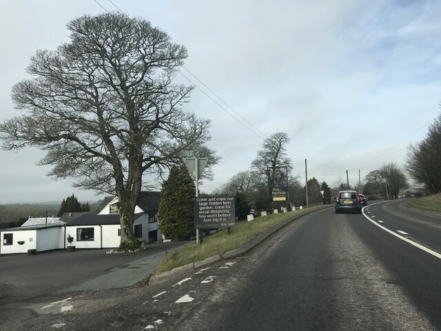
Cliff Top is well-equipped for visitors, with designated parking areas and picnic spots at the base of the hill. Additionally, there are nearby facilities such as cafes and visitor centers that provide information and refreshments. The hill's accessibility and natural beauty make it a popular destination for both locals and tourists seeking a peaceful retreat or an adventurous hike in the stunning Staffordshire landscape.

If you have any feedback on the listing, please let us know in the comments section below.

Cliff Top Images

Images are sourced within 2km of 53.030662/-1.7984672 or Grid Reference SK1348. Thanks to Geograph Open Source API. All images are credited.

Autumn view from Blore Pastures  Taken from Blore Pastures Picnic site looking across towards Bunster Hill and the mouth of Dovedale.
Autumn view from Blore Pastures
Taken from Blore Pastures Picnic site looking across towards Bunster Hill and the mouth of Dovedale.
Trees in the last of the light
Junction signage on A52
Speed Camera Warning Signage
Dog & Partridge - Swinscoe
Speed Limit change
Speed Limit change
Junction signage
Junction signage
View towards Dove Dale  Taken from the picnic area on Blore Pasture.
View towards Dove Dale
Taken from the picnic area on Blore Pasture.
The Waterings Farm The farm is off Blore Lane and has a good view across and down the valley.
The Waterings Farm
The farm is off Blore Lane and has a good view across and down the valley.
Looking along Blore Lane Looking back down the road from the position of the previous submission <a href="https://www.geograph.org.uk/photo/7479439">SK1249 : The Waterings Farm</a>.
Looking along Blore Lane
Looking back down the road from the position of the previous submission SK1249 : The Waterings Farm.
Dog and Partridge Inn On the edge of the Peak District National Park
Dog and Partridge Inn
On the edge of the Peak District National Park
Drive to Little Moor Cottage
Lay-by on A52 near Cornpark The A52 is a major east-west road in the East Midlands. It runs east from a junction with the A53 at Newcastle-under-Lyme near Stoke-on-Trent (just east of the M6) to the Lincolnshire coast at Mablethorpe. Running for approximately 147 miles, its route passes via Ashbourne, Derby, Stapleford, Nottingham, West Bridgford, Bingham, Grantham, Boston and Skegness.
Lay-by on A52 near Cornpark
The A52 is a major east-west road in the East Midlands. It runs east from a junction with the A53 at Newcastle-under-Lyme near Stoke-on-Trent (just east of the M6) to the Lincolnshire coast at Mablethorpe. Running for approximately 147 miles, its route passes via Ashbourne, Derby, Stapleford, Nottingham, West Bridgford, Bingham, Grantham, Boston and Skegness.
The Dog and Partridge at Swinscoe
Drive to Littlemoor Cottage (a footpath)
Long straight length of A52, west of Swinscoe The A52 is a major east-west road in the East Midlands. It runs east from a junction with the A53 at Newcastle-under-Lyme near Stoke-on-Trent (just east of the M6) to the Lincolnshire coast at Mablethorpe. Running for approximately 147 miles, its route passes via Ashbourne, Derby, Stapleford, Nottingham, West Bridgford, Bingham, Grantham, Boston and Skegness.
Long straight length of A52, west of Swinscoe
The A52 is a major east-west road in the East Midlands. It runs east from a junction with the A53 at Newcastle-under-Lyme near Stoke-on-Trent (just east of the M6) to the Lincolnshire coast at Mablethorpe. Running for approximately 147 miles, its route passes via Ashbourne, Derby, Stapleford, Nottingham, West Bridgford, Bingham, Grantham, Boston and Skegness.
Bus shelter by A52, Swinscoe The A52 is a major east-west road in the East Midlands. It runs east from a junction with the A53 at Newcastle-under-Lyme near Stoke-on-Trent (just east of the M6) to the Lincolnshire coast at Mablethorpe. Running for approximately 147 miles, its route passes via Ashbourne, Derby, Stapleford, Nottingham, West Bridgford, Bingham, Grantham, Boston and Skegness.
Bus shelter by A52, Swinscoe
The A52 is a major east-west road in the East Midlands. It runs east from a junction with the A53 at Newcastle-under-Lyme near Stoke-on-Trent (just east of the M6) to the Lincolnshire coast at Mablethorpe. Running for approximately 147 miles, its route passes via Ashbourne, Derby, Stapleford, Nottingham, West Bridgford, Bingham, Grantham, Boston and Skegness.
Lay-by on A52 south-east of Swinscoe Shallow and unprotected
Lay-by on A52 south-east of Swinscoe
Shallow and unprotected
Show me another place!

Cliff Top is located at Grid Ref: SK1348 (Lat: 53.030662, Lng: -1.7984672)

Administrative County: Staffordshire

District: Staffordshire Moorlands

Police Authority: Staffordshire

What 3 Words

///fairly.sometimes.spurned. Near Mayfield, Staffordshire

Nearby Locations

Swinscoe Cliff Top

Related Wikis

Blore with Swinscoe

Blore with Swinscoe is a civil parish north-west of Ashbourne, in the Staffordshire Moorlands district of Staffordshire, England, on the edge of the Peak...

Blore

Blore (grid reference SK137493) is a small village and parish in the Staffordshire Moorlands District of England. It is on an acclivity above Dovedale...

Swinscoe

Swinscoe is a small hamlet within the Staffordshire Moorlands in Staffordshire, England. Administratively, the hamlet is part of the civil parish of Blore...

Ilam, Staffordshire

Ilam ( ) is a village in the Staffordshire Peak District of England, lying on the River Manifold. The population of the civil parish as taken at the 2011...

Okeover Hall

Okeover Hall is a privately owned Grade II* listed country house in Okeover, Staffordshire, England. It is the family seat of the Okeover family, who have...

Stanton, Staffordshire

Stanton is a small village situated at the eastern end of the Weaver Hills, Staffordshire, England. Stanton is located 146 miles (235.0 km) north-west...

River Manifold

The River Manifold is a river in Staffordshire, England. It is a tributary of the River Dove (which also flows through the Peak District, forming the boundary...

Thorswood

Thorswood is a nature reserve of the Staffordshire Wildlife Trust, situated in the Weaver Hills near the village of Stanton, in Staffordshire, England...

Nearby Amenities

Located within 500m of 53.030662,-1.7984672
Bus Stop
Townend Lane
Bench: no
Bin: no
Bus: yes
Naptan AtcoCode: 3800C839701
Naptan Bearing: SE
Naptan CommonName: Townend Lane
Naptan Indicator: Opp
Naptan Landmark: Townend Ln
Naptan Street: Swinscoe Hill
Naptan Verified: no
Public Transport: platform
Shelter: yes
Source: naptan_import
Lat/Long: 53.0316476/-1.8025836
Townend Lane
Naptan AtcoCode: 3800C839702
Naptan Bearing: NW
Naptan BusStopType: CUS
Naptan CommonName: Townend Lane
Naptan Indicator: Adj
Naptan Landmark: Townend Ln
Naptan Street: Swinscoe Hill
Naptan Verified: no
Source: naptan_import
Lat/Long: 53.0315178/-1.8026942
Post Box
Brand: Royal Mail
Brand Wikidata: Q638098
Operator: Royal Mail
Operator Wikidata: Q638098
Ref: DE6 825
Lat/Long: 53.0309024/-1.802397
Pub
Dog and Partridge
Addr City: Ashbourne
Addr Postcode: DE6 2HS
Addr Street: Town End Lane
Addr Village: Swinscoe
Fhrs Id: 1259790
Food: yes
Parking: yes
Real Ale: yes
Real Fire: yes
Website: http://www.dogandpartridge.co.uk/
Lat/Long: 53.0301048/-1.8013958
Barrier: stile
Material: stone
Source: survey;gps
Stile: squeezer
Lat/Long: 53.0340979/-1.7971458
Speed Camera
Lat/Long: 53.0299592/-1.8005762
Speed Camera
Lat/Long: 53.0279764/-1.7966153
Barrier: stile
Material: stone
Source: survey;gps
Stile: stepover
Lat/Long: 53.0303582/-1.8033142
Barrier: stile
Material: wood
Source: survey;gps
Stile: stepover
Lat/Long: 53.0305196/-1.8041757
Barrier: stile
Material: stone
Source: survey;gps
Stile: squeezer
Lat/Long: 53.0307652/-1.8050363
Swinscoe
Place: hamlet
Lat/Long: 53.0301805/-1.8027835
Barrier: stile
Material: wood
Source: survey;gps
Stile: stepover
Lat/Long: 53.0316643/-1.8025722
Barrier: stile
Material: stone
Source: survey;gps
Stile: squeezer
Lat/Long: 53.0331939/-1.8006437
Barrier: stile
Material: wood
Source: survey;gps
Stile: stepover
Lat/Long: 53.0325025/-1.8051727
Barrier: stile
Material: stone
Source: survey;gps
Stile: squeezer
Lat/Long: 53.0346091/-1.7953849
Barrier: stile
Stile: squeezer
Lat/Long: 53.0301919/-1.8034947
Barrier: stile
Material: wood
Steps: 5
Stile: ladder
Lat/Long: 53.0271241/-1.7947396
Barrier: cattle_grid
Lat/Long: 53.0269921/-1.7949735
Barrier: stile
Material: wood
Source: survey;gps
Stile: stepover
Lat/Long: 53.0276192/-1.7957058
The data included in this document is from www.openstreetmap.org. The data is made available under ODbL.

Have you been to Cliff Top?

Leave your review of Cliff Top below (or comments, questions and feedback).