Coldwell Hill

Hill, Mountain in Northumberland

England

Coldwell Hill

Gateway, Hagg Farm
Gateway, Hagg Farm Credit: Andrew Curtis

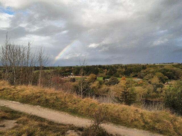
Coldwell Hill is a prominent geographical feature located in Northumberland, England. Situated in the northernmost part of the county, it is part of the North Pennines Area of Outstanding Natural Beauty. Rising to an elevation of approximately 480 meters (1,575 feet), Coldwell Hill is classified as a hill or mountain depending on the criteria used.

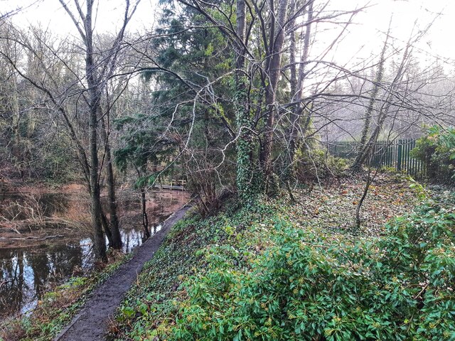
The hill is characterized by its rugged and undulating terrain, covered mostly with heather and grasses, interspersed with patches of woodland. Its slopes are relatively steep, offering breathtaking panoramic views of the surrounding countryside, including the Cheviot Hills to the northeast and the Northumberland National Park to the west.

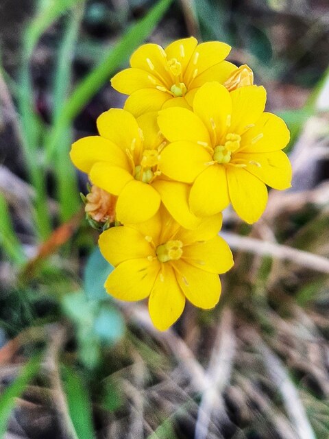
Coldwell Hill is a popular destination for outdoor enthusiasts and nature lovers. It offers a variety of recreational activities, including hiking, walking, and birdwatching. The hill is home to a diverse range of plant and animal species, including heather, bilberry, and various bird species such as curlew and red grouse.

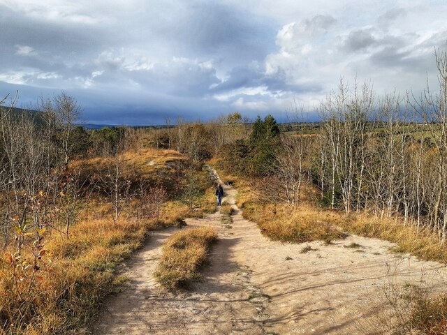
The hill is easily accessible via well-maintained footpaths and trails, providing visitors with the opportunity to explore the area's natural beauty. Additionally, the nearby villages of Allenheads and Nenthead provide convenient accommodation options for those wishing to spend more time in the vicinity.

Overall, Coldwell Hill is a picturesque and tranquil location, offering visitors a chance to immerse themselves in the stunning natural landscape of Northumberland. Whether it's a leisurely stroll or a challenging hike, this hill provides a rewarding experience for anyone seeking to connect with nature.

If you have any feedback on the listing, please let us know in the comments section below.

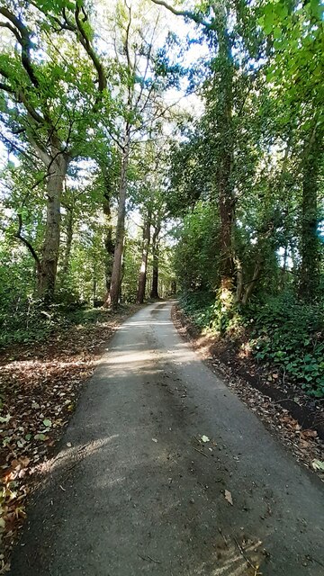
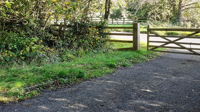
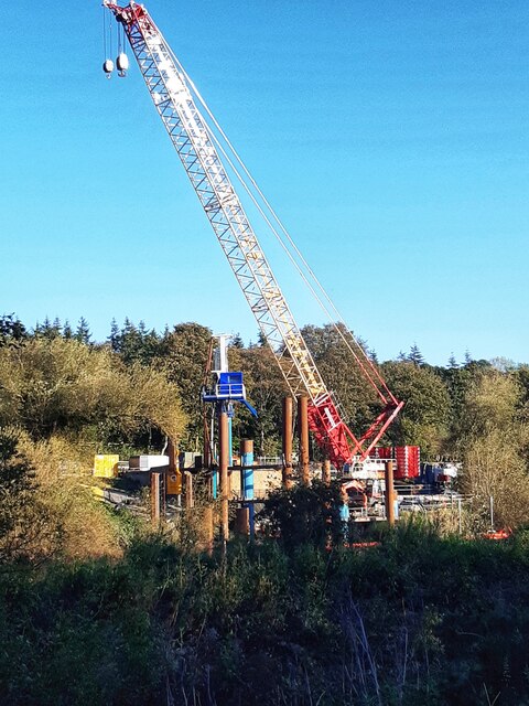
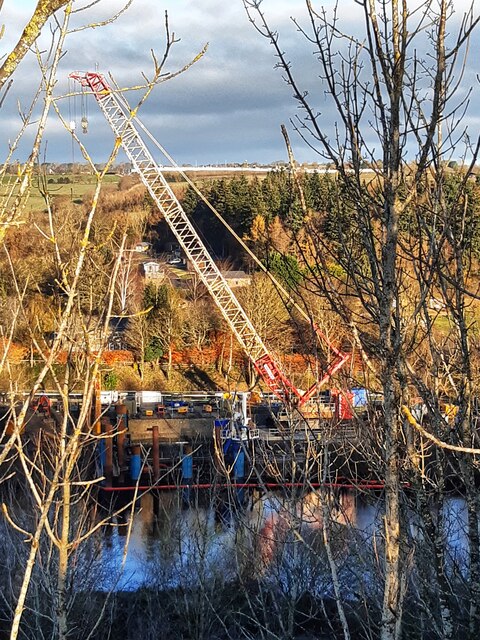
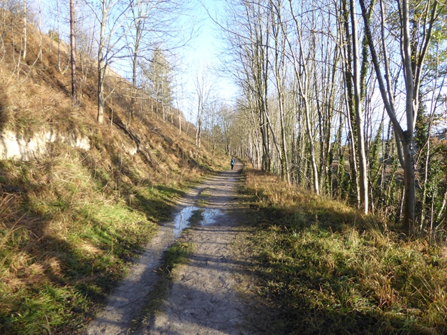
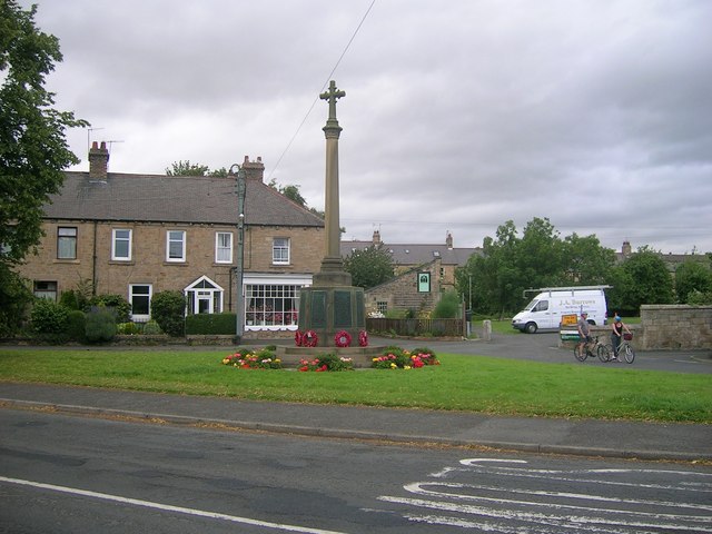
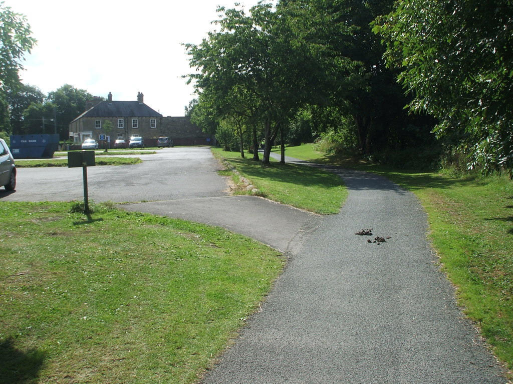
Coldwell Hill Images

Images are sourced within 2km of 54.971198/-1.8210617 or Grid Reference NZ1164. Thanks to Geograph Open Source API. All images are credited.

Gateway, Hagg Farm
Gateway, Hagg Farm
East Lodge, Hagg Farm
Close to railway, Tyne Riverside Park The second edition Ordnance Survey map (published 1897) shows the route of an old waggonway <a href="https://www.geograph.org.uk/photo/7648850">NZ1064 : Old wagonway, Ovingham Riverside</a> which joined the Newcastle & Carlisle Railway just west of a junction at Hagg Bank. The modern line is protected by the green-painted metal fence on the right of the photograph. The old waggonway served a colliery near the River Tyne close to Hagg Farm but neither the colliery or waggonway are shown on the first edition 6" map (published 1864) and both appear to have gone out of use by 1897. A branch railway along the same route was installed later to serve an aerial ropeway across the river used to transport materials for the construction activities of the Newcastle & Gateshead Water Company.
Close to railway, Tyne Riverside Park
The second edition Ordnance Survey map (published 1897) shows the route of an old waggonway NZ1064 : Old wagonway, Ovingham Riverside which joined the Newcastle & Carlisle Railway just west of a junction at Hagg Bank. The modern line is protected by the green-painted metal fence on the right of the photograph. The old waggonway served a colliery near the River Tyne close to Hagg Farm but neither the colliery or waggonway are shown on the first edition 6" map (published 1864) and both appear to have gone out of use by 1897. A branch railway along the same route was installed later to serve an aerial ropeway across the river used to transport materials for the construction activities of the Newcastle & Gateshead Water Company.
Hagg Farm
Hagg Farm
View over River Tyne from the Spetchells A rainbow in the dark, sunlit sky shows of rain on its way.
View over River Tyne from the Spetchells
A rainbow in the dark, sunlit sky shows of rain on its way.
Yellow-wort (Blackstonia perfoliata), The Spetchells Yellow-wort is a yellow-flowered member of the Gentian family. It grows from ten to fifty centimetres tall with stiff, branching stems. The leaves are glaucous, opposite and entire, the upper ones perfoliate, being united at the base. It bears terminal cymes of bright yellow, stalked flowers, 1–1.5 cm across. The calyx is deeply divided into 6–10 linear lobes or sepals, spirally arranged, free or nearly free from each other at the base and shorter than the corolla. The petals number six to ten and form a short tube. There are six to ten adherent stamens and a two-lobed stigma. It flowers from June to October in Britain where it is widespread but not common.
<span class="nowrap"><a title="https://en.wikipedia.org/wiki/Blackstonia_perfoliata" rel="nofollow ugc noopener" href="https://en.wikipedia.org/wiki/Blackstonia_perfoliata">Link</a><img style="margin-left:2px;" alt="External link" title="External link - shift click to open in new window" src="https://s1.geograph.org.uk/img/external.png" width="10" height="10"/></span>

Its main habitats are lowland calcareous grasslands and fixed sand dunes, but it can be an abundant colonist of disturbed ground, including quarries and railway cuttings, and on road verges and pathsides.

There has been little change in the overall distribution of this species since the 1962 Atlas, although it has spread into Northumberland since then.
<span class="nowrap"><a title="https://www.brc.ac.uk/plantatlas/plant/blackstonia-perfoliata" rel="nofollow ugc noopener" href="https://www.brc.ac.uk/plantatlas/plant/blackstonia-perfoliata">Link</a><img style="margin-left:2px;" alt="External link" title="External link - shift click to open in new window" src="https://s1.geograph.org.uk/img/external.png" width="10" height="10"/></span>
Yellow-wort (Blackstonia perfoliata), The Spetchells
Yellow-wort is a yellow-flowered member of the Gentian family. It grows from ten to fifty centimetres tall with stiff, branching stems. The leaves are glaucous, opposite and entire, the upper ones perfoliate, being united at the base. It bears terminal cymes of bright yellow, stalked flowers, 1–1.5 cm across. The calyx is deeply divided into 6–10 linear lobes or sepals, spirally arranged, free or nearly free from each other at the base and shorter than the corolla. The petals number six to ten and form a short tube. There are six to ten adherent stamens and a two-lobed stigma. It flowers from June to October in Britain where it is widespread but not common. LinkExternal link Its main habitats are lowland calcareous grasslands and fixed sand dunes, but it can be an abundant colonist of disturbed ground, including quarries and railway cuttings, and on road verges and pathsides. There has been little change in the overall distribution of this species since the 1962 Atlas, although it has spread into Northumberland since then. LinkExternal link
Walking on Northumberland's chalk hills Although geology left no chalk rocks in Northumberland, strangely the county does have one area of chalk grassland, the Spetchells.
Spetchells, is an old name of uncertain origin, originally applied to the area of rough grassland and scrub along the south bank of the River Tyne near Prudhoe which was traditionally used for recreation. According to Northumberland Words by Richard Oliver Heslop (1894), a spetchel or spatchel was the thin layer of turf laid between horizontal rows of stones used in building a wall ('a stone and spetchel dike').
The name is now associated with the 1km long mound of calcium carbonate dumped between the River Tyne and the railway as industrial waste by ICI as the result of manufacturing ammonium sulphate for fertiliser and explosives during World War II. The plant closed in 1963. The process involved using calcium sulphate obtained from powdered natural gypsum, or anhydrite, added to a solution of ammonium carbonate. Calcium carbonate precipitates out from the reaction <span class="nowrap"><a title="http://en.wikipedia.org/wiki/Ammonium_sulfate" rel="nofollow ugc noopener" href="http://en.wikipedia.org/wiki/Ammonium_sulfate">Link</a><img style="margin-left:2px;" alt="External link" title="External link - shift click to open in new window" src="https://s1.geograph.org.uk/img/external.png" width="10" height="10"/></span>
The Spetchells are estimated to comprise two and a half million tons of this chalk. The dump was turfed over to make it less obvious to German bombers. Ash and sycamore trees were planted on the slopes, and hornbeams on the top, in an attempt to stabilise the mounds. The Spetchells now support plants typical of the ungrazed chalk grasslands of southern England, and a specialised chalk-loving fauna has also arrived, including rare butterflies and moths. 
<span class="nowrap"><a title="http://www.prudhoe.org/walking/walk4p2.htm" rel="nofollow ugc noopener" href="http://www.prudhoe.org/walking/walk4p2.htm">Link</a><img style="margin-left:2px;" alt="External link" title="External link - shift click to open in new window" src="https://s1.geograph.org.uk/img/external.png" width="10" height="10"/></span>

<span class="nowrap"><a title="https://www.prudhoelocalhistory.com/industrial-expansion.html" rel="nofollow ugc noopener" href="https://www.prudhoelocalhistory.com/industrial-expansion.html">Link</a><img style="margin-left:2px;" alt="External link" title="External link - shift click to open in new window" src="https://s1.geograph.org.uk/img/external.png" width="10" height="10"/></span> <span class="nowrap"><a title="https://web.archive.org/web/20210520150418/https://www.prudhoelocalhistory.com/industrial-expansion.html" rel="nofollow ugc noopener" href="https://web.archive.org/web/20210520150418/https://www.prudhoelocalhistory.com/industrial-expansion.html">Archive Link</a><img style="margin-left:2px;" alt="External link" title="External link - shift click to open in new window" src="https://s1.geograph.org.uk/img/external.png" width="10" height="10"/></span>

<span class="nowrap"><a title="https://www.prudhoetowncouncil.gov.uk/wp-content/uploads/2019/07/paths-around-prudhoe-leaflet-1.pdf" rel="nofollow ugc noopener" href="https://www.prudhoetowncouncil.gov.uk/wp-content/uploads/2019/07/paths-around-prudhoe-leaflet-1.pdf">Link</a><img style="margin-left:2px;" alt="External link" title="External link - shift click to open in new window" src="https://s1.geograph.org.uk/img/external.png" width="10" height="10"/></span> <span class="nowrap"><a title="https://web.archive.org/web/20211028160538/https://www.prudhoetowncouncil.gov.uk/wp-content/uploads/2019/07/paths-around-prudhoe-leaflet-1.pdf" rel="nofollow ugc noopener" href="https://web.archive.org/web/20211028160538/https://www.prudhoetowncouncil.gov.uk/wp-content/uploads/2019/07/paths-around-prudhoe-leaflet-1.pdf">Archive Link</a><img style="margin-left:2px;" alt="External link" title="External link - shift click to open in new window" src="https://s1.geograph.org.uk/img/external.png" width="10" height="10"/></span>
Walking on Northumberland's chalk hills
Although geology left no chalk rocks in Northumberland, strangely the county does have one area of chalk grassland, the Spetchells. Spetchells, is an old name of uncertain origin, originally applied to the area of rough grassland and scrub along the south bank of the River Tyne near Prudhoe which was traditionally used for recreation. According to Northumberland Words by Richard Oliver Heslop (1894), a spetchel or spatchel was the thin layer of turf laid between horizontal rows of stones used in building a wall ('a stone and spetchel dike'). The name is now associated with the 1km long mound of calcium carbonate dumped between the River Tyne and the railway as industrial waste by ICI as the result of manufacturing ammonium sulphate for fertiliser and explosives during World War II. The plant closed in 1963. The process involved using calcium sulphate obtained from powdered natural gypsum, or anhydrite, added to a solution of ammonium carbonate. Calcium carbonate precipitates out from the reaction LinkExternal link The Spetchells are estimated to comprise two and a half million tons of this chalk. The dump was turfed over to make it less obvious to German bombers. Ash and sycamore trees were planted on the slopes, and hornbeams on the top, in an attempt to stabilise the mounds. The Spetchells now support plants typical of the ungrazed chalk grasslands of southern England, and a specialised chalk-loving fauna has also arrived, including rare butterflies and moths. LinkExternal link LinkExternal link Archive LinkExternal link LinkExternal link Archive LinkExternal link
Terrace path below The Spetchells More naturalised Columbines growing on the chalk showing large variation in flower shape and colour.
Terrace path below The Spetchells
More naturalised Columbines growing on the chalk showing large variation in flower shape and colour.
Mining bee burrows on the Spetchells Apparently  several varieties of mining bees make their homes on the only chalk hills in Northumberland.

For an explanation of the Spetchells, see Andrew Curtis' entry

<a href="https://www.geograph.org.uk/photo/2039327">NZ1064 : The Spetchells, east end</a>
Mining bee burrows on the Spetchells
Apparently several varieties of mining bees make their homes on the only chalk hills in Northumberland. For an explanation of the Spetchells, see Andrew Curtis' entry NZ1064 : The Spetchells, east end
Road/bridleway between South Lodge and North Lodge
Gateway from sewage pumping station onto Ovingham to Wylam road Ordnance Survey documents indicate that a rivet benchmark levelled at 13.426m above Newlyn Datum was verified in 1961 on a culvert at the junction of the stream on the left hand side of the track and the fence
Gateway from sewage pumping station onto Ovingham to Wylam road
Ordnance Survey documents indicate that a rivet benchmark levelled at 13.426m above Newlyn Datum was verified in 1961 on a culvert at the junction of the stream on the left hand side of the track and the fence
Crane by River Tyne Northumbrian Water's Ovingham Raw Water Pumping Station (RWPS) is an abstraction station located on the north bank of the River Tyne in South Northumberland between the towns of Wylam and Ovingham. The station provides raw water from the River Tyne to Horsley Water Treatment Works (WTW) and the Great Southern Reservoir at Whittle Dene WTW. Treated water is then pumped to Birney Hill Reservoir and supplies the City of Newcastle upon Tyne and Tyneside with a population in excess of 800,000.

The current project here involves the installation of new vertical turbine pumps and variable speed drive to avoid problems caused by silt uptake. The company involved is  Mott MacDonald Bentley (MMB).
<span class="nowrap"><a title="https://waterprojectsonline.com/custom_case_study/ovingham-rwps-2023/" rel="nofollow ugc noopener" href="https://waterprojectsonline.com/custom_case_study/ovingham-rwps-2023/">Link</a><img style="margin-left:2px;" alt="External link" title="External link - shift click to open in new window" src="https://s1.geograph.org.uk/img/external.png" width="10" height="10"/></span> <span class="nowrap"><a title="https://web.archive.org/web/20231018095120/https://waterprojectsonline.com/custom_case_study/ovingham-rwps-2023/" rel="nofollow ugc noopener" href="https://web.archive.org/web/20231018095120/https://waterprojectsonline.com/custom_case_study/ovingham-rwps-2023/">Archive Link</a><img style="margin-left:2px;" alt="External link" title="External link - shift click to open in new window" src="https://s1.geograph.org.uk/img/external.png" width="10" height="10"/></span>
Crane by River Tyne
Northumbrian Water's Ovingham Raw Water Pumping Station (RWPS) is an abstraction station located on the north bank of the River Tyne in South Northumberland between the towns of Wylam and Ovingham. The station provides raw water from the River Tyne to Horsley Water Treatment Works (WTW) and the Great Southern Reservoir at Whittle Dene WTW. Treated water is then pumped to Birney Hill Reservoir and supplies the City of Newcastle upon Tyne and Tyneside with a population in excess of 800,000. The current project here involves the installation of new vertical turbine pumps and variable speed drive to avoid problems caused by silt uptake. The company involved is Mott MacDonald Bentley (MMB). LinkExternal link Archive LinkExternal link
Crane at pumping station opposite The Hermitage
Footpath through woodland towards Horsley
Enclosure of sewage pumping station on west side of Mill Way Ordnance Survey documents indicate that a rivet benchmark levelled at 49.509m above Newlyn Datum was verified in 1961 on a manhole on the left hand side of the road at this location
Enclosure of sewage pumping station on west side of Mill Way
Ordnance Survey documents indicate that a rivet benchmark levelled at 49.509m above Newlyn Datum was verified in 1961 on a manhole on the left hand side of the road at this location
Mill Way passing entrance to sewage pumping station There is a manhole cover in the middle of the road in the foreground
Mill Way passing entrance to sewage pumping station
There is a manhole cover in the middle of the road in the foreground
Works at Ovingham water intake on River Tyne The white fence surrounding the Water Treatment Works at Horsley can be seen at the top of the hill. The construction works are described here <a href="https://www.geograph.org.uk/photo/7626963">NZ0964 : Crane by River Tyne</a>
Works at Ovingham water intake on River Tyne
The white fence surrounding the Water Treatment Works at Horsley can be seen at the top of the hill. The construction works are described here NZ0964 : Crane by River Tyne
Path along the south side of the Spetchells The Spetchelles are a giant man-made ridge of industrial waste in the form of calcium carbonate. It now constitutes a chalk downland ecosystem  unique in the north of England.
Path along the south side of the Spetchells
The Spetchelles are a giant man-made ridge of industrial waste in the form of calcium carbonate. It now constitutes a chalk downland ecosystem unique in the north of England.
Show me another place!

Coldwell Hill is located at Grid Ref: NZ1164 (Lat: 54.971198, Lng: -1.8210617)

Unitary Authority: Northumberland

Police Authority: Northumbria

What 3 Words

///identify.geese.snuck. Near Wylam, Northumberland

Related Wikis

Wylam

Wylam is a village and civil parish in the county of Northumberland. It is located about 10 miles (16 km) west of Newcastle upon Tyne. It is famous for...

Wylam railway station

Wylam is a railway station on the Tyne Valley Line, which runs between Newcastle and Carlisle via Hexham. The station, situated 9 miles 71 chains (9.89...

Wylam Bridge

Wylam Bridge is a road bridge in Northumberland, England linking the residential area of North Wylam and neighbouring villages of Heddon-on-the-Wall, and...

North Wylam railway station

North Wylam railway station served the village of Wylam, Northumberland, England from 1876 to 1968 on the Tyne Valley Line. == History == The station opened...

Prudhoe Town F.C.

Prudhoe Town Football Club was a football club based in Prudhoe, Northumberland, England. The club is affiliated to the Northumberland Football Association...

Prudhoe Youth Club F.C.

Prudhoe Youth Club Football Club is a football club based in Prudhoe, England. They are currently members of the Northern League Division Two and play...

Newcastle University F.C.

Newcastle University Football Club is a football club based in Newcastle upon Tyne, Tyne and Wear, England. They are current members of the Northern League...

George Stephenson's Birthplace

George Stephenson's Birthplace is the 18th-century stone cottage home of rail pioneer George Stephenson. Located along the north bank of the River Tyne...

Nearby Amenities

Located within 500m of 54.971198,-1.8210617
Source: PGS
Lat/Long: 54.9726219/-1.8275359
Source: PGS
Lat/Long: 54.9729879/-1.828214
Source: PGS
Lat/Long: 54.9733022/-1.8272951
Source: PGS
Lat/Long: 54.9730275/-1.8265969
Source: PGS
Lat/Long: 54.9728339/-1.82517
Source: PGS
Lat/Long: 54.9727945/-1.824458
Source: PGS
Lat/Long: 54.9730341/-1.822935
Source: PGS
Lat/Long: 54.9732989/-1.8222638
Source: PGS
Lat/Long: 54.9738694/-1.8211062
Source: PGS
Lat/Long: 54.9740958/-1.8204705
Source: PGS
Lat/Long: 54.9742448/-1.8199785
Source: PGS
Lat/Long: 54.9746608/-1.8187904
Source: PGS
Lat/Long: 54.9748712/-1.8180214
Source: PGS
Lat/Long: 54.9749987/-1.8176504
Source: PGS
Lat/Long: 54.9745975/-1.8167358
Source: PGS
Lat/Long: 54.9744029/-1.817358
Source: PGS
Lat/Long: 54.9742665/-1.8178125
Source: PGS
Lat/Long: 54.9740067/-1.8185591
Source: PGS
Lat/Long: 54.9737465/-1.8195701
Source: PGS
Lat/Long: 54.9735517/-1.8200389
Source: PGS
Lat/Long: 54.9731794/-1.820711
Source: PGS
Lat/Long: 54.9729093/-1.821386
Source: PGS
Lat/Long: 54.972269/-1.8234931
Source: PGS
Lat/Long: 54.9722135/-1.8251584
Source: PGS
Lat/Long: 54.9722327/-1.8256389
Source: PGS
Lat/Long: 54.9724293/-1.8267386
Wylam Cricket Club
Club: sport
Leisure: pitch
Sport: cricket
Lat/Long: 54.9748994/-1.820202
Wylam Wood
Place: farm
Lat/Long: 54.9715011/-1.8174052
Board Type: nature
Description: Wylam Haughs information board
Information: board
Source: survey
Tourism: information
Lat/Long: 54.9732064/-1.8260585
Board Type: nature
Description: Wylam Haughs information board
Information: board
Source: survey
Tourism: information
Lat/Long: 54.9739667/-1.8239077
Board Type: history
Check Date: 2021-01-10
Description: Information board on the history of Hagg Bank Bridge
Information: board
Source: survey
Tourism: information
Lat/Long: 54.9732796/-1.827063
Doctors
Riversdale Surgery
Addr City: Wylam
Addr Housenumber: 51
Addr Postcode: NE41 8DH
Addr Street: Woodcroft Road
Healthcare: doctor
Phone: +44 1661 852208
Website: http://riversdalesurgery.co.uk
Lat/Long: 54.9749091/-1.8238225
Addr City: Wylam
Addr Housenumber: 31
Addr Street: Woodcroft Road
Lat/Long: 54.9754013/-1.8220156
Addr City: Wylam
Addr Housenumber: 33
Addr Street: Woodcroft Road
Lat/Long: 54.9753644/-1.8221577
Addr City: Wylam
Addr Housenumber: 27
Addr Street: Woodcroft Road
Lat/Long: 54.9756522/-1.8215354
Addr City: Wylam
Addr Housenumber: 47
Addr Postcode: NE41 8DH
Addr Street: Woodcroft Road
Lat/Long: 54.975001/-1.8233406
Addr City: Wylam
Addr Housenumber: 49
Addr Postcode: NE41 8DH
Addr Street: Woodcroft Road
Lat/Long: 54.9749672/-1.8234532
Addr City: Wylam
Addr Housenumber: 45
Addr Postcode: NE41 8DH
Addr Street: Woodcroft Road
Lat/Long: 54.975078/-1.8230589
Bench
Lat/Long: 54.9734924/-1.8222918
Addr City: Wylam
Addr Housenumber: 43
Addr Postcode: NE41 8DH
Addr Street: Woodcroft Road
Lat/Long: 54.9751211/-1.8229409
Addr City: Wylam
Addr Housenumber: 46
Addr Street: Woodcroft Road
Lat/Long: 54.9751657/-1.8242553
Addr City: Wylam
Addr Housenumber: 44
Addr Street: Woodcroft Road
Lat/Long: 54.9751919/-1.8241695
Addr City: Wylam
Addr Housenumber: 37
Addr Street: Woodcroft Road
Lat/Long: 54.9752658/-1.8224581
Addr City: Wylam
Addr Housenumber: 35
Addr Street: Woodcroft Road
Lat/Long: 54.9752997/-1.8223347
Addr City: Wylam
Addr Housenumber: 39
Addr Street: Woodcroft Road
Lat/Long: 54.9752104/-1.8226325
Addr City: Wylam
Addr Housenumber: 41
Addr Street: Woodcroft Road
Lat/Long: 54.975175/-1.8227612
Waste Basket
Lat/Long: 54.9749487/-1.8241507
Addr City: Wylam
Addr Housenumber: 30
Addr Postcode: NE41 8DH
Addr Street: Woodcroft Road
Lat/Long: 54.9754872/-1.8232578
Addr City: Wylam
Addr Housenumber: 28
Addr Postcode: NE41 8DH
Addr Street: Woodcroft Road
Lat/Long: 54.9755226/-1.8231505
Addr City: Wylam
Addr Postcode: NE41 8DH
Lat/Long: 54.9751515/-1.8239525
Addr City: Wylam
Addr Housenumber: 40
Addr Postcode: NE41 8DH
Addr Street: Woodcroft Road
Lat/Long: 54.9752778/-1.8238801
Addr City: Wylam
Addr Housenumber: 36
Addr Postcode: NE41 8DH
Addr Street: Woodcroft Road
Lat/Long: 54.975361/-1.8236253
Addr City: Wylam
Addr Housenumber: 34
Addr Postcode: NE41 8DH
Addr Street: Woodcroft Road
Lat/Long: 54.9754086/-1.8234805
Addr City: Wylam
Addr Housenumber: 38
Addr Postcode: NE41 8DH
Addr Street: Woodcroft Road
Lat/Long: 54.9753256/-1.8237353
Addr City: Wylam
Addr Housenumber: 32
Addr Postcode: NE41 8DH
Addr Street: Woodcroft Road
Lat/Long: 54.9754333/-1.8234
Addr City: Wylam
Addr Housenumber: 42
Addr Postcode: NE41 8DH
Addr Street: Woodcroft Road
Lat/Long: 54.9752316/-1.8240142
Addr City: Wylam
Addr Housename: Elm Bank Cottage
Addr Street: Elm Bank Road
Source: survey
Lat/Long: 54.9739777/-1.8157825
Addr City: Wylam
Addr Housename: Scarbriw
Addr Street: Elm Bank Road
Source: survey
Lat/Long: 54.9738394/-1.8162134
Addr City: Wylam
Addr Housename: Eagelesfield
Addr Street: Elm Bank Road
Source: survey
Lat/Long: 54.9737182/-1.8164736
Addr City: Wylam
Addr Housename: Lyton
Addr Street: Elm Bank Road
Source: survey
Lat/Long: 54.9736558/-1.8166677
Addr City: Wylam
Addr Housename: Breaside
Addr Street: Elm Bank Road
Source: survey
Lat/Long: 54.9734819/-1.8162475
Addr City: Wylam
Addr Housename: Fairholme
Addr Street: The Crescent
Source: survey
Lat/Long: 54.9731465/-1.8159276
Addr City: Wylam
Addr Housename: Easthill
Addr Street: The Crescent
Source: survey
Lat/Long: 54.972805/-1.8159766
Addr City: Wylam
Addr Housename: Woodside
Addr Street: The Crescent
Source: survey
Lat/Long: 54.9721607/-1.8159887
Addr City: Wylam
Addr Housename: Wylam Wood
Addr Street: Wylam Wood Road
Source: survey
Lat/Long: 54.9715133/-1.8158051
Addr City: Wylam
Addr Housename: Wylam Wood Farm
Addr Street: Wylam Wood Road
Source: survey
Lat/Long: 54.9712347/-1.8167808
Addr City: Wylam
Addr Housename: Hague Cottage
Addr Street: Wylam Wood Road
Lat/Long: 54.9716298/-1.8174388
Addr City: Wylam
Addr Housename: Briardine
Addr Street: The Crescent
Source: survey
Lat/Long: 54.9720044/-1.8167925
Addr City: Wylam
Addr Housename: Glennview
Addr Street: The Crescent
Source: survey
Lat/Long: 54.9721097/-1.8168053
Addr City: Wylam
Addr Housename: Sourthcroft
Addr Street: The Crescent
Source: survey
Lat/Long: 54.9723802/-1.8167584
Addr City: Wylam
Addr Housename: Moncrief
Addr Street: The Crescent
Lat/Long: 54.9724671/-1.816769
Addr City: Wylam
Addr Housename: Loughrigg
Addr Street: The Crescent
Source: survey
Lat/Long: 54.9726654/-1.816705
Addr City: Wylam
Addr Housename: Woddburry
Addr Street: The Crescent
Source: survey
Lat/Long: 54.9727536/-1.8166986
Addr City: Wylam
Addr Housename: Hillcrest
Addr Street: The Crescent
Source: survey
Lat/Long: 54.9729727/-1.8166133
Addr City: Wylam
Addr Housename: Wickersley
Addr Street: The Crescent
Source: survey
Lat/Long: 54.9730523/-1.8166389
Addr City: Wylam
Addr Housename: Tiggy
Addr Street: Elm Bank Road
Source: survey
Lat/Long: 54.9732114/-1.8169205
Addr City: Wylam
Addr Housename: Holmfield
Addr Street: Elm Bank Road
Source: survey
Lat/Long: 54.9735077/-1.8170015
Addr City: Wylam
Addr Housename: Dalry
Addr Street: Elm Bank Road
Source: survey
Lat/Long: 54.9733412/-1.8175027
Addr City: Wylam
Addr Housename: Fernbank
Addr Street: Wylam Wood Road
Source: survey
Lat/Long: 54.9721618/-1.8175622
Addr City: Wylam
Addr Housename: Lynfors
Addr Street: Wylam Wood Road
Source: survey
Lat/Long: 54.9721661/-1.8177299
Addr City: Wylam
Addr Housename: Wingrove
Addr Street: Wylam Wood Road
Source: survey
Lat/Long: 54.9721737/-1.8178806
Addr City: Wylam
Addr Housename: Cosquet House
Addr Street: Wylam Wood Road
Source: survey
Lat/Long: 54.972218/-1.818116
Addr City: Wylam
Addr Housename: Hillside
Addr Street: Wylam Wood Road
Source: survey
Lat/Long: 54.9722256/-1.8182761
Addr City: Wylam
Addr Housename: Craigöands
Addr Street: Wylam Wood Road
Source: survey
Lat/Long: 54.9722353/-1.8183421
Addr City: Wylam
Addr Housename: Cranford
Addr Street: Wylam Wood Road
Lat/Long: 54.9722343/-1.8184381
Addr City: Wylam
Addr Housename: Tallandhouse
Addr Street: Wylam Wood Road
Source: survey
Lat/Long: 54.9722083/-1.8185888
Addr City: Wylam
Addr Housename: Highfield
Addr Street: Wylam Wood Road
Source: survey
Lat/Long: 54.9722818/-1.8186755
Addr City: Wylam
Addr Housename: Meadowfield
Addr Street: Wylam Wood Road
Source: survey
Lat/Long: 54.9722094/-1.8187715
Addr City: Wylam
Addr Housename: Thornton House
Addr Street: Wylam Wood Road
Source: survey
Lat/Long: 54.9722613/-1.8189505
Addr City: Wylam
Addr Housename: Rosemount
Addr Street: Elm Bank Road
Source: survey
Lat/Long: 54.9728235/-1.8174228
Addr City: Wylam
Addr Housename: Haverbrack
Addr Street: Elm Bank Road
Source: survey
Lat/Long: 54.9728094/-1.8176206
Addr City: Wylam
Addr Housename: Thornwood
Addr Street: Elm Bank Road
Source: survey
Lat/Long: 54.9727748/-1.8178937
Addr City: Wylam
Addr Housename: Elton
Addr Street: Elm Bank Road
Source: survey
Lat/Long: 54.9727629/-1.818067
Addr City: Wylam
Addr Housename: Wanford
Addr Street: Elm Bank Road
Source: survey
Lat/Long: 54.9727197/-1.8183289
Addr City: Wylam
Addr Housename: Nithsdale
Addr Street: Elm Bank Road
Source: survey
Lat/Long: 54.9726386/-1.8187828
Addr City: Wylam
Addr Housename: Oakhurst
Addr Street: Elm Bank Road
Source: survey
Lat/Long: 54.9725964/-1.8189561
Addr City: Wylam
Addr Housename: Eversley
Addr Street: Elm Bank Road
Source: survey
Lat/Long: 54.9725359/-1.8192745
Addr City: Wylam
Addr Housename: Soutrhbank
Addr Street: Elm Bank Road
Source: survey
Lat/Long: 54.9725056/-1.8194647
Addr City: Wylam
Addr Housename: The Shieling
Addr Street: Elm Bank Road
Source: survey
Lat/Long: 54.9729035/-1.8192669
Addr City: Wylam
Addr Housename: lynthorpe
Addr Street: Elm Bank Road
Source: survey
Lat/Long: 54.972937/-1.8190371
Addr City: Wylam
Addr Housename: Eskdale
Addr Street: Elm Bank Road
Source: survey
Lat/Long: 54.9729792/-1.8188356
Addr City: Wylam
Addr Housename: Garda
Addr Street: Elm Bank Road
Source: survey
Lat/Long: 54.9731013/-1.8183647
Addr City: Wylam
Addr Housename: Haven
Addr Street: Elm Bank Road
Source: survey
Lat/Long: 54.9732062/-1.8180482
Addr City: Wylam
Addr Housename: The Hollies
Addr Street: Elm Bank Road
Source: survey
Lat/Long: 54.9732754/-1.8178467
Generator Method: photovoltaic
Generator Output Electricity: yes
Generator Source: solar
Generator Type: solar_photovoltaic_panel
Location: roof
Power: generator
Lat/Long: 54.9750821/-1.8229318
Generator Method: photovoltaic
Generator Output Electricity: yes
Generator Source: solar
Generator Type: solar_photovoltaic_panel
Location: roof
Power: generator
Lat/Long: 54.9751806/-1.8226448
Generator Method: photovoltaic
Generator Output Electricity: yes
Generator Source: solar
Generator Type: solar_photovoltaic_panel
Location: roof
Power: generator
Lat/Long: 54.975373/-1.8181709
Generator Method: photovoltaic
Generator Output Electricity: yes
Generator Source: solar
Generator Type: solar_photovoltaic_panel
Location: roof
Power: generator
Lat/Long: 54.9753915/-1.8182299
Generator Method: photovoltaic
Generator Output Electricity: yes
Generator Source: solar
Generator Type: solar_photovoltaic_panel
Location: roof
Power: generator
Lat/Long: 54.9748111/-1.824871
Generator Method: photovoltaic
Generator Output Electricity: yes
Generator Source: solar
Generator Type: solar_photovoltaic_panel
Location: roof
Power: generator
Lat/Long: 54.9748111/-1.8249676
Leisure: nature_reserve
Lat/Long: 54.9730094/-1.8246415
Leisure: nature_reserve
Lat/Long: 54.9738484/-1.8241292
Leisure: nature_reserve
Lat/Long: 54.9732372/-1.8230456
Direction: SSE
Generator Method: photovoltaic
Generator Output Electricity: yes
Generator Source: solar
Generator Type: solar_photovoltaic_panel
Location: roof
Power: generator
Lat/Long: 54.9752742/-1.8223339
Direction: WSW
Generator Method: photovoltaic
Generator Output Electricity: yes
Generator Source: solar
Generator Type: solar_photovoltaic_panel
Power: generator
Source: survey
Lat/Long: 54.9749436/-1.8246722
Direction: E
Generator Method: photovoltaic
Generator Output Electricity: yes
Generator Source: solar
Generator Type: solar_photovoltaic_panel
Power: generator
Source: survey
Lat/Long: 54.9750444/-1.8250316
Direction: W
Generator Method: photovoltaic
Generator Output Electricity: yes
Generator Source: solar
Generator Type: solar_photovoltaic_panel
Power: generator
Source: survey
Lat/Long: 54.9750452/-1.8250799
Direction: SSE
Generator Method: photovoltaic
Generator Output Electricity: yes
Generator Solar Modules: 12
Generator Source: solar
Generator Type: solar_photovoltaic_panel
Power: generator
Source: survey
Lat/Long: 54.9729371/-1.8190645
Direction: SSE
Generator Method: photovoltaic
Generator Output Electricity: yes
Generator Solar Modules: 12
Generator Source: solar
Generator Type: solar_photovoltaic_panel
Power: generator
Source: survey
Lat/Long: 54.9729748/-1.8188124
Direction: SSE
Generator Method: photovoltaic
Generator Output Electricity: yes
Generator Source: solar
Generator Type: solar_photovoltaic_panel
Power: generator
Source: survey
Lat/Long: 54.9733989/-1.8149339
Defibrillator
Defibrillator Location: On external wall of sports pavilion
Emergency: defibrillator
Indoor: no
Ref GB The Circuit: CCBD2DDE-377B-40C5-97B7-AECB0119EAA5
Lat/Long: 54.9754601/-1.8200062
The data included in this document is from www.openstreetmap.org. The data is made available under ODbL.

Have you been to Coldwell Hill?

Leave your review of Coldwell Hill below (or comments, questions and feedback).