Cloud Hill
Hill, Mountain in Gloucestershire Cotswold
England
Cloud Hill

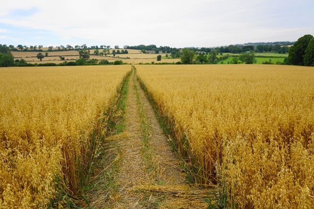
Cloud Hill is a prominent hill located in the county of Gloucestershire, England. Rising to an elevation of approximately 267 meters (876 feet), it is considered one of the highest points in the region. Situated in the Cotswold Area of Outstanding Natural Beauty, Cloud Hill offers breathtaking panoramic views of the surrounding countryside and is a popular destination for nature enthusiasts and hikers.
Covered in lush greenery, the hill is home to a diverse range of flora and fauna, including rare species of wildflowers and birds. The landscape is characterized by rolling hills, meandering streams, and ancient woodlands, creating a tranquil and picturesque setting. Walking trails and footpaths crisscross the hill, providing visitors with the opportunity to explore its natural beauty at their own pace.
Cloud Hill is also steeped in history, with evidence of human settlement dating back to the Iron Age. The remains of an Iron Age hillfort can still be seen on its summit, serving as a testament to the area's ancient past. Additionally, the hill is dotted with remnants of old quarries, which were once active during the 19th century.
Visitors to Cloud Hill can enjoy a range of outdoor activities, such as hiking, picnicking, and birdwatching. The hill is easily accessible by car, with parking facilities available nearby. Its proximity to other attractions in Gloucestershire, such as the charming villages of the Cotswolds, makes it an ideal location for a day trip or a longer stay. Whether seeking tranquility, natural beauty, or a glimpse into the past, Cloud Hill offers an unforgettable experience for all who visit.
If you have any feedback on the listing, please let us know in the comments section below.
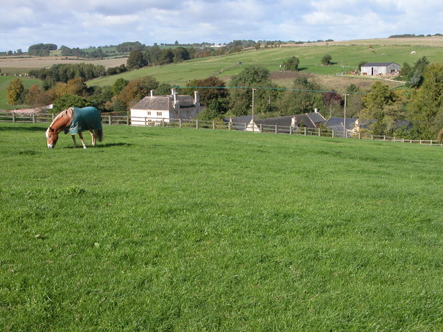
Cloud Hill Images
Images are sourced within 2km of 51.902414/-1.86548 or Grid Reference SP0922. Thanks to Geograph Open Source API. All images are credited.


Cloud Hill is located at Grid Ref: SP0922 (Lat: 51.902414, Lng: -1.86548)
Administrative County: Gloucestershire
District: Cotswold
Police Authority: Gloucestershire
What 3 Words
///starlight.heartburn.inhaler. Near Westfield, Gloucestershire
Nearby Locations
Related Wikis

Notgrove railway station
Notgrove railway station was a Gloucestershire station on the Great Western Railway's Banbury and Cheltenham Direct Railway. == History == The station...

Notgrove Long Barrow
Notgrove Long Barrow is a prehistoric long barrow burial mound in Gloucestershire, England. It consists of a large mound with a passage running through...

Guiting Power
Guiting Power is a village and civil parish in the Cotswolds, in Gloucestershire, England. The population of the parish at the 2011 census was 296.Guiting...
Aylworth
Aylworth is a village in Gloucestershire, England. == References == == External links == Media related to Aylworth at Wikimedia Commons Aylworth in the...
Related Videos

A Cold, Misty & Mysterious Early Morning Walk Through a Cotswold Village & Countryside
So, today we are out and about walking in the village of Guiting Power which is located within the heart of the Cotswolds in the ...
A Never Before Seen Sunrise Skyline - Magnificent COTSWOLDS Village Walk, ENGLAND
Experience the breathtaking beauty of a never before seen Sunrise Skyline in the enchanting Cotswolds village of England!

The Three Fords Walk
Starting at the car park near to Guiting Power, the route is circular with a halfway point at Kineton. The full route can be followed ...

Duntisbourne Rouse to Daglingworth
Charlotte and I tried out this fantastic little route from Duntisbourne Rouse to Daglingworth. A nice little family walk or good for a ...
Nearby Amenities
Located within 500m of 51.902414,-1.86548Have you been to Cloud Hill?
Leave your review of Cloud Hill below (or comments, questions and feedback).