Bleaklow Head

Hill, Mountain in Derbyshire High Peak

England

Bleaklow Head

Wreckage of B-29 Superfortress Wreckage of the B-29 Superfortress Overexposed which crashed on 3rd Nov 1948
Wreckage of B-29 Superfortress Credit: Shaun Ferguson

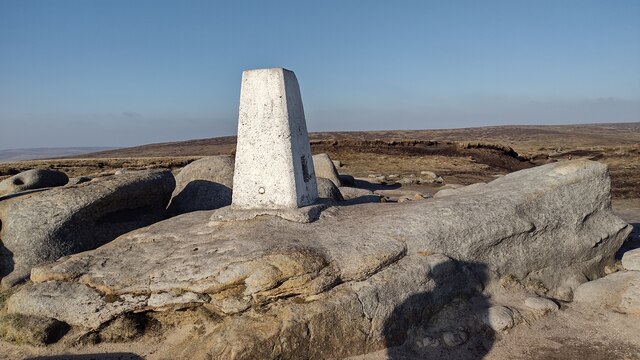
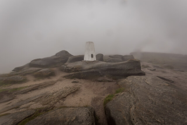
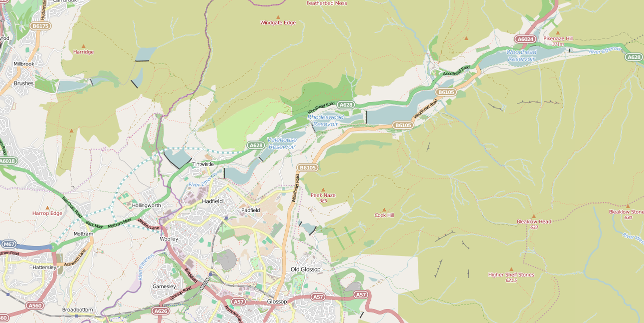
Bleaklow Head is a prominent hill located in the Peak District National Park in Derbyshire, England. Standing at an elevation of 633 meters (2,077 feet), it is often referred to as a mountain due to its impressive height and rugged terrain. The hill is part of the Dark Peak region, which is known for its wild and desolate landscapes.

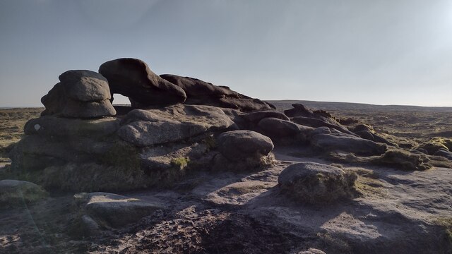
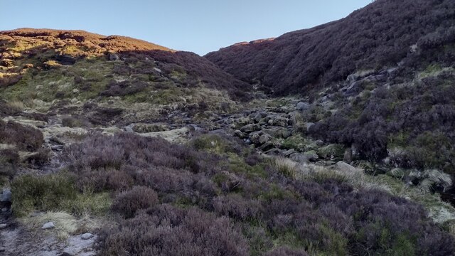
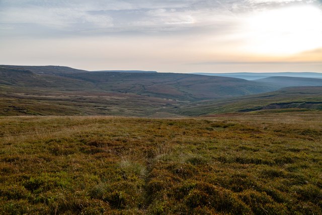
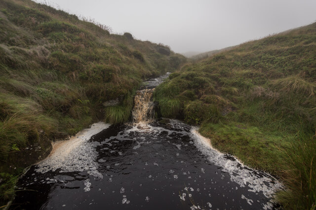
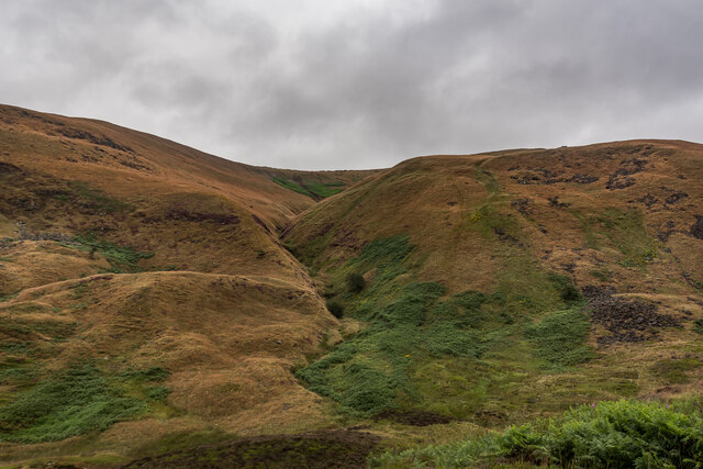
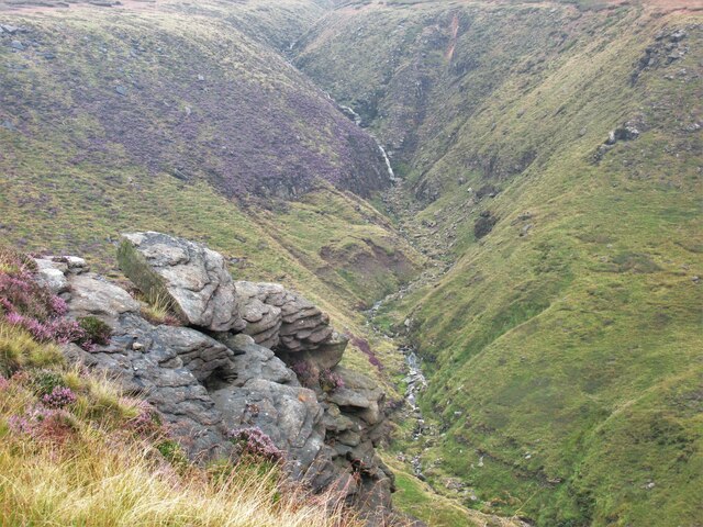
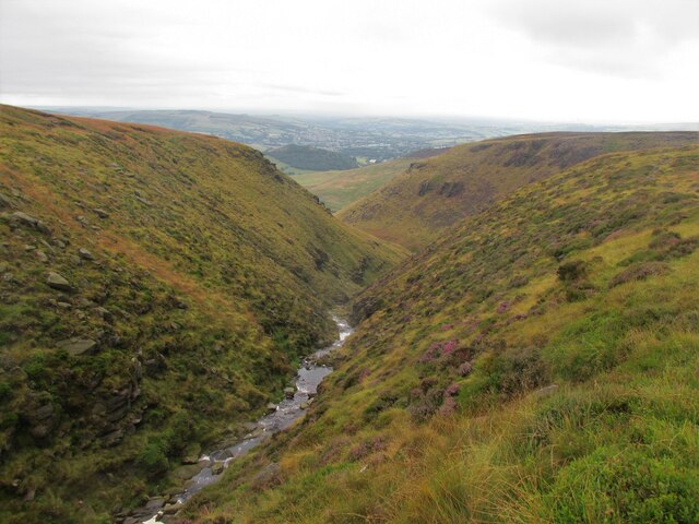
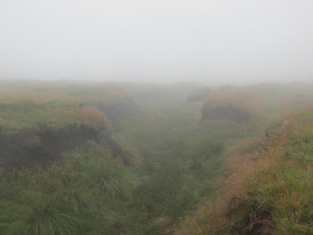
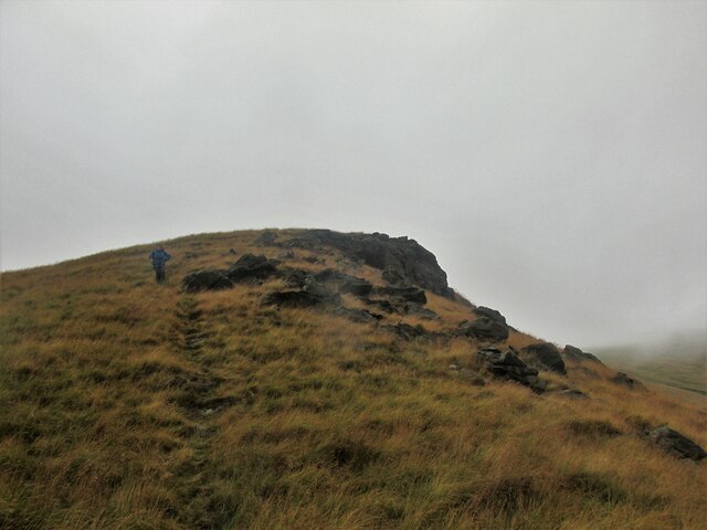
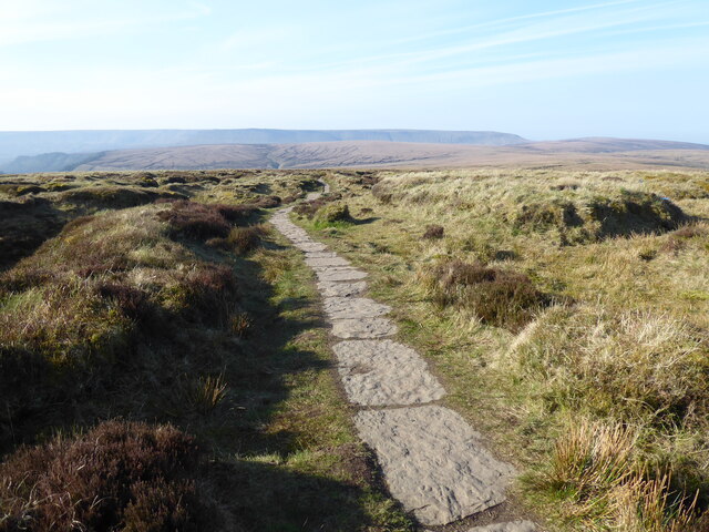
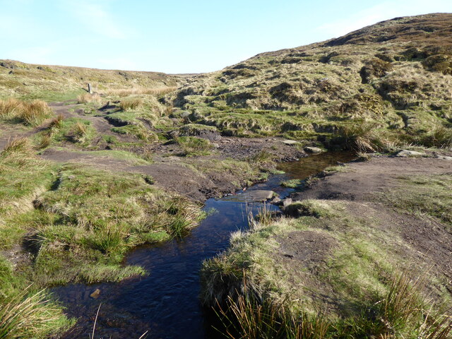
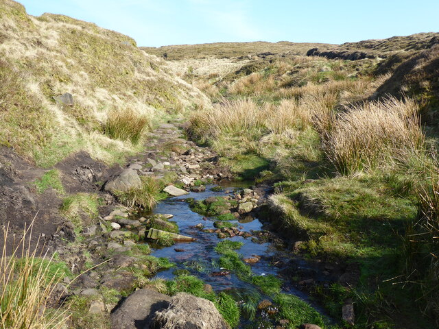
Bleaklow Head is characterized by its peat-covered moorland, rocky outcrops, and deep valleys. The hill is renowned for its harsh and unpredictable weather conditions, with strong winds and heavy fog being common occurrences. Despite its challenging environment, Bleaklow Head attracts many hikers, ramblers, and outdoor enthusiasts who are drawn to its remote and untamed beauty.

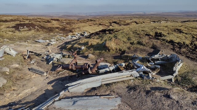
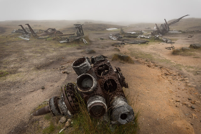
The hill is also notable for its historical significance. It was once a site for aircraft crash sites from World War II, with several wreckage remnants still visible today. The most famous of these is the B-29 Superfortress "Overexposed," which crashed in 1948 and left a lasting mark on the landscape.

Bleaklow Head offers breathtaking panoramic views of the surrounding countryside, including the Kinder Scout plateau and the Snake Pass road. The area is home to a variety of wildlife, including mountain hares, red grouse, and peregrine falcons. It is also a vital habitat for rare plant species, such as the cotton sedge and cranberry.

Overall, Bleaklow Head is a captivating destination for nature lovers and adventurers seeking a challenging and rewarding outdoor experience. Its rugged beauty, rich history, and unique ecosystem make it a must-visit location within the Peak District National Park.

If you have any feedback on the listing, please let us know in the comments section below.

Bleaklow Head Images

Images are sourced within 2km of 53.460111/-1.862108 or Grid Reference SK0995. Thanks to Geograph Open Source API. All images are credited.

Wreckage of B-29 Superfortress Wreckage of the B-29 Superfortress Overexposed which crashed on 3rd Nov 1948
Wreckage of B-29 Superfortress
Wreckage of the B-29 Superfortress Overexposed which crashed on 3rd Nov 1948
Trig Point Higher Shelf Stones trig point
Trig Point
Higher Shelf Stones trig point
Hern Stones Hern Stones on Bleaklow
Hern Stones
Hern Stones on Bleaklow
Pennine Way Pennine Way heading up to Bleaklow Head
Pennine Way
Pennine Way heading up to Bleaklow Head
Wildboar Grain Wildboar Grain with Pennine Way heading to Bleaklow Head
Wildboar Grain
Wildboar Grain with Pennine Way heading to Bleaklow Head
Pennine Way Pennine Way passes through fence line
Pennine Way
Pennine Way passes through fence line
Grains in the Water
Grains in the Water
Boeing RB-29A Wreckage, Higher Shelf Boeing 'RB-29A 44-61999 was part of the 16th Photographic Reconnaissance Squadron, 91st Reconnaissance Group, 311th Air Division in the Strategic Air Command of USAF. The aircraft bore the name Over Exposed after it was flown in July 1946 by the 509th Composite Group during Operation Crossroads to photograph nuclear testing at Bikini Atoll, including the dropping of an atomic bomb by B-29 Superfortress Dave's Dream. 

Centre of the image is one of the 4 engines. To the right is the nose wheel and to the left is one of the landing legs.

<span class="nowrap"><a title="https://en.wikipedia.org/wiki/Bleaklow_Bomber" rel="nofollow ugc noopener" href="https://en.wikipedia.org/wiki/Bleaklow_Bomber">Link</a><img style="margin-left:2px;" alt="External link" title="External link - shift click to open in new window" src="https://s1.geograph.org.uk/img/external.png" width="10" height="10"/></span>
Boeing RB-29A Wreckage, Higher Shelf
Boeing 'RB-29A 44-61999 was part of the 16th Photographic Reconnaissance Squadron, 91st Reconnaissance Group, 311th Air Division in the Strategic Air Command of USAF. The aircraft bore the name Over Exposed after it was flown in July 1946 by the 509th Composite Group during Operation Crossroads to photograph nuclear testing at Bikini Atoll, including the dropping of an atomic bomb by B-29 Superfortress Dave's Dream. Centre of the image is one of the 4 engines. To the right is the nose wheel and to the left is one of the landing legs. LinkExternal link
Hern Clough
Hern Clough
Higher Shelfstones Trigpoint TP3826 Very wet and Misty day on the high ground. Just up from the B29 crash site.

<span class="nowrap"><a title="http://trigpointing.uk/trig/3826" rel="nofollow ugc noopener" href="http://trigpointing.uk/trig/3826">Link</a><img style="margin-left:2px;" alt="External link" title="External link - shift click to open in new window" src="https://s1.geograph.org.uk/img/external.png" width="10" height="10"/></span>
Higher Shelfstones Trigpoint TP3826
Very wet and Misty day on the high ground. Just up from the B29 crash site. LinkExternal link
Ashton Clough From Doctor's Gate Path
Yellowslacks Brook Along the rocks at Dog Rock.
Yellowslacks Brook
Along the rocks at Dog Rock.
Dowstone Clough A steady climb up from Old Glossop.
Dowstone Clough
A steady climb up from Old Glossop.
A clough near the Hern Stones A typical summer day on Bleaklow.
A clough near the Hern Stones
A typical summer day on Bleaklow.
Lower Shelf Stones Dropping down to the Doctor's Gate path.
Lower Shelf Stones
Dropping down to the Doctor's Gate path.
The Pennine Way near Alport Low
The Pennine Way near Hern Clough
Show me another place!

Bleaklow Head is located at Grid Ref: SK0995 (Lat: 53.460111, Lng: -1.862108)

Administrative County: Derbyshire

District: High Peak

Police Authority: Derbyshire

What 3 Words

///plotter.fruits.coverage. Near Glossop, Derbyshire

Nearby Locations

Bleaklow Head Hern Stones

Related Wikis

Bleaklow

Bleaklow is a high, largely peat-covered, gritstone moorland in the Derbyshire High Peak near the town of Glossop. It is north of Kinder Scout, across...

Bleaklow Bomber

The Bleaklow Bomber was a US Air Force (USAF) Boeing RB-29A Superfortress that crashed near Higher Shelf Stones on Bleaklow in the Peak District in 1948...

Snake Pass

Snake Pass is a hill pass in the Derbyshire section of the Peak District, crossing the Pennines between Glossop and the Ladybower Reservoir at Ashopton...

Crowden railway station

Crowden railway station is a closed railway station on the Woodhead Line between Manchester and Sheffield, that served the hamlet of Crowden, Derbyshire...

Longdendale Chain

The Longdendale Chain is a sequence of six reservoirs on the River Etherow in the Longdendale Valley, in northern Derbyshire. They were constructed between...

Torside Reservoir

Torside Reservoir is the largest man-made lake in Longdendale in north Derbyshire, England. It was constructed by John Frederick Bateman between April...

Mossy Lea Reservoir

Mossy Lea Reservoir is a disused reservoir near Glossop, north Derbyshire. In 1837, 50 local millowners and gentlemen, known as the "Glossop Commissioners...

Woodhead Reservoir

Woodhead reservoir is a man-made lake near the hamlet of Woodhead in Longdendale in north Derbyshire, England. It was constructed by John Frederick Bateman...

Nearby Amenities

Located within 500m of 53.460111,-1.862108
Bleaklow Head
Ele: 633
Natural: peak
Wikidata: Q883307
Wikipedia: en:Bleaklow
Lat/Long: 53.4612885/-1.858914
Wain Stones
Natural: rock
Tourism: attraction
Lat/Long: 53.4598786/-1.8632098
Far Moss
Place: locality
Lat/Long: 53.4638246/-1.8618555
Ford: yes
Lat/Long: 53.4592823/-1.8550607
Ford: yes
Lat/Long: 53.4589978/-1.856059
The data included in this document is from www.openstreetmap.org. The data is made available under ODbL.

Have you been to Bleaklow Head?

Leave your review of Bleaklow Head below (or comments, questions and feedback).