Aboyne

Settlement in Aberdeenshire

Scotland

Aboyne

Bench by Tarland Burn
Bench by Tarland Burn Credit: Alan Reid

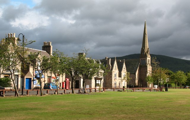
Aboyne is a picturesque village located in Aberdeenshire, Scotland. Situated on the banks of the River Dee, it is surrounded by the stunning landscapes of the Cairngorms National Park. With a population of around 2,500, Aboyne maintains a small-town charm while offering a range of amenities to its residents and visitors.

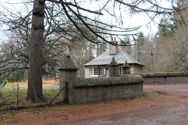
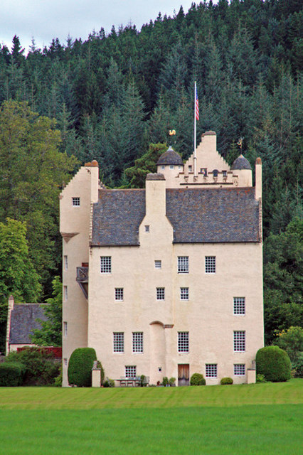
The village is known for its rich history, with evidence of settlements dating back to the Bronze Age. Aboyne Castle, a 13th-century tower house, stands as a testament to the area's past. Today, it serves as a private residence and is not open to the public. However, the stunning gardens surrounding the castle can be enjoyed during the annual Aboyne Castle Highland Games.

Speaking of the Highland Games, Aboyne is renowned for hosting one of Scotland's oldest and most prestigious events of its kind. Held annually on the first Saturday in August, the games attract participants and spectators from all over the world. Traditional Scottish events such as caber tossing, hammer throwing, and Highland dancing take center stage, creating a vibrant and festive atmosphere.

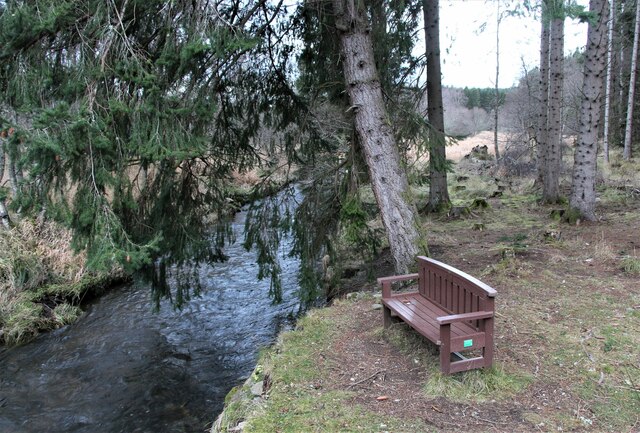
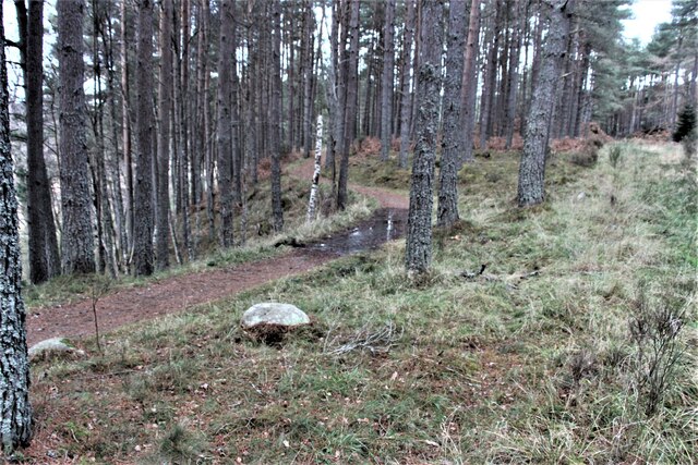
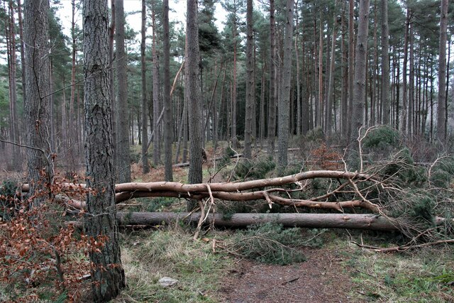
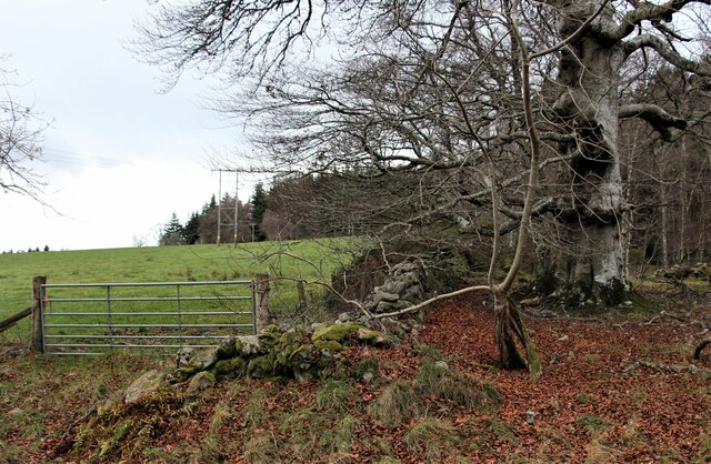
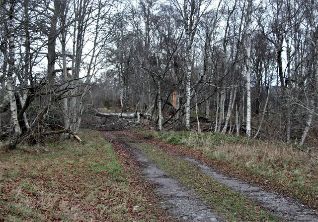
Nature enthusiasts are drawn to Aboyne for its proximity to the Cairngorms, offering ample opportunities for outdoor activities. Hiking, mountain biking, fishing, and wildlife spotting are just a few of the pursuits available in the surrounding area. The nearby Muir of Dinnet National Nature Reserve provides a haven for various bird species and offers tranquil walking trails.

In addition to its natural beauty, Aboyne offers a range of amenities, including shops, restaurants, and accommodation options. The village also holds a weekly farmers market, showcasing local produce and crafts. Overall, Aboyne is a charming and historic village that combines natural splendor with cultural events, making it a must-visit destination in Aberdeenshire.

If you have any feedback on the listing, please let us know in the comments section below.
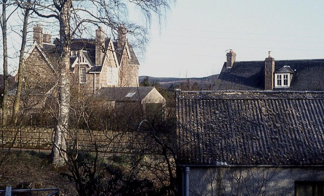
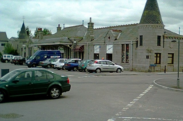
Aboyne Images

Images are sourced within 2km of 57.075944/-2.792078 or Grid Reference NO5298. Thanks to Geograph Open Source API. All images are credited.

Bench by Tarland Burn
Forest path in Coull Estate
Aftermath of Storm 'Arwen' Trees across a path in Coull Estate.
Aftermath of Storm 'Arwen'
Trees across a path in Coull Estate.
Forest edge north of Aboyne
Aftermath of Storm 'Arwen' A blocked woodland track north of Aboyne.
Aftermath of Storm 'Arwen'
A blocked woodland track north of Aboyne.
Tarland Burn in Allach Wood
Road to Aboyne Golf Club
Eastern suburb of Aboyne
Rhu-na-haven gate lodge
A93 towards Aboyne
A93 towards Aboyne
A93 in Aboyne
A93 in Aboyne
Bell wood seat with a view Geocaching is a type of global treasure hunt of people looking for caches, or hidden stashes of objects. Geocaching may also be described as a series of hide-and-seek games, where hiders provide online clues for seekers. Seekers use global positioning system (GPS) devices to find hidden caches
Bell wood seat with a view
Geocaching is a type of global treasure hunt of people looking for caches, or hidden stashes of objects. Geocaching may also be described as a series of hide-and-seek games, where hiders provide online clues for seekers. Seekers use global positioning system (GPS) devices to find hidden caches
The Corner House Shop and telephone box, Aboyne.
The Corner House
Shop and telephone box, Aboyne.
19th century post box, Aboyne Victoria cypher post box.
19th century post box, Aboyne
Victoria cypher post box.
Granite houses near Ballater
Church and Park in Aboyne
Massed Bands Pipes and Drums at Aboyne Highland Games,held in summer this is one of the main attractions to Aboyneheld on the village green.
Massed Bands
Pipes and Drums at Aboyne Highland Games,held in summer this is one of the main attractions to Aboyneheld on the village green.
Aboyne Runners One of the races at Aboyne.As part of the games circuit runners are attracted from all over. in this case the runner in blue, rear left, was part of a French film crew covering the highland games.
Aboyne Runners
One of the races at Aboyne.As part of the games circuit runners are attracted from all over. in this case the runner in blue, rear left, was part of a French film crew covering the highland games.
Show me another place!

Aboyne is located at Grid Ref: NO5298 (Lat: 57.075944, Lng: -2.792078)

Unitary Authority: Aberdeenshire

Police Authority: North East

What 3 Words

///police.campus.take. Near Aboyne, Aberdeenshire

Nearby Locations

Aboyne

Related Wikis

Nearby Amenities

Located within 500m of 57.075944,-2.792078
Traffic Calming: cushion
Lat/Long: 57.0734246/-2.7913742
Traffic Calming: cushion
Lat/Long: 57.0735624/-2.7929564
Traffic Calming: cushion
Lat/Long: 57.0730072/-2.7918767
Crossing
Crossing: uncontrolled
Crossing Ref: zebra
Tactile Paving: yes
Lat/Long: 57.0759092/-2.7929973
Post Box
Brand: Royal Mail
Brand Wikidata: Q638098
Collection Times: Mo-Fr 09:00; Sa 07:00
Operator: Royal Mail
Operator Wikidata: Q638098
Post Box Type: lamp
Ref: AB34 372
Royal Cypher: scottish_crown
Lat/Long: 57.0733415/-2.7913696
Barrier: cycle_barrier
Lat/Long: 57.0742257/-2.7917601
Barrier: cycle_barrier
Lat/Long: 57.0740246/-2.7920096
Traffic Calming: cushion
Lat/Long: 57.0787792/-2.7953024
Bus Stop
Bridge View Road
Bench: yes
Bin: yes
Bus: yes
Lit: yes
Naptan AtcoCode: 630041632
Naptan Bearing: W
Naptan CommonName: Bridge View Road
Naptan Indicator: at
Naptan Landmark: Bridgeview Road
Naptan NaptanCode: 23628294
Naptan Street: Ballater Road
Public Transport: platform
Ref: 23628294
Shelter: yes
Tactile Paving: no
Lat/Long: 57.0759939/-2.7950819
Bus Stop
Bridge View Road
Bench: yes
Bin: yes
Bus: yes
Lit: yes
Naptan AtcoCode: 630041631
Naptan Bearing: E
Naptan CommonName: Bridge View Road
Naptan Indicator: opp
Naptan Landmark: Bridgeview Road
Naptan NaptanCode: 23628326
Naptan Street: Ballater Road
Public Transport: platform
Ref: 23628326
Shelter: yes
Tactile Paving: no
Lat/Long: 57.0761383/-2.7963224
805 start
Lat/Long: 57.0760073/-2.7922219
Noexit: yes
Lat/Long: 57.0756154/-2.7992285
Recycling
Recycling Clothes: yes
Recycling Shoes: yes
Recycling Type: container
Lat/Long: 57.0742239/-2.7924615
Power: pole
Lat/Long: 57.0795002/-2.7965234
Bus Stop
Ladywood
Bench: no
Bin: yes
Bus: yes
Check Date Shelter: 2022-11-26
Lit: yes
Naptan AtcoCode: 630041633
Naptan Bearing: W
Naptan CommonName: Ladywood
Naptan Indicator: at
Naptan Landmark: Ladywood
Naptan NaptanCode: 23629654
Naptan Street: Ballater Road
Public Transport: platform
Ref: 23629654
Shelter: no
Tactile Paving: no
Lat/Long: 57.0762215/-2.7994597
Bus Stop
Old Tollhouse Road
Bench: no
Bin: no
Bus: yes
Lit: yes
Naptan AtcoCode: 630045222
Naptan Bearing: W
Naptan CommonName: Old Tollhouse Road
Naptan Indicator: at
Naptan Landmark: Old Tollhouse Road
Naptan NaptanCode: 23623475
Naptan Street: A93
Public Transport: platform
Ref: 23623475
Shelter: no
Tactile Paving: no
Lat/Long: 57.0757459/-2.7906514
Bus Stop
Old Tollhouse Road
Bench: no
Bin: no
Bus: yes
Lit: yes
Naptan AtcoCode: 630045221
Naptan Bearing: E
Naptan CommonName: Old Tollhouse Road
Naptan Indicator: opp
Naptan Landmark: Old Tollhouse Road
Naptan NaptanCode: 23628352
Naptan Street: A93
Public Transport: platform
Ref: 23628352
Shelter: no
Tactile Paving: no
Lat/Long: 57.0758192/-2.7905072
Bus Stop
Gordon Crescent
Bench: no
Bin: no
Bus: yes
Lit: yes
Naptan AtcoCode: 630045211
Naptan Bearing: E
Naptan CommonName: Gordon Crescent
Naptan Indicator: opp
Naptan Landmark: Gordon Crescent
Naptan NaptanCode: 23623484
Naptan Street: A93
Public Transport: platform
Ref: 23623484
Shelter: no
Tactile Paving: no
Lat/Long: 57.0755565/-2.7859374
Bus Stop
Gordon Crescent
Bench: no
Bin: no
Bus: yes
Lit: yes
Naptan AtcoCode: 630045212
Naptan Bearing: W
Naptan CommonName: Gordon Crescent
Naptan Indicator: at
Naptan Landmark: Gordon Crescent
Naptan NaptanCode: 23623486
Naptan Street: Ballater Road
Public Transport: platform
Ref: 23623486
Shelter: no
Tactile Paving: no
Lat/Long: 57.0754221/-2.7851187
Traffic Calming: cushion
Lat/Long: 57.0803979/-2.7930942
Crossing
Lat/Long: 57.0804189/-2.7929238
Post Box
Brand: Royal Mail
Brand Wikidata: Q638098
Collection Times: Mo-Fr 09:00; Sa 07:00
Operator: Royal Mail
Operator Wikidata: Q638098
Post Box Design: 2010_pattern
Post Box Type: lamp
Ref: AB34 207
Royal Cypher: scottish_crown
Source: survey
Lat/Long: 57.075566/-2.7875846
Generator Method: photovoltaic
Generator Output Electricity: small_installation
Generator Source: solar
Location: roof
Power: generator
Lat/Long: 57.0749671/-2.7842054
Stop
Direction: backward
Lat/Long: 57.0718912/-2.7894451
Stop
Direction: forward
Lat/Long: 57.0718503/-2.7895215
Waste Basket
Waste: dog_excrement
Lat/Long: 57.0731195/-2.7913635
Generator Method: photovoltaic
Generator Output Electricity: small_installation
Generator Source: solar
Location: roof
Power: generator
Lat/Long: 57.0720822/-2.7953292
Waste Basket
Waste: dog_excrement
Lat/Long: 57.07387/-2.7921011
Grit Bin
Lat/Long: 57.0740253/-2.7924351
Traffic Calming: cushion
Lat/Long: 57.0785562/-2.7948739
Traffic Calming: cushion
Lat/Long: 57.0790304/-2.7958824
Traffic Calming: cushion
Lat/Long: 57.079214/-2.7967621
Generator Method: photovoltaic
Generator Output Electricity: small_installation
Generator Source: solar
Location: roof
Power: generator
Lat/Long: 57.0800981/-2.7944353
Generator Method: photovoltaic
Generator Output Electricity: small_installation
Generator Source: solar
Location: roof
Power: generator
Lat/Long: 57.0782512/-2.7940149
Generator Method: photovoltaic
Generator Output Electricity: small_installation
Generator Source: solar
Location: roof
Power: generator
Lat/Long: 57.0779057/-2.7937983
Generator Method: photovoltaic
Generator Output Electricity: small_installation
Generator Source: solar
Generator Type: solar_photovoltaic_panel
Location: roof
Power: generator
Lat/Long: 57.0763193/-2.7892065
Generator Method: photovoltaic
Generator Output Electricity: small_installation
Generator Source: solar
Location: roof
Power: generator
Lat/Long: 57.0768535/-2.7959005
Generator Method: photovoltaic
Generator Output Electricity: small_installation
Generator Source: solar
Location: roof
Power: generator
Lat/Long: 57.0773787/-2.7979758
Generator Method: photovoltaic
Generator Output Electricity: small_installation
Generator Source: solar
Location: roof
Power: generator
Lat/Long: 57.0768102/-2.7968694
Generator Method: photovoltaic
Generator Output Electricity: small_installation
Generator Source: solar
Location: roof
Power: generator
Lat/Long: 57.0767898/-2.7972892
Generator Method: photovoltaic
Generator Output Electricity: small_installation
Generator Source: solar
Location: roof
Power: generator
Lat/Long: 57.0768/-2.7977988
Generator Method: photovoltaic
Generator Output Electricity: small_installation
Generator Source: solar
Location: roof
Power: generator
Lat/Long: 57.0764071/-2.7980308
Generator Method: photovoltaic
Generator Output Electricity: small_installation
Generator Source: solar
Location: roof
Power: generator
Lat/Long: 57.0764548/-2.7989367
Generator Method: photovoltaic
Generator Output Electricity: small_installation
Generator Source: solar
Location: roof
Power: generator
Lat/Long: 57.0727696/-2.7968158
Generator Method: photovoltaic
Generator Output Electricity: small_installation
Generator Source: solar
Location: roof
Power: generator
Lat/Long: 57.0727714/-2.7969492
Generator Method: photovoltaic
Generator Output Electricity: small_installation
Generator Source: solar
Location: roof
Power: generator
Lat/Long: 57.0734468/-2.7989012
Generator Method: photovoltaic
Generator Output Electricity: small_installation
Generator Source: solar
Location: roof
Power: generator
Lat/Long: 57.0739024/-2.798468
Traffic Calming: cushion
Lat/Long: 57.0736961/-2.7938211
Traffic Calming: cushion
Lat/Long: 57.0789327/-2.798006
Traffic Calming: cushion
Lat/Long: 57.0790821/-2.7977767
Crossing
Crossing: unmarked
Crossing Island: no
Tactile Paving: yes
Lat/Long: 57.0785198/-2.7948457
Crossing
Crossing: unmarked
Crossing Island: no
Tactile Paving: yes
Lat/Long: 57.0792847/-2.7945372
Crossing
Crossing: unmarked
Crossing Island: no
Tactile Paving: yes
Lat/Long: 57.0789378/-2.7955022
Crossing
Crossing: unmarked
Crossing Island: no
Tactile Paving: yes
Lat/Long: 57.0793204/-2.7966629
Crossing
Crossing: unmarked
Crossing Island: no
Tactile Paving: yes
Lat/Long: 57.0789611/-2.7980194
Generator Method: photovoltaic
Generator Output Electricity: small_installation
Generator Source: solar
Location: roof
Power: generator
Lat/Long: 57.0798773/-2.7957711
Man Made: tower
Tower Construction: lattice
Tower Type: observation
Lat/Long: 57.0739451/-2.7932225
Recycling
Recycling Clothes: yes
Recycling Shoes: yes
Recycling Type: container
Lat/Long: 57.0739756/-2.7938476
Entrance: yes
Lat/Long: 57.0749127/-2.7947158
Entrance: main
Lat/Long: 57.0751895/-2.7943441
Entrance: yes
Lat/Long: 57.075007/-2.7963605
Community Centre Entrance
Entrance: main
Lat/Long: 57.0755037/-2.7948206
Traffic Calming: cushion
Lat/Long: 57.0753617/-2.7937132
Traffic Calming: cushion
Lat/Long: 57.0747342/-2.7918956
Leisure: picnic_table
Lat/Long: 57.0757018/-2.7944263
Leisure: picnic_table
Lat/Long: 57.0756415/-2.7943539
Traffic Calming: cushion
Lat/Long: 57.0749968/-2.7932881
Traffic Calming: cushion
Lat/Long: 57.074618/-2.7928417
Traffic Calming: cushion
Lat/Long: 57.0742671/-2.7917232
Traffic Calming: cushion
Lat/Long: 57.0756705/-2.7920977
Traffic Calming: cushion
Lat/Long: 57.0729227/-2.7907535
Traffic Calming: cushion
Lat/Long: 57.0725514/-2.7902969
Traffic Calming: cushion
Lat/Long: 57.0719928/-2.7896271
The data included in this document is from www.openstreetmap.org. The data is made available under ODbL.

Have you been to Aboyne?

Leave your review of Aboyne below (or comments, questions and feedback).