Greenhaw Hill

Hill, Mountain in Yorkshire Craven

England

Greenhaw Hill

Straight across the moor The drystone walls at Jack Hole Flat run in straight lines and are an indication of 19th century parliamentary enclosures. In the distance can be seen the gritstone outcrop of Wig Stones.
Straight across the moor Credit: Gordon Hatton

Greenhaw Hill is a prominent geographical feature located in the county of Yorkshire, England. Situated in the scenic Yorkshire Dales National Park, it is classified as a hill rather than a mountain due to its elevation, reaching a height of approximately 453 meters (1,486 feet) above sea level.

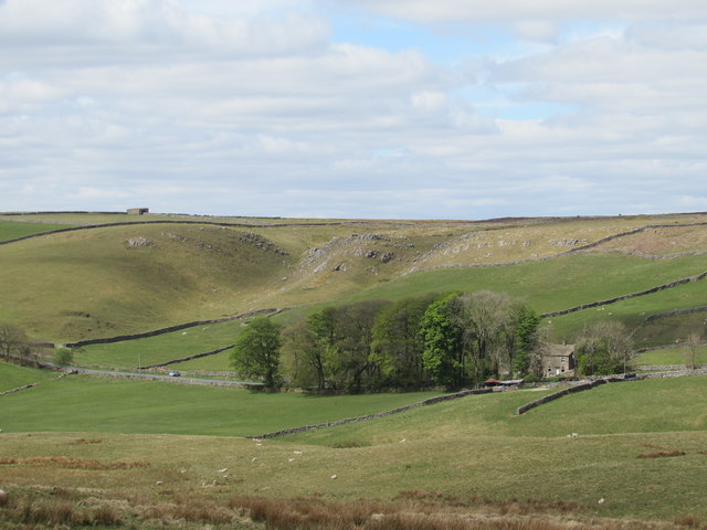
The hill is characterized by its picturesque landscape, featuring lush green meadows, rocky outcrops, and a diverse range of flora and fauna. Its slopes are covered in heather and bracken, providing a vibrant display of colors throughout the year, particularly during the summer months when the heather blooms in hues of purple and pink.

Greenhaw Hill offers breathtaking panoramic views of the surrounding countryside, including the rolling hills of the Yorkshire Dales and the nearby Nidderdale Area of Outstanding Natural Beauty. On clear days, visitors can even catch a glimpse of the distant Pennines to the west.

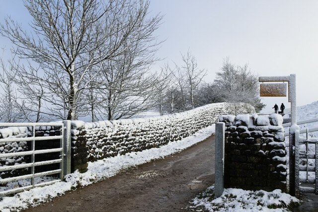
The hill is a popular destination for outdoor enthusiasts, attracting hikers, walkers, and nature lovers alike. Several well-marked trails crisscross the area, providing opportunities for exploration and adventure. The summit of Greenhaw Hill offers a rewarding vantage point, where visitors can enjoy a sense of tranquility and soak in the stunning vistas.

Greenhaw Hill is also home to a variety of wildlife, with frequent sightings of birds such as buzzards, kestrels, and curlews. The surrounding area supports a rich ecosystem, with numerous species of plants, insects, and small mammals.

Overall, Greenhaw Hill is a captivating natural landmark, offering visitors a chance to experience the beauty and serenity of the Yorkshire countryside.

If you have any feedback on the listing, please let us know in the comments section below.

Greenhaw Hill Images

Images are sourced within 2km of 54.081351/-1.8860149 or Grid Reference SE0765. Thanks to Geograph Open Source API. All images are credited.

Straight across the moor The drystone walls at Jack Hole Flat run in straight lines and are an indication of 19th century parliamentary enclosures. In the distance can be seen the gritstone outcrop of Wig Stones.
Straight across the moor
The drystone walls at Jack Hole Flat run in straight lines and are an indication of 19th century parliamentary enclosures. In the distance can be seen the gritstone outcrop of Wig Stones.
Gritstone and Limestone Life gets complicated geology-wise around here. An outcrop of carboniferous limestone to the right is only a few metres from a couple of large gritstone boulders which look to be on the surface as opposed to part of the strata. Maybe they were dumped here by a glacier.
Gritstone and Limestone
Life gets complicated geology-wise around here. An outcrop of carboniferous limestone to the right is only a few metres from a couple of large gritstone boulders which look to be on the surface as opposed to part of the strata. Maybe they were dumped here by a glacier.
Limestone outcrop, Nursery Knot A view from the summit area of Nursery Knot across moorland towards Grimwith Reservoir. On the horizon can be seen the hump of Great Whernside with a thin cover of snow.
Limestone outcrop, Nursery Knot
A view from the summit area of Nursery Knot across moorland towards Grimwith Reservoir. On the horizon can be seen the hump of Great Whernside with a thin cover of snow.
Summit rocks, Nursery Knot This small hill to the north of the B6265 has a summit crowned by an outcrop of carboniferous limestone which dips quite steeply to the north. The rocks of the Yorkshire Dales are stacked one on top of the other in almost level layers - with a gentle dip towards the north east, but here everything changes as this site is close to the Craven fault zone where rock has been put under great pressure and pushed out of shape. The limestone here is part of a thin finger which stretches eastwards for another 2 or 3 miles to Coldstones Quarry before fading out above Pateley Bridge.
Summit rocks, Nursery Knot
This small hill to the north of the B6265 has a summit crowned by an outcrop of carboniferous limestone which dips quite steeply to the north. The rocks of the Yorkshire Dales are stacked one on top of the other in almost level layers - with a gentle dip towards the north east, but here everything changes as this site is close to the Craven fault zone where rock has been put under great pressure and pushed out of shape. The limestone here is part of a thin finger which stretches eastwards for another 2 or 3 miles to Coldstones Quarry before fading out above Pateley Bridge.
Pockmarked hillside near Stump Cross Looking almost like shell holes from an old battlefield, these dips and hollows are almost certainly the work of man. Note also the line of hollows running across the photo higher up. All these features are due to lead workings, the higher line following a vein across the moor. This area close to the B6265 is also close to the eastern end of the Craven fault zone, and where there are fault lines in the Dales, then there are likely to be veins of valuable minerals such as lead, plus calcite, barytes etc.
Pockmarked hillside near Stump Cross
Looking almost like shell holes from an old battlefield, these dips and hollows are almost certainly the work of man. Note also the line of hollows running across the photo higher up. All these features are due to lead workings, the higher line following a vein across the moor. This area close to the B6265 is also close to the eastern end of the Craven fault zone, and where there are fault lines in the Dales, then there are likely to be veins of valuable minerals such as lead, plus calcite, barytes etc.
Yorkshire  Dales  Sailing  Club  Grimwith  Reservoir The reservoir dam can be seen at the left, there is a 4.5 mile walk around the reservoir, far from the maddening crowds.
Yorkshire Dales Sailing Club Grimwith Reservoir
The reservoir dam can be seen at the left, there is a 4.5 mile walk around the reservoir, far from the maddening crowds.
Grimwith  Reservoir Access road off the B6265, a car park and picnic tables, separate from the sailing club. A walk around the reservoir is 4.5 miles
Grimwith Reservoir
Access road off the B6265, a car park and picnic tables, separate from the sailing club. A walk around the reservoir is 4.5 miles
Old Boundary Marker near Cranberry Gill, Appletreewick parish Estate Boundary Marker in parish of Appletreewick (Craven District), Cranberry Gill, 1000 metres South of Grey Crag.

Inscription reads:-
: J Y / A : : J Y / B :

North Yorkshire HER.
NY SMR Number: MNY37764 <span class="nowrap"><a title="https://www.heritagegateway.org.uk/Gateway/Results_Single.aspx?uid=MNY37764&resourceID=1009" rel="nofollow ugc noopener" href="https://www.heritagegateway.org.uk/Gateway/Results_Single.aspx?uid=MNY37764&resourceID=1009">Link</a><img style="margin-left:2px;" alt="External link" title="External link - shift click to open in new window" src="https://s1.geograph.org.uk/img/external.png" width="10" height="10"/></span>

Surveyed

Milestone Society National ID: YW_APPLET02em
Old Boundary Marker near Cranberry Gill, Appletreewick parish
Estate Boundary Marker in parish of Appletreewick (Craven District), Cranberry Gill, 1000 metres South of Grey Crag. Inscription reads:- : J Y / A : : J Y / B : North Yorkshire HER. NY SMR Number: MNY37764 LinkExternal link Surveyed Milestone Society National ID: YW_APPLET02em
Dry Gill Limekilns Two large partially collapsed nineteenth century running kilns located close to Stump Cross Caverns.
Dry Gill Limekilns
Two large partially collapsed nineteenth century running kilns located close to Stump Cross Caverns.
Nussey House Farm Plantation woodland to the west, where the prevailing wind would normally come from. Croft Gill is the nick in the escarpment behind the farm.
Nussey House Farm
Plantation woodland to the west, where the prevailing wind would normally come from. Croft Gill is the nick in the escarpment behind the farm.
Rams Gill The upper reaches of a dry side valley that cuts down through the limestone bedrock, exiting behind Nussey House Farm. Probably created at the end of the last Ice Age, when water flowed over perma-frosted ground.
Rams Gill
The upper reaches of a dry side valley that cuts down through the limestone bedrock, exiting behind Nussey House Farm. Probably created at the end of the last Ice Age, when water flowed over perma-frosted ground.
Low water levels at Grimwith reservoir Compare with <a href="https://www.geograph.org.uk/photo/4594677">SE0664 : The draw-off  tower and dam at Grimwith Reservoir</a> (2015).

The reservoir was originally built in 1864 as part of Bradford's water supply system, destroying the hamlets of Grimwith and Gate Up in the process.  It was later increased in size in the 1970s/80s.
Low water levels at Grimwith reservoir
Compare with SE0664 : The draw-off tower and dam at Grimwith Reservoir (2015). The reservoir was originally built in 1864 as part of Bradford's water supply system, destroying the hamlets of Grimwith and Gate Up in the process. It was later increased in size in the 1970s/80s.
Gated track South of Grimwith Reservoir
Walkers on the permissive path, Grimwith Reservoir
Snowy seat by Grimwith Reservoir
A snowy Grimwith Reservoir
Bend in the track to High Laithe
High Shaws Laithe in the snow
Show me another place!

Greenhaw Hill is located at Grid Ref: SE0765 (Lat: 54.081351, Lng: -1.8860149)

Division: West Riding

Administrative County: North Yorkshire

District: Craven

Police Authority: North Yorkshire

What 3 Words

///beeline.upward.gloom. Near Grassington, North Yorkshire

Related Wikis

Grimwith Reservoir

Grimwith Reservoir is located in the Yorkshire Dales in North Yorkshire, England. It was originally built by the Bradford Corporation as one of eleven...

Stump Cross Caverns

Stump Cross Caverns is a limestone cave system between Wharfedale and Nidderdale in North Yorkshire, England. == Geography == The caverns at Stump Cross...

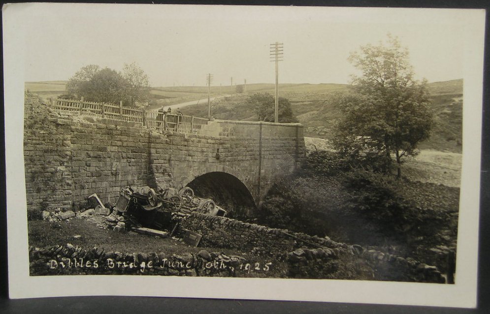
1925 Dibbles Bridge coach crash

On 10 June 1925, a coach crashed at the bottom of a steep hill at Dibbles Bridge, near Hebden in North Yorkshire, England. Seven people were killed and...

1975 Dibbles Bridge coach crash

On 27 May 1975, a coach carrying elderly passengers crashed at the bottom of a steep hill at Dibble's Bridge, near Hebden in North Yorkshire, England....

Trollers Gill

Trollers Gill is a limestone gill or gorge in North Yorkshire, England, close to the village of Skyreholme and 4.7 miles (7.5 km) south-east of Grassington...

Parcevall Hall

Parcevall Hall -- also known as Parceval Hall -- and its gardens are located at Skyreholme near Appletreewick village, Wharfedale, North Yorkshire, England...

Greenhow

Greenhow is a village in North Yorkshire, England, often referred to as Greenhow Hill. The term how derives from the Old Norse word haugr meaning a hill...

Skyreholme

Skyreholme is a hamlet in Wharfedale in the Yorkshire Dales, North Yorkshire, England. It lies 1-mile (1.6 km) east of Appletreewick, in the small side...

Nearby Amenities

Located within 500m of 54.081351,-1.8860149
Natural: waterfall
Source: OS 1853
Lat/Long: 54.0851812/-1.8875265
Ralph Hill
Natural: peak
Source: OS 1:25k
Lat/Long: 54.0795842/-1.8792624
Greenhaw Hill
Natural: peak
Source: OS 1:25k
Lat/Long: 54.0811426/-1.8856997
Middle Tongue
Natural: ridge
Source: OS 1:25k
Lat/Long: 54.0793835/-1.8900579
The data included in this document is from www.openstreetmap.org. The data is made available under ODbL.

Have you been to Greenhaw Hill?

Leave your review of Greenhaw Hill below (or comments, questions and feedback).