Penhill

Hill, Mountain in Yorkshire Richmondshire

England

Penhill

Benchmark on Langthwaite Barn Ordnance Survey cut mark benchmark described on the Bench Mark Database at <span class="nowrap"><a title="http://www.bench-marks.org.uk/bm38516" rel="nofollow ugc noopener" href="http://www.bench-marks.org.uk/bm38516">Link</a><img style="margin-left:2px;" alt="External link" title="External link - shift click to open in new window" src="https://s1.geograph.org.uk/img/external.png" width="10" height="10"/></span>
Benchmark on Langthwaite Barn Credit: Roger Templeman

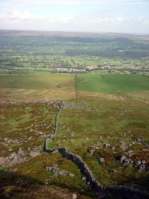
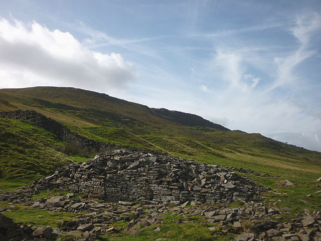
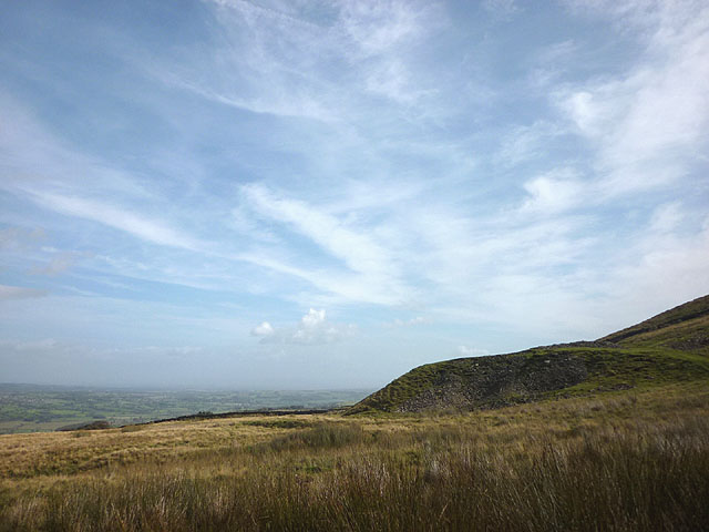
Penhill is a prominent hill located in the Yorkshire Dales National Park, in the county of North Yorkshire, England. Standing at an impressive height of 564 meters (1,850 feet), it is a beloved natural landmark in the region.

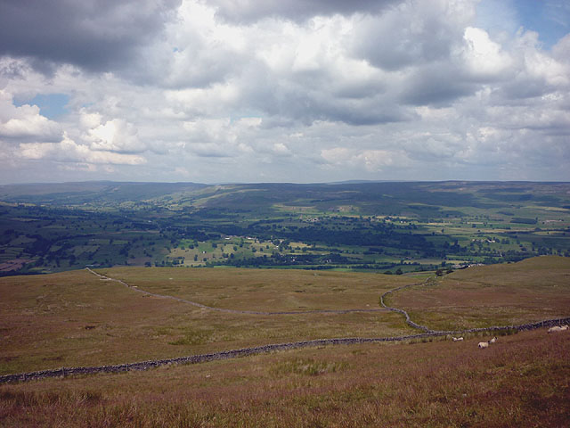
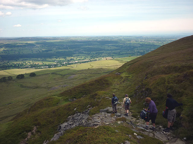
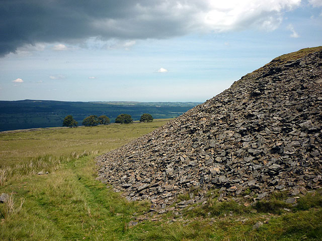
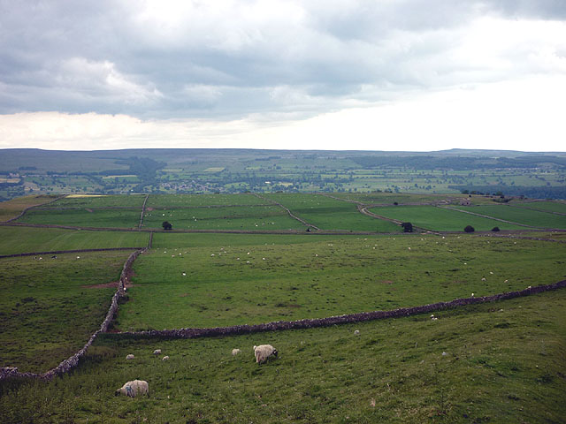
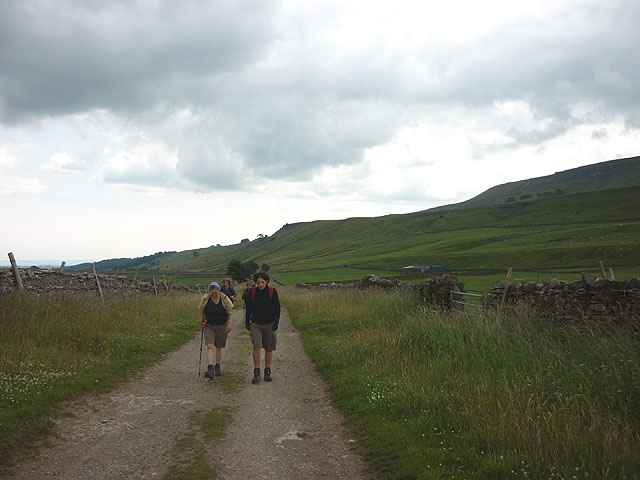
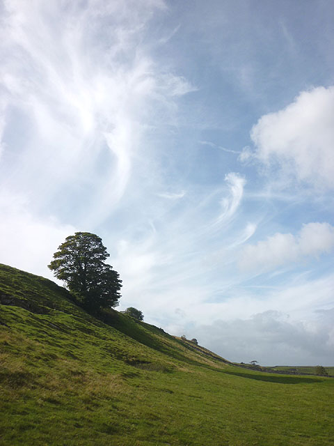
The hill boasts stunning views of the surrounding countryside, with its slopes covered in lush greenery and dotted with rocky outcrops. It is a popular destination for hikers and nature enthusiasts, offering a variety of walking trails and pathways that cater to all skill levels.

At the summit of Penhill, visitors are rewarded with breathtaking panoramic vistas that stretch across the Yorkshire Dales, including views of nearby landmarks such as the famous Aysgarth Falls and the rolling hills of Wensleydale.

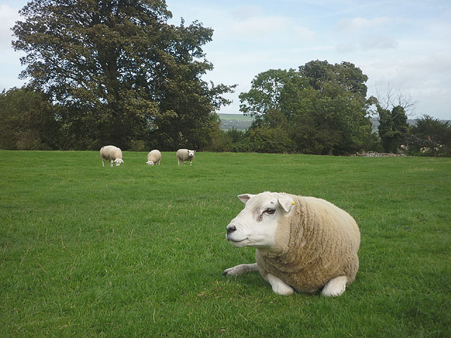
The hill is also home to a rich array of wildlife, with many rare plant and animal species calling it home. Birdwatchers can spot a variety of species, including peregrine falcons, red kites, and curlews, among others.

The nearby town of Leyburn serves as a gateway to Penhill, offering amenities such as parking, accommodations, and local eateries. The hill's proximity to other attractions in the Yorkshire Dales makes it an ideal base for exploring the wider area.

Overall, Penhill in Yorkshire is a natural gem, offering visitors a chance to immerse themselves in the beauty of the Yorkshire Dales and experience the tranquility of its stunning landscapes.

If you have any feedback on the listing, please let us know in the comments section below.

Penhill Images

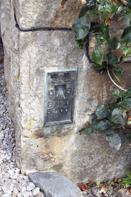
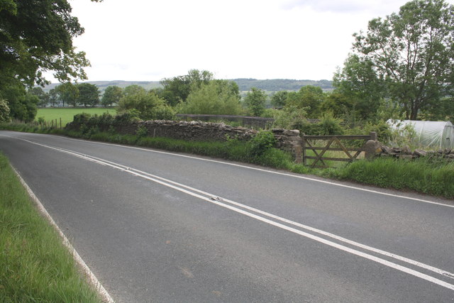
Images are sourced within 2km of 54.276227/-1.9234415 or Grid Reference SE0586. Thanks to Geograph Open Source API. All images are credited.

Benchmark on Langthwaite Barn Ordnance Survey cut mark benchmark described on the Bench Mark Database at <span class="nowrap"><a title="http://www.bench-marks.org.uk/bm38516" rel="nofollow ugc noopener" href="http://www.bench-marks.org.uk/bm38516">Link</a><img style="margin-left:2px;" alt="External link" title="External link - shift click to open in new window" src="https://s1.geograph.org.uk/img/external.png" width="10" height="10"/></span>
Benchmark on Langthwaite Barn
Ordnance Survey cut mark benchmark described on the Bench Mark Database at LinkExternal link
On Height of Hazely, Penhill Looking down over the junction of Wensleydale and Bishopdale. This is open access land but the route up from West Burton is complicated by new fences and blocked gateways.
On Height of Hazely, Penhill
Looking down over the junction of Wensleydale and Bishopdale. This is open access land but the route up from West Burton is complicated by new fences and blocked gateways.
Descending north off Penhill An engineered path descends to the east of Black Scar with views to the lower part of Wensleydale around West Witton and Leyburn.
Descending north off Penhill
An engineered path descends to the east of Black Scar with views to the lower part of Wensleydale around West Witton and Leyburn.
Spoil heap, Penhill Quarry (disused) There is a long line of tips below the north flank of Penhill. The rock is a kind of fine grained sandstone that splits into thin, evenly bedded flags probably once used for roofing and building.
Spoil heap, Penhill Quarry (disused)
There is a long line of tips below the north flank of Penhill. The rock is a kind of fine grained sandstone that splits into thin, evenly bedded flags probably once used for roofing and building.
Sheep on West Witton Moor above High Lane The path from Black Crags descends through an extensive complex of grazing pastures above lower Wensleydale.
Sheep on West Witton Moor above High Lane
The path from Black Crags descends through an extensive complex of grazing pastures above lower Wensleydale.
High Lane at Gunnery Plain The steep flanks of Penhill high on the right.
High Lane at Gunnery Plain
The steep flanks of Penhill high on the right.
Benchmark dating from 1845 on house 'East View' Ordnance Survey cut mark benchmark described on the Bench Mark Database at <span class="nowrap"><a title="http://www.bench-marks.org.uk/bm25470" rel="nofollow ugc noopener" href="http://www.bench-marks.org.uk/bm25470">Link</a><img style="margin-left:2px;" alt="External link" title="External link - shift click to open in new window" src="https://s1.geograph.org.uk/img/external.png" width="10" height="10"/></span>
Benchmark dating from 1845 on house 'East View'
Ordnance Survey cut mark benchmark described on the Bench Mark Database at LinkExternal link
Houses beside the main road through West Witton The house on the right carries an OS benchmark cut on the 1845 1GL survey line from Kendal to Thirsk <a href="https://www.geograph.org.uk/photo/2598611">SE0588 : Benchmark dating from 1845 on house 'East View'</a>
Houses beside the main road through West Witton
The house on the right carries an OS benchmark cut on the 1845 1GL survey line from Kendal to Thirsk SE0588 : Benchmark dating from 1845 on house 'East View'
Benchmark on the old School House Ordnance Survey flush bracket with serial number S8100 described on the Bench Mark Database at <span class="nowrap"><a title="http://www.bench-marks.org.uk/bm11795" rel="nofollow ugc noopener" href="http://www.bench-marks.org.uk/bm11795">Link</a><img style="margin-left:2px;" alt="External link" title="External link - shift click to open in new window" src="https://s1.geograph.org.uk/img/external.png" width="10" height="10"/></span>
Benchmark on the old School House
Ordnance Survey flush bracket with serial number S8100 described on the Bench Mark Database at LinkExternal link
Gatepost with 1845 benchmark at Oaktree Farm Ordnance Survey cut mark benchmark described on the Bench Mark Database at <span class="nowrap"><a title="http://www.bench-marks.org.uk/bm25469" rel="nofollow ugc noopener" href="http://www.bench-marks.org.uk/bm25469">Link</a><img style="margin-left:2px;" alt="External link" title="External link - shift click to open in new window" src="https://s1.geograph.org.uk/img/external.png" width="10" height="10"/></span>
Gatepost with 1845 benchmark at Oaktree Farm
Ordnance Survey cut mark benchmark described on the Bench Mark Database at LinkExternal link
Looking across the A684 outside Oaktree Farm
Boulder field, Penhill A jumble of gritstone boulders fallen from Penhill Scar. West Witton far below.
Boulder field, Penhill
A jumble of gritstone boulders fallen from Penhill Scar. West Witton far below.
Wall below Penhill Scar Threading through a jumble of gritstone boulders fallen from Penhill Scar. West Witton far below.
Wall below Penhill Scar
Threading through a jumble of gritstone boulders fallen from Penhill Scar. West Witton far below.
Old quarry ruin, Penhill Park The stone was flat-bedded flagstone used for buildings and roofing 'slates'.
Old quarry ruin, Penhill Park
The stone was flat-bedded flagstone used for buildings and roofing 'slates'.
Spoil heap, Penhill Park Part of the old flagstone quarries below Penhill's north flank.
Spoil heap, Penhill Park
Part of the old flagstone quarries below Penhill's north flank.
Escarpment below Flint Lane A band of harder limestone creates this steep slope on the north flank of Penhill.
Escarpment below Flint Lane
A band of harder limestone creates this steep slope on the north flank of Penhill.
Rams on the edge of West Witton Texel (or Beltex?) rams grazing happily in a pasture south of the village.
Rams on the edge of West Witton
Texel (or Beltex?) rams grazing happily in a pasture south of the village.
Benchmark on wall of Witton Steeps Ordnance Survey cut mark benchmark described on the Bench Mark Database at <span class="nowrap"><a title="http://www.bench-marks.org.uk/bm39656" rel="nofollow ugc noopener" href="http://www.bench-marks.org.uk/bm39656">Link</a><img style="margin-left:2px;" alt="External link" title="External link - shift click to open in new window" src="https://s1.geograph.org.uk/img/external.png" width="10" height="10"/></span>
Benchmark on wall of Witton Steeps
Ordnance Survey cut mark benchmark described on the Bench Mark Database at LinkExternal link
Show me another place!

Penhill is located at Grid Ref: SE0586 (Lat: 54.276227, Lng: -1.9234415)

Division: North Riding

Administrative County: North Yorkshire

District: Richmondshire

Police Authority: North Yorkshire

What 3 Words

///joys.revolting.steady. Near Leyburn, North Yorkshire

Nearby Locations

Penhill Beacon Penhill

Related Wikis

Penhill

Penhill (526 metres (1,726 ft) high at the trig point, 553 metres (1,814 ft) at Height of Hazely) is a prominent hill, 5.5 miles (9 km) south west of Leyburn...

St Bartholomew's Church, West Witton

St Bartholomew's Church, West Witton is a Grade II listed parish church in the Church of England: 387  in West Witton, North Yorkshire. == History == The...

West Witton

West Witton is a village and civil parish in the Richmondshire district of North Yorkshire, England. Located in Wensleydale in the Yorkshire Dales it lies...

Swinithwaite

Swinithwaite is a hamlet in the Yorkshire Dales, North Yorkshire, England. It lies on the A684 road, 2 miles (3.2 km) miles east of Aysgarth.The hamlet...

Nearby Amenities

Located within 500m of 54.276227,-1.9234415
Penhill
Ele: 526.7
Image: https://www.geograph.org.uk/photo/6855440
Man Made: survey_point
Ref: SE38S014
Tpuk Ref: 5374
Lat/Long: 54.2762358/-1.9234564
Penhill Beacon
Historic: beacon
Man Made: beacon
Lat/Long: 54.2762707/-1.9176824
Shelter
Covered: no
Image: https://www.geograph.org.uk/photo/6856389
Note: Formerly a large cairn (Pile of Stones on older maps), this has been rebuilt as a wind shelter
Shelter Type: weather_shelter
Lat/Long: 54.2756266/-1.9158347
Penhill Quarry
Place: locality
Lat/Long: 54.2782314/-1.9281367
Barrier: stile
Foot: yes
Lat/Long: 54.2762464/-1.9202095
Tourism: viewpoint
Lat/Long: 54.2762906/-1.9176451
Barrier: stile
Foot: yes
Lat/Long: 54.2764549/-1.9252976
Hunting Stand
Hunting Stand: grouse_butt
Lat/Long: 54.2720848/-1.9208103
Hunting Stand
Hunting Stand: grouse_butt
Lat/Long: 54.2723213/-1.9209632
Hunting Stand
Hunting Stand: grouse_butt
Lat/Long: 54.272539/-1.9210893
Hunting Stand
Hunting Stand: grouse_butt
Lat/Long: 54.2728303/-1.9212851
Hunting Stand
Hunting Stand: grouse_butt
Lat/Long: 54.2730731/-1.9214326
Hunting Stand
Hunting Stand: grouse_butt
Lat/Long: 54.2732908/-1.9215587
Hunting Stand
Hunting Stand: grouse_butt
Lat/Long: 54.2735523/-1.921725
The data included in this document is from www.openstreetmap.org. The data is made available under ODbL.

Have you been to Penhill?

Leave your review of Penhill below (or comments, questions and feedback).