Diamond Hill

Hill, Mountain in Derbyshire High Peak

England

Diamond Hill

Minor road passing Thirkelow Rocks
Minor road passing Thirkelow Rocks Credit: Graham Hogg

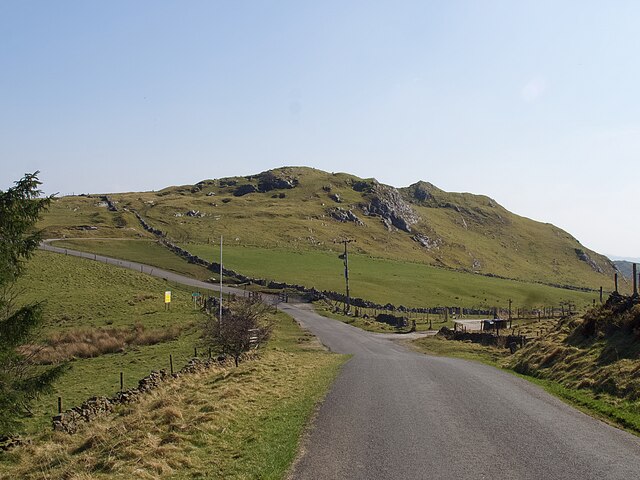
Diamond Hill is a prominent hill located in the Derbyshire Dales district, within the county of Derbyshire, England. Standing at an elevation of approximately 458 meters (1,503 feet), it is considered one of the notable peaks in the region. The hill is situated within the Peak District National Park, renowned for its picturesque landscapes and stunning natural beauty.

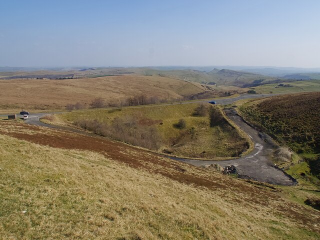
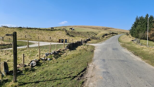
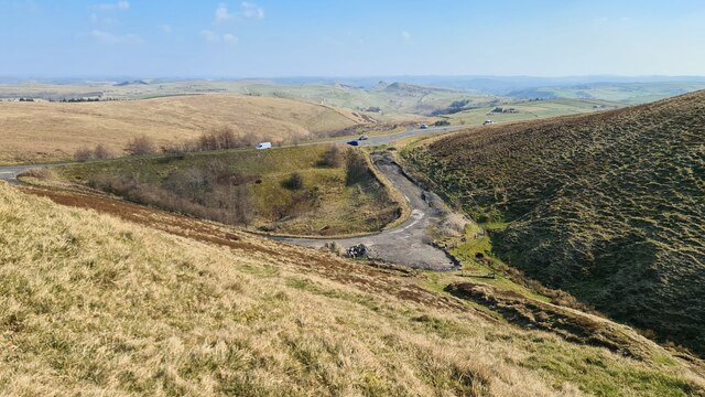
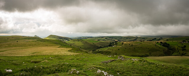
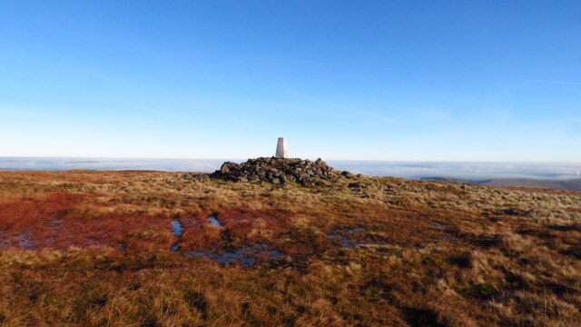
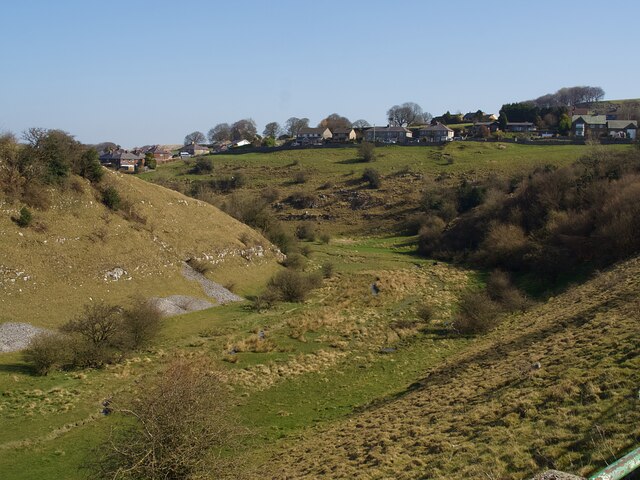
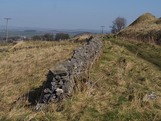
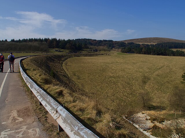
Diamond Hill offers breathtaking panoramic views of the surrounding countryside, making it a popular destination for hikers, nature enthusiasts, and photographers. Its location on the edge of the Peak District provides visitors with a unique perspective of the area, with sweeping vistas of rolling hills, lush valleys, and charming villages.

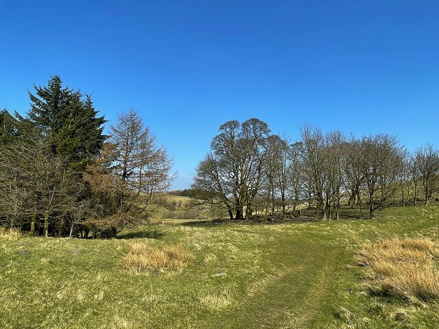
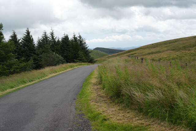
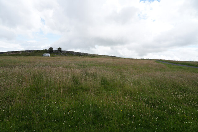
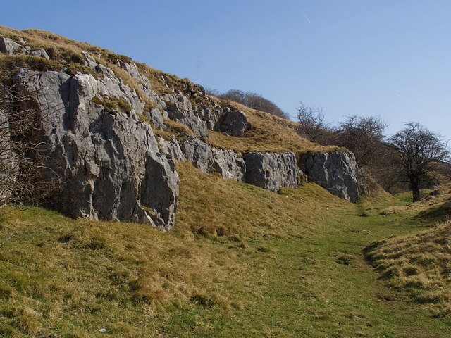
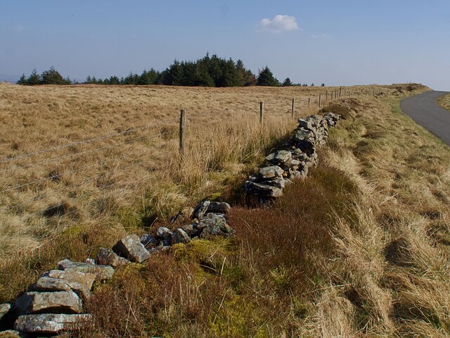
The hill itself is characterized by its gentle slopes, covered in a mix of grasses, heather, and wildflowers, creating a vibrant and colorful tapestry. The terrain is relatively easy to navigate, making it accessible to walkers of various abilities. Numerous footpaths and trails crisscross the hill, allowing visitors to explore its diverse flora and fauna.

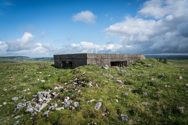
In addition to its natural beauty, Diamond Hill boasts a rich cultural and historical heritage. The area is dotted with remnants of ancient settlements, such as Bronze Age tumuli and Iron Age hillforts, offering a glimpse into the region's past. These archaeological features, combined with the idyllic countryside, contribute to the hill's unique charm and appeal.

Overall, Diamond Hill is a gem within the Derbyshire landscape, offering visitors a chance to immerse themselves in the beauty of the Peak District while enjoying its rich history and stunning vistas.

If you have any feedback on the listing, please let us know in the comments section below.
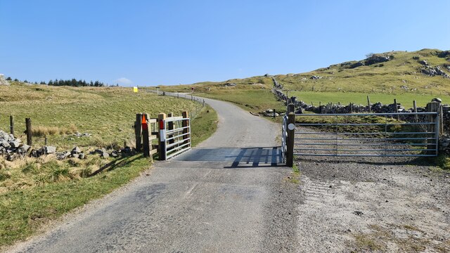
Diamond Hill Images

Images are sourced within 2km of 53.233861/-1.9253374 or Grid Reference SK0570. Thanks to Geograph Open Source API. All images are credited.

Minor road passing Thirkelow Rocks
Overlooking the A53 Leek - Buxton Road Evidence of the road having been straightened here.
Overlooking the A53 Leek - Buxton Road
Evidence of the road having been straightened here.
Footpath through trees On moorland near Turncliffe Common
Footpath through trees
On moorland near Turncliffe Common
Road below Thirkelow Rocks
A53 below Axe Edge
A53 below Axe Edge
Near Leap Edge Not really very far from Buxton, but the area looks quite bleak.
Near Leap Edge
Not really very far from Buxton, but the area looks quite bleak.
Near Buxton Raceway The view is looking east with the Buxton Raceway to the north but not really visible from this spot.
Near Buxton Raceway
The view is looking east with the Buxton Raceway to the north but not really visible from this spot.
Thirkelow Hill Summit 451m / 1480ft Class TuMP 

The Peak on the left, just poking out is Chrome Hill and Hollins Hill Next to it.

<span class="nowrap"><a title="https://www.hill-bagging.co.uk/mountaindetails.php?qu=S&rf=16504" rel="nofollow ugc noopener" href="https://www.hill-bagging.co.uk/mountaindetails.php?qu=S&rf=16504">Link</a><img style="margin-left:2px;" alt="External link" title="External link - shift click to open in new window" src="https://s1.geograph.org.uk/img/external.png" width="10" height="10"/></span>
Thirkelow Hill Summit 451m / 1480ft
Class TuMP The Peak on the left, just poking out is Chrome Hill and Hollins Hill Next to it. LinkExternal link
New Friends It's always good to make new friends when out walking . These were a tad boisterous...
New Friends
It's always good to make new friends when out walking . These were a tad boisterous...
Cairn and Pill Box, High Edge It's showing on the map as a cairn but there is a WW2 pill box right in the centre.
Cairn and Pill Box, High Edge
It's showing on the map as a cairn but there is a WW2 pill box right in the centre.
Axe Edge Trig Point Even on this December day, the summit was warm enough for a leisurely lunch stop. A cold air inversion covers much of the Peak District.
Axe Edge Trig Point
Even on this December day, the summit was warm enough for a leisurely lunch stop. A cold air inversion covers much of the Peak District.
Solomon's Temple Also known as Grinlow Tower. <span class="nowrap"><a title="https://poolescavern.co.uk/woodland-walks/solomons-temple/" rel="nofollow ugc noopener" href="https://poolescavern.co.uk/woodland-walks/solomons-temple/">Link</a><img style="margin-left:2px;" alt="External link" title="External link - shift click to open in new window" src="https://s1.geograph.org.uk/img/external.png" width="10" height="10"/></span>
Solomon's Temple
Also known as Grinlow Tower. LinkExternal link
Path below an outcrop of limestone rock On Grin Low between Solomon's Temple and Grin Low Road
Path below an outcrop of limestone rock
On Grin Low between Solomon's Temple and Grin Low Road
Almost dry valley below Harpur Hill Very little  water in this unnamed stream which flows into the River Wye a little way to the north.
Almost dry valley below Harpur Hill
Very little water in this unnamed stream which flows into the River Wye a little way to the north.
Broken drystone wall  Beside an abandoned railway alignment to the south west of Harpur Hill
Broken drystone wall
Beside an abandoned railway alignment to the south west of Harpur Hill
Road on a former railway alignment Originally part of the Cromford and High Peak Railway it is now a link road between sites in the Health and Safety Executive testing area.
Road on a former railway alignment
Originally part of the Cromford and High Peak Railway it is now a link road between sites in the Health and Safety Executive testing area.
Broken drystone wall  On Moorland to the south of Buxton. Unlikely to be repaired given that a post and wire replacement fence has been erected.
Broken drystone wall
On Moorland to the south of Buxton. Unlikely to be repaired given that a post and wire replacement fence has been erected.
Show me another place!

Diamond Hill is located at Grid Ref: SK0570 (Lat: 53.233861, Lng: -1.9253374)

Administrative County: Derbyshire

District: High Peak

Police Authority: Derbyshire

What 3 Words

///slip.shame.storms. Near Buxton, Derbyshire

Nearby Locations

Diamond Hill

Related Wikis

RAF Harpur Hill

RAF Harpur Hill is a former Royal Air Force station, situated at Harpur Hill near Buxton, Derbyshire in England. The site was operational from 1938 to...

Health and Safety Laboratory

The Health and Safety Laboratory (HSE Laboratory or HSL Buxton) is a large 550-acre research site in rural High Peak, Derbyshire, south of Buxton. It researches...

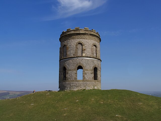
Solomon's Temple, Buxton

Solomon's Temple, also known as Grinlow Tower, is a Victorian folly on the summit of Grin Low hill, near the spa town of Buxton in the Derbyshire Peak...

Grin Low

Grin Low is a hill overlooking Buxton in Derbyshire, in the Peak District. The summit is 434 metres (1,424 ft) above sea level.Grin Low was the main location...

Nearby Amenities

Located within 500m of 53.233861,-1.9253374
Anthony Hill
Natural: peak
Source: NPE
Lat/Long: 53.2327139/-1.931826
Archaeological Site: tumulus
Heritage: yes
Historic: archaeological_site
Wikidata: Q17650289
Lat/Long: 53.2329272/-1.931824
Parking
Capacity: 20
Lat/Long: 53.2326897/-1.9183553
The data included in this document is from www.openstreetmap.org. The data is made available under ODbL.

Have you been to Diamond Hill?

Leave your review of Diamond Hill below (or comments, questions and feedback).