Bareleg Hill

Hill, Mountain in Staffordshire Staffordshire Moorlands

England

Bareleg Hill

Moorland ruin
Moorland ruin Credit: John H Darch

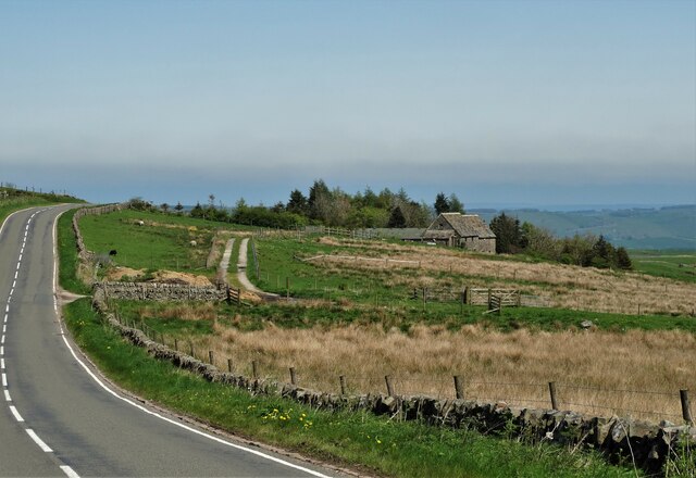
Bareleg Hill is a prominent hill located in Staffordshire, England. Situated in the southern part of the county near the town of Leek, it forms part of the beautiful landscape of the Staffordshire Moorlands. Rising to an elevation of approximately 450 meters (1,480 feet), Bareleg Hill offers breathtaking panoramic views of the surrounding countryside.

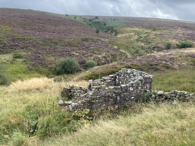
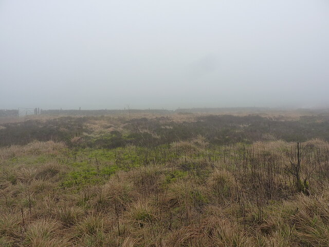
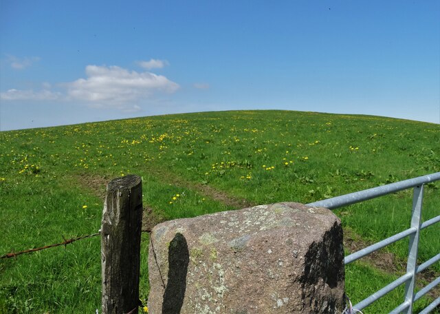
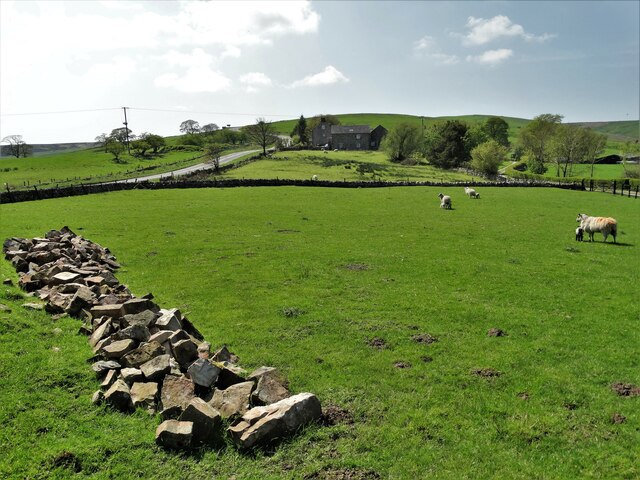
The hill is composed mainly of gritstone and offers a relatively gentle slope, making it easily accessible for hikers and walkers of all abilities. The terrain is mostly grassy, with patches of heather and bracken dotting the landscape. At its summit, a trig point can be found, providing a reference point for surveying purposes.

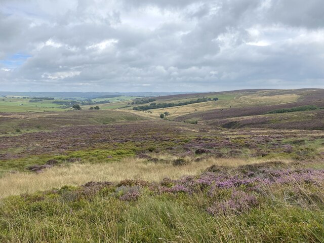
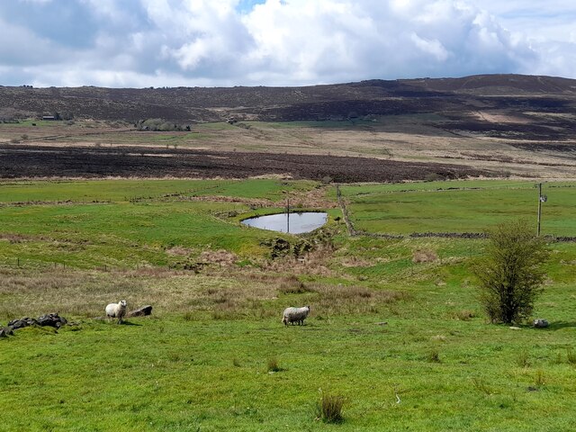
The views from Bareleg Hill are truly stunning. On a clear day, one can see for miles in every direction, taking in the rolling hills of Staffordshire, the distant peaks of the Peak District National Park, and even glimpses of the Cheshire plains. The hill is particularly popular among nature enthusiasts, who appreciate the diverse wildlife that inhabits the area. Birdwatchers may spot a variety of species, including kestrels, buzzards, and peregrine falcons.

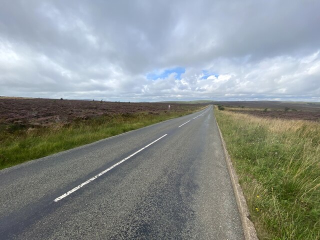
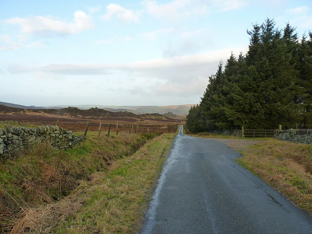
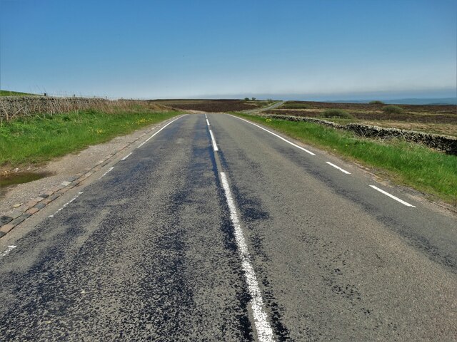
Access to Bareleg Hill is relatively straightforward, with several footpaths leading to its summit. The most common starting point is the nearby village of Meerbrook, where ample parking is available. From there, a well-marked trail guides visitors through fields and woodlands, gradually ascending towards the hilltop.

Overall, Bareleg Hill presents a fantastic opportunity for visitors to immerse themselves in the natural beauty of Staffordshire, providing a rewarding experience for both casual walkers and seasoned outdoor enthusiasts.

If you have any feedback on the listing, please let us know in the comments section below.
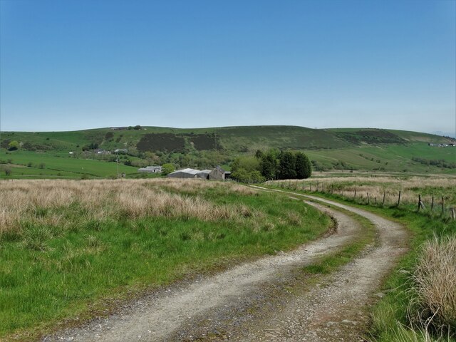
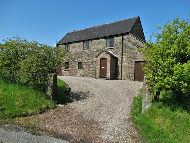
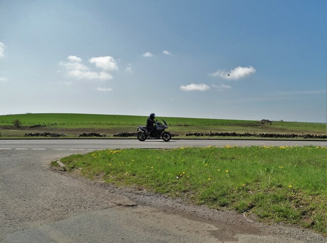
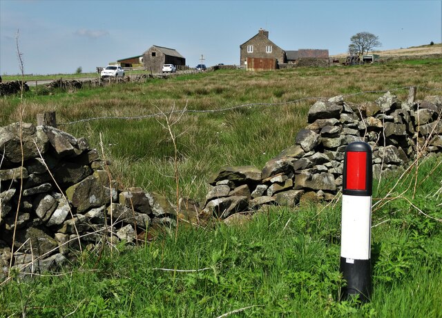
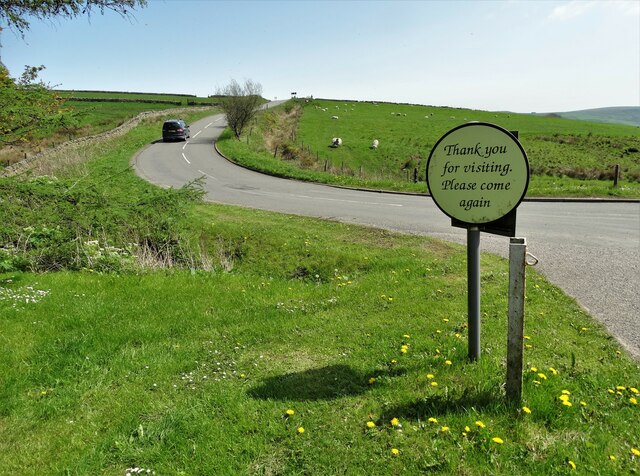
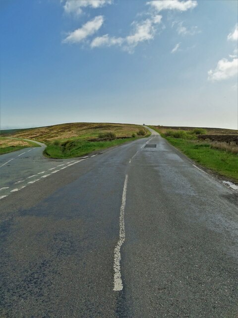
Bareleg Hill Images

Images are sourced within 2km of 53.177281/-1.9526956 or Grid Reference SK0364. Thanks to Geograph Open Source API. All images are credited.

Moorland ruin
Moorland ruin
Heather moorland On the western side of Morridge.
Heather moorland
On the western side of Morridge.
Heading north towards the A53 On the moorland road over Middle Hills.
Heading north towards the A53
On the moorland road over Middle Hills.
Rear view of the Winking Man At 1450' one of the ten highest pubs in England.
Rear view of the Winking Man
At 1450' one of the ten highest pubs in England.
A bleak morning at Morridge Top Driving along the road that particular morning wasn't much more attractive than this view - pretty much wall-to-wall cloud.
A bleak morning at Morridge Top
Driving along the road that particular morning wasn't much more attractive than this view - pretty much wall-to-wall cloud.
Morridge Top (Heathylee) milepost Dating originally from the late 19th century, and Grade II listed <span class="nowrap"><a title="https://britishlistedbuildings.co.uk/101190449-milepost-leek-6-miles-heathylee#.Y9bXlXbP3IU" rel="nofollow ugc noopener" href="https://britishlistedbuildings.co.uk/101190449-milepost-leek-6-miles-heathylee#.Y9bXlXbP3IU">Link</a><img style="margin-left:2px;" alt="External link" title="External link - shift click to open in new window" src="https://s1.geograph.org.uk/img/external.png" width="10" height="10"/></span> & <span class="nowrap"><a title="https://historicengland.org.uk/listing/the-list/list-entry/1190449" rel="nofollow ugc noopener" href="https://historicengland.org.uk/listing/the-list/list-entry/1190449">Link</a><img style="margin-left:2px;" alt="External link" title="External link - shift click to open in new window" src="https://s1.geograph.org.uk/img/external.png" width="10" height="10"/></span> in 1985. It went 'walkabout' sometime after that (stolen, basically...) before being rediscovered for sale on an internet auction site and was restored to its rightful location in mid 2017 <a href="https://www.geograph.org.uk/photo/5436708">SK0365 : Old Milepost by the A53, Morridge Top</a>
Morridge Top (Heathylee) milepost
Dating originally from the late 19th century, and Grade II listed LinkExternal link & LinkExternal link in 1985. It went 'walkabout' sometime after that (stolen, basically...) before being rediscovered for sale on an internet auction site and was restored to its rightful location in mid 2017 SK0365 : Old Milepost by the A53, Morridge Top
Pond below Hazel Barrow Farm
Along the road towards Adders Green and Gib Tor A very similar view to that in <a href="https://www.geograph.org.uk/photo/5083781">SK0264 : Minor road below Brund Hill</a>, taken from a little further back towards the A53.
Along the road towards Adders Green and Gib Tor
A very similar view to that in SK0264 : Minor road below Brund Hill, taken from a little further back towards the A53.
The track to Smallshaw Farm
"The Barn" - house by Wickenlow Lane Once a field barn but converted to a house in 1984.
"The Barn" - house by Wickenlow Lane
Once a field barn but converted to a house in 1984.
Biker on the A53 Buxton-Leek road
View to a former wayside tavern on the A53 The pub in question was "The Royal Cottage"
View to a former wayside tavern on the A53
The pub in question was "The Royal Cottage"
Gateway and view of Bareleg Hill From Leek Road near Royal Cottage
Gateway and view of Bareleg Hill
From Leek Road near Royal Cottage
Leek Road by Bareleg Hill
Approaching Ridge Head by Leek Road
View to Merril Grove Farm
Leaving "The Winking Man" A pub at Upper Hume by Buxton Road
Leaving "The Winking Man"
A pub at Upper Hume by Buxton Road
Morridge at the Shawfields junction
Show me another place!

Bareleg Hill is located at Grid Ref: SK0364 (Lat: 53.177281, Lng: -1.9526956)

Administrative County: Staffordshire

District: Staffordshire Moorlands

Police Authority: Staffordshire

What 3 Words

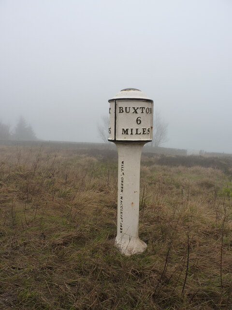
///unzips.marine.tokens. Near Buxton, Derbyshire

Nearby Locations

Bareleg Hill

Related Wikis

Heathylee

Heathylee is a civil parish in the district of Staffordshire Moorlands in north-east Staffordshire, England. There is no village centre. The parish has...

Black Brook Nature Reserve

Black Brook is a nature reserve of the Staffordshire Wildlife Trust, about 7 miles (11 km) north-east of Leek, in Staffordshire, England. It is moorland...

Flash, Staffordshire

Flash is a village in the Staffordshire Moorlands, England, and Peak District National Park. At 1,519 feet (463 m) above sea level, it is the highest village...

Quarnford

Quarnford is a village and civil parish in the Staffordshire Moorlands district of Staffordshire, England. According to the 2001 census it had a population...

Nearby Amenities

Located within 500m of 53.177281,-1.9526956
Ele: 448.0969238
Lat/Long: 53.1815059/-1.9516297
Ele: 430.5529785
Note: Stream runs under or over path depending on water level
Lat/Long: 53.1804323/-1.9502574
The data included in this document is from www.openstreetmap.org. The data is made available under ODbL.

Have you been to Bareleg Hill?

Leave your review of Bareleg Hill below (or comments, questions and feedback).