Greenleighton Hill

Hill, Mountain in Northumberland

England

Greenleighton Hill

Fontburn emergency overflow.  Gone! All the 'over centre' 'release gates' have been deliberately toppled and laid flat; their outlines can be clearly seen on the ground (with a layer of gravel to reduce the possibility of tripping over their edges?).  In the event of extremely high water levels in the reservoir, it will now overspill through this route at a significantly lower level than that  required to trigger the 'release gates'.  I wonder if this is a measure designed to reduce the absolute maximum pressure on an old dam as part of a national reassessment following the Whaley Bridge dam incident in August 2019?

See <a href="https://www.geograph.org.uk/photo/6496686">NZ0493 : Fontburn emergency overflow</a> and <a href="https://www.geograph.org.uk/photo/6474900">NZ0493 : Giant plughole in action 2</a>
Fontburn emergency overflow. Gone! Credit: Leanmeanmo

Greenleighton Hill is a prominent hill located in Northumberland, England. Standing at an elevation of 285 meters (935 feet), it offers stunning panoramic views of the surrounding countryside and the nearby villages of Belsay and Ponteland. The hill is a popular destination for hikers and nature enthusiasts, with a network of well-marked trails leading to the summit.

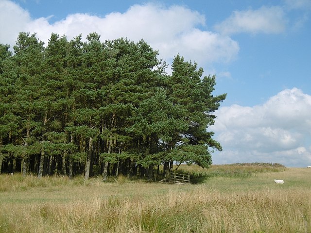
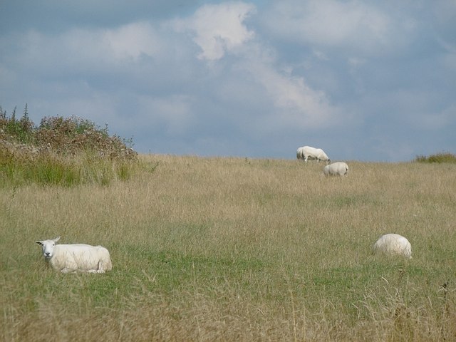
The landscape of Greenleighton Hill is characterized by rolling green pastures, scattered woodlands, and picturesque meadows. The hill is home to a variety of wildlife, including birds of prey, deer, and rabbits, making it a haven for nature lovers and birdwatchers.

At the summit of Greenleighton Hill, visitors can enjoy a peaceful picnic while taking in the breathtaking views of the Northumberland countryside. On a clear day, it is possible to see as far as the Cheviot Hills and the North Sea.

Overall, Greenleighton Hill is a tranquil and picturesque spot that offers visitors a chance to immerse themselves in the beauty of the Northumberland countryside.

If you have any feedback on the listing, please let us know in the comments section below.

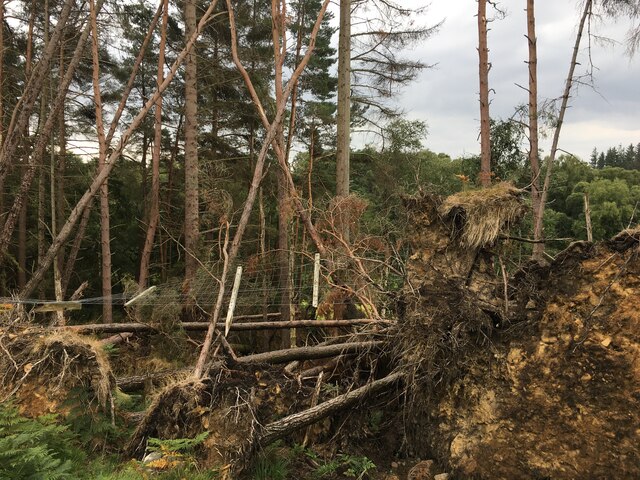
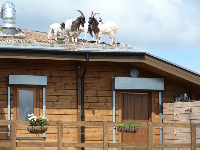
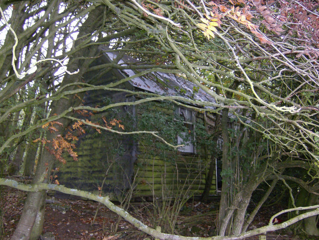
Greenleighton Hill Images

Images are sourced within 2km of 55.223763/-1.950485 or Grid Reference NZ0392. Thanks to Geograph Open Source API. All images are credited.

Fontburn emergency overflow.  Gone! All the 'over centre' 'release gates' have been deliberately toppled and laid flat; their outlines can be clearly seen on the ground (with a layer of gravel to reduce the possibility of tripping over their edges?).  In the event of extremely high water levels in the reservoir, it will now overspill through this route at a significantly lower level than that  required to trigger the 'release gates'.  I wonder if this is a measure designed to reduce the absolute maximum pressure on an old dam as part of a national reassessment following the Whaley Bridge dam incident in August 2019?

See <a href="https://www.geograph.org.uk/photo/6496686">NZ0493 : Fontburn emergency overflow</a> and <a href="https://www.geograph.org.uk/photo/6474900">NZ0493 : Giant plughole in action 2</a>
Fontburn emergency overflow. Gone!
All the 'over centre' 'release gates' have been deliberately toppled and laid flat; their outlines can be clearly seen on the ground (with a layer of gravel to reduce the possibility of tripping over their edges?). In the event of extremely high water levels in the reservoir, it will now overspill through this route at a significantly lower level than that required to trigger the 'release gates'. I wonder if this is a measure designed to reduce the absolute maximum pressure on an old dam as part of a national reassessment following the Whaley Bridge dam incident in August 2019? See NZ0493 : Fontburn emergency overflow and NZ0493 : Giant plughole in action 2
More carnage from Storm Arwen The fence was suspended some 2m in the air. One year on and there is still a huge backlog of fallen trees to clear.
More carnage from Storm Arwen
The fence was suspended some 2m in the air. One year on and there is still a huge backlog of fallen trees to clear.
Drought at Fontburn Reservoir Towards the upper end of the reservoir. The water level has been lower in the past but, some 20 ft down from its maximum, this was close to the lowest point of the summer.
Drought at Fontburn Reservoir
Towards the upper end of the reservoir. The water level has been lower in the past but, some 20 ft down from its maximum, this was close to the lowest point of the summer.
Woodland by road
Woodland by road
Cup and Ring marked stone, Fontburn Reservoir On  my second visit, I knew to look for the cup and ring markings. See <a href="https://www.geograph.org.uk/photo/2137036">NZ0393 : Cup and ring marked stone, Fontburn Reservoir</a>.
Cup and Ring marked stone, Fontburn Reservoir
On my second visit, I knew to look for the cup and ring markings. See NZ0393 : Cup and ring marked stone, Fontburn Reservoir.
Goat on the roof One of the eponymous goats which gives its name to the cafe (see <a href="https://www.geograph.org.uk/photo/2137078">NZ0493 : "Goats on the Roof" cafe</a> and <a href="https://www.geograph.org.uk/photo/2137076">NZ0493 : Goats off the roof</a>).
Goat on the roof
One of the eponymous goats which gives its name to the cafe (see NZ0493 : "Goats on the Roof" cafe and NZ0493 : Goats off the roof).
Goats on the roof Eponymous cafe at Fontburn Reservoir. Each time you visit, the goats are on the roof which they reach via a ladder.
Goats on the roof
Eponymous cafe at Fontburn Reservoir. Each time you visit, the goats are on the roof which they reach via a ladder.
Rothley Shiel - youth hostel ruin Rothley Shiel was a tiny Northumberland Youth hostel opened in July 1949. The warden was Miss E Carmon. It was a very small wooden bungalow built as a shooting lodge, and named Wideopen Cottage on a recent OS map, but a ruin obliterated by vegetation in 2007. According to anecdote, it had no rear exit.
The youth hostel closed on the 8th April 1956 after only a short life. It would be interesting to know if it saw any other use before falling into disrepair.
Kindly contact if you have any tales of old British and Irish youth hostels such as this.
Rothley Shiel - youth hostel ruin
Rothley Shiel was a tiny Northumberland Youth hostel opened in July 1949. The warden was Miss E Carmon. It was a very small wooden bungalow built as a shooting lodge, and named Wideopen Cottage on a recent OS map, but a ruin obliterated by vegetation in 2007. According to anecdote, it had no rear exit. The youth hostel closed on the 8th April 1956 after only a short life. It would be interesting to know if it saw any other use before falling into disrepair. Kindly contact if you have any tales of old British and Irish youth hostels such as this.
Rough grazing, Rothley Shield East The windmill is just north of the farm buildings at Rothley Shield East, see <a href="https://www.geograph.org.uk/photo/3657127">NZ0491 : Rough grazing land, Rothley Shield East</a>.
Rough grazing, Rothley Shield East
The windmill is just north of the farm buildings at Rothley Shield East, see NZ0491 : Rough grazing land, Rothley Shield East.
Rough grazing land, Rothley Shield East The windmill is by Rothley Shield East Farm, which just creeps into the edge of the square and the right of the picture. See also <a href="https://www.geograph.org.uk/photo/3657126">NZ0491 : Rough grazing, Rothley Shield East</a>.
Rough grazing land, Rothley Shield East
The windmill is by Rothley Shield East Farm, which just creeps into the edge of the square and the right of the picture. See also NZ0491 : Rough grazing, Rothley Shield East.
Rough grazing and plantation north of Rothley Shield East The trees were being buffeted by a strong wind on this stormy day which had spells of dazzling sunshine interspersed with dark skies and sudden showers.
Rough grazing and plantation north of Rothley Shield East
The trees were being buffeted by a strong wind on this stormy day which had spells of dazzling sunshine interspersed with dark skies and sudden showers.
Approaching site of former Long Witton station, 2000 View southward on B4342 road at Rothley, ahead is the bridge over the trackbed of the ex-NBR (Reedsmouth) - Scotsgap - Rothbury branch. The station had been on the left, closure of line and station having occurred on 15/9/52 for passengers, 11/11/63 for goods.
Approaching site of former Long Witton station, 2000
View southward on B4342 road at Rothley, ahead is the bridge over the trackbed of the ex-NBR (Reedsmouth) - Scotsgap - Rothbury branch. The station had been on the left, closure of line and station having occurred on 15/9/52 for passengers, 11/11/63 for goods.
Fontburn Reservoir Nice sunny day at Fontburn
Fontburn Reservoir
Nice sunny day at Fontburn
Telephone box, Rothley Shiel Cottages The telephone box was still working in 2015. The bridge in the background is near the site of Long Witton station on the Rothbury Branch (Northumberland Central Railway).
Telephone box, Rothley Shiel Cottages
The telephone box was still working in 2015. The bridge in the background is near the site of Long Witton station on the Rothbury Branch (Northumberland Central Railway).
Quarry, Liniel Law There is limestone here, and it was quarried for lime making. The limestones in the Rothbury area were a driver for the building of the Northumberland Central Railway.  Coal was also mined here.
Quarry, Liniel Law
There is limestone here, and it was quarried for lime making. The limestones in the Rothbury area were a driver for the building of the Northumberland Central Railway. Coal was also mined here.
Ewesley Fell A small plantation on Ewesley Fell.
Ewesley Fell
A small plantation on Ewesley Fell.
Ewesley ewes Grassland on Ewesley Fell.
Ewesley ewes
Grassland on Ewesley Fell.
Ewesley Fell There is an earthwork in the wood according to the maps.
Ewesley Fell
There is an earthwork in the wood according to the maps.
Show me another place!

Greenleighton Hill is located at Grid Ref: NZ0392 (Lat: 55.223763, Lng: -1.950485)

Unitary Authority: Northumberland

Police Authority: Northumbria

What 3 Words

///failed.cities.piled. Near Rothley, Northumberland

Nearby Locations

Greenleighton Hill

Related Wikis

Fallowlees Flush

Fallowlees Flush is the name given to a Site of Special Scientific Interest (SSSI) in mid-Northumberland, England. The steeply sloping site has calcium...

Longwitton railway station

Longwitton station was a weather board and corrugated iron built railway station in Northumberland on the Rothbury Branch. Originally known as Rothley...

Ewesley railway station

Ewesley station was a weather board and corrugated iron built railway station in Northumberland on the Rothbury Branch built to serve the local farming...

Fontburn Halt railway station

Fontburn Halt was a weatherboard and corrugated-iron-built railway station in Northumberland, England, on the Rothbury Branch, built to serve the pre-existing...

Nearby Amenities

Located within 500m of 55.223763,-1.950485
Man Made: survey_point
Lat/Long: 55.2239004/-1.9503999
Barrier: cattle_grid
Lat/Long: 55.220087/-1.9523197
The data included in this document is from www.openstreetmap.org. The data is made available under ODbL.

Have you been to Greenleighton Hill?

Leave your review of Greenleighton Hill below (or comments, questions and feedback).