Coppy Hill

Hill, Mountain in Yorkshire

England

Coppy Hill

Benchmark on stone wall on east side of Barrows Lane Ordnance Survey cut mark benchmark levelled at 166.083m above Newlyn Data verified in 1962
Benchmark on stone wall on east side of Barrows Lane Credit: Roger Templeman

Coppy Hill is a picturesque hill located in the county of Yorkshire, England. Situated in the northern region of the country, it is part of the beautiful Yorkshire Dales National Park. Coppy Hill is known for its stunning natural beauty and offers breathtaking views of the surrounding landscape.

Rising to an elevation of approximately 450 meters (1476 feet), Coppy Hill is considered a moderate-sized hill in comparison to the nearby peaks of the Yorkshire Dales. It is characterized by its gentle slopes, covered with lush green grass and scattered with vibrant wildflowers during the summer months. The hill is predominantly made up of limestone, which gives it a unique geological composition.

Coppy Hill is a popular destination for outdoor enthusiasts, offering a range of activities such as hiking, walking, and nature exploration. Several well-marked trails traverse the hill, allowing visitors to explore its diverse flora and fauna. The hill provides an ideal habitat for various bird species, making it a haven for birdwatchers.

The summit of Coppy Hill offers panoramic views of the surrounding countryside, including rolling dales, meandering rivers, and charming villages. On a clear day, it is even possible to see as far as the distant Yorkshire Moors. The hill's summit can be reached by following a relatively easy trail, making it accessible to individuals of various fitness levels.

Overall, Coppy Hill is a hidden gem in the Yorkshire Dales, offering visitors a chance to immerse themselves in the natural beauty of the region while enjoying a variety of outdoor activities.

If you have any feedback on the listing, please let us know in the comments section below.
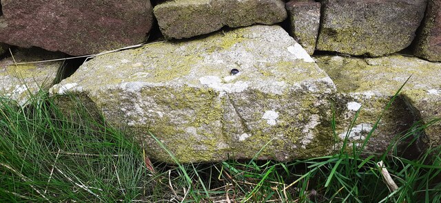
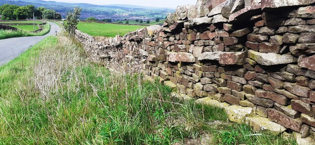
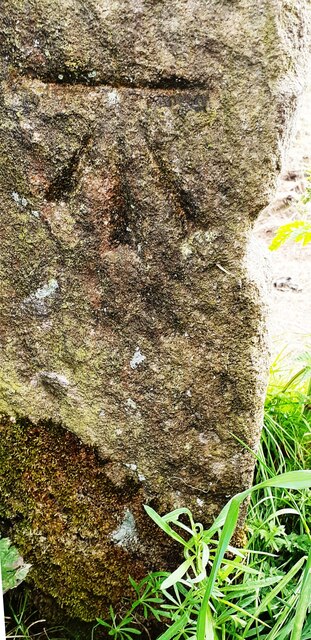
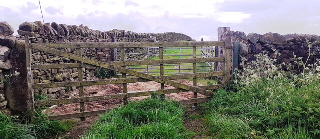
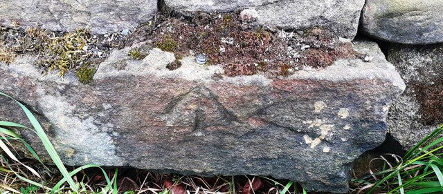
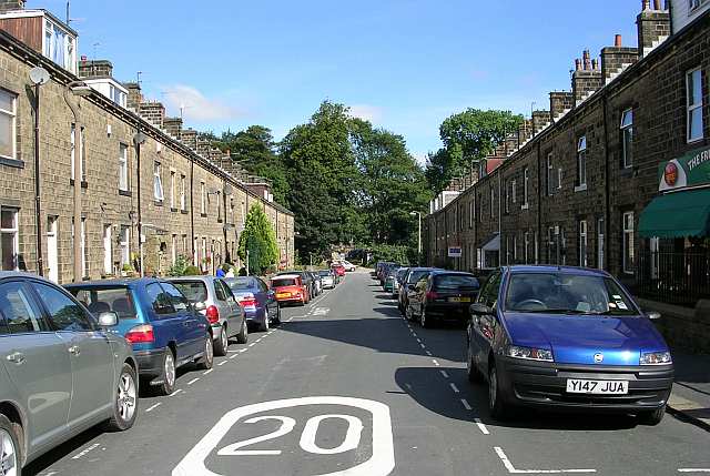
Coppy Hill Images

Images are sourced within 2km of 53.874914/-1.9557187 or Grid Reference SE0342. Thanks to Geograph Open Source API. All images are credited.

Benchmark on stone wall on east side of Barrows Lane Ordnance Survey cut mark benchmark levelled at 166.083m above Newlyn Data verified in 1962
Benchmark on stone wall on east side of Barrows Lane
Ordnance Survey cut mark benchmark levelled at 166.083m above Newlyn Data verified in 1962
Looking south along Barrows Lane There is an Ordnance Survey benchmark <a href="https://www.geograph.org.uk/photo/7175899">SE0343 : Benchmark on stone wall on east side of Barrows Lane</a> on a stone in the left hand side roadside wall, below a notebook placed on top of the wall
Looking south along Barrows Lane
There is an Ordnance Survey benchmark SE0343 : Benchmark on stone wall on east side of Barrows Lane on a stone in the left hand side roadside wall, below a notebook placed on top of the wall
Field with cows on east side of Barrows Lane near Whitley Head
Benchmark on The Churns, Nutt Head Farm Ordnance Survey cut mark benchmark levelled at 225.619m above Newlyn Datum verified 1962
Benchmark on The Churns, Nutt Head Farm
Ordnance Survey cut mark benchmark levelled at 225.619m above Newlyn Datum verified 1962
Buildings at Nutt Head Farm on east side of Redcar Lane There is an Ordnance Survey benchmark <a href="https://www.geograph.org.uk/photo/7176320">SE0243 : Benchmark on The Churns, Nutt Head Farm</a> on the left hand corner, road face, of the house, The Churns
Buildings at Nutt Head Farm on east side of Redcar Lane
There is an Ordnance Survey benchmark SE0243 : Benchmark on The Churns, Nutt Head Farm on the left hand corner, road face, of the house, The Churns
Benchmark on stone in wall on east side of Redcar Lane Ordnance Survey cut mark benchmark levelled at 241.335m above Newlyn Datum verified 1962
Benchmark on stone in wall on east side of Redcar Lane
Ordnance Survey cut mark benchmark levelled at 241.335m above Newlyn Datum verified 1962
Trees and dry stone wall on east side of Redcar Lane There is an Ordnance Survey benchmark <a href="https://www.geograph.org.uk/photo/7176343">SE0243 : Benchmark on stone in wall on east side of Redcar Lane</a> on a stone in the wall behind the gap in the leaves in the centre of the image
Trees and dry stone wall on east side of Redcar Lane
There is an Ordnance Survey benchmark SE0243 : Benchmark on stone in wall on east side of Redcar Lane on a stone in the wall behind the gap in the leaves in the centre of the image
Benchmark on gatepost at field gateway on north side of Redcar Lane Ordnance Survey cut mark benchmark levelled at 255.679m above Newlyn Datum verified 1962
Benchmark on gatepost at field gateway on north side of Redcar Lane
Ordnance Survey cut mark benchmark levelled at 255.679m above Newlyn Datum verified 1962
View though field gateway on north side of Redcar Lane There is an Ordnance Survey benchmark <a href="https://www.geograph.org.uk/photo/7176394">SE0242 : Benchmark on gatepost at field gateway on north side of Redcar Lane</a> on the inside face of the gatepost
View though field gateway on north side of Redcar Lane
There is an Ordnance Survey benchmark SE0242 : Benchmark on gatepost at field gateway on north side of Redcar Lane on the inside face of the gatepost
Benchmark on house at Westy Bank Croft Ordnance Survey cut mark benchmark levelled at 262.357m above Newlyn Datum verified 1962
Benchmark on house at Westy Bank Croft
Ordnance Survey cut mark benchmark levelled at 262.357m above Newlyn Datum verified 1962
Houses at Westy Bank Croft, Redcar Lane There is an Ordnance Survey benchmark <a href="https://www.geograph.org.uk/photo/7176426">SE0342 : Benchmark on house at Westy Bank Croft</a> on the right hand corner, left hand face, of the nearest house
Houses at Westy Bank Croft, Redcar Lane
There is an Ordnance Survey benchmark SE0342 : Benchmark on house at Westy Bank Croft on the right hand corner, left hand face, of the nearest house
Benchmark on gatepost at field gateway on east side of Redcar Lane Ordnance Survey cut mark benchmark levelled at 269.721m above Newlyn Datum verified 1962
Benchmark on gatepost at field gateway on east side of Redcar Lane
Ordnance Survey cut mark benchmark levelled at 269.721m above Newlyn Datum verified 1962
Field gateway on east side of Redcar Lane opposite Middle Redcar Farm There is an Ordnance Survey benchmark <a href="https://www.geograph.org.uk/photo/7176457">SE0342 : Benchmark on gatepost at field gateway on east side of Redcar Lane</a> on the inside face of the left hand gatepost
Field gateway on east side of Redcar Lane opposite Middle Redcar Farm
There is an Ordnance Survey benchmark SE0342 : Benchmark on gatepost at field gateway on east side of Redcar Lane on the inside face of the left hand gatepost
Benchmark on stone in wall on east side of Redcar Lane Ordnance Survey rivet benchmark levelled at 283.940m above Newkyn Datum verified 1962
Benchmark on stone in wall on east side of Redcar Lane
Ordnance Survey rivet benchmark levelled at 283.940m above Newkyn Datum verified 1962
Redcar Lane heading north towards Westy Bank Croft There is an Ordnance Survey benchmark <a href="https://www.geograph.org.uk/photo/7176655">SE0342 : Benchmark on stone in wall on east side of Redcar Lane</a> on a protruding stone at base of the wall at the right foreground
Redcar Lane heading north towards Westy Bank Croft
There is an Ordnance Survey benchmark SE0342 : Benchmark on stone in wall on east side of Redcar Lane on a protruding stone at base of the wall at the right foreground
Benchmark on gatepost at field gateway on SW side of Black Hill Lane Ordnance Survey cut mark benchmark levelled at 301.880m above Newlyn Datum verified 1962
Benchmark on gatepost at field gateway on SW side of Black Hill Lane
Ordnance Survey cut mark benchmark levelled at 301.880m above Newlyn Datum verified 1962
Field gateway on SW side of Black Hill Lane opposite Tarn House There is an Ordnance Survey benchmark <a href="https://www.geograph.org.uk/photo/7176738">SE0342 : Benchmark on gatepost at field gateway on SW side of Black Hill Lane</a> on the road face of the left hand gatepost
Field gateway on SW side of Black Hill Lane opposite Tarn House
There is an Ordnance Survey benchmark SE0342 : Benchmark on gatepost at field gateway on SW side of Black Hill Lane on the road face of the left hand gatepost
Benchmark on stone in wall on SW side of Black Hill Lane opposite Redcar Tarn Ordnance Survey rivet benchmark levelled at 290.295m above Newlyn Datum verified 1962
Benchmark on stone in wall on SW side of Black Hill Lane opposite Redcar Tarn
Ordnance Survey rivet benchmark levelled at 290.295m above Newlyn Datum verified 1962
Show me another place!

Coppy Hill is located at Grid Ref: SE0342 (Lat: 53.874914, Lng: -1.9557187)

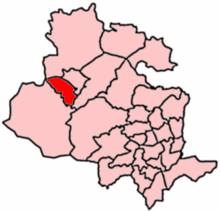
Division: West Riding

Unitary Authority: Bradford

Police Authority: West Yorkshire

What 3 Words

///good.boats.deeper. Near Steeton, West Yorkshire

Related Wikis

Laycock, West Yorkshire

Laycock is a small village in the Bradford District of West Yorkshire that overlooks the hamlet of Goose Eye. The village is 1.9 miles (3 km) west of the...

Keighley West

Keighley West (population 15,784 - 2001 UK census) is a ward within the City of Bradford Metropolitan District Council in the county of West Yorkshire...

Steeton with Eastburn

Steeton with Eastburn is a civil parish within the City of Bradford Metropolitan District, West Yorkshire, England. Historically part of the West Riding...

Steeton, West Yorkshire

Steeton is a village in the City of Bradford metropolitan borough, West Yorkshire, England. Historically part of the West Riding of Yorkshire, it is situated...

Nearby Amenities

Located within 500m of 53.874914,-1.9557187
Redcar
Building: yes
Source: npe
Lat/Long: 53.8780546/-1.9517537
Cutshaw
Building: yes
Source: npe
Lat/Long: 53.8746138/-1.9545432
Power: tower
Source: OS 1:25k
Lat/Long: 53.8737974/-1.951377
Cutshaw Moor
Place: locality
Source: OSODSV
Lat/Long: 53.8777821/-1.9561024
Power: tower
Lat/Long: 53.8749917/-1.9500196
Power: tower
Lat/Long: 53.8760844/-1.9487429
Power: tower
Lat/Long: 53.8725849/-1.9528118
Power: tower
Lat/Long: 53.8713388/-1.9542548
Generator Method: wind_turbine
Generator Source: wind
Power: generator
Lat/Long: 53.8739097/-1.9489813
The data included in this document is from www.openstreetmap.org. The data is made available under ODbL.

Have you been to Coppy Hill?

Leave your review of Coppy Hill below (or comments, questions and feedback).