Dumpit Hill

Hill, Mountain in Yorkshire Craven

England

Dumpit Hill

Meadowsweet in Wharfedale Taken on the section of the Dales Way between Linton and Hebden as I near Hebden, I am looking across the River Wharfe at the glorious display of meadowsweet on the opposite bank.
Meadowsweet in Wharfedale Credit: Carroll Pierce

Dumpit Hill is a prominent natural landmark located in the county of Yorkshire, England. Situated near the village of Kirby Malzeard, in the Nidderdale Area of Outstanding Natural Beauty, Dumpit Hill is a low-lying hill rather than a mountain, reaching an elevation of approximately 331 meters (1,086 feet) above sea level.

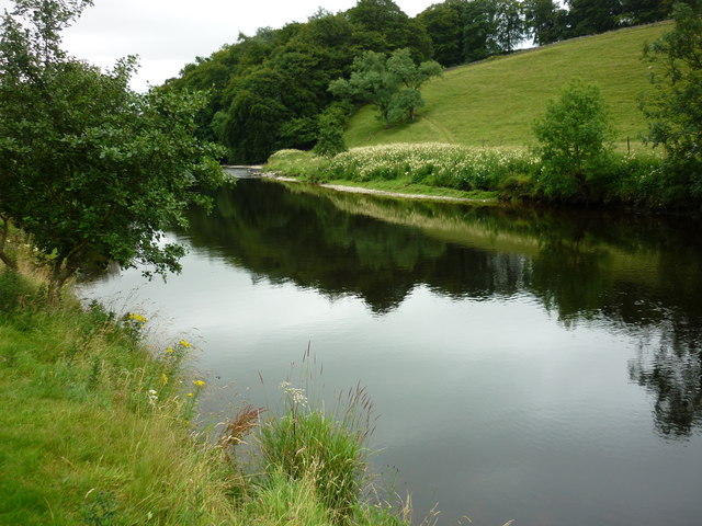
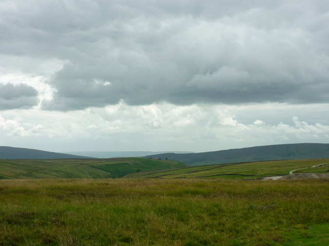
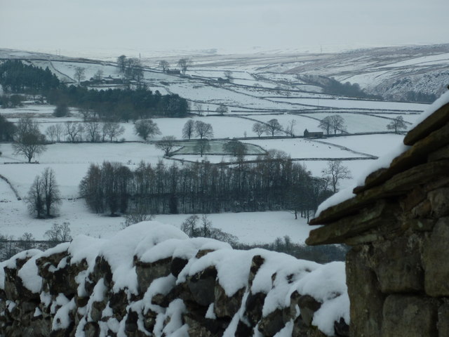
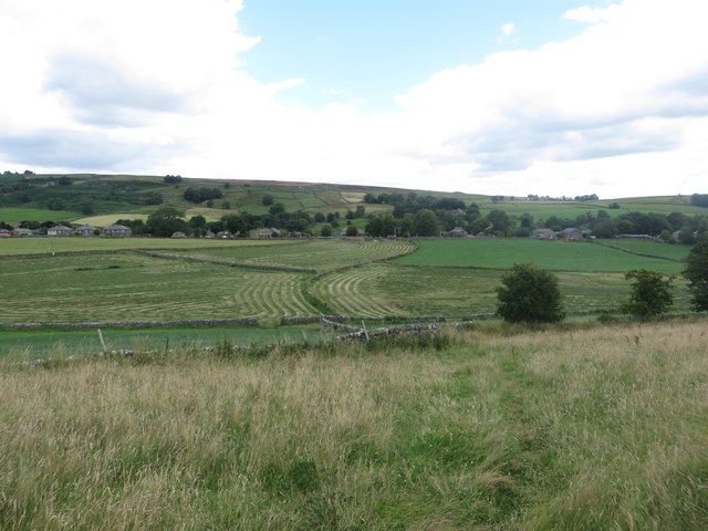
The hill is characterized by its gently sloping sides and offers panoramic views of the surrounding countryside, including the picturesque landscapes of Nidderdale and the Yorkshire Dales National Park. On clear days, visitors can enjoy breathtaking vistas of rolling green hills, charming villages, and distant peaks.

The name "Dumpit" is derived from the Old English word "dun," meaning hill, and "pit," referring to a hollow or cavity. This name aptly describes the topography of the hill, which features a shallow depression or dip towards its summit, giving it a distinctive appearance.

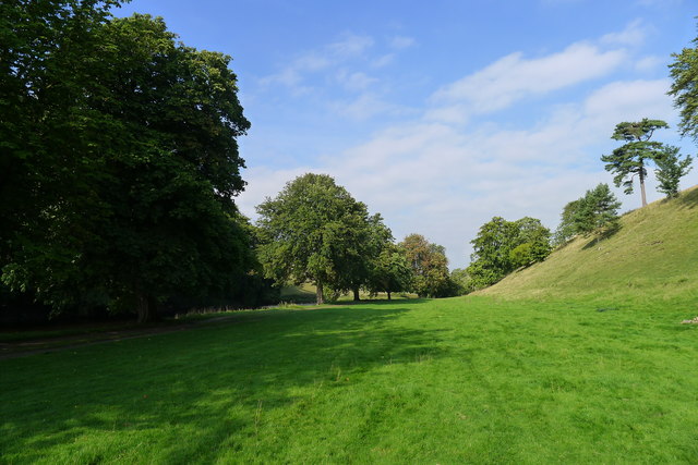
Dumpit Hill is a popular destination for outdoor enthusiasts, offering various walking and hiking trails that cater to different levels of difficulty. Its accessible location and relatively easy terrain make it suitable for families, nature lovers, and those seeking a leisurely stroll in a tranquil setting. The hill is also abundant in flora and fauna, with a diverse range of plant and animal species calling it home.

Whether it's for a peaceful walk, birdwatching, or simply taking in the breathtaking views, Dumpit Hill remains a delightful spot for visitors to connect with nature and appreciate the beauty of the Yorkshire countryside.

If you have any feedback on the listing, please let us know in the comments section below.
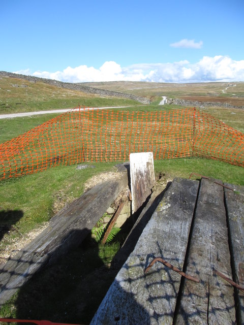
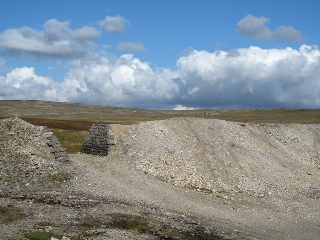
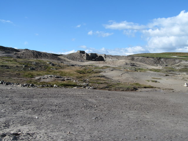
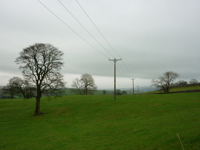
Dumpit Hill Images

Images are sourced within 2km of 54.07304/-1.958474 or Grid Reference SE0264. Thanks to Geograph Open Source API. All images are credited.
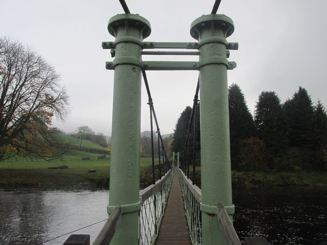
Meadowsweet in Wharfedale Taken on the section of the Dales Way between Linton and Hebden as I near Hebden, I am looking across the River Wharfe at the glorious display of meadowsweet on the opposite bank.
Meadowsweet in Wharfedale
Taken on the section of the Dales Way between Linton and Hebden as I near Hebden, I am looking across the River Wharfe at the glorious display of meadowsweet on the opposite bank.
Yarnbury to Barden Moor Taken on Duke's New Road which connects the old smelting works with the lead mine workings and spoils at Yarnbury, Grassington, I am looking south west towards Barden Moor. Scar Top House is just discernible at the head of Slate Pit Ridge to the left of shot.
Yarnbury to Barden Moor
Taken on Duke's New Road which connects the old smelting works with the lead mine workings and spoils at Yarnbury, Grassington, I am looking south west towards Barden Moor. Scar Top House is just discernible at the head of Slate Pit Ridge to the left of shot.
Field footpath near Hartlington
The suspension bridge and stepping stones to Hebden "In 1884, following the drowning of a local man while trying to cross the stepping stones on the River Wharfe below Hebden, a committee was formed with the intention of building a footbridge. A great storm the previous year had also destroyed Burnsall Bridge down stream causing the villagers great problems. The new bridge was designed as a suspension bridge and was built by the village blacksmith, William Bell [in 1885, and recently refurbished by the National Park Authority]" from <span class="nowrap"><a title="http://www.outofoblivion.org.uk/record.asp?id=282" rel="nofollow ugc noopener" href="http://www.outofoblivion.org.uk/record.asp?id=282">Link</a><img style="margin-left:2px;" alt="External link" title="External link - shift click to open in new window" src="https://s1.geograph.org.uk/img/external.png" width="10" height="10"/></span>
The suspension bridge and stepping stones to Hebden
"In 1884, following the drowning of a local man while trying to cross the stepping stones on the River Wharfe below Hebden, a committee was formed with the intention of building a footbridge. A great storm the previous year had also destroyed Burnsall Bridge down stream causing the villagers great problems. The new bridge was designed as a suspension bridge and was built by the village blacksmith, William Bell [in 1885, and recently refurbished by the National Park Authority]" from LinkExternal link
A line of horse chestnut trees alongside the Dales Way
Hebden suspension bridge. Walking the Dales way.
Hebden suspension bridge.
Walking the Dales way.
Old mine shaft at Yarnbury Until recently this shaft was covered by timber planks, but one appears to have decayed to the point where it has fallen in. Some plastic netting warns people not to get too close.  There are thousands of these old shafts in the dales area, most of which appear to be shallow grassy bowls, but one never knows what the grass hides as there is a fair chance that there will be rotting timbers over a hidden shaft.
Old mine shaft at Yarnbury
Until recently this shaft was covered by timber planks, but one appears to have decayed to the point where it has fallen in. Some plastic netting warns people not to get too close. There are thousands of these old shafts in the dales area, most of which appear to be shallow grassy bowls, but one never knows what the grass hides as there is a fair chance that there will be rotting timbers over a hidden shaft.
Recently repaired stonework at Yarnbury These buttresses once supported a small bridge, used to carry waste material from the nearby lead mine to a tip. The stonework had decayed over the years and the whole lot was in danger of collapse, so work has been done to consolidate the stonework some of which is now mortared using lime mortar.
Recently repaired stonework at Yarnbury
These buttresses once supported a small bridge, used to carry waste material from the nearby lead mine to a tip. The stonework had decayed over the years and the whole lot was in danger of collapse, so work has been done to consolidate the stonework some of which is now mortared using lime mortar.
Yarnbury mining area The scarred landscape of Grassington Moor at Yarnbury, an area once busy with lead mining. This view shows the recently repaired buttresses of a former bridge which carried tubs laden with waste material. Close by were the Beevers and Union shafts, plus a crushing and dressing floor. On the skyline is the chimney at the top end of the extensive flue system which snaked across the moor from the smelt mill.
Yarnbury mining area
The scarred landscape of Grassington Moor at Yarnbury, an area once busy with lead mining. This view shows the recently repaired buttresses of a former bridge which carried tubs laden with waste material. Close by were the Beevers and Union shafts, plus a crushing and dressing floor. On the skyline is the chimney at the top end of the extensive flue system which snaked across the moor from the smelt mill.
Old mining ground at Yarnbury Old tips and polluted ground close to the former Beevers and Union shafts at Yarnbury. The distant ruins were part of a crushing and dressing area, but were renovated and reused in the 20thC when the area was reworked for minerals such as barytes and fluorite. Although the tips have been untouched for decades, nothing grows on them.
Old mining ground at Yarnbury
Old tips and polluted ground close to the former Beevers and Union shafts at Yarnbury. The distant ruins were part of a crushing and dressing area, but were renovated and reused in the 20thC when the area was reworked for minerals such as barytes and fluorite. Although the tips have been untouched for decades, nothing grows on them.
To Hebden Taken on the lane leading up to Thorpe, North Yorkshire, just off the B6160 to Burnsall, I am looking east towards where Hebden is located.
To Hebden
Taken on the lane leading up to Thorpe, North Yorkshire, just off the B6160 to Burnsall, I am looking east towards where Hebden is located.
Hebden Moor Taken on the access road up to Thorpe from the B6160 Threshfield to Burnsall road, I am looking north across Grassington Park Estate to Hebden Moor. Grassington Moor is beyond to the left of shot and the chimney at the disused mine workings is discernible against the snowy background.
Hebden Moor
Taken on the access road up to Thorpe from the B6160 Threshfield to Burnsall road, I am looking north across Grassington Park Estate to Hebden Moor. Grassington Moor is beyond to the left of shot and the chimney at the disused mine workings is discernible against the snowy background.
Hebden and Appletreewick Moors Taken on the access road from the B6160 Threshfield to Burnsall road up to Thorpe, North Yorkshire, I am looking north east to Hebden and Appletreewick Moors.
Hebden and Appletreewick Moors
Taken on the access road from the B6160 Threshfield to Burnsall road up to Thorpe, North Yorkshire, I am looking north east to Hebden and Appletreewick Moors.
Halfway House Farm Looking across a pasture of short grass towards the farm buildings of Halfway House Farm.
Halfway House Farm
Looking across a pasture of short grass towards the farm buildings of Halfway House Farm.
Sheep grazing near Halfway House Farm Sheep are grazing a flat field of grass close to Halfway House Farm.
Sheep grazing near Halfway House Farm
Sheep are grazing a flat field of grass close to Halfway House Farm.
Mown grass field at New Dyke Lathes Looking across a field of mown grass at New Dyke Lathes.
Mown grass field at New Dyke Lathes
Looking across a field of mown grass at New Dyke Lathes.
Spread mown grass at New Dyke Lathes A field of mown grass spread out to dry before being made into hay at New Dyke Lathes.
Spread mown grass at New Dyke Lathes
A field of mown grass spread out to dry before being made into hay at New Dyke Lathes.
Grass fields at Hebden Looking down on small grass fields on the western edge of the village of Hebden. A few have been mown, the first stage in turning the grass into hay or silage.
Grass fields at Hebden
Looking down on small grass fields on the western edge of the village of Hebden. A few have been mown, the first stage in turning the grass into hay or silage.
Show me another place!

Dumpit Hill is located at Grid Ref: SE0264 (Lat: 54.07304, Lng: -1.958474)

Division: West Riding

Administrative County: North Yorkshire

District: Craven

Police Authority: North Yorkshire

What 3 Words

///bloom.mixed.steep. Near Grassington, North Yorkshire

Related Wikis

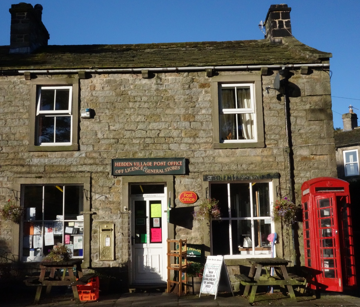
Hebden, North Yorkshire

Hebden ( HEB-dərn) is a village and civil parish in the Craven District of North Yorkshire, England, and one of four villages in the ecclesiastical parish...

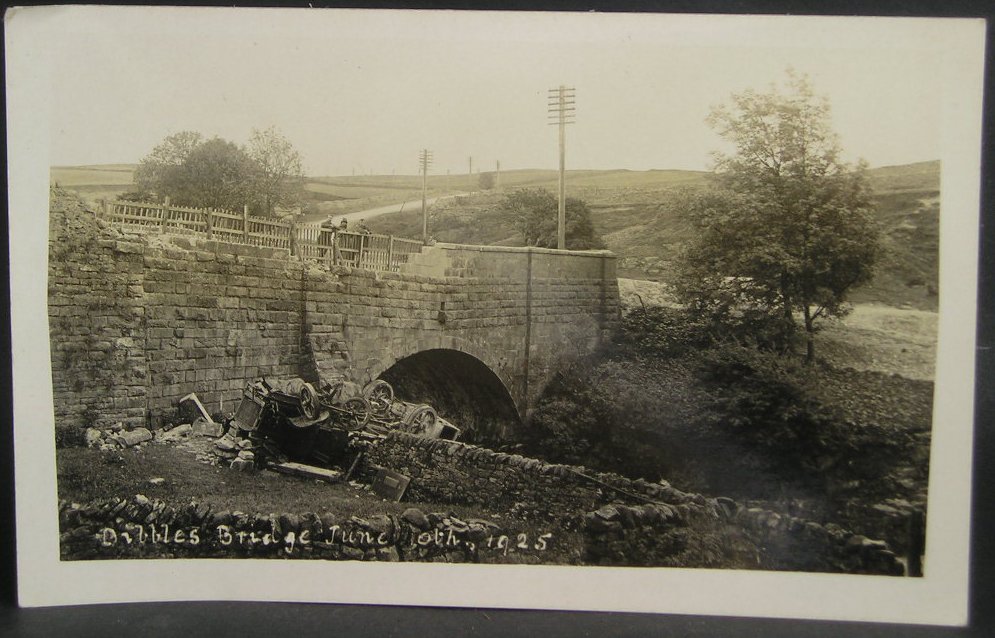
1925 Dibbles Bridge coach crash

On 10 June 1925, a coach crashed at the bottom of a steep hill at Dibbles Bridge, near Hebden in North Yorkshire, England. Seven people were killed and...

1975 Dibbles Bridge coach crash

On 27 May 1975, a coach carrying elderly passengers crashed at the bottom of a steep hill at Dibble's Bridge, near Hebden in North Yorkshire, England....

Grassington

Grassington is a village and civil parish in North Yorkshire, England. The population of the parish at the 2011 Census was 1,126. Historically part of...

Burnsall

Burnsall is a village and civil parish in the Craven district of North Yorkshire, England. It is situated on the River Wharfe in Wharfedale, and is in...

Thorpe, North Yorkshire

Thorpe is a village and civil parish in the Craven district of North Yorkshire, England. It is 2 miles (3 km) south of Grassington and 6 miles (10 km)...

Linton Falls Hydro

Linton Falls Hydro is a hydroelectric generating power station located on the Linton Falls Weir of the River Wharfe, near Grassington, North Yorkshire...

Hartlington

Hartlington is a small village and civil parish in the Craven district of North Yorkshire, England. At the 2011 Census, the population of the parish was...

Nearby Amenities

Located within 500m of 54.07304,-1.958474
Scala Waterfall
Fixme: check exact location
Source: OS sheet 134,1853
Waterway: waterfall
Lat/Long: 54.0711064/-1.9644025
Hole Bottom
Is In: UK, England, North Yorkshire, Wharfedale, Yorkshire Dales
Place: hamlet
Lat/Long: 54.0723197/-1.9645429
Barrier: cattle_grid
Lat/Long: 54.0698926/-1.9568172
Barrier: cattle_grid
Source: Bing
Lat/Long: 54.0689965/-1.9586884
Mossy Moor Ridge
Is In: UK,Yorkshire,North Yorkshire,Nidderdale
Is In Country: UK
Is In County: North Yorkshire
Is In Historical County: Yorkshire
Natural: peak
Source: OS 1:25k
Lat/Long: 54.0730402/-1.9586987
Dumpit Hill
Is In: UK,Yorkshire,North Yorkshire,Nidderdale
Is In Country: UK
Is In County: North Yorkshire
Is In Historical County: Yorkshire
Man Made: survey_point
Natural: peak
Source: OS 1:25k
Lat/Long: 54.0702212/-1.9529051
Historic: mine_shaft
Mineral: lead
Source: Bing
Lat/Long: 54.0743311/-1.9529098
Historic: mine_shaft
Mineral: lead
Source: Bing
Lat/Long: 54.076945/-1.9584378
Barrier: entrance
Source: survey;gps
Lat/Long: 54.0712064/-1.9615988
Barrier: stile
Material: steel
Source: survey;gps
Stile: squeezer
Lat/Long: 54.0727909/-1.965031
Barrier: stile
Material: wood
Source: survey;gps
Stile: stepover
Lat/Long: 54.0728317/-1.9650732
Barrier: cattle_grid
Bicycle: yes
Foot: yes
Lat/Long: 54.0728338/-1.9649624
Barrier: cattle_grid
Bicycle: yes
Foot: yes
Lat/Long: 54.0712919/-1.9576372
Barrier: stile
Material: stone
Source: survey;gps
Stile: squeezer
Lat/Long: 54.0692776/-1.9579861
Barrier: stile
Material: wood
Stile: stepover
Lat/Long: 54.0699173/-1.9574507
Barrier: stile
Material: stone
Source: survey;gps
Stile: stepover
Lat/Long: 54.0709331/-1.9615292
Scale Haw
Natural: peak
Source: OS Yorshire 134, 1853
Lat/Long: 54.0719236/-1.9647724
Description: ruin in mid-C9th. Unknown
Historic: archaeological_site
Source: OS sheet 134,1853
Lat/Long: 54.0709415/-1.9624862
Historic: lime_kiln
Mineral: limestone
Output: lime
Source: OS sheet 134,1853
Lat/Long: 54.0710014/-1.9632318
Leisure: picnic_table
Lat/Long: 54.0732997/-1.9638987
Abandoned: yes
Access: no
Man Made: adit
Lat/Long: 54.0769077/-1.9608296
Archaeological Site: mineral_extraction
Description: Almost certainly lead mining
Historic: mine_shaft
Source: Bing
Lat/Long: 54.074744/-1.9613091
Archaeological Site: mineral_extraction
Description: Almost certainly lead mining
Historic: mine_shaft
Source: Bing
Lat/Long: 54.0754631/-1.9606842
Historic: mine_shaft
Mineral: lead
Source: Bing
Lat/Long: 54.07656/-1.9591285
Historic: mine_shaft
Mineral: lead
Source: Bing
Lat/Long: 54.0765868/-1.958989
Archaeological Site: mineral_extraction
Description: Almost certainly lead mining
Historic: mine_shaft
Source: Bing
Lat/Long: 54.0744355/-1.9607539
Historic: mine_shaft
Mineral: lead
Source: Bing
Lat/Long: 54.076593/-1.959099
Archaeological Site: mineral_extraction
Description: Almost certainly lead mining
Historic: mine_shaft
Source: Bing
Lat/Long: 54.0760406/-1.9610463
Information: guidepost
Tourism: information
Lat/Long: 54.0692786/-1.957971
Information: guidepost
Tourism: information
Lat/Long: 54.0693106/-1.9587684
Information: guidepost
Tourism: information
Lat/Long: 54.0693201/-1.9583065
Ford: yes
Lat/Long: 54.0709493/-1.964385
Power: pole
Lat/Long: 54.0728075/-1.9656535
Power: pole
Lat/Long: 54.072791/-1.9652654
Power: pole
Lat/Long: 54.0686925/-1.9573917
Power: pole
Lat/Long: 54.0692907/-1.9585274
Power: pole
Lat/Long: 54.0698503/-1.9589069
Power: pole
Lat/Long: 54.0703609/-1.9592863
The data included in this document is from www.openstreetmap.org. The data is made available under ODbL.

Have you been to Dumpit Hill?

Leave your review of Dumpit Hill below (or comments, questions and feedback).