Mossy Moor Reservoir

Lake, Pool, Pond, Freshwater Marsh in Yorkshire Craven

England

Mossy Moor Reservoir

Yarnbury to Barden Moor Taken on Duke's New Road which connects the old smelting works with the lead mine workings and spoils at Yarnbury, Grassington, I am looking south west towards Barden Moor. Scar Top House is just discernible at the head of Slate Pit Ridge to the left of shot.
Yarnbury to Barden Moor Credit: Carroll Pierce

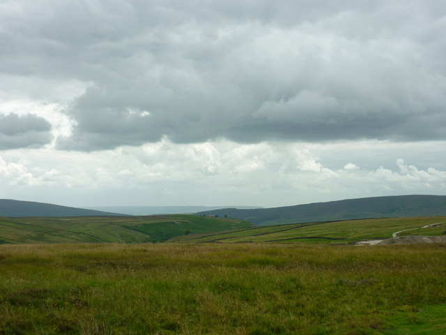
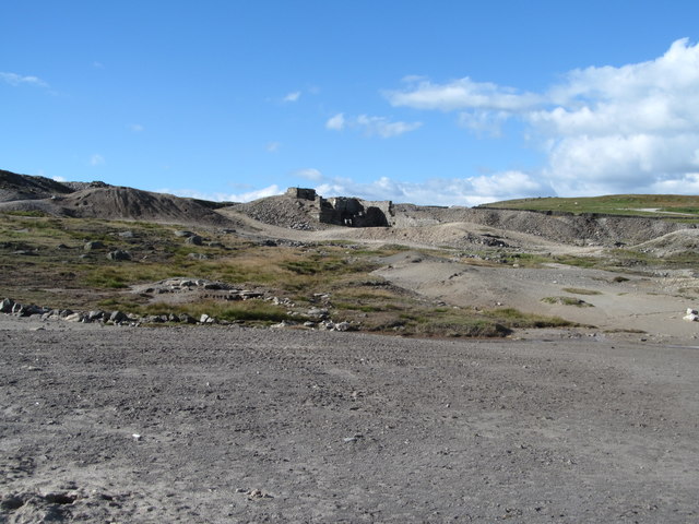
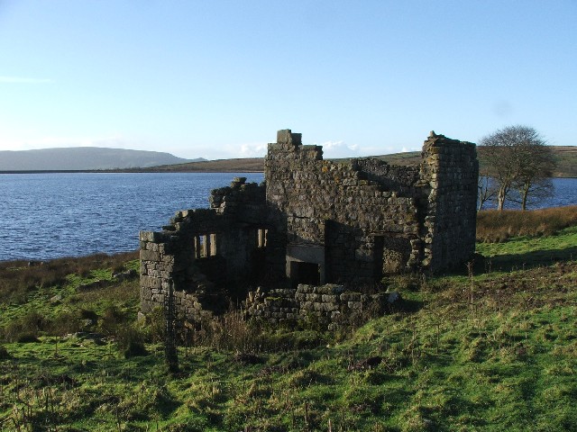
Mossy Moor Reservoir, located in the picturesque region of Yorkshire, is a stunning freshwater marsh that serves as a vital water source for the surrounding areas. Spanning over a vast expanse, the reservoir is often referred to as a lake due to its size and depth. It covers an area of approximately 100 acres, making it an ideal spot for various recreational activities.

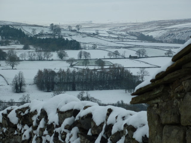
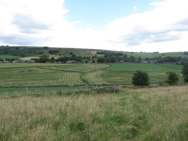
The reservoir is nestled amidst the breathtaking Yorkshire landscape, surrounded by rolling hills and lush greenery. Its tranquil waters are home to a diverse range of aquatic flora and fauna, making it a haven for nature enthusiasts and birdwatchers alike. The marshy edges of the reservoir provide the perfect habitat for a variety of water-loving plants such as reeds, rushes, and water lilies.

The reservoir's clear, freshwater not only sustains a wide array of plant life but also supports a thriving ecosystem of fish, including perch, pike, and roach. Anglers are often drawn to Mossy Moor Reservoir for its abundant fish population, making it a popular spot for fishing enthusiasts.

Visitors to Mossy Moor Reservoir can enjoy a range of activities, from leisurely walks around the perimeter to birdwatching from one of the designated viewpoints. The reservoir is also a favorite spot for boating and kayaking, offering visitors the opportunity to explore its serene waters and soak in the breathtaking Yorkshire scenery.

Overall, Mossy Moor Reservoir stands as a natural gem in Yorkshire, providing both a vital water source and a serene recreational area for visitors to enjoy.

If you have any feedback on the listing, please let us know in the comments section below.

Mossy Moor Reservoir Images

Images are sourced within 2km of 54.075645/-1.9557052 or Grid Reference SE0264. Thanks to Geograph Open Source API. All images are credited.

Yarnbury to Barden Moor Taken on Duke's New Road which connects the old smelting works with the lead mine workings and spoils at Yarnbury, Grassington, I am looking south west towards Barden Moor. Scar Top House is just discernible at the head of Slate Pit Ridge to the left of shot.
Yarnbury to Barden Moor
Taken on Duke's New Road which connects the old smelting works with the lead mine workings and spoils at Yarnbury, Grassington, I am looking south west towards Barden Moor. Scar Top House is just discernible at the head of Slate Pit Ridge to the left of shot.
Old mine shaft at Yarnbury There has been some attempt to persuade humans and animals not to approach too closely to this open shaft, mainly through the use of some old corrugated sheeting and a rusting wheelbarrow, neither of which succeed in closing off the shaft, whilst the surrounding drystone wall now has large gaps.
Old mine shaft at Yarnbury
There has been some attempt to persuade humans and animals not to approach too closely to this open shaft, mainly through the use of some old corrugated sheeting and a rusting wheelbarrow, neither of which succeed in closing off the shaft, whilst the surrounding drystone wall now has large gaps.
Old mine shaft at Yarnbury Until recently this shaft was covered by timber planks, but one appears to have decayed to the point where it has fallen in. Some plastic netting warns people not to get too close.  There are thousands of these old shafts in the dales area, most of which appear to be shallow grassy bowls, but one never knows what the grass hides as there is a fair chance that there will be rotting timbers over a hidden shaft.
Old mine shaft at Yarnbury
Until recently this shaft was covered by timber planks, but one appears to have decayed to the point where it has fallen in. Some plastic netting warns people not to get too close. There are thousands of these old shafts in the dales area, most of which appear to be shallow grassy bowls, but one never knows what the grass hides as there is a fair chance that there will be rotting timbers over a hidden shaft.
Recently repaired stonework at Yarnbury These buttresses once supported a small bridge, used to carry waste material from the nearby lead mine to a tip. The stonework had decayed over the years and the whole lot was in danger of collapse, so work has been done to consolidate the stonework some of which is now mortared using lime mortar.
Recently repaired stonework at Yarnbury
These buttresses once supported a small bridge, used to carry waste material from the nearby lead mine to a tip. The stonework had decayed over the years and the whole lot was in danger of collapse, so work has been done to consolidate the stonework some of which is now mortared using lime mortar.
Yarnbury mining area The scarred landscape of Grassington Moor at Yarnbury, an area once busy with lead mining. This view shows the recently repaired buttresses of a former bridge which carried tubs laden with waste material. Close by were the Beevers and Union shafts, plus a crushing and dressing floor. On the skyline is the chimney at the top end of the extensive flue system which snaked across the moor from the smelt mill.
Yarnbury mining area
The scarred landscape of Grassington Moor at Yarnbury, an area once busy with lead mining. This view shows the recently repaired buttresses of a former bridge which carried tubs laden with waste material. Close by were the Beevers and Union shafts, plus a crushing and dressing floor. On the skyline is the chimney at the top end of the extensive flue system which snaked across the moor from the smelt mill.
Old mining ground at Yarnbury Old tips and polluted ground close to the former Beevers and Union shafts at Yarnbury. The distant ruins were part of a crushing and dressing area, but were renovated and reused in the 20thC when the area was reworked for minerals such as barytes and fluorite. Although the tips have been untouched for decades, nothing grows on them.
Old mining ground at Yarnbury
Old tips and polluted ground close to the former Beevers and Union shafts at Yarnbury. The distant ruins were part of a crushing and dressing area, but were renovated and reused in the 20thC when the area was reworked for minerals such as barytes and fluorite. Although the tips have been untouched for decades, nothing grows on them.
Hebden Moor Taken on the access road up to Thorpe from the B6160 Threshfield to Burnsall road, I am looking north across Grassington Park Estate to Hebden Moor. Grassington Moor is beyond to the left of shot and the chimney at the disused mine workings is discernible against the snowy background.
Hebden Moor
Taken on the access road up to Thorpe from the B6160 Threshfield to Burnsall road, I am looking north across Grassington Park Estate to Hebden Moor. Grassington Moor is beyond to the left of shot and the chimney at the disused mine workings is discernible against the snowy background.
Mown grass field at New Dyke Lathes Looking across a field of mown grass at New Dyke Lathes.
Mown grass field at New Dyke Lathes
Looking across a field of mown grass at New Dyke Lathes.
Spread mown grass at New Dyke Lathes A field of mown grass spread out to dry before being made into hay at New Dyke Lathes.
Spread mown grass at New Dyke Lathes
A field of mown grass spread out to dry before being made into hay at New Dyke Lathes.
Grass fields at Hebden Looking down on small grass fields on the western edge of the village of Hebden. A few have been mown, the first stage in turning the grass into hay or silage.
Grass fields at Hebden
Looking down on small grass fields on the western edge of the village of Hebden. A few have been mown, the first stage in turning the grass into hay or silage.
Weir beside Hebden Beck Looking across a weir over which water is flowing into Hebden Beck.
Weir beside Hebden Beck
Looking across a weir over which water is flowing into Hebden Beck.
Hebden Methodist Church The Methodist church in the small Wharfedale village of Hebden.
Hebden Methodist Church
The Methodist church in the small Wharfedale village of Hebden.
Chapel Lane, Hebden Looking along a narrow lane between houses in the Yorkshire village of Hebden.
Chapel Lane, Hebden
Looking along a narrow lane between houses in the Yorkshire village of Hebden.
Former public toilets, Hebden A permanently closed block of public toilets in the Yorkshire Dales village of Hebden.
Former public toilets, Hebden
A permanently closed block of public toilets in the Yorkshire Dales village of Hebden.
Gold Postbox, Hebden The gold painted post box commemorates the gold medal won by Andrew Triggs Hodge at the Olympic Games held in London in the summer of 2012. The post box appears to have replaced a wall box in the wall of the former post office (<a href="https://www.geograph.org.uk/photo/3658443">SE0263 : Gold painted post-box, Hebden</a> and <a href="https://www.geograph.org.uk/photo/3134187">SE0263 : Gold Post Box at Hebden Post Office</a>). A close up of the plaque on the post box can be seen in <a href="https://www.geograph.org.uk/photo/4889544">SE0263 : Plaque on post box, Hebden</a>.
Gold Postbox, Hebden
The gold painted post box commemorates the gold medal won by Andrew Triggs Hodge at the Olympic Games held in London in the summer of 2012. The post box appears to have replaced a wall box in the wall of the former post office (SE0263 : Gold painted post-box, Hebden and SE0263 : Gold Post Box at Hebden Post Office). A close up of the plaque on the post box can be seen in SE0263 : Plaque on post box, Hebden.
Plaque on post box, Hebden The plaque mounted on the post box outside the former post office in Hebden. The gold post box commemorates the gold medal won by Andrew Triggs Hodge in a rowing event at the Olympic Games held in London during the summer of 2012. The plaque has been relocated to a new postbox after the closure of the village's post office. <a href="https://www.geograph.org.uk/photo/3658443">SE0263 : Gold painted post-box, Hebden</a>. The post box the plaque is mounted on can be seen in <a href="https://www.geograph.org.uk/photo/4889538">SE0263 : Gold Postbox, Hebden</a>.
Plaque on post box, Hebden
The plaque mounted on the post box outside the former post office in Hebden. The gold post box commemorates the gold medal won by Andrew Triggs Hodge in a rowing event at the Olympic Games held in London during the summer of 2012. The plaque has been relocated to a new postbox after the closure of the village's post office. SE0263 : Gold painted post-box, Hebden. The post box the plaque is mounted on can be seen in SE0263 : Gold Postbox, Hebden.
Bus shelter, Hebden A stone built bus shelter in the Yorkshire Dales village of Hebden.
Bus shelter, Hebden
A stone built bus shelter in the Yorkshire Dales village of Hebden.
The Clarendon Hotel, Hebden A large, rural pub with rooms on the edge of the small Dales village of Hebden.
The Clarendon Hotel, Hebden
A large, rural pub with rooms on the edge of the small Dales village of Hebden.
Show me another place!

Mossy Moor Reservoir is located at Grid Ref: SE0264 (Lat: 54.075645, Lng: -1.9557052)

Division: West Riding

Administrative County: North Yorkshire

District: Craven

Police Authority: North Yorkshire

What 3 Words

///monkeys.hills.stealthier. Near Grassington, North Yorkshire

Related Wikis

Hebden, North Yorkshire

Hebden ( HEB-dərn) is a village and civil parish in the Craven District of North Yorkshire, England, and one of four villages in the ecclesiastical parish...

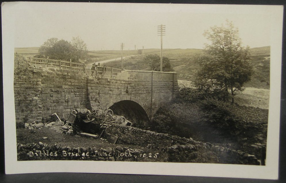
1925 Dibbles Bridge coach crash

On 10 June 1925, a coach crashed at the bottom of a steep hill at Dibbles Bridge, near Hebden in North Yorkshire, England. Seven people were killed and...

1975 Dibbles Bridge coach crash

On 27 May 1975, a coach carrying elderly passengers crashed at the bottom of a steep hill at Dibble's Bridge, near Hebden in North Yorkshire, England....

Grassington

Grassington is a village and civil parish in North Yorkshire, England. The population of the parish at the 2011 Census was 1,126. Historically part of...

Burnsall

Burnsall is a village and civil parish in the Craven district of North Yorkshire, England. It is situated on the River Wharfe in Wharfedale, and is in...

Grimwith Reservoir

Grimwith Reservoir is located in the Yorkshire Dales in North Yorkshire, England. It was originally built by the Bradford Corporation as one of eleven...

Thorpe, North Yorkshire

Thorpe is a village and civil parish in the Craven district of North Yorkshire, England. It is 2 miles (3 km) south of Grassington and 6 miles (10 km)...

Linton Falls Hydro

Linton Falls Hydro is a hydroelectric generating power station located on the Linton Falls Weir of the River Wharfe, near Grassington, North Yorkshire...

Nearby Amenities

Located within 500m of 54.075645,-1.9557052
Historic: mine_shaft
Mineral: lead
Source: Bing
Lat/Long: 54.078647/-1.9595093
Historic: mine_shaft
Mineral: lead
Source: Bing
Lat/Long: 54.0793677/-1.9597024
Historic: mine_shaft
Mineral: lead
Source: Bing
Lat/Long: 54.0778867/-1.9603541
Historic: mine_shaft
Mineral: lead
Source: Bing
Lat/Long: 54.0782221/-1.9601476
Historic: mine_shaft
Mineral: lead
Source: Bing
Lat/Long: 54.0789114/-1.9597668
Historic: mine_shaft
Mineral: lead
Source: Bing
Lat/Long: 54.0781685/-1.960153
Historic: mine_shaft
Mineral: lead
Source: Bing
Lat/Long: 54.0782599/-1.9601154
Historic: mine_shaft
Mineral: lead
Source: Bing
Lat/Long: 54.0793738/-1.9598419
Historic: mine_shaft
Mineral: lead
Source: Bing
Lat/Long: 54.0783102/-1.9601154
Mossy Moor Ridge
Is In: UK,Yorkshire,North Yorkshire,Nidderdale
Is In Country: UK
Is In County: North Yorkshire
Is In Historical County: Yorkshire
Natural: peak
Source: OS 1:25k
Lat/Long: 54.0730402/-1.9586987
Historic: mine_shaft
Mineral: lead
Source: Bing
Lat/Long: 54.0743311/-1.9529098
Historic: mine_shaft
Mineral: lead
Source: Bing
Lat/Long: 54.076945/-1.9584378
Barrier: cattle_grid
Bicycle: yes
Foot: yes
Lat/Long: 54.0712919/-1.9576372
Historic: mine_shaft
Mineral: lead
Source: Bing
Lat/Long: 54.0792369/-1.9593723
Historic: mine_shaft
Source: Bing
Lat/Long: 54.0792399/-1.9595225
Historic: mine_shaft
Mineral: lead
Source: Bing
Lat/Long: 54.0791014/-1.9596727
Historic: mine_shaft
Mineral: lead
Source: Bing
Lat/Long: 54.0793783/-1.9596191
Historic: mine_shaft
Mineral: lead
Source: Bing
Lat/Long: 54.0794067/-1.959367
Abandoned: yes
Access: no
Man Made: adit
Lat/Long: 54.0769077/-1.9608296
Archaeological Site: mineral_extraction
Description: Almost certainly lead mining
Historic: mine_shaft
Source: Bing
Lat/Long: 54.074744/-1.9613091
Archaeological Site: mineral_extraction
Description: Almost certainly lead mining
Historic: mine_shaft
Source: Bing
Lat/Long: 54.0754631/-1.9606842
Historic: mine_shaft
Mineral: lead
Source: Bing
Lat/Long: 54.07656/-1.9591285
Historic: mine_shaft
Mineral: lead
Source: Bing
Lat/Long: 54.0765868/-1.958989
Archaeological Site: mineral_extraction
Description: Almost certainly lead mining
Historic: mine_shaft
Source: Bing
Lat/Long: 54.0744355/-1.9607539
Historic: mine_shaft
Mineral: lead
Source: Bing
Lat/Long: 54.076593/-1.959099
Archaeological Site: mineral_extraction
Description: Almost certainly lead mining
Historic: mine_shaft
Source: Bing
Lat/Long: 54.0760406/-1.9610463
The data included in this document is from www.openstreetmap.org. The data is made available under ODbL.

Have you been to Mossy Moor Reservoir?

Leave your review of Mossy Moor Reservoir below (or comments, questions and feedback).