Kersey Tye

Settlement in Suffolk Babergh

England

Kersey Tye

The Bell Inn, Kersey Dates from the fifteenth and sixteenth centuries <span class="nowrap"><a title="https://historicengland.org.uk/listing/the-list/list-entry/1285465?section=official-listing" rel="nofollow ugc noopener" href="https://historicengland.org.uk/listing/the-list/list-entry/1285465?section=official-listing">Link</a><img style="margin-left:2px;" alt="External link" title="External link - shift click to open in new window" src="https://s1.geograph.org.uk/img/external.png" width="10" height="10"/></span>
The Bell Inn, Kersey Credit: Jonathan Thacker

Kersey Tye is a small village located in the county of Suffolk, England. It is situated approximately 10 miles northeast of Ipswich, the county town. The village is part of the Babergh district and falls within the civil parish of Kersey.

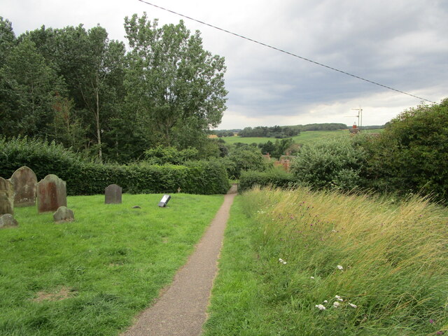
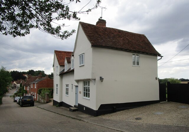
Kersey Tye is known for its picturesque countryside and rural charm. The village is surrounded by rolling hills, lush green fields, and meandering streams, making it an idyllic location for nature lovers and outdoor enthusiasts. The area is also renowned for its historic architecture, with many traditional thatched cottages and timber-framed houses dotting the landscape.

Despite its small size, Kersey Tye boasts a close-knit and friendly community. The village is home to a tight network of residents who actively participate in local events and initiatives. The village hall serves as a focal point for community gatherings and activities, including social events, clubs, and meetings.

The village is also known for its quaint church, St. Mary's Church, which dates back to the 14th century. The church is a significant piece of local history and attracts visitors from near and far. Additionally, Kersey Tye benefits from its proximity to other nearby attractions, including Kersey Mill, a restored water mill with a tea room and craft shops, which adds to the village's appeal.

Overall, Kersey Tye offers a peaceful and picturesque setting, rich in history and natural beauty, making it an attractive destination for both residents and visitors seeking a tranquil escape in the heart of Suffolk.

If you have any feedback on the listing, please let us know in the comments section below.

Kersey Tye Images

Images are sourced within 2km of 52.050499/0.893707 or Grid Reference TL9843. Thanks to Geograph Open Source API. All images are credited.

The Bell Inn, Kersey Dates from the fifteenth and sixteenth centuries <span class="nowrap"><a title="https://historicengland.org.uk/listing/the-list/list-entry/1285465?section=official-listing" rel="nofollow ugc noopener" href="https://historicengland.org.uk/listing/the-list/list-entry/1285465?section=official-listing">Link</a><img style="margin-left:2px;" alt="External link" title="External link - shift click to open in new window" src="https://s1.geograph.org.uk/img/external.png" width="10" height="10"/></span>
The Bell Inn, Kersey
Dates from the fifteenth and sixteenth centuries LinkExternal link
Carlton House, Kersey Datea from the sixteenth and seventeenth centuries <span class="nowrap"><a title="https://historicengland.org.uk/listing/the-list/list-entry/1037248?section=official-listing" rel="nofollow ugc noopener" href="https://historicengland.org.uk/listing/the-list/list-entry/1037248?section=official-listing">Link</a><img style="margin-left:2px;" alt="External link" title="External link - shift click to open in new window" src="https://s1.geograph.org.uk/img/external.png" width="10" height="10"/></span>
Carlton House, Kersey
Datea from the sixteenth and seventeenth centuries LinkExternal link
The River Brett at Kersey
River View, Kersey Of seventeenth century origin <span class="nowrap"><a title="https://historicengland.org.uk/listing/the-list/list-entry/1037234?section=official-listing" rel="nofollow ugc noopener" href="https://historicengland.org.uk/listing/the-list/list-entry/1037234?section=official-listing">Link</a><img style="margin-left:2px;" alt="External link" title="External link - shift click to open in new window" src="https://s1.geograph.org.uk/img/external.png" width="10" height="10"/></span>
River View, Kersey
Of seventeenth century origin LinkExternal link
Olde Drift House. Kersey Much altered house dating from the sixteenth century <span class="nowrap"><a title="https://historicengland.org.uk/listing/the-list/list-entry/1037235?section=official-listing" rel="nofollow ugc noopener" href="https://historicengland.org.uk/listing/the-list/list-entry/1037235?section=official-listing">Link</a><img style="margin-left:2px;" alt="External link" title="External link - shift click to open in new window" src="https://s1.geograph.org.uk/img/external.png" width="10" height="10"/></span>
Olde Drift House. Kersey
Much altered house dating from the sixteenth century LinkExternal link
7 Church Hill, Kersey Seventeenth century cottage <span class="nowrap"><a title="https://historicengland.org.uk/listing/the-list/list-entry/1037274?section=official-listing" rel="nofollow ugc noopener" href="https://historicengland.org.uk/listing/the-list/list-entry/1037274?section=official-listing">Link</a><img style="margin-left:2px;" alt="External link" title="External link - shift click to open in new window" src="https://s1.geograph.org.uk/img/external.png" width="10" height="10"/></span>
7 Church Hill, Kersey
Seventeenth century cottage LinkExternal link
Path and steps to the church, Kersey
Church Hill, Kersey
Church Hill, Kersey
St. Mary's church, Kersey The church largely dates from the fourteenth and fifteenth centuries <span class="nowrap"><a title="https://historicengland.org.uk/listing/the-list/list-entry/1351459?section=official-listing" rel="nofollow ugc noopener" href="https://historicengland.org.uk/listing/the-list/list-entry/1351459?section=official-listing">Link</a><img style="margin-left:2px;" alt="External link" title="External link - shift click to open in new window" src="https://s1.geograph.org.uk/img/external.png" width="10" height="10"/></span>
St. Mary's church, Kersey
The church largely dates from the fourteenth and fifteenth centuries LinkExternal link
Church Hill, Kersey
Church Hill, Kersey
Path through the churchyard, Kersey
The Little Manor, Kersey The oldest parts date to the fourteenth century <span class="nowrap"><a title="https://historicengland.org.uk/listing/the-list/list-entry/1351461?section=official-listing" rel="nofollow ugc noopener" href="https://historicengland.org.uk/listing/the-list/list-entry/1351461?section=official-listing">Link</a><img style="margin-left:2px;" alt="External link" title="External link - shift click to open in new window" src="https://s1.geograph.org.uk/img/external.png" width="10" height="10"/></span>
The Little Manor, Kersey
The oldest parts date to the fourteenth century LinkExternal link
Ley's House, Kersey A much altered timber framed house <span class="nowrap"><a title="https://historicengland.org.uk/listing/the-list/list-entry/1180354?section=official-listing" rel="nofollow ugc noopener" href="https://historicengland.org.uk/listing/the-list/list-entry/1180354?section=official-listing">Link</a><img style="margin-left:2px;" alt="External link" title="External link - shift click to open in new window" src="https://s1.geograph.org.uk/img/external.png" width="10" height="10"/></span>
Ley's House, Kersey
A much altered timber framed house LinkExternal link
The ford at Kersey With St Mary’s church beyond, at the summit of Church Hill.
The ford at Kersey
With St Mary’s church beyond, at the summit of Church Hill.
Church Hill The village of Kersey from near the summit.
Church Hill
The village of Kersey from near the summit.
The ford at Kersey A similar view of <a href="https://www.geograph.org.uk/photo/7072506">TM0044 : The ford at Kersey</a> but showing the parked car from its rear.
The ford at Kersey
A similar view of TM0044 : The ford at Kersey but showing the parked car from its rear.
Lane at Kersey Leads from the village allotments to The Street.
Lane at Kersey
Leads from the village allotments to The Street.
Show me another place!

Kersey Tye is located at Grid Ref: TL9843 (Lat: 52.050499, Lng: 0.893707)

Administrative County: Suffolk

District: Babergh

Police Authority: Suffolk

What 3 Words

///crumple.expect.occur. Near Hadleigh, Suffolk

Nearby Locations

Kersey Tye Kersey

Related Wikis

Groton Wood

Groton Wood is a 20.2-hectare (50-acre) biological Site of Special Scientific Interest north-east of Groton in Suffolk. It is owned and managed by the...

St James' Chapel, Lindsey

St James' Chapel is a 13th-century chapel located near the village of Lindsey, Suffolk, England. Built in 1250 of flint, brick and stone, the small church...

Kersey, Suffolk

Kersey is a village and civil parish in the Babergh district in Suffolk, in the east of England. The main street has a ford across a stream. Its principal...

Lindsey, Suffolk

Lindsey is a small village and a civil parish, located in mid-to-south Suffolk, under the purview of Babergh District Council. == Layout == The parish...

Nearby Amenities

Located within 500m of 52.050499,0.893707
Bus Stop
Crossroads
Naptan AtcoCode: 390010351
Naptan Bearing: E
Naptan BusStopType: CUS
Naptan CommonName: Crossroads
Naptan Indicator: E-bound
Naptan Landmark: Crossroads
Naptan NaptanCode: sufagaga
Naptan Street: The Tye
Naptan Verified: no
Source: naptan_import
Lat/Long: 52.050379/0.8938787
Bus Stop
Crossroads
Naptan AtcoCode: 390010352
Naptan Bearing: W
Naptan BusStopType: CUS
Naptan CommonName: Crossroads
Naptan Indicator: W-bound
Naptan Landmark: Crossroads
Naptan NaptanCode: sufagagd
Naptan Street: The Tye
Naptan Verified: no
Source: naptan_import
Lat/Long: 52.0504229/0.8939253
Post Box
Ref: IP7 1242
Lat/Long: 52.0472628/0.893742
Kersey Tye
Place: hamlet
Wikidata: Q125771
Lat/Long: 52.0510262/0.8927457
The data included in this document is from www.openstreetmap.org. The data is made available under ODbL.

Have you been to Kersey Tye?

Leave your review of Kersey Tye below (or comments, questions and feedback).