Kersey

Civil Parish in Suffolk Babergh

England

Kersey

The ford at Kersey The River Brett crosses the main street of the village.
The ford at Kersey Credit: Jonathan Thacker

Kersey is a picturesque civil parish located in the county of Suffolk, England. Situated in the Babergh district, this charming village is known for its idyllic setting and historical significance. With a population of around 400 residents, Kersey offers a peaceful and close-knit community atmosphere.

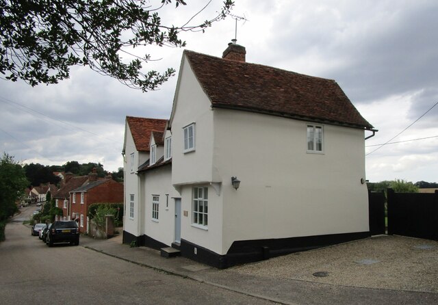
The village is known for its stunning architecture, particularly its timber-framed houses that date back to the medieval period. The most famous of these is the "Kersey Pot," a distinctive Grade I listed building that attracts visitors from near and far. The village's historic church, St. Mary's, is also a notable landmark, featuring a beautiful tower and a rich history.

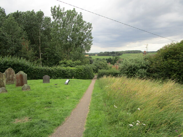
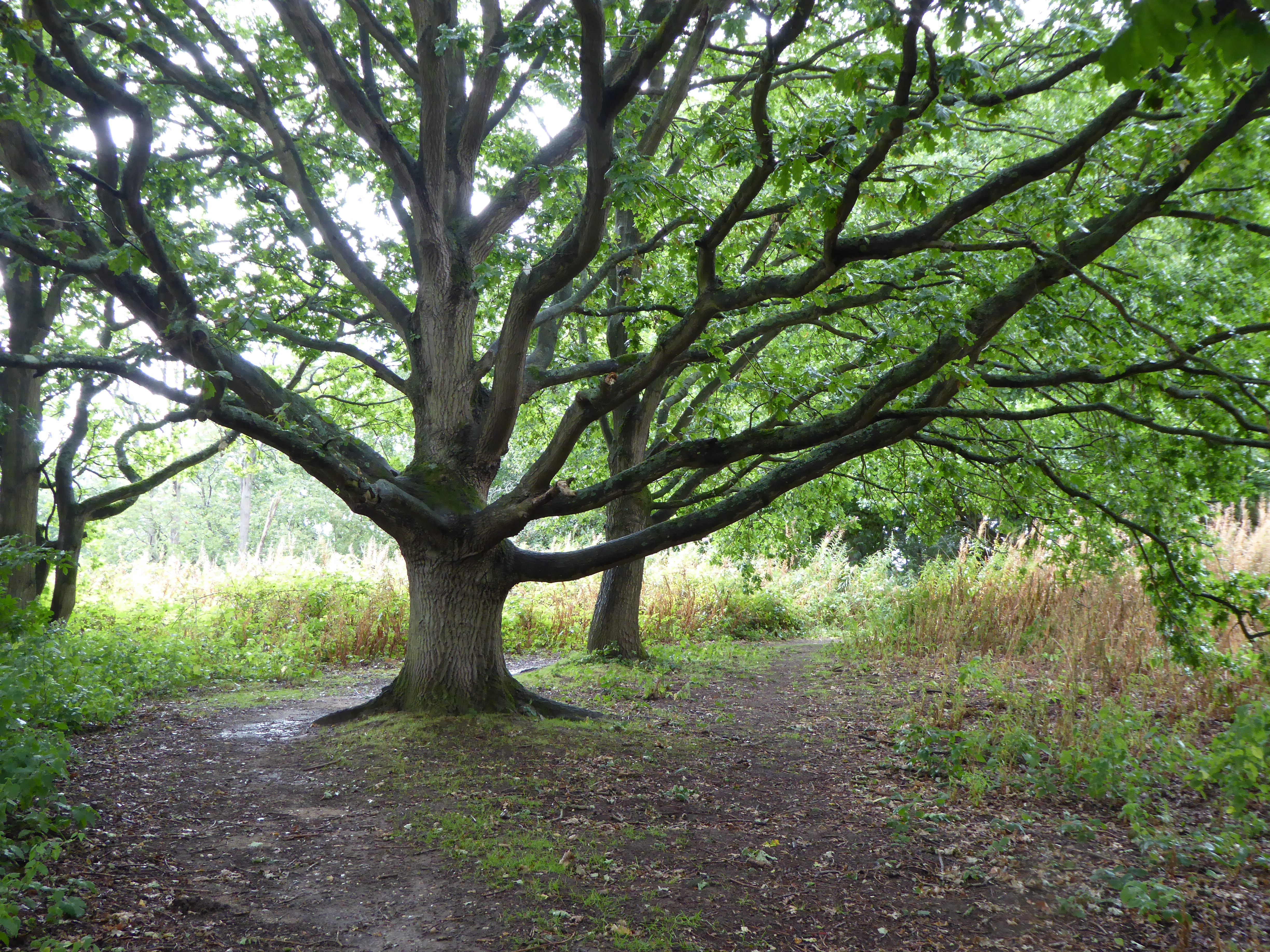
Surrounded by lush countryside, Kersey offers scenic walking trails and open green spaces, making it a popular destination for nature enthusiasts. The River Brett flows through the village, adding to its charm and providing opportunities for leisurely strolls along the water's edge.

Despite its small size, Kersey boasts a strong sense of community and offers a range of amenities for its residents. These include a village hall, a primary school, and a local pub, where locals and visitors alike can enjoy a pint and traditional pub fare.

Kersey's proximity to larger towns such as Ipswich and Colchester provides residents with access to a wider range of services and amenities. The village is also well-connected by road, making it easily accessible for commuters and tourists alike.

In summary, Kersey is a quaint and historic village in Suffolk, known for its charming architecture, natural beauty, and strong community spirit.

If you have any feedback on the listing, please let us know in the comments section below.
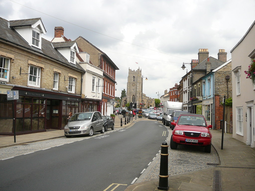
Kersey Images

Images are sourced within 2km of 52.049974/0.900806 or Grid Reference TL9843. Thanks to Geograph Open Source API. All images are credited.

The ford at Kersey The River Brett crosses the main street of the village.
The ford at Kersey
The River Brett crosses the main street of the village.
The churchyard at Kersey This churchyard has a numerous collection of iron grave markers of the early twentieth century. There were two local manufacturers of such markers - Hunt at the Atlas Works, Earls Colne, Essex and L Ward at Long Melford <span class="nowrap"><a title="https://industrial-archaeology.org/wp-content/uploads/2016/04/AIA-Bulletin-15-3-1988.pdf" rel="nofollow ugc noopener" href="https://industrial-archaeology.org/wp-content/uploads/2016/04/AIA-Bulletin-15-3-1988.pdf">Link</a><img style="margin-left:2px;" alt="External link" title="External link - shift click to open in new window" src="https://s1.geograph.org.uk/img/external.png" width="10" height="10"/></span>
The churchyard at Kersey
This churchyard has a numerous collection of iron grave markers of the early twentieth century. There were two local manufacturers of such markers - Hunt at the Atlas Works, Earls Colne, Essex and L Ward at Long Melford LinkExternal link
The Bell Inn, Kersey Dates from the fifteenth and sixteenth centuries <span class="nowrap"><a title="https://historicengland.org.uk/listing/the-list/list-entry/1285465?section=official-listing" rel="nofollow ugc noopener" href="https://historicengland.org.uk/listing/the-list/list-entry/1285465?section=official-listing">Link</a><img style="margin-left:2px;" alt="External link" title="External link - shift click to open in new window" src="https://s1.geograph.org.uk/img/external.png" width="10" height="10"/></span>
The Bell Inn, Kersey
Dates from the fifteenth and sixteenth centuries LinkExternal link
Carlton House, Kersey Datea from the sixteenth and seventeenth centuries <span class="nowrap"><a title="https://historicengland.org.uk/listing/the-list/list-entry/1037248?section=official-listing" rel="nofollow ugc noopener" href="https://historicengland.org.uk/listing/the-list/list-entry/1037248?section=official-listing">Link</a><img style="margin-left:2px;" alt="External link" title="External link - shift click to open in new window" src="https://s1.geograph.org.uk/img/external.png" width="10" height="10"/></span>
Carlton House, Kersey
Datea from the sixteenth and seventeenth centuries LinkExternal link
The River Brett at Kersey
River View, Kersey Of seventeenth century origin <span class="nowrap"><a title="https://historicengland.org.uk/listing/the-list/list-entry/1037234?section=official-listing" rel="nofollow ugc noopener" href="https://historicengland.org.uk/listing/the-list/list-entry/1037234?section=official-listing">Link</a><img style="margin-left:2px;" alt="External link" title="External link - shift click to open in new window" src="https://s1.geograph.org.uk/img/external.png" width="10" height="10"/></span>
River View, Kersey
Of seventeenth century origin LinkExternal link
Olde Drift House. Kersey Much altered house dating from the sixteenth century <span class="nowrap"><a title="https://historicengland.org.uk/listing/the-list/list-entry/1037235?section=official-listing" rel="nofollow ugc noopener" href="https://historicengland.org.uk/listing/the-list/list-entry/1037235?section=official-listing">Link</a><img style="margin-left:2px;" alt="External link" title="External link - shift click to open in new window" src="https://s1.geograph.org.uk/img/external.png" width="10" height="10"/></span>
Olde Drift House. Kersey
Much altered house dating from the sixteenth century LinkExternal link
7 Church Hill, Kersey Seventeenth century cottage <span class="nowrap"><a title="https://historicengland.org.uk/listing/the-list/list-entry/1037274?section=official-listing" rel="nofollow ugc noopener" href="https://historicengland.org.uk/listing/the-list/list-entry/1037274?section=official-listing">Link</a><img style="margin-left:2px;" alt="External link" title="External link - shift click to open in new window" src="https://s1.geograph.org.uk/img/external.png" width="10" height="10"/></span>
7 Church Hill, Kersey
Seventeenth century cottage LinkExternal link
Path and steps to the church, Kersey
Church Hill, Kersey
Church Hill, Kersey
St. Mary's church, Kersey The church largely dates from the fourteenth and fifteenth centuries <span class="nowrap"><a title="https://historicengland.org.uk/listing/the-list/list-entry/1351459?section=official-listing" rel="nofollow ugc noopener" href="https://historicengland.org.uk/listing/the-list/list-entry/1351459?section=official-listing">Link</a><img style="margin-left:2px;" alt="External link" title="External link - shift click to open in new window" src="https://s1.geograph.org.uk/img/external.png" width="10" height="10"/></span>
St. Mary's church, Kersey
The church largely dates from the fourteenth and fifteenth centuries LinkExternal link
Church Hill, Kersey
Church Hill, Kersey
Path through the churchyard, Kersey
The Little Manor, Kersey The oldest parts date to the fourteenth century <span class="nowrap"><a title="https://historicengland.org.uk/listing/the-list/list-entry/1351461?section=official-listing" rel="nofollow ugc noopener" href="https://historicengland.org.uk/listing/the-list/list-entry/1351461?section=official-listing">Link</a><img style="margin-left:2px;" alt="External link" title="External link - shift click to open in new window" src="https://s1.geograph.org.uk/img/external.png" width="10" height="10"/></span>
The Little Manor, Kersey
The oldest parts date to the fourteenth century LinkExternal link
Ley's House, Kersey A much altered timber framed house <span class="nowrap"><a title="https://historicengland.org.uk/listing/the-list/list-entry/1180354?section=official-listing" rel="nofollow ugc noopener" href="https://historicengland.org.uk/listing/the-list/list-entry/1180354?section=official-listing">Link</a><img style="margin-left:2px;" alt="External link" title="External link - shift click to open in new window" src="https://s1.geograph.org.uk/img/external.png" width="10" height="10"/></span>
Ley's House, Kersey
A much altered timber framed house LinkExternal link
The ford at Kersey With St Mary’s church beyond, at the summit of Church Hill.
The ford at Kersey
With St Mary’s church beyond, at the summit of Church Hill.
Church Hill The village of Kersey from near the summit.
Church Hill
The village of Kersey from near the summit.
Show me another place!

Kersey is located at Grid Ref: TL9843 (Lat: 52.049974, Lng: 0.900806)

Administrative County: Suffolk

District: Babergh

Police Authority: Suffolk

What 3 Words

///flippers.bombshell.repeats. Near Hadleigh, Suffolk

Nearby Locations

Kersey Kersey Tye

Related Wikis

Kersey, Suffolk

Kersey is a village and civil parish in the Babergh district in Suffolk, in the east of England. The main street has a ford across a stream. Its principal...

Groton Wood

Groton Wood is a 20.2-hectare (50-acre) biological Site of Special Scientific Interest north-east of Groton in Suffolk. It is owned and managed by the...

Kersey Priory

Kersey Priory was a priory in Kersey, Suffolk, England. It was founded before 1218 as a hospital dedicated St Mary the Blessed Virgin and St Anthony under...

Lindsey, Suffolk

Lindsey is a small village and a civil parish, located in mid-to-south Suffolk, under the purview of Babergh District Council. == Layout == The parish...

Boxford, Suffolk

Boxford is a large village and civil parish in the Babergh district of Suffolk, England. Located around six miles east of Sudbury straddling the River...

Broom Hill, Hadleigh

Broom Hill, Hadleigh is a 9.6 hectares (24 acres) Local Nature Reserve in Hadleigh in Suffolk. It is owned and managed by Babergh District Council.This...

Babergh District

Babergh District (pronounced , BAY-bə) is a local government district in Suffolk, England. This district is primarily a rural area, containing just two...

Groton, Suffolk

Groton is a village and civil parish in the Babergh district, Suffolk, England, located around a mile north of the A1071 between Hadleigh and Sudbury....

Related Videos

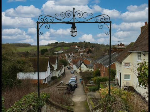
A picturesque English village. Kersey, Suffolk (subtitles)

Kersey is a picturesque unspoilt English village, it is one of the few places where the time really stands still. It is quite small, with ...

Christmas 2021

Over Christmas, we stayed on Polstead Camping and Caravan Site. It was lovely and had everything we needed. We also took a ...

The Prettiest Village In Suffolk | Explore Kersey With Us

This is the longest video so far (and the chattiest!). I've just spent the past week and a half in my home county of Suffolk, England, ...

Polstead Country Park Campsite

Motorhome Trip to Polstead Country Park near Sudbury Suffolk its a adult campsite offers both hard-standing pitches for caravan, ...

Nearby Amenities

Located within 500m of 52.049974,0.900806
Bus Stop
Culphs Lane
Naptan AtcoCode: 390010349
Naptan Bearing: W
Naptan CommonName: Culphs Lane
Naptan Indicator: adj
Naptan Landmark: Culphs Lane
Naptan NaptanCode: sufagadt
Naptan Street: Culphs Lane
Naptan Verified: no
Source: naptan_import
Lat/Long: 52.049622/0.903078
Bus Stop
Culphs Lane
Naptan AtcoCode: 390010350
Naptan Bearing: E
Naptan BusStopType: CUS
Naptan CommonName: Culphs Lane
Naptan Indicator: opp
Naptan Landmark: Culphs Lane
Naptan NaptanCode: sufagadw
Naptan Street: Culphs Lane
Naptan Verified: no
Source: naptan_import
Lat/Long: 52.0495042/0.9031141
Bus Stop
Crossroads
Naptan AtcoCode: 390010351
Naptan Bearing: E
Naptan BusStopType: CUS
Naptan CommonName: Crossroads
Naptan Indicator: E-bound
Naptan Landmark: Crossroads
Naptan NaptanCode: sufagaga
Naptan Street: The Tye
Naptan Verified: no
Source: naptan_import
Lat/Long: 52.050379/0.8938787
Bus Stop
Crossroads
Naptan AtcoCode: 390010352
Naptan Bearing: W
Naptan BusStopType: CUS
Naptan CommonName: Crossroads
Naptan Indicator: W-bound
Naptan Landmark: Crossroads
Naptan NaptanCode: sufagagd
Naptan Street: The Tye
Naptan Verified: no
Source: naptan_import
Lat/Long: 52.0504229/0.8939253
Power: pole
Lat/Long: 52.0523431/0.9053293
Power: pole
Lat/Long: 52.0529606/0.9060449
Kersey Upland
Place: hamlet
Wikidata: Q1396473
Lat/Long: 52.0488885/0.9018545
Post Box
Mapillary: 1192181521530953
Post Box Mounting: brick_wall
Post Box Type: wall
Ref: IP7 1170
Survey Date: 2022-04-23
Lat/Long: 52.0501679/0.9048749
The data included in this document is from www.openstreetmap.org. The data is made available under ODbL.

Have you been to Kersey?

Leave your review of Kersey below (or comments, questions and feedback).