Kersey

Settlement in Suffolk Babergh

England

Kersey

The ford at Kersey The River Brett crosses the main street of the village.
The ford at Kersey Credit: Jonathan Thacker

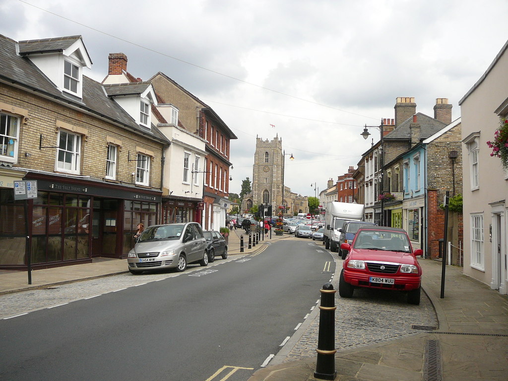
Kersey is a small village located in the county of Suffolk, England. Situated about 10 miles west of Ipswich, it is nestled in the picturesque countryside that characterizes this region. The village is known for its charming and well-preserved medieval architecture, making it a popular destination for history enthusiasts and tourists alike.

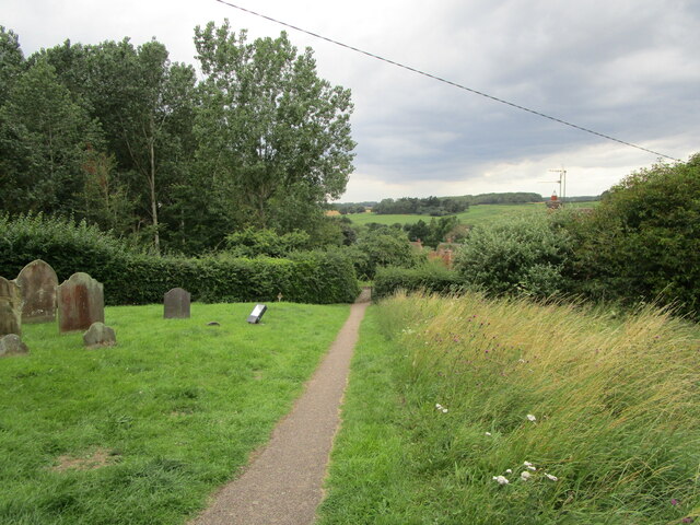
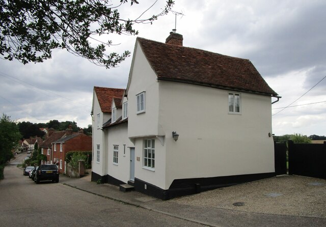
One of the prominent features of Kersey is its stunning 14th-century church, St. Mary's Church. This Grade I listed building boasts a magnificent tower and a beautiful interior, showcasing the village's rich historical heritage. Additionally, Kersey is renowned for its distinctive timber-framed houses, which line the streets and add to the village's unique character. These houses date back several centuries and contribute to the area's quintessentially English charm.

Nature lovers will appreciate the tranquil surroundings of Kersey. The village is surrounded by rolling hills and lush green fields, making it an ideal location for scenic walks and bike rides. The nearby River Brett adds to the area's natural beauty, with its meandering waters and peaceful atmosphere.

Despite its small size, Kersey offers a range of amenities to its residents. The village has a community center, a primary school, and a traditional pub, The Bell Inn, where locals and visitors can enjoy a refreshing drink or a hearty meal.

Overall, Kersey is a delightful village that seamlessly combines history, natural beauty, and a strong sense of community. Its idyllic setting and well-preserved architecture make it a truly charming destination for visitors to Suffolk.

If you have any feedback on the listing, please let us know in the comments section below.

Kersey Images

Images are sourced within 2km of 52.058497/0.91767 or Grid Reference TM0044. Thanks to Geograph Open Source API. All images are credited.

The ford at Kersey The River Brett crosses the main street of the village.
The ford at Kersey
The River Brett crosses the main street of the village.
The churchyard at Kersey This churchyard has a numerous collection of iron grave markers of the early twentieth century. There were two local manufacturers of such markers - Hunt at the Atlas Works, Earls Colne, Essex and L Ward at Long Melford <span class="nowrap"><a title="https://industrial-archaeology.org/wp-content/uploads/2016/04/AIA-Bulletin-15-3-1988.pdf" rel="nofollow ugc noopener" href="https://industrial-archaeology.org/wp-content/uploads/2016/04/AIA-Bulletin-15-3-1988.pdf">Link</a><img style="margin-left:2px;" alt="External link" title="External link - shift click to open in new window" src="https://s1.geograph.org.uk/img/external.png" width="10" height="10"/></span>
The churchyard at Kersey
This churchyard has a numerous collection of iron grave markers of the early twentieth century. There were two local manufacturers of such markers - Hunt at the Atlas Works, Earls Colne, Essex and L Ward at Long Melford LinkExternal link
The Bell Inn, Kersey Dates from the fifteenth and sixteenth centuries <span class="nowrap"><a title="https://historicengland.org.uk/listing/the-list/list-entry/1285465?section=official-listing" rel="nofollow ugc noopener" href="https://historicengland.org.uk/listing/the-list/list-entry/1285465?section=official-listing">Link</a><img style="margin-left:2px;" alt="External link" title="External link - shift click to open in new window" src="https://s1.geograph.org.uk/img/external.png" width="10" height="10"/></span>
The Bell Inn, Kersey
Dates from the fifteenth and sixteenth centuries LinkExternal link
Carlton House, Kersey Datea from the sixteenth and seventeenth centuries <span class="nowrap"><a title="https://historicengland.org.uk/listing/the-list/list-entry/1037248?section=official-listing" rel="nofollow ugc noopener" href="https://historicengland.org.uk/listing/the-list/list-entry/1037248?section=official-listing">Link</a><img style="margin-left:2px;" alt="External link" title="External link - shift click to open in new window" src="https://s1.geograph.org.uk/img/external.png" width="10" height="10"/></span>
Carlton House, Kersey
Datea from the sixteenth and seventeenth centuries LinkExternal link
The River Brett at Kersey
River View, Kersey Of seventeenth century origin <span class="nowrap"><a title="https://historicengland.org.uk/listing/the-list/list-entry/1037234?section=official-listing" rel="nofollow ugc noopener" href="https://historicengland.org.uk/listing/the-list/list-entry/1037234?section=official-listing">Link</a><img style="margin-left:2px;" alt="External link" title="External link - shift click to open in new window" src="https://s1.geograph.org.uk/img/external.png" width="10" height="10"/></span>
River View, Kersey
Of seventeenth century origin LinkExternal link
Olde Drift House. Kersey Much altered house dating from the sixteenth century <span class="nowrap"><a title="https://historicengland.org.uk/listing/the-list/list-entry/1037235?section=official-listing" rel="nofollow ugc noopener" href="https://historicengland.org.uk/listing/the-list/list-entry/1037235?section=official-listing">Link</a><img style="margin-left:2px;" alt="External link" title="External link - shift click to open in new window" src="https://s1.geograph.org.uk/img/external.png" width="10" height="10"/></span>
Olde Drift House. Kersey
Much altered house dating from the sixteenth century LinkExternal link
7 Church Hill, Kersey Seventeenth century cottage <span class="nowrap"><a title="https://historicengland.org.uk/listing/the-list/list-entry/1037274?section=official-listing" rel="nofollow ugc noopener" href="https://historicengland.org.uk/listing/the-list/list-entry/1037274?section=official-listing">Link</a><img style="margin-left:2px;" alt="External link" title="External link - shift click to open in new window" src="https://s1.geograph.org.uk/img/external.png" width="10" height="10"/></span>
7 Church Hill, Kersey
Seventeenth century cottage LinkExternal link
Path and steps to the church, Kersey
Church Hill, Kersey
Church Hill, Kersey
St. Mary's church, Kersey The church largely dates from the fourteenth and fifteenth centuries <span class="nowrap"><a title="https://historicengland.org.uk/listing/the-list/list-entry/1351459?section=official-listing" rel="nofollow ugc noopener" href="https://historicengland.org.uk/listing/the-list/list-entry/1351459?section=official-listing">Link</a><img style="margin-left:2px;" alt="External link" title="External link - shift click to open in new window" src="https://s1.geograph.org.uk/img/external.png" width="10" height="10"/></span>
St. Mary's church, Kersey
The church largely dates from the fourteenth and fifteenth centuries LinkExternal link
Church Hill, Kersey
Church Hill, Kersey
Path through the churchyard, Kersey
The Little Manor, Kersey The oldest parts date to the fourteenth century <span class="nowrap"><a title="https://historicengland.org.uk/listing/the-list/list-entry/1351461?section=official-listing" rel="nofollow ugc noopener" href="https://historicengland.org.uk/listing/the-list/list-entry/1351461?section=official-listing">Link</a><img style="margin-left:2px;" alt="External link" title="External link - shift click to open in new window" src="https://s1.geograph.org.uk/img/external.png" width="10" height="10"/></span>
The Little Manor, Kersey
The oldest parts date to the fourteenth century LinkExternal link
Ley's House, Kersey A much altered timber framed house <span class="nowrap"><a title="https://historicengland.org.uk/listing/the-list/list-entry/1180354?section=official-listing" rel="nofollow ugc noopener" href="https://historicengland.org.uk/listing/the-list/list-entry/1180354?section=official-listing">Link</a><img style="margin-left:2px;" alt="External link" title="External link - shift click to open in new window" src="https://s1.geograph.org.uk/img/external.png" width="10" height="10"/></span>
Ley's House, Kersey
A much altered timber framed house LinkExternal link
The ford at Kersey With St Mary’s church beyond, at the summit of Church Hill.
The ford at Kersey
With St Mary’s church beyond, at the summit of Church Hill.
Church Hill The village of Kersey from near the summit.
Church Hill
The village of Kersey from near the summit.
Show me another place!

Kersey is located at Grid Ref: TM0044 (Lat: 52.058497, Lng: 0.91767)

Administrative County: Suffolk

District: Babergh

Police Authority: Suffolk

What 3 Words

///flip.charts.contact. Near Hadleigh, Suffolk

Nearby Locations

Kersey

Related Wikis

Kersey Priory

Kersey Priory was a priory in Kersey, Suffolk, England. It was founded before 1218 as a hospital dedicated St Mary the Blessed Virgin and St Anthony under...

Kersey, Suffolk

Kersey is a village and civil parish in the Babergh district in Suffolk, in the east of England. The main street has a ford across a stream. Its principal...

Babergh District

Babergh District (pronounced , BAY-bə) is a local government district in Suffolk, England. In 2021 it had a population of 92,300. The district is primarily...

Lindsey, Suffolk

Lindsey is a small village and a civil parish, located in mid-to-south Suffolk, under the purview of Babergh District Council. == Layout == The parish...

Nearby Amenities

Located within 500m of 52.058497,0.91767
Kersey
Created By: Potlatch 0.10b
Place: village
Wikidata: Q1024009
Lat/Long: 52.059731/0.9186492
Kersey Splash
Ford: yes
Lat/Long: 52.0592945/0.9167433
Bus Stop
Bell
Bus: yes
Naptan AtcoCode: 390010345
Naptan Bearing: N
Naptan CommonName: Bell
Naptan Indicator: adj
Naptan Landmark: Bell
Naptan NaptanCode: sufagadg
Naptan Street: The Street
Naptan Verified: no
Public Transport: platform
Source: naptan_import
Lat/Long: 52.0599012/0.9162052
Bus Stop
Bell
Bus: yes
Naptan AtcoCode: 390010346
Naptan Bearing: S
Naptan BusStopType: CUS
Naptan CommonName: Bell
Naptan Indicator: opp
Naptan Landmark: Bell
Naptan NaptanCode: sufagadj
Naptan Street: The Street
Naptan Verified: no
Public Transport: platform
Source: naptan_import
Lat/Long: 52.0598631/0.9162903
Bus Stop
Church Corner
Bus: yes
Naptan AtcoCode: 390010347
Naptan Bearing: W
Naptan BusStopType: CUS
Naptan CommonName: Church Corner
Naptan Indicator: adj
Naptan Landmark: Church Corner
Naptan NaptanCode: sufagadm
Naptan Street: Church Hill
Naptan Verified: no
Public Transport: platform
Source: naptan_import
Lat/Long: 52.056604/0.9186019
Bus Stop
Church Corner
Bus: yes
Naptan AtcoCode: 390010348
Naptan Bearing: E
Naptan BusStopType: CUS
Naptan CommonName: Church Corner
Naptan Indicator: opp
Naptan Landmark: Church Corner
Naptan NaptanCode: sufagadp
Naptan Street: Church Hill
Naptan Verified: no
Public Transport: platform
Source: naptan_import
Lat/Long: 52.0566457/0.9187359
Bus Stop
Church Corner
Bus: yes
Naptan AtcoCode: 390010777
Naptan Bearing: SE
Naptan BusStopType: CUS
Naptan CommonName: Church Corner
Naptan Indicator: near
Naptan Landmark: Church Corner
Naptan NaptanCode: sufjdpmj
Naptan Street: The Street
Naptan Verified: no
Public Transport: platform
Source: naptan_import
Lat/Long: 52.0566762/0.918592
Bus Stop
Phone Box
Bus: yes
Naptan AtcoCode: 390010804
Naptan Bearing: E
Naptan BusStopType: CUS
Naptan CommonName: Phone Box
Naptan Indicator: o/s
Naptan Landmark: Phone Box
Naptan NaptanCode: sufjmwmw
Naptan Street: The Row
Naptan Verified: no
Public Transport: platform
Source: naptan_import
Lat/Long: 52.0613978/0.9167843
Bus Stop
Phone Box
Bus: yes
Naptan AtcoCode: 390010805
Naptan Bearing: W
Naptan BusStopType: CUS
Naptan CommonName: Phone Box
Naptan Indicator: opp
Naptan Landmark: Phone Box
Naptan NaptanCode: sufjmwpa
Naptan Street: The Row
Naptan Verified: no
Public Transport: platform
Source: naptan_import
Lat/Long: 52.0611984/0.9168443
Pub
The Bell
Addr City: Ipswich
Addr Postcode: IP7 6DY
Addr Street: The Street
Addr Village: Kersey
Fhrs Id: 1595512
Source Addr: FSA Food Hygiene Ratings Database
Wikidata: Q26574157
Lat/Long: 52.0597373/0.9160645
Power: pole
Lat/Long: 52.0573065/0.9108675
Post Box
Collection Times: Mo-Fr 15:45; Sa 07:00
Operator: Royal Mail
Post Box Apertures: 1
Post Box Type: wall
Ref: IP7 1194
Royal Cypher: EIIR
Royal Cypher Wikidata: Q33102113
Lat/Long: 52.0602917/0.9161589
Post Box
Ref: IP7 1390
Lat/Long: 52.0550795/0.9206139
Defibrillator
Defibrillator Location: In open shelter near the back door of the Bell Inn.
Emergency: defibrillator
Indoor: no
Lat/Long: 52.0597477/0.9160031
The data included in this document is from www.openstreetmap.org. The data is made available under ODbL.

Have you been to Kersey?

Leave your review of Kersey below (or comments, questions and feedback).