Stony Hill

Hill, Mountain in Wiltshire

England

Stony Hill

River Wylye above the former mill at Fisherton de la Mere
River Wylye above the former mill at Fisherton de la Mere Credit: David Martin

Stony Hill is a prominent hill located in the county of Wiltshire, England. It is situated in the southern part of the county, near the town of Devizes. With an elevation of approximately 235 meters (771 feet), Stony Hill is not classified as a mountain but rather a hill.

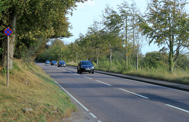
The hill gets its name from the stony nature of its terrain, with large amounts of exposed rocks and boulders scattered across its slopes. It is a popular destination for outdoor enthusiasts, offering breathtaking views of the surrounding countryside. On a clear day, visitors can enjoy panoramic vistas that stretch as far as Salisbury Plain and the nearby Pewsey Vale.

Stony Hill is renowned for its rich biodiversity, with a variety of flora and fauna inhabiting its slopes. The hill is covered in patches of woodland, primarily consisting of beech and oak trees, providing a habitat for numerous bird species and small mammals.

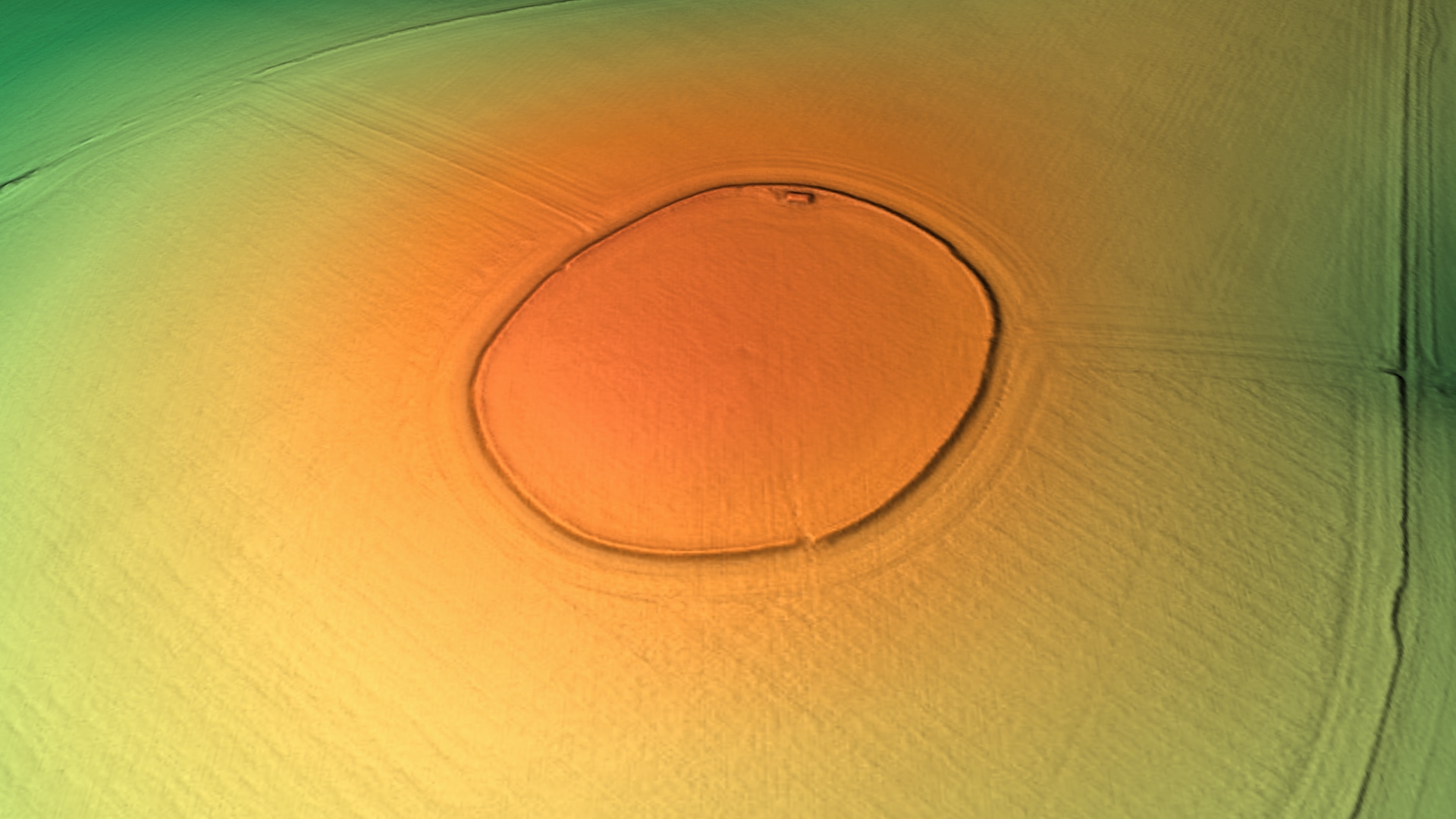
For those interested in history, Stony Hill also carries archaeological significance. The hill is home to an Iron Age hillfort, which dates back over 2,000 years. The remains of the fort's earthworks and defensive ditches can still be seen today, offering visitors a glimpse into the region's ancient past.

Access to Stony Hill is relatively easy, with several footpaths and trails leading up to its summit. The hill's location near Devizes makes it a popular destination for locals and tourists alike, offering a peaceful escape into nature with stunning views and a touch of historical intrigue.

If you have any feedback on the listing, please let us know in the comments section below.

Stony Hill Images

Images are sourced within 2km of 51.161131/-2.0035106 or Grid Reference ST9940. Thanks to Geograph Open Source API. All images are credited.

River Wylye above the former mill at Fisherton de la Mere
Footbridge over the River Wylye at Fisherton de la Mere
Old Boundary Marker by the A36, Salisbury Road, Codford Parish Boundary Marker by the A36, in parish of Codford (West Wiltshire District), Salisbury Road, Codford. Junction with track to Starveall, on embankment.

Inscription reads:-
: CODFORD ST MARY : : FISHERTON / DE LA MER : 

Grade II listed.
List Entry Number: 1181168 <span class="nowrap"><a title="https://historicengland.org.uk/listing/the-list/list-entry/1181168" rel="nofollow ugc noopener" href="https://historicengland.org.uk/listing/the-list/list-entry/1181168">Link</a><img style="margin-left:2px;" alt="External link" title="External link - shift click to open in new window" src="https://s1.geograph.org.uk/img/external.png" width="10" height="10"/></span>

Surveyed

Milestone Society National ID: WI_SAWM12pb
Old Boundary Marker by the A36, Salisbury Road, Codford
Parish Boundary Marker by the A36, in parish of Codford (West Wiltshire District), Salisbury Road, Codford. Junction with track to Starveall, on embankment. Inscription reads:- : CODFORD ST MARY : : FISHERTON / DE LA MER : Grade II listed. List Entry Number: 1181168 LinkExternal link Surveyed Milestone Society National ID: WI_SAWM12pb
2012 : Farm track south to Fisherton de la Mere The northern end of a two mile track from the A36 at Fisherton de la mere. Most of it is dead straight as here, though there are a few minor kinks at the far end.
This section covers almost all of two grid squares.
Winter wheat is in the field to the right, oilseed rape to the left, both are coming on nicely.
2012 : Farm track south to Fisherton de la Mere
The northern end of a two mile track from the A36 at Fisherton de la mere. Most of it is dead straight as here, though there are a few minor kinks at the far end. This section covers almost all of two grid squares. Winter wheat is in the field to the right, oilseed rape to the left, both are coming on nicely.
2012 : Friendly lady in a pickup with a friendlier dog The friendly Jack Russell licked my fingers, the lady did not.
Walking the dog the easy way.
The farm road runs straight** from this point across two grid squares.

** That is if you don't count the hills.
2012 : Friendly lady in a pickup with a friendlier dog
The friendly Jack Russell licked my fingers, the lady did not. Walking the dog the easy way. The farm road runs straight** from this point across two grid squares. ** That is if you don't count the hills.
2012 : Farm track on East Codford Down A turn to the right at the bushes and the track heads due south to Fisherton de la Mere.
The north east corner of a large wheat field to the right, oil seed rape beyond the track. Ploughed fields wait a sowing, possibly of barley.
2012 : Farm track on East Codford Down
A turn to the right at the bushes and the track heads due south to Fisherton de la Mere. The north east corner of a large wheat field to the right, oil seed rape beyond the track. Ploughed fields wait a sowing, possibly of barley.
2012 : East from Claypit Hill Or it might be East Codford Down.
A field of winter wheat well advanced for mid March, followed by some scrubby looking trees, followed by more of the same for the next four miles to Shrewton.
Better than Southwark though.
2012 : East from Claypit Hill
Or it might be East Codford Down. A field of winter wheat well advanced for mid March, followed by some scrubby looking trees, followed by more of the same for the next four miles to Shrewton. Better than Southwark though.
2012 : The lower slopes of East Codford Down With a row of conifers forming a field hedge.
The field contains oilseed rape.
Looking south east the Wylye Valley is over the next hill, or two.
2012 : The lower slopes of East Codford Down
With a row of conifers forming a field hedge. The field contains oilseed rape. Looking south east the Wylye Valley is over the next hill, or two.
2012 : Owl box at the foot of Codford Hill A friend tells me owls prefer a box with a landing platform and a small entrance hole. Raptors prefer a box with an open front and a low ledge.
2012 : Owl box at the foot of Codford Hill
A friend tells me owls prefer a box with a landing platform and a small entrance hole. Raptors prefer a box with an open front and a low ledge.
2012 : A long and lonely road From the A36 near Fisherton de la Mere over 1km behind the camera position, the straight bit stops at the other end of the grid square and turns to the left to Clay Pit Hill. Mostly used by farm vehicles, geographers (2 so far) and the occasional dog walker.
2012 : A long and lonely road
From the A36 near Fisherton de la Mere over 1km behind the camera position, the straight bit stops at the other end of the grid square and turns to the left to Clay Pit Hill. Mostly used by farm vehicles, geographers (2 so far) and the occasional dog walker.
2012 : South of east near Parry's Field Barn Looking across a dry valley, coombe or bottom to Deptford Down.
Oil seed rape in the foreground only a few weeks before flowering.
Fields, small woods and copses for the next four miles til you get to Stapleford.
If you want peace and quiet this is the place but watch out for the A303.
2012 : South of east near Parry's Field Barn
Looking across a dry valley, coombe or bottom to Deptford Down. Oil seed rape in the foreground only a few weeks before flowering. Fields, small woods and copses for the next four miles til you get to Stapleford. If you want peace and quiet this is the place but watch out for the A303.
2012 : Bridleway to Parry's Field Barn Over the next hill. 
Then on to Fisherton de la Mere and the A36.
Also serves as a farm road.
Wheat in the field to the right, a large field. Treetops over the hill are in the southern hedgerow, the northern hedgerow is over one km behind the camera.
2012 : Bridleway to Parry's Field Barn
Over the next hill. Then on to Fisherton de la Mere and the A36. Also serves as a farm road. Wheat in the field to the right, a large field. Treetops over the hill are in the southern hedgerow, the northern hedgerow is over one km behind the camera.
2012 : South east near Parry's Field Barn The field of oil seed rape we saw two grid squares to the north is still with us.
Deptford Field Barn is on the skyline.
With a helicopter you could fly straight ahead, over the barn on the horizon then look into the Wylye Valley nearly three miles over.
2012 : South east near Parry's Field Barn
The field of oil seed rape we saw two grid squares to the north is still with us. Deptford Field Barn is on the skyline. With a helicopter you could fly straight ahead, over the barn on the horizon then look into the Wylye Valley nearly three miles over.
2012 : North east near Parry's Field Barn The oilseed rape in the foreground reaches north to the next hedgerow which coincides with the end of the grid square next door. The next field over is probably barley or oats, too late for wheat.
Look carefully left of centre and you may see a lone barn standing on the horizon.
The next place in this direction is Upavon, twelve miles across the military range.
2012 : North east near Parry's Field Barn
The oilseed rape in the foreground reaches north to the next hedgerow which coincides with the end of the grid square next door. The next field over is probably barley or oats, too late for wheat. Look carefully left of centre and you may see a lone barn standing on the horizon. The next place in this direction is Upavon, twelve miles across the military range.
2011 : East along the Wylye Valley A view from the A36.
The little blue line marking the edge of the grid square runs through the trees bordering the pasture, houses on the edge of Fisherton de la Mare are beyond.
Hills under cloud are on the other side of the valley.
2011 : East along the Wylye Valley
A view from the A36. The little blue line marking the edge of the grid square runs through the trees bordering the pasture, houses on the edge of Fisherton de la Mare are beyond. Hills under cloud are on the other side of the valley.
2011 : A36 heading east toward Salisbury The turning to Fisherton de la Mere is a few hundred yards to the right.
2011 : A36 heading east toward Salisbury
The turning to Fisherton de la Mere is a few hundred yards to the right.
2011 : A36 heading west toward Warminster Along the north side of the Wylye Valley.
After a bright sunny afternoon the clouds are closing in.
2011 : A36 heading west toward Warminster
Along the north side of the Wylye Valley. After a bright sunny afternoon the clouds are closing in.
2011 : South across the Wylye Valley from the A36 Meadows with a water supply, a recycled caravan rests to the left alongside a black barn.
Hills rise on the other side of the valley returning to Salisbury Plain, Teffont Magna is among them four miles south.
2011 : South across the Wylye Valley from the A36
Meadows with a water supply, a recycled caravan rests to the left alongside a black barn. Hills rise on the other side of the valley returning to Salisbury Plain, Teffont Magna is among them four miles south.
Show me another place!

Stony Hill is located at Grid Ref: ST9940 (Lat: 51.161131, Lng: -2.0035106)

Unitary Authority: Wiltshire

Police Authority: Wiltshire

What 3 Words

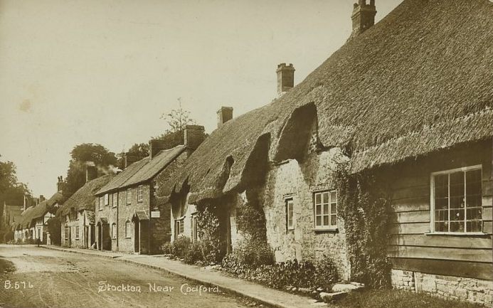
///holidays.swoop.stream. Near Stockton, Wiltshire

Nearby Locations

Stony Hill Hare Covert

Related Wikis

Starveall and Stony Down

Starveall and Stony Down is a 22.5 hectare biological Site of Special Scientific Interest in the parishes of Codford and Wylye, Wiltshire, England, notified...

Codford Circle

Codford Circle, also known as Wilsbury Ring, Woldsbury, and possibly Oldbury Camp, is a neolithic hill top enclosure or possible hillfort located on the...

Fisherton de la Mere

Fisherton de la Mere, also spelt Fisherton Delamere, is a small village and former civil parish, now in the parish of Wylye, on the River Wylye, Wiltshire...

St Nicholas's Church, Fisherton Delamere

St Nicholas's Church in Fisherton Delamere, Wiltshire, England, was built in the 14th century. It is recorded in the National Heritage List for England...

Bapton

Bapton is a hamlet in Wiltshire, England, in the civil parish of Stockton. It lies south of the A36 and the River Wylye, on the minor road which follows...
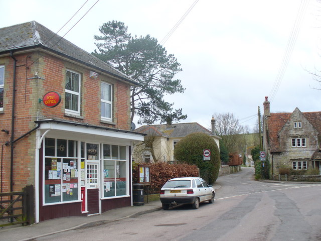
Stockton, Wiltshire

Stockton is a small village and civil parish in the Wylye Valley in Wiltshire, England, about 8 miles (13 km) southeast of Warminster. The parish includes...

Wylye

Wylye () is a village and civil parish on the River Wylye in Wiltshire, England. The village is about 9+1⁄2 miles (15 km) northwest of Salisbury and a...

Wylye railway station

Wylye railway station is a former railway station in Wylye, Wiltshire, UK, in the Wylye Valley. The station name was spelled "Wiley" by the GWR until 1874...

Nearby Amenities

Located within 500m of 51.161131,-2.0035106
Stony Hill
Ele: 163
Natural: peak
Lat/Long: 51.1611166/-2.0032068
The data included in this document is from www.openstreetmap.org. The data is made available under ODbL.

Have you been to Stony Hill?

Leave your review of Stony Hill below (or comments, questions and feedback).