Hare Covert

Wood, Forest in Wiltshire

England

Hare Covert

Old Boundary Marker by the A36, Salisbury Road, Codford Parish Boundary Marker by the A36, in parish of Codford (West Wiltshire District), Salisbury Road, Codford. Junction with track to Starveall, on embankment.

Inscription reads:-
: CODFORD ST MARY : : FISHERTON / DE LA MER : 

Grade II listed.
List Entry Number: 1181168 <span class="nowrap"><a title="https://historicengland.org.uk/listing/the-list/list-entry/1181168" rel="nofollow ugc noopener" href="https://historicengland.org.uk/listing/the-list/list-entry/1181168">Link</a><img style="margin-left:2px;" alt="External link" title="External link - shift click to open in new window" src="https://s1.geograph.org.uk/img/external.png" width="10" height="10"/></span>

Surveyed

Milestone Society National ID: WI_SAWM12pb
Old Boundary Marker by the A36, Salisbury Road, Codford Credit: Mike Faherty

Hare Covert is a picturesque woodland area located in the county of Wiltshire, England. Covering an approximate area of X square kilometers, it is nestled in the heart of the county, surrounded by rolling hills and rural landscapes. The covert is predominantly composed of various tree species, including oak, beech, and pine, creating a diverse and enchanting forest environment.

The woodland is home to a plethora of wildlife, making it a popular spot for nature enthusiasts and birdwatchers. Visitors can expect to spot a range of bird species, such as woodpeckers, owls, and various songbirds. Additionally, small mammals like rabbits, foxes, and squirrels can often be observed scurrying through the undergrowth.

Hare Covert offers several well-maintained walking trails, allowing visitors to immerse themselves in the tranquil surroundings while enjoying a leisurely stroll. These paths wind their way through the forest, offering glimpses of hidden clearings and babbling brooks along the way.

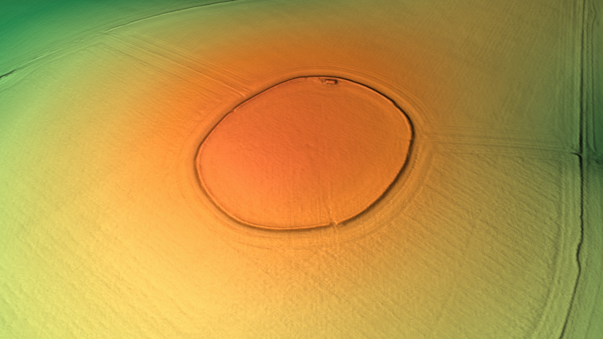
The woodland is not only valued for its natural beauty but also for its historical significance. Hare Covert has been mentioned in historical records dating back several centuries, and remnants of ancient settlements and burial mounds can still be found within its boundaries. Archaeological discoveries have shed light on the area's rich history, making it a fascinating destination for history enthusiasts.

Overall, Hare Covert, Wiltshire, is a captivating woodland area that combines natural splendor with historical intrigue. Whether one seeks a peaceful retreat, a chance to connect with nature, or a glimpse into the past, Hare Covert offers a memorable experience for all who visit.

If you have any feedback on the listing, please let us know in the comments section below.
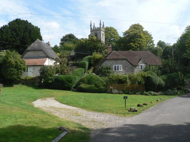
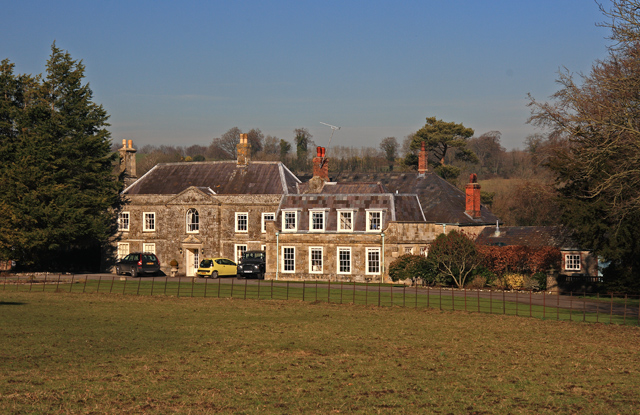
Hare Covert Images

Images are sourced within 2km of 51.165797/-2.0122351 or Grid Reference ST9940. Thanks to Geograph Open Source API. All images are credited.

Old Boundary Marker by the A36, Salisbury Road, Codford Parish Boundary Marker by the A36, in parish of Codford (West Wiltshire District), Salisbury Road, Codford. Junction with track to Starveall, on embankment.

Inscription reads:-
: CODFORD ST MARY : : FISHERTON / DE LA MER : 

Grade II listed.
List Entry Number: 1181168 <span class="nowrap"><a title="https://historicengland.org.uk/listing/the-list/list-entry/1181168" rel="nofollow ugc noopener" href="https://historicengland.org.uk/listing/the-list/list-entry/1181168">Link</a><img style="margin-left:2px;" alt="External link" title="External link - shift click to open in new window" src="https://s1.geograph.org.uk/img/external.png" width="10" height="10"/></span>

Surveyed

Milestone Society National ID: WI_SAWM12pb
Old Boundary Marker by the A36, Salisbury Road, Codford
Parish Boundary Marker by the A36, in parish of Codford (West Wiltshire District), Salisbury Road, Codford. Junction with track to Starveall, on embankment. Inscription reads:- : CODFORD ST MARY : : FISHERTON / DE LA MER : Grade II listed. List Entry Number: 1181168 LinkExternal link Surveyed Milestone Society National ID: WI_SAWM12pb
2012 : Farm track south to Fisherton de la Mere The northern end of a two mile track from the A36 at Fisherton de la mere. Most of it is dead straight as here, though there are a few minor kinks at the far end.
This section covers almost all of two grid squares.
Winter wheat is in the field to the right, oilseed rape to the left, both are coming on nicely.
2012 : Farm track south to Fisherton de la Mere
The northern end of a two mile track from the A36 at Fisherton de la mere. Most of it is dead straight as here, though there are a few minor kinks at the far end. This section covers almost all of two grid squares. Winter wheat is in the field to the right, oilseed rape to the left, both are coming on nicely.
2012 : Friendly lady in a pickup with a friendlier dog The friendly Jack Russell licked my fingers, the lady did not.
Walking the dog the easy way.
The farm road runs straight** from this point across two grid squares.

** That is if you don't count the hills.
2012 : Friendly lady in a pickup with a friendlier dog
The friendly Jack Russell licked my fingers, the lady did not. Walking the dog the easy way. The farm road runs straight** from this point across two grid squares. ** That is if you don't count the hills.
2012 : Farm track on East Codford Down A turn to the right at the bushes and the track heads due south to Fisherton de la Mere.
The north east corner of a large wheat field to the right, oil seed rape beyond the track. Ploughed fields wait a sowing, possibly of barley.
2012 : Farm track on East Codford Down
A turn to the right at the bushes and the track heads due south to Fisherton de la Mere. The north east corner of a large wheat field to the right, oil seed rape beyond the track. Ploughed fields wait a sowing, possibly of barley.
2012 : East from Claypit Hill Or it might be East Codford Down.
A field of winter wheat well advanced for mid March, followed by some scrubby looking trees, followed by more of the same for the next four miles to Shrewton.
Better than Southwark though.
2012 : East from Claypit Hill
Or it might be East Codford Down. A field of winter wheat well advanced for mid March, followed by some scrubby looking trees, followed by more of the same for the next four miles to Shrewton. Better than Southwark though.
2012 : The lower slopes of East Codford Down With a row of conifers forming a field hedge.
The field contains oilseed rape.
Looking south east the Wylye Valley is over the next hill, or two.
2012 : The lower slopes of East Codford Down
With a row of conifers forming a field hedge. The field contains oilseed rape. Looking south east the Wylye Valley is over the next hill, or two.
2012 : Owl box at the foot of Codford Hill A friend tells me owls prefer a box with a landing platform and a small entrance hole. Raptors prefer a box with an open front and a low ledge.
2012 : Owl box at the foot of Codford Hill
A friend tells me owls prefer a box with a landing platform and a small entrance hole. Raptors prefer a box with an open front and a low ledge.
2012 : A long and lonely road From the A36 near Fisherton de la Mere over 1km behind the camera position, the straight bit stops at the other end of the grid square and turns to the left to Clay Pit Hill. Mostly used by farm vehicles, geographers (2 so far) and the occasional dog walker.
2012 : A long and lonely road
From the A36 near Fisherton de la Mere over 1km behind the camera position, the straight bit stops at the other end of the grid square and turns to the left to Clay Pit Hill. Mostly used by farm vehicles, geographers (2 so far) and the occasional dog walker.
2012 : South of east near Parry's Field Barn Looking across a dry valley, coombe or bottom to Deptford Down.
Oil seed rape in the foreground only a few weeks before flowering.
Fields, small woods and copses for the next four miles til you get to Stapleford.
If you want peace and quiet this is the place but watch out for the A303.
2012 : South of east near Parry's Field Barn
Looking across a dry valley, coombe or bottom to Deptford Down. Oil seed rape in the foreground only a few weeks before flowering. Fields, small woods and copses for the next four miles til you get to Stapleford. If you want peace and quiet this is the place but watch out for the A303.
2012 : Bridleway to Parry's Field Barn Over the next hill. 
Then on to Fisherton de la Mere and the A36.
Also serves as a farm road.
Wheat in the field to the right, a large field. Treetops over the hill are in the southern hedgerow, the northern hedgerow is over one km behind the camera.
2012 : Bridleway to Parry's Field Barn
Over the next hill. Then on to Fisherton de la Mere and the A36. Also serves as a farm road. Wheat in the field to the right, a large field. Treetops over the hill are in the southern hedgerow, the northern hedgerow is over one km behind the camera.
2012 : South east near Parry's Field Barn The field of oil seed rape we saw two grid squares to the north is still with us.
Deptford Field Barn is on the skyline.
With a helicopter you could fly straight ahead, over the barn on the horizon then look into the Wylye Valley nearly three miles over.
2012 : South east near Parry's Field Barn
The field of oil seed rape we saw two grid squares to the north is still with us. Deptford Field Barn is on the skyline. With a helicopter you could fly straight ahead, over the barn on the horizon then look into the Wylye Valley nearly three miles over.
2012 : North east near Parry's Field Barn The oilseed rape in the foreground reaches north to the next hedgerow which coincides with the end of the grid square next door. The next field over is probably barley or oats, too late for wheat.
Look carefully left of centre and you may see a lone barn standing on the horizon.
The next place in this direction is Upavon, twelve miles across the military range.
2012 : North east near Parry's Field Barn
The oilseed rape in the foreground reaches north to the next hedgerow which coincides with the end of the grid square next door. The next field over is probably barley or oats, too late for wheat. Look carefully left of centre and you may see a lone barn standing on the horizon. The next place in this direction is Upavon, twelve miles across the military range.
2011 : Private road to East Codford Down A bridleway sign at the end suggests it is OK by foot.
The corrugated iron barn ahead was not investigated but probably to do with the dairy industry.
2011 : Private road to East Codford Down
A bridleway sign at the end suggests it is OK by foot. The corrugated iron barn ahead was not investigated but probably to do with the dairy industry.
2011 : Here is the moos A herd of cows were reported today harassing a photographer near Chitterne with cries of "Take our picture mister" and threatening to "do him over" if he did not. Luckily he was protected by a strand of barbed wire.
2011 : Here is the moos
A herd of cows were reported today harassing a photographer near Chitterne with cries of "Take our picture mister" and threatening to "do him over" if he did not. Luckily he was protected by a strand of barbed wire.
2011 : Private farm road heading toward Codford Road A bridleway sign at the end suggested a footpath.
2011 : Private farm road heading toward Codford Road
A bridleway sign at the end suggested a footpath.
2011 : Farm road to East Codford Down and Clay pit Hill
2011 : Small chalk quarry on the road from Claypit Hill Appears to be currently in use.
Believe crushed chalk is used as a soil conditioner rather than as a fertilizer.
2011 : Small chalk quarry on the road from Claypit Hill
Appears to be currently in use. Believe crushed chalk is used as a soil conditioner rather than as a fertilizer.
2011 : A36 heading east beyond Codford St.Peter Along the edge of Foxhole Bottom to the left of the road.
The bypass round Codfords St.Peter and St.Mary is behind then follows the Wylye Valley to the right.
2011 : A36 heading east beyond Codford St.Peter
Along the edge of Foxhole Bottom to the left of the road. The bypass round Codfords St.Peter and St.Mary is behind then follows the Wylye Valley to the right.
Show me another place!

Hare Covert is located at Grid Ref: ST9940 (Lat: 51.165797, Lng: -2.0122351)

Unitary Authority: Wiltshire

Police Authority: Wiltshire

What 3 Words

///verbs.misted.escapades. Near Stockton, Wiltshire

Nearby Locations

Stony Hill Hare Covert

Related Wikis

Starveall and Stony Down

Starveall and Stony Down is a 22.5 hectare biological Site of Special Scientific Interest in the parishes of Codford and Wylye, Wiltshire, England, notified...

Codford Circle

Codford Circle, also known as Wilsbury Ring, Woldsbury, and possibly Oldbury Camp, is a neolithic hill top enclosure or possible hillfort located on the...

Fisherton de la Mere

Fisherton de la Mere, also spelt Fisherton Delamere, is a small village and former civil parish, now in the parish of Wylye, on the River Wylye, Wiltshire...

St Nicholas's Church, Fisherton Delamere

St Nicholas's Church in Fisherton Delamere, Wiltshire, England, was built in the 14th century. It is recorded in the National Heritage List for England...

Aston Valley Barrow Cemetery

The Aston Valley Barrow Cemetery, or Ashton Valley Barrow Cemetery, is a group of Bronze Age bowl barrow and bell barrow tumuli on the south facing edge...

Codford

Codford is a civil parish south of Salisbury Plain in the Wylye Valley in Wiltshire, England. Its settlements are the adjacent villages of Codford St Peter...

Woolstore Theatre

The Woolstore Theatre is a theatre in the village of Codford, Wiltshire, England. The theatre has been operating since 1928, when it was built by Colonel...

Bapton

Bapton is a hamlet in Wiltshire, England, in the civil parish of Stockton. It lies south of the A36 and the River Wylye, on the minor road which follows...

Have you been to Hare Covert?

Leave your review of Hare Covert below (or comments, questions and feedback).