Lowe Hill

Hill, Mountain in Staffordshire Staffordshire Moorlands

England

Lowe Hill

Farm buildings south-east of Leek, Staffordshire Seen from a passing train on the Churnet Valley Railway.
Farm buildings south-east of Leek, Staffordshire Credit: Roger D Kidd

Lowe Hill is a prominent landmark located in the county of Staffordshire, England. It is classified as a hill rather than a mountain due to its relatively modest elevation. Situated in the southern part of the county, Lowe Hill forms part of the rolling landscape of the Staffordshire Moorlands.

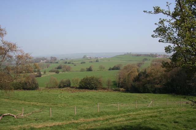
Standing at an altitude of approximately 348 meters (1,142 feet), Lowe Hill offers spectacular views of the surrounding countryside. Its strategic location provides an ideal vantage point to observe the nearby towns and villages, including Leek and Biddulph. On a clear day, visitors can even catch a glimpse of the Peak District National Park to the east.

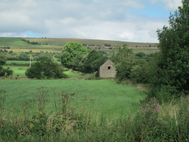
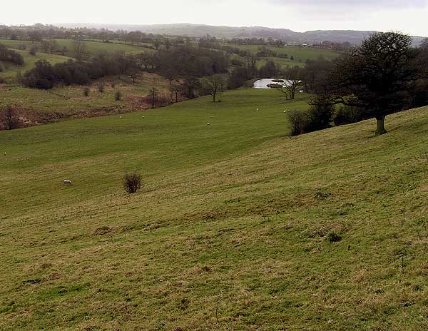
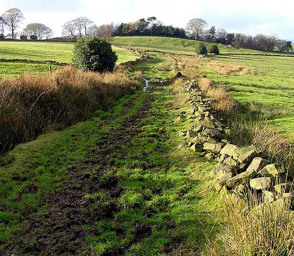
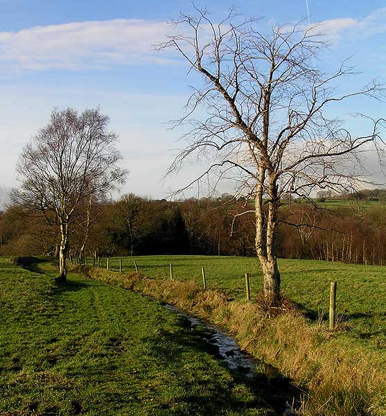
The hill is covered in lush green vegetation, mainly consisting of grasses and shrubs. It is a popular destination for hikers and nature enthusiasts, offering various walking trails that cater to different levels of difficulty. The paths meander through woodlands and open fields, providing an opportunity to observe the local flora and fauna.

Lowe Hill is also known for its historical significance. At its summit, the remains of an ancient fortification can be found, believed to date back to the Iron Age. This archaeological feature adds to the hill's intrigue and attracts history buffs looking to explore the area's past.

Overall, Lowe Hill offers a peaceful and picturesque setting for those seeking to immerse themselves in the natural beauty and history of Staffordshire. Its accessibility and panoramic views make it a popular destination for outdoor enthusiasts and anyone looking for a tranquil escape.

If you have any feedback on the listing, please let us know in the comments section below.
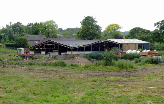
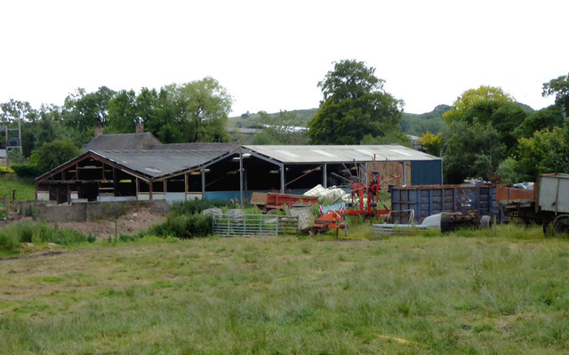
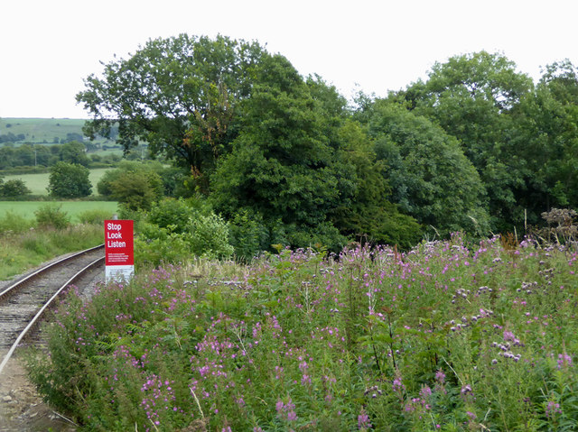
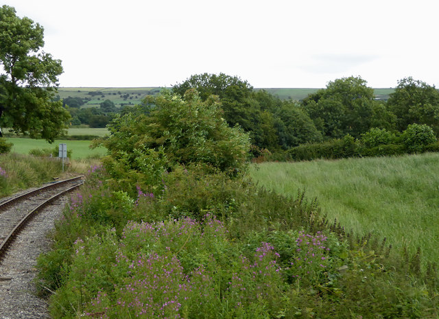
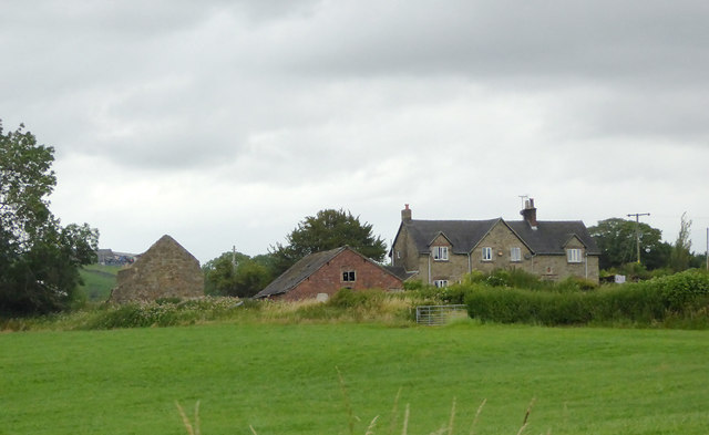
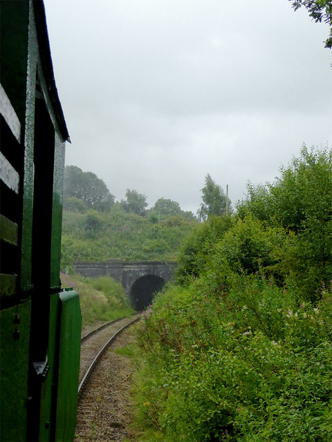
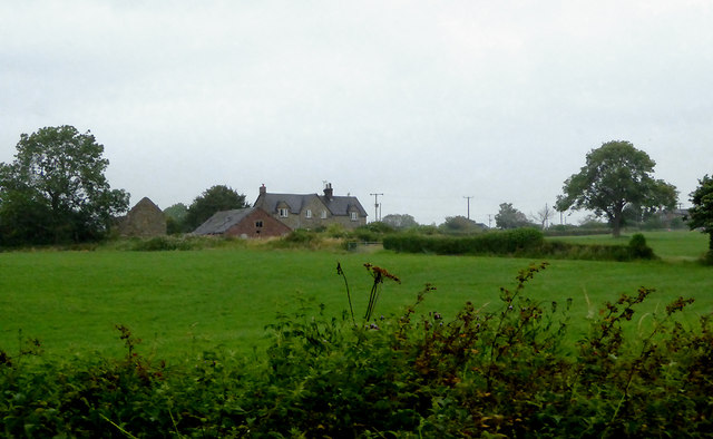
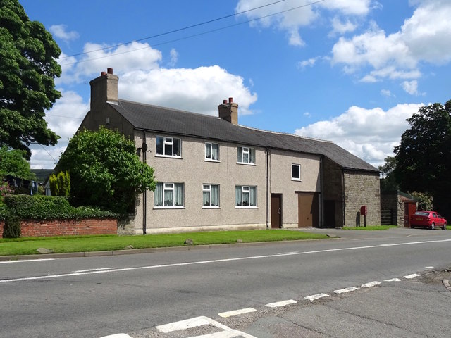
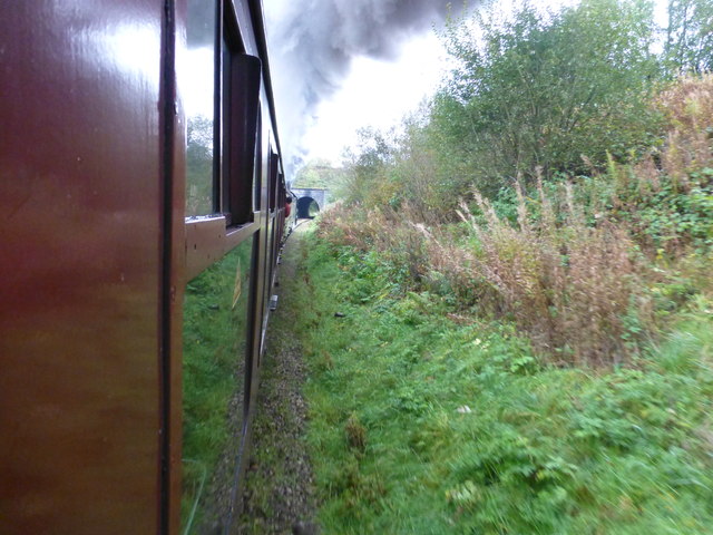
Lowe Hill Images

Images are sourced within 2km of 53.095301/-2.0072468 or Grid Reference SJ9955. Thanks to Geograph Open Source API. All images are credited.

Farm buildings south-east of Leek, Staffordshire Seen from a passing train on the Churnet Valley Railway.
Farm buildings south-east of Leek, Staffordshire
Seen from a passing train on the Churnet Valley Railway.
Farm buildings south-east of Leek, Staffordshire Buildings at Cliff Farm seen from a passing train on the Churnet Valley Railway.
Farm buildings south-east of Leek, Staffordshire
Buildings at Cliff Farm seen from a passing train on the Churnet Valley Railway.
Railway trackside south-east of Leek, Staffordshire A public footpath crosses the line here near Cliff Farm.

The preserved Churnet Valley Railway operates steam and diesel (sometimes both!) locomotives to haul trains between Kingsley and Froghall Station to Cheddleton, and sometimes beyond to Ipstones. <span class="nowrap"><a title="https://www.churnet-valley-railway.co.uk/" rel="nofollow ugc noopener" href="https://www.churnet-valley-railway.co.uk/">Link</a><img style="margin-left:2px;" alt="External link" title="External link - shift click to open in new window" src="https://s1.geograph.org.uk/img/external.png" width="10" height="10"/></span>
Railway trackside south-east of Leek, Staffordshire
A public footpath crosses the line here near Cliff Farm. The preserved Churnet Valley Railway operates steam and diesel (sometimes both!) locomotives to haul trains between Kingsley and Froghall Station to Cheddleton, and sometimes beyond to Ipstones. LinkExternal link
Farmland by the railway near Bradnop, Staffordshire Seen from a passing train approaching the footpath crossing near Cliff Farm.

The preserved Churnet Valley Railway operates steam and diesel (sometimes both!) locomotives to haul trains between Kingsley and Froghall Station to Cheddleton, and sometimes beyond to Ipstones. <span class="nowrap"><a title="https://www.churnet-valley-railway.co.uk/" rel="nofollow ugc noopener" href="https://www.churnet-valley-railway.co.uk/">Link</a><img style="margin-left:2px;" alt="External link" title="External link - shift click to open in new window" src="https://s1.geograph.org.uk/img/external.png" width="10" height="10"/></span>
Farmland by the railway near Bradnop, Staffordshire
Seen from a passing train approaching the footpath crossing near Cliff Farm. The preserved Churnet Valley Railway operates steam and diesel (sometimes both!) locomotives to haul trains between Kingsley and Froghall Station to Cheddleton, and sometimes beyond to Ipstones. LinkExternal link
Farm land south-east of Leek, Staffordshire Seen from a passing train, this telephoto assisted image shows Wildgoose Farm.
Farm land south-east of Leek, Staffordshire
Seen from a passing train, this telephoto assisted image shows Wildgoose Farm.
Railway at Bradnop, Staffordshire This is looking back (south-east) at the bridge at Bradnop. The train is being pulled on the return to Froghall by a diesel unit which helped the small green Polish steam locomotive haul it up the gradient to Ipstones by pushing from the rear.
The line is currently being used as far as the former Ipstones Station by the Churnet Valley Railway Company, but is currently owned by the Moorland and City Railways Company, with plans to reopen lines as far as Leek and Stoke, and agreements likely that CVR will have access to all of its tracks.
Railway at Bradnop, Staffordshire
This is looking back (south-east) at the bridge at Bradnop. The train is being pulled on the return to Froghall by a diesel unit which helped the small green Polish steam locomotive haul it up the gradient to Ipstones by pushing from the rear. The line is currently being used as far as the former Ipstones Station by the Churnet Valley Railway Company, but is currently owned by the Moorland and City Railways Company, with plans to reopen lines as far as Leek and Stoke, and agreements likely that CVR will have access to all of its tracks.
Pasture south-east of Leek, Staffordshire Looking at land by Wildgoose Farm on a very gloomy morning, seen from a passing Churnet Valley Railway train.
Pasture south-east of Leek, Staffordshire
Looking at land by Wildgoose Farm on a very gloomy morning, seen from a passing Churnet Valley Railway train.
Farm building near Bradnop Seen from a lay-by on the A523 not far from Leek, an isolated farm building. The higher ground beyond is Morridge.
Farm building near Bradnop
Seen from a lay-by on the A523 not far from Leek, an isolated farm building. The higher ground beyond is Morridge.
Four Sycamores, formerly the Blacksmith's Arms The Blacksmith's Arms closed after a fire in about 1940, leaving Bradnop with no pub.
Four Sycamores, formerly the Blacksmith's Arms
The Blacksmith's Arms closed after a fire in about 1940, leaving Bradnop with no pub.
Bridge near Bradnop View from steam train on the Cauldon Lowe Branch
Bridge near Bradnop
View from steam train on the Cauldon Lowe Branch
Old Milepost by the A523, Ashbourne Road, Bradnop Ashbourne iron bobbin by the A523, in parish of Bradnop (Staffordshire Moorlands District), West of Bradnop, on grass verge.

Inscription reads:-
: LEEK / 2 / MILES : : LONDON 152 MILES : : ASHBOURNE / 13 / MILES :

'Lost' since 2010

Milestone Society National ID: ST_LKAB02
Old Milepost by the A523, Ashbourne Road, Bradnop
Ashbourne iron bobbin by the A523, in parish of Bradnop (Staffordshire Moorlands District), West of Bradnop, on grass verge. Inscription reads:- : LEEK / 2 / MILES : : LONDON 152 MILES : : ASHBOURNE / 13 / MILES : 'Lost' since 2010 Milestone Society National ID: ST_LKAB02
Hidden valley Valley of brook running southwards towards the River Churnet
Hidden valley
Valley of brook running southwards towards the River Churnet
Green Lane towards Egg Well Right of way
Green Lane towards Egg Well
Right of way
Stream running towards Ashenhurst
Bradnop Church built in 1862 as part of the village school.
Bradnop Church
built in 1862 as part of the village school.
Railway Cottages Ashbourne Road, Bradnop. Back in 1905 there were no planning committees to say "you can't build in brick - the natural building material in this area is stone". So the North Staffordshire Railway <span class="nowrap"><a title="http://en.wikipedia.org/wiki/North_Staffordshire_Railway" rel="nofollow ugc noopener" href="http://en.wikipedia.org/wiki/North_Staffordshire_Railway">Link</a><img style="margin-left:2px;" alt="External link" title="External link - shift click to open in new window" src="https://s1.geograph.org.uk/img/external.png" width="10" height="10"/></span> erected the same pattern housing as everywhere else in their network. In this case it was for the staff of Bradnop Station nearby.
Railway Cottages
Ashbourne Road, Bradnop. Back in 1905 there were no planning committees to say "you can't build in brick - the natural building material in this area is stone". So the North Staffordshire Railway LinkExternal link erected the same pattern housing as everywhere else in their network. In this case it was for the staff of Bradnop Station nearby.
Roost Hill and Revedge From the lane near Combes Valley Nature Reserve looking NNE.
Roost Hill and Revedge
From the lane near Combes Valley Nature Reserve looking NNE.
Bradnop Church Although looking more like a church hall, this building is marked as being Bradnop Church, with <a href="https://www.geograph.org.uk/photo/224611">SK0155 : Bradnop Church</a> appearing to be the church hall. 

Confirmation is needed
Bradnop Church
Although looking more like a church hall, this building is marked as being Bradnop Church, with SK0155 : Bradnop Church appearing to be the church hall. Confirmation is needed
Show me another place!

Lowe Hill is located at Grid Ref: SJ9955 (Lat: 53.095301, Lng: -2.0072468)

Administrative County: Staffordshire

District: Staffordshire Moorlands

Police Authority: Staffordshire

What 3 Words

///hamster.eagle.skimmers. Near Leek, Staffordshire

Nearby Locations

Lowe Hill Lowe Hill

Related Wikis

Leek High School

Leek High School is a mixed upper school (termed 'high school') located in Leek, Staffordshire, England. As of 2021, the number of students at the school...

The Meadows School, Leek

The Meadows School is a mixed special school co-located with Leek High School in Leek, Staffordshire, England.In 2014 Ofsted said “Students make good...

All Saints' Church, Leek

All Saints' Church is an Anglican church in Leek, Staffordshire, England. It is a Grade I listed building. It was designed by Norman Shaw, and built in...

Nicholson War Memorial

The Nicholson War Memorial in Leek, Staffordshire, England is a 1925 war memorial. It was commissioned by local manufacturer Sir Arthur Nicholson and his...

Nearby Amenities

Located within 500m of 53.095301,-2.0072468
Barrier: cattle_grid
Lat/Long: 53.0946676/-2.0091382
Barrier: stile
Bicycle: no
Foot: yes
Material: wood
Step Count: 0
Stile: stepover
Lat/Long: 53.0955587/-2.0137663
Material: wood
Operator Ref: MIDE
Power: pole
Lat/Long: 53.0964614/-2.0125813
Waste Basket
Waste: trash;dog_excrement
Lat/Long: 53.099354/-2.0066697
Direction: 270
Maxspeed: national
Traffic Sign: maxspeed
Lat/Long: 53.0973916/-2.0060433
Direction: 90
Traffic Sign: no_entry
Lat/Long: 53.0973882/-2.0060348
Barrier: stile
Material: wood
Step Count: 2
Stile: stepover
Lat/Long: 53.0911596/-2.0088431
Barrier: stile
Lat/Long: 53.0938014/-2.010462
Material: wood
Operator Ref: MIDE
Power: pole
Lat/Long: 53.0965785/-2.0103518
Material: wood
Operator Ref: MIDE
Power: pole
Lat/Long: 53.0969384/-2.0088229
Material: wood
Operator Ref: MIDE
Power: pole
Lat/Long: 53.0974629/-2.0066017
Material: wood
Operator Ref: MIDE
Power: pole
Lat/Long: 53.0979132/-2.0062145
Material: wood
Operator Ref: MIDE
Power: pole
Lat/Long: 53.0993185/-2.0038945
Lowe Hill
Ele: 250
Natural: peak
Lat/Long: 53.0953502/-2.0072612
The data included in this document is from www.openstreetmap.org. The data is made available under ODbL.

Have you been to Lowe Hill?

Leave your review of Lowe Hill below (or comments, questions and feedback).