Whaley Moor

Hill, Mountain in Cheshire

England

Whaley Moor

Outflow from Toddbrook Reservoir The level of this reservoir has been kept much lower than normal since a national incident in August 2019 when the dam was in danger of breaking. Remedial works are now in course but will take several years to complete. The footpath across the dam has been closed.
Outflow from Toddbrook Reservoir Credit: Bill Boaden

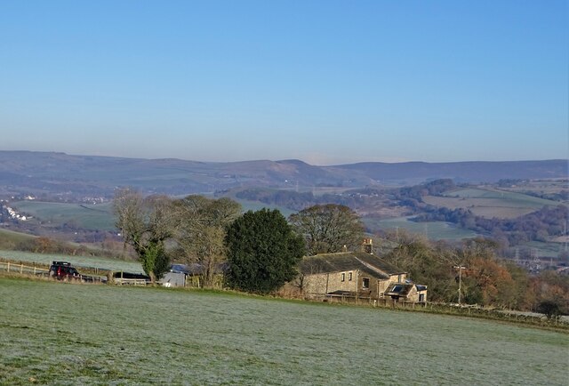
Whaley Moor is a picturesque hill located in the county of Cheshire, England. Situated near the village of Whaley Bridge, it is part of the Peak District National Park and stands at an elevation of approximately 410 meters (1,345 feet) above sea level.

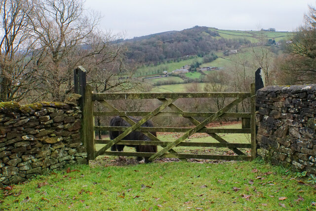
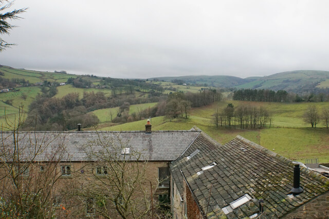
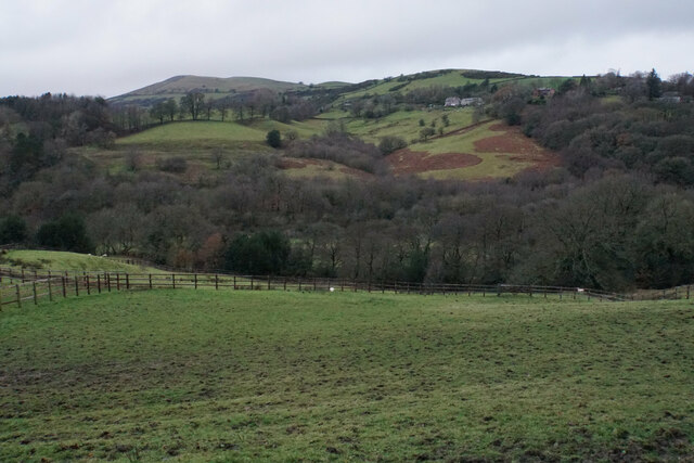
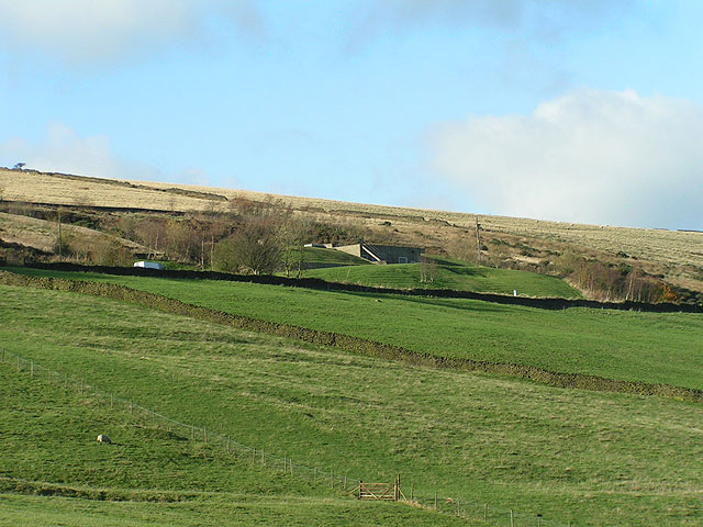
The moor offers stunning panoramic views of the surrounding countryside, with its rolling hills and lush green valleys. It is a popular destination for hikers and nature enthusiasts, who flock to the area to explore its diverse flora and fauna.

Whaley Moor is known for its well-preserved heather moorland, which provides habitat for a variety of wildlife species. Visitors may catch a glimpse of birds such as red grouse, skylarks, and meadow pipits, as well as rabbits and hares that inhabit the area.

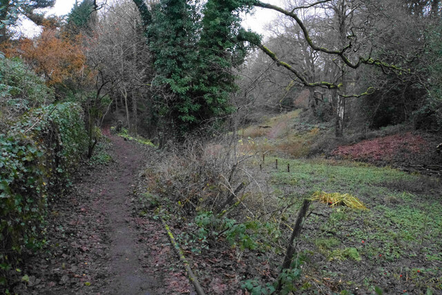
The hill offers several walking trails, varying in difficulty, allowing visitors to choose a route that suits their preferences and abilities. These trails often lead to landmarks like the Goyt Valley, Fernilee Reservoir, and the nearby Toddbrook Reservoir.

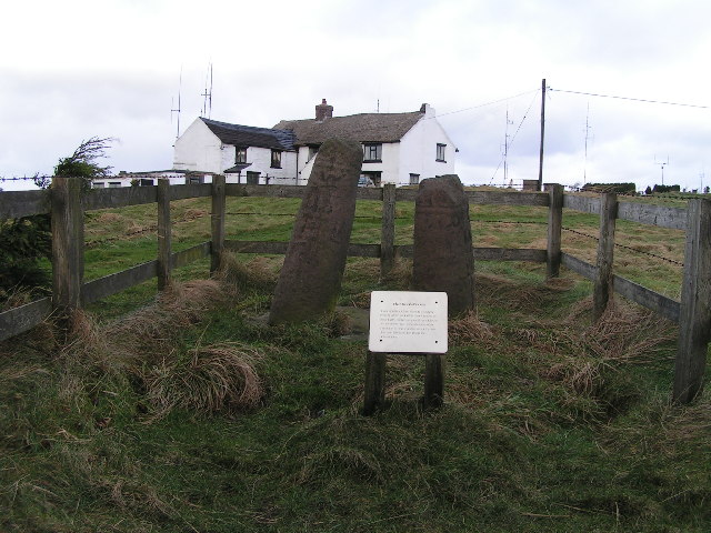
Whaley Moor is also steeped in history, with evidence of human activity dating back to the Bronze Age. Archaeological remains, such as stone circles and burial mounds, can still be found on the hillside, adding to its allure.

Overall, Whaley Moor is a captivating natural landmark that showcases the beauty of Cheshire's countryside. With its stunning views, abundant wildlife, and rich history, it offers a captivating experience for all those who venture to its summit.

If you have any feedback on the listing, please let us know in the comments section below.
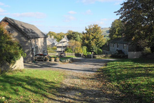
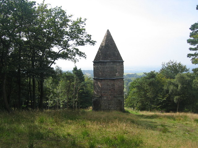
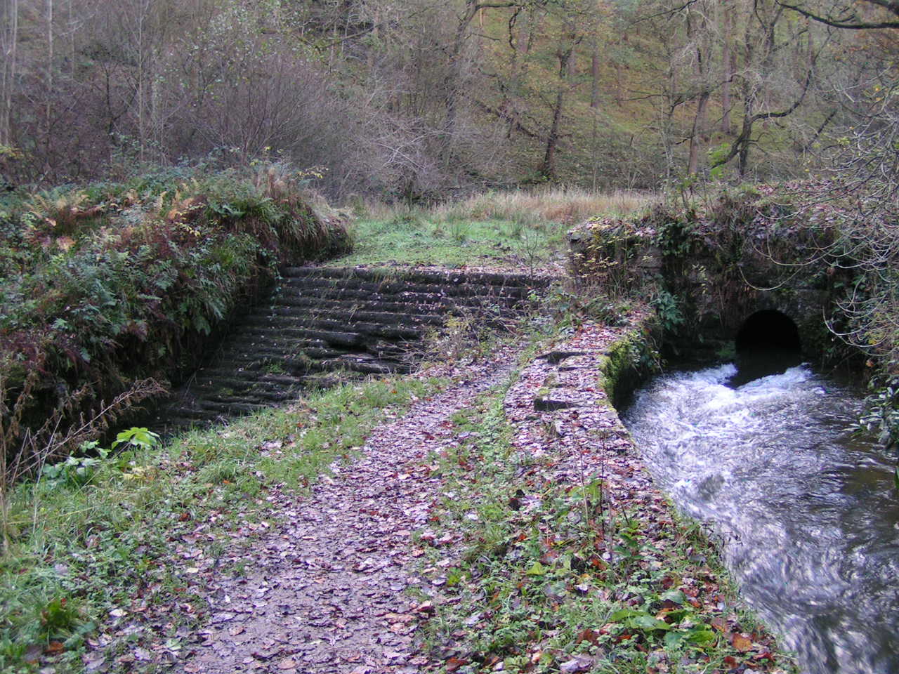
Whaley Moor Images

Images are sourced within 2km of 53.336138/-2.0165847 or Grid Reference SJ9882. Thanks to Geograph Open Source API. All images are credited.

Outflow from Toddbrook Reservoir The level of this reservoir has been kept much lower than normal since a national incident in August 2019 when the dam was in danger of breaking. Remedial works are now in course but will take several years to complete. The footpath across the dam has been closed.
Outflow from Toddbrook Reservoir
The level of this reservoir has been kept much lower than normal since a national incident in August 2019 when the dam was in danger of breaking. Remedial works are now in course but will take several years to complete. The footpath across the dam has been closed.
Hurst Clough The path on the left follows the clough up from Toddbrook Reservoir to Start Lane.
Hurst Clough
The path on the left follows the clough up from Toddbrook Reservoir to Start Lane.
Field entrance off Start Lane This point gives a view over the Todd Brook valley, with Taxal Edge climbing behind.
Field entrance off Start Lane
This point gives a view over the Todd Brook valley, with Taxal Edge climbing behind.
Rooftops by Start Lane From here there is a view across the Todd Brook valley in the direction of Kettleshulme.
Rooftops by Start Lane
From here there is a view across the Todd Brook valley in the direction of Kettleshulme.
Grazing land by Walker Brow Farm The land is mainly used for equestrianism. It is overlooking the valley of Todd Brook.
Grazing land by Walker Brow Farm
The land is mainly used for equestrianism. It is overlooking the valley of Todd Brook.
The top of Yeardsley Lane The end of the adopted highway, but several tracks and paths continue.
The top of Yeardsley Lane
The end of the adopted highway, but several tracks and paths continue.
Ruined barn below Ringstone Farm There are views into the Goyt Valley.
Ruined barn below Ringstone Farm
There are views into the Goyt Valley.
Hockerley A small farming hamlet which is now on the outskirts of Whaley Bridge.
Hockerley
A small farming hamlet which is now on the outskirts of Whaley Bridge.
Footpath down to Bridgemont The path comes down from Hockerley skirting round some smallholding plots to the right. The River Goyt is in the valley ahead.
Footpath down to Bridgemont
The path comes down from Hockerley skirting round some smallholding plots to the right. The River Goyt is in the valley ahead.
A view of Brownough A former farm south west of Furness Vale
A view of Brownough
A former farm south west of Furness Vale
The Bowstones This double cross ("not later than the 10th century" according to English Heritage) is a Scheduled Ancient Monument southwest of Lyme Park - see <span class="nowrap"><a title="https://historicengland.org.uk/listing/the-list/list-entry/1011116" rel="nofollow ugc noopener" href="https://historicengland.org.uk/listing/the-list/list-entry/1011116">Link</a><img style="margin-left:2px;" alt="External link" title="External link - shift click to open in new window" src="https://s1.geograph.org.uk/img/external.png" width="10" height="10"/></span>  for more information. Bowstonegate is to the rear.
The Bowstones
This double cross ("not later than the 10th century" according to English Heritage) is a Scheduled Ancient Monument southwest of Lyme Park - see LinkExternal link for more information. Bowstonegate is to the rear.
The Lantern It is said that if the owner of Lyme Park Estate could not see The Lantern from his breakfast table in Lyme Hall then the weather was not suitable for hunting.
The Lantern
It is said that if the owner of Lyme Park Estate could not see The Lantern from his breakfast table in Lyme Hall then the weather was not suitable for hunting.
Diglee Viewed from the entrance track looking northeast; beyond Diglee is Broadhey, and in the distance Lantern Pike (<a href="https://www.geograph.org.uk/gridref/SK0288">SK0288</a>).
Diglee
Viewed from the entrance track looking northeast; beyond Diglee is Broadhey, and in the distance Lantern Pike (SK0288).
Longside Reservoir A covered reservoir beside Whaley Lane; this picture is taken from Diglee SJ997827.
Longside Reservoir
A covered reservoir beside Whaley Lane; this picture is taken from Diglee SJ997827.
The Dipping Stone Described in the Ancient Monument Schedule as a "Wayside and Boundary Cross", the Dipping Stone lies just off a public footpath below the end of Whaley Moor and offers views to Chinley Churn (<a href="https://www.geograph.org.uk/gridref/SK0383">SK0383</a>) and beyond that the Kinder Scout plateau. The similarity to <a href="https://www.geograph.org.uk/photo/44825">SJ9781 : The Bowstones</a> and <a href="https://www.geograph.org.uk/photo/11401">SK0090 : Robin Hoods Picking Rods</a> is notable; all three appear to have (or have had) one square shaft and one round.
The Dipping Stone
Described in the Ancient Monument Schedule as a "Wayside and Boundary Cross", the Dipping Stone lies just off a public footpath below the end of Whaley Moor and offers views to Chinley Churn (SK0383) and beyond that the Kinder Scout plateau. The similarity to SJ9781 : The Bowstones and SK0090 : Robin Hoods Picking Rods is notable; all three appear to have (or have had) one square shaft and one round.
Hawkhurst Head Hawkhurst Head (in the foreground) is an extension of Whaley Moor; beyond it lies Ladder Hill (<a href="https://www.geograph.org.uk/gridref/SJ028789">SJ028789</a>) with its TV mast, and beyond that the plateau of Combs Moss. Photo taken from the northwest near the Dipping Stone.
Hawkhurst Head
Hawkhurst Head (in the foreground) is an extension of Whaley Moor; beyond it lies Ladder Hill (SJ028789) with its TV mast, and beyond that the plateau of Combs Moss. Photo taken from the northwest near the Dipping Stone.
Between Pennant End and Kishfield Bridge Although marked on the OS map as a "yellow" road, this lane is signposted "unsuitable for motor vehicles" and includes a cobbled stretch. In this picture the lane descends down a hollow way before reaching Kishfield Bridge over Todd Brook.
Between Pennant End and Kishfield Bridge
Although marked on the OS map as a "yellow" road, this lane is signposted "unsuitable for motor vehicles" and includes a cobbled stretch. In this picture the lane descends down a hollow way before reaching Kishfield Bridge over Todd Brook.
Kishfield Bridge This bridge conveys a minor lane over Todd Brook
Kishfield Bridge
This bridge conveys a minor lane over Todd Brook
Show me another place!

Whaley Moor is located at Grid Ref: SJ9882 (Lat: 53.336138, Lng: -2.0165847)

Unitary Authority: Cheshire East

Police Authority: Cheshire

What 3 Words

///maddening.gosh.transmits. Near Whaley Bridge, Derbyshire

Related Wikis

Bowstones

The Bowstones are a pair of Anglian cross shafts in Cheshire, England. Situated beside the old ridgeway between Disley and Macclesfield, overlooking Lyme...
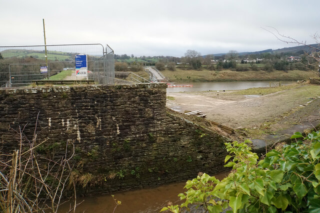
Toddbrook Reservoir

Toddbrook Reservoir, a feeder for the Peak Forest Canal, opened in 1838. It is above the town of Whaley Bridge in the High Peak area of Derbyshire, England...

Bollinhurst Reservoir

The Bollinhurst Reservoir was constructed in Lyme Park in 1872 for the Stockport District Waterworks Company. At the time of the First World War, it had...

Todd Brook

Todd Brook is a small river running through the English counties of Cheshire and Derbyshire. The Brook rises beneath Shining Tor on the border between...

Nearby Amenities

Located within 500m of 53.336138,-2.0165847
Barrier: stile
Material: stone
Step Count: 3
Stile: stepover
Lat/Long: 53.332982/-2.0168026
Barrier: stile
Material: wood
Step Count: 3
Stile: ladder
Lat/Long: 53.3338342/-2.0210483
Black Hill
Ele: 410
Natural: peak
Lat/Long: 53.3361615/-2.016692
Whaley Moor
Place: locality
Lat/Long: 53.3372168/-2.0166949
The data included in this document is from www.openstreetmap.org. The data is made available under ODbL.

Have you been to Whaley Moor?

Leave your review of Whaley Moor below (or comments, questions and feedback).