Kerchesters

Settlement in Roxburghshire

Scotland

Kerchesters

Minor road from Sprouston A minor road up through farmland to meet the B6396. Even after midday, there was still some frost on the road in the shadow of the woodland.
Minor road from Sprouston Credit: Jim Barton

The requested URL returned error: 429 Too Many Requests

If you have any feedback on the listing, please let us know in the comments section below.
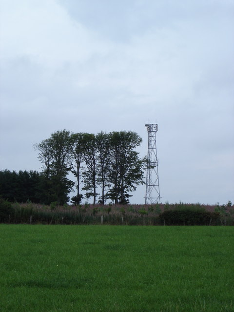
Kerchesters Images

Images are sourced within 2km of 55.608057/-2.3666444 or Grid Reference NT7735. Thanks to Geograph Open Source API. All images are credited.

Minor road from Sprouston A minor road up through farmland to meet the B6396. Even after midday, there was still some frost on the road in the shadow of the woodland.
Minor road from Sprouston
A minor road up through farmland to meet the B6396. Even after midday, there was still some frost on the road in the shadow of the woodland.
Minor road from Sprouston (2) A straight road between neat hedges in the farmland rising to the south of the Tweed near Kelso.
Minor road from Sprouston (2)
A straight road between neat hedges in the farmland rising to the south of the Tweed near Kelso.
Minor road from Sprouston (3) The view across the Tweed valley opens out, here including the monument to James Thomson, author of the words of 'Rule Britannia', visible as the stone obelisk above the trees L of centre.
Minor road from Sprouston (3)
The view across the Tweed valley opens out, here including the monument to James Thomson, author of the words of 'Rule Britannia', visible as the stone obelisk above the trees L of centre.
Road to Kersquarter At the junction with the minor road up from Sprouston.
Road to Kersquarter
At the junction with the minor road up from Sprouston.
Farmland above the Tweed A glimpse of the river from the road to Windywalls.
Farmland above the Tweed
A glimpse of the river from the road to Windywalls.
Sprouston Parish Church The church was built in 1781 on the site of a previous building. The external harled walls have recently been repainted.
Sprouston Parish Church
The church was built in 1781 on the site of a previous building. The external harled walls have recently been repainted.
Great mullein (Verbascum thapsus) This tall erect biennial plant with light yellow flowers is also known as Aaron’s Rod. This photo was taken in Sprouston Parish Churchyard.
Great mullein (Verbascum thapsus)
This tall erect biennial plant with light yellow flowers is also known as Aaron’s Rod. This photo was taken in Sprouston Parish Churchyard.
Great mullein (Verbascum thapsus) For a wider view of the plant in Sprouston Parish Churchyard; see <a href="https://www.geograph.org.uk/photo/7532227">NT7535 : Great mullein (Verbascum thapsus)</a>.
Great mullein (Verbascum thapsus)
For a wider view of the plant in Sprouston Parish Churchyard; see NT7535 : Great mullein (Verbascum thapsus).
Inside Sprouston Parish Church This is a view down a central aisle with pews either side towards the chancel. The church is usually closed but I was lucky when someone arrived to put a notice up inside the vestibule and I was kindly allowed in.
Inside Sprouston Parish Church
This is a view down a central aisle with pews either side towards the chancel. The church is usually closed but I was lucky when someone arrived to put a notice up inside the vestibule and I was kindly allowed in.
A stained glass window at Sprouston Parish Church This window on the south wall is dedicated to John Agnew Findlay, a former minister of the church between 1891 and 1901.
A stained glass window at Sprouston Parish Church
This window on the south wall is dedicated to John Agnew Findlay, a former minister of the church between 1891 and 1901.
A symbolic gravestone at Sprouston Parish Churchyard This 18th century stone displays symbols of mortality and immortality. The skull, crossed bones and horizontal hourglass are symbols of mortality, while the winged soul at the head of the stone and the flower at the lower right are symbols of immortality.
A symbolic gravestone at Sprouston Parish Churchyard
This 18th century stone displays symbols of mortality and immortality. The skull, crossed bones and horizontal hourglass are symbols of mortality, while the winged soul at the head of the stone and the flower at the lower right are symbols of immortality.
Inside Sprouston Parish Church This is a view from the chancel towards the gallery.
Inside Sprouston Parish Church
This is a view from the chancel towards the gallery.
A war grave in Sprouston Parish Churchyard The inscription reads:

7353 PRIVATE
J. PATTERSON
K.O. SCOTTISH BORDERERS
3RD OCTOBER 1916

BELOVED SON
OF WILLIAM & AGNES PATTERSON
SPROUSTON
A war grave in Sprouston Parish Churchyard
The inscription reads: 7353 PRIVATE J. PATTERSON K.O. SCOTTISH BORDERERS 3RD OCTOBER 1916 BELOVED SON OF WILLIAM & AGNES PATTERSON SPROUSTON
Woodland, Hadden Rig
Arable land, Lempitlaw
Mast at Jockscairn Wood
Sprouston Parish Church This rectangular four-bay church dates back to 1781, is harled and white painted, and has round headed main windows. It has a stone bellcote with ball finial.
(Source: Borders and Berwick, An Architectural Guide by Charles Alexander Strang)
Sprouston Parish Church
This rectangular four-bay church dates back to 1781, is harled and white painted, and has round headed main windows. It has a stone bellcote with ball finial. (Source: Borders and Berwick, An Architectural Guide by Charles Alexander Strang)
The village of Sprouston near Kelso This is looking down the B6350 road to Wark, with the church and the war memorial to the right. The name Sprouston is probably from the Old English -'tun' - the farmstead, of someone called 'sprow'.
The village of Sprouston near Kelso
This is looking down the B6350 road to Wark, with the church and the war memorial to the right. The name Sprouston is probably from the Old English -'tun' - the farmstead, of someone called 'sprow'.
Show me another place!

Kerchesters is located at Grid Ref: NT7735 (Lat: 55.608057, Lng: -2.3666444)

Unitary Authority: The Scottish Borders

Police Authority: The Lothians and Scottish Borders

What 3 Words

///flashback.overjoyed.polices. Near Maxwellheugh, Scottish Borders

Nearby Locations

Kerchesters

Related Wikis

Sprouston railway station

Sprouston railway station served the village of Sprouston, Scottish Borders, Scotland, from 1849 to 1965 on the Kelso Branch. == History == The station...

Sprouston

Sprouston is a village, parish and former feudal barony in the Scottish Borders area of Scotland, as well as the historic county of Roxburghshire, located...

Battle of Haddon Rig

The Battle of Hadden Rig was a battle fought about three miles east of Kelso, in the Scottish Borders, between Scotland and England on 24 August 1542,...

Hadden, Roxburghshire

Hadden is a hamlet in Scotland near Kelso, and is now part of the Scottish Borders district. "Hadden is an inhabited place in the parish of Sprouston....

Nearby Amenities

Located within 500m of 55.608057,-2.3666444
Cocker Law
Natural: peak
Lat/Long: 55.6084778/-2.3718252
Power: pole
Lat/Long: 55.6092559/-2.3738451
Power: pole
Lat/Long: 55.6093305/-2.3728836
Power: pole
Lat/Long: 55.6094221/-2.3717687
Power: pole
Lat/Long: 55.6095124/-2.3706644
Power: pole
Lat/Long: 55.6096039/-2.3694792
Power: pole
Lat/Long: 55.6097327/-2.3684196
Power: pole
Lat/Long: 55.6098652/-2.3673687
Power: pole
Lat/Long: 55.6100181/-2.3661109
Power: pole
Lat/Long: 55.6101987/-2.3648084
Power: pole
Lat/Long: 55.6106562/-2.3638533
Power: pole
Lat/Long: 55.6111547/-2.3628663
Power: pole
Lat/Long: 55.6116484/-2.3618793
Power: pole
Lat/Long: 55.6118964/-2.3635335
Power: pole
Lat/Long: 55.6121553/-2.3637808
The data included in this document is from www.openstreetmap.org. The data is made available under ODbL.

Have you been to Kerchesters?

Leave your review of Kerchesters below (or comments, questions and feedback).