Toby Hill

Hill, Mountain in Durham

England

Toby Hill

Nemour Hall Nemour Hall appears in this image as a fairly modest house with a barn attached at the rear; it is in fact revealed to be a quite large building once the front comes into view.
Nemour Hall Credit: Trevor Littlewood

Toby Hill, located in Durham, is a prominent hill and natural landmark in the northeastern region of England. Situated within the North Pennines Area of Outstanding Natural Beauty, it offers breathtaking views and a plethora of outdoor recreational activities for visitors.

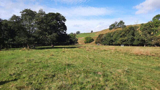
Rising to an elevation of approximately 460 meters (1,509 feet), Toby Hill is part of the larger North Pennines range, characterized by its distinctive rolling hills and rugged terrain. The hill is primarily composed of limestone, resulting in unique geological formations and diverse flora and fauna. It is a designated Site of Special Scientific Interest due to its ecological significance.

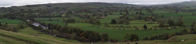
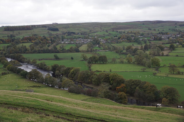
Toby Hill attracts both hikers and nature enthusiasts, as it offers a variety of trails and pathways that wind through its picturesque landscape. The hill's summit provides panoramic vistas of the surrounding countryside, including the nearby River Wear and the historic city of Durham.

In addition to its natural beauty, Toby Hill holds historical significance. It is believed to have been a strategic site during medieval times, with remnants of ancient settlements and fortifications still visible. The hill's rich history contributes to its appeal for those interested in archaeological exploration and heritage tourism.

Access to Toby Hill is available through several footpaths, and there are parking facilities nearby for those driving to the area. It is advised to come prepared with appropriate outdoor gear and to be mindful of the local wildlife and conservation efforts in place to preserve this remarkable natural landmark.

If you have any feedback on the listing, please let us know in the comments section below.
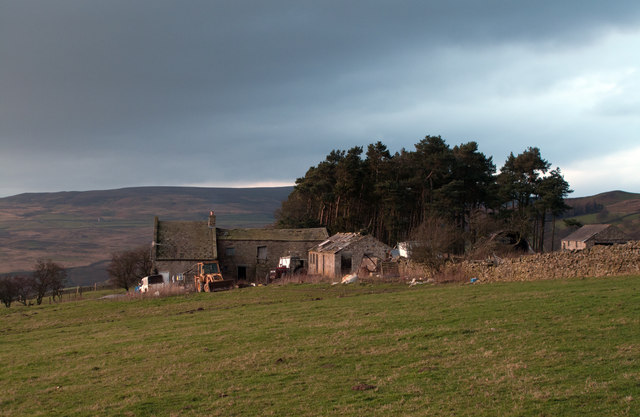
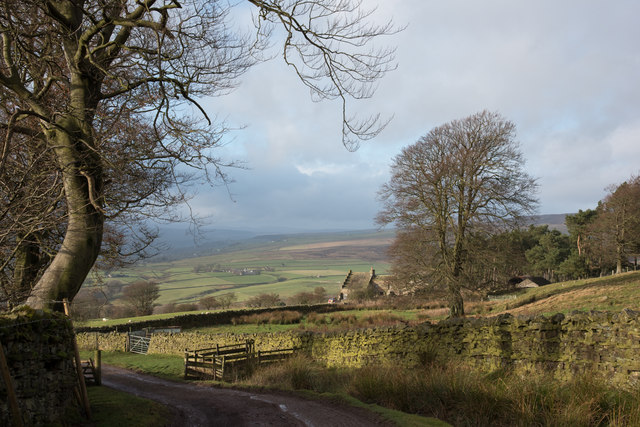
Toby Hill Images

Images are sourced within 2km of 54.615282/-2.0300073 or Grid Reference NY9824. Thanks to Geograph Open Source API. All images are credited.

Nemour Hall Nemour Hall appears in this image as a fairly modest house with a barn attached at the rear; it is in fact revealed to be a quite large building once the front comes into view.
Nemour Hall
Nemour Hall appears in this image as a fairly modest house with a barn attached at the rear; it is in fact revealed to be a quite large building once the front comes into view.
Nemour Hall The unusually named Nemour Hall is seen beyond the tree, right of centre; it lies above fields overlooking the village of Eggleston.
Nemour Hall
The unusually named Nemour Hall is seen beyond the tree, right of centre; it lies above fields overlooking the village of Eggleston.
Teesdale from Egglesburn viewpoint
River Tees at Egglesburn
Pasture adjacent to the River Tees This pasture is crossed while walking on the Teesdale Way walking Trail.
Pasture adjacent to the River Tees
This pasture is crossed while walking on the Teesdale Way walking Trail.
The River Tees on the northern side of Eggleston Bridge
Tees Railway path between Mickleton and Romaldkirk
Tees Railway path close to Mickleton
Roman Road (B6278) Towards Middle End.
Roman Road (B6278)
Towards Middle End.
New housing under construction on the B6278, Eggleston
Village Hall, Eggleston
George V postbox, Hill Top Postbox No. DL12 229.
George V postbox, Hill Top
Postbox No. DL12 229.
Houses on Roman Road, Hill Top Showing position of Postbox No. DL12 229.
Houses on Roman Road, Hill Top
Showing position of Postbox No. DL12 229.
Neamour Lane, Hill Top
Footpath off Roman Road, Hill Top
B6278, Blackton Towards Stanhope.
B6278, Blackton
Towards Stanhope.
East Skears valley
East Skears valley
Show me another place!

Toby Hill is located at Grid Ref: NY9824 (Lat: 54.615282, Lng: -2.0300073)

Unitary Authority: County Durham

Police Authority: Durham

What 3 Words

///brimmed.prowling.wrong. Near Mickleton, Co. Durham

Related Wikis

Egglesburn

Egglesburn is a village in County Durham, Northern England. It is in the Teesdale, Mickleton is on opposite bank of the River Tees. In the 1960s Durham...

Hill Top, Teesdale

Hill Top is a small village in County Durham, in England. It is situated to the north of Eggleston. == References ==

Mickleton railway station

Mickleton railway station was situated on the Tees Valley Railway between Barnard Castle and Middleton-in-Teesdale. It served the village of Mickleton...

Eggleston

Eggleston is a village in County Durham, in England. The population of the civil parish taken at the 2011 Census was 448. It is in the Teesdale, a few...

Nearby Amenities

Located within 500m of 54.615282,-2.0300073
Bus Stop
Bus stop
Naptan AtcoCode: 13007822C
Naptan Bearing: E
Naptan CommonName: Bus stop
Naptan Indicator: east bound
Naptan Landmark: Landmark not known
Naptan NaptanCode: durgagwt
Naptan Notes: Outside Egglesburn House (House Name)- B6282- near road leading to Hill Top- Eggleston
Naptan Street: Street not known
Naptan Verified: no
Source: naptan_import
Lat/Long: 54.6156712/-2.0288471
Bus Stop
Bus stop
Naptan AtcoCode: 13007822G
Naptan Bearing: W
Naptan CommonName: Bus stop
Naptan Indicator: west bound
Naptan Landmark: Landmark not known
Naptan NaptanCode: durgajad
Naptan Notes: Opposite Egglesburn House- B6282- near road leading to Hill Top- Eggleston
Naptan Street: Street not known
Naptan Verified: no
Source: naptan_import
Lat/Long: 54.6155091/-2.027944
Ornelly
Place: farm
Source: OS 1:25k
Lat/Long: 54.6137861/-2.0348486
Toby Hill
Place: farm
Source: OS 1:25k
Lat/Long: 54.6146108/-2.0295003
The data included in this document is from www.openstreetmap.org. The data is made available under ODbL.

Have you been to Toby Hill?

Leave your review of Toby Hill below (or comments, questions and feedback).