Cat Stone Hill

Hill, Mountain in Yorkshire Craven

England

Cat Stone Hill

The Pennine Way near Old Bess Hill
The Pennine Way near Old Bess Hill Credit: Dave Kelly

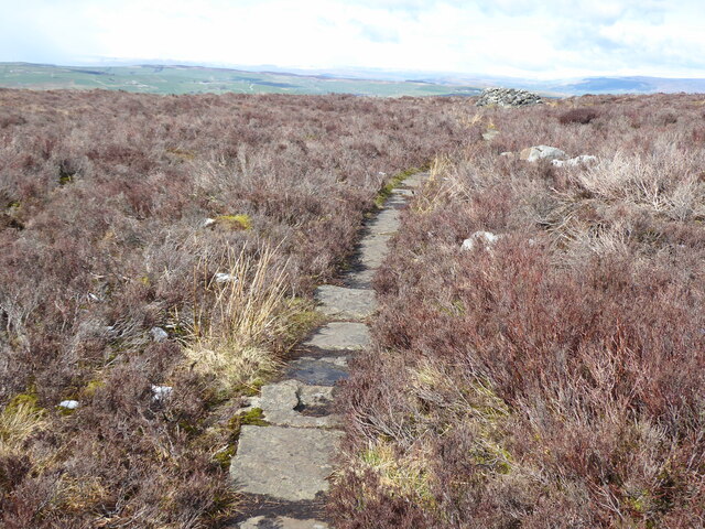
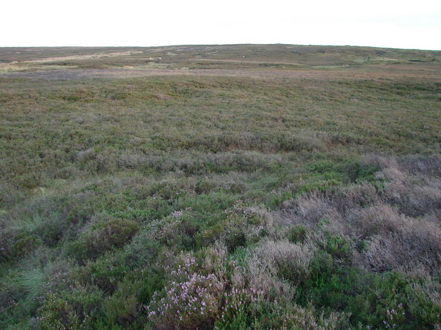
Cat Stone Hill is a prominent geographical feature located in Yorkshire, England. As its name suggests, it is a hill or mountain formation known for its distinctive shape resembling a cat. Situated within the Yorkshire Dales National Park, Cat Stone Hill offers breathtaking views of the surrounding countryside and is a popular destination for nature enthusiasts and hikers.

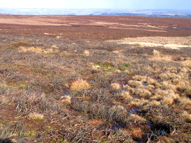
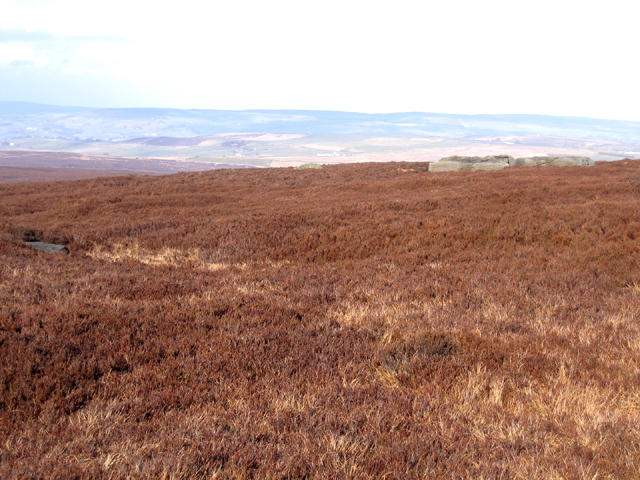
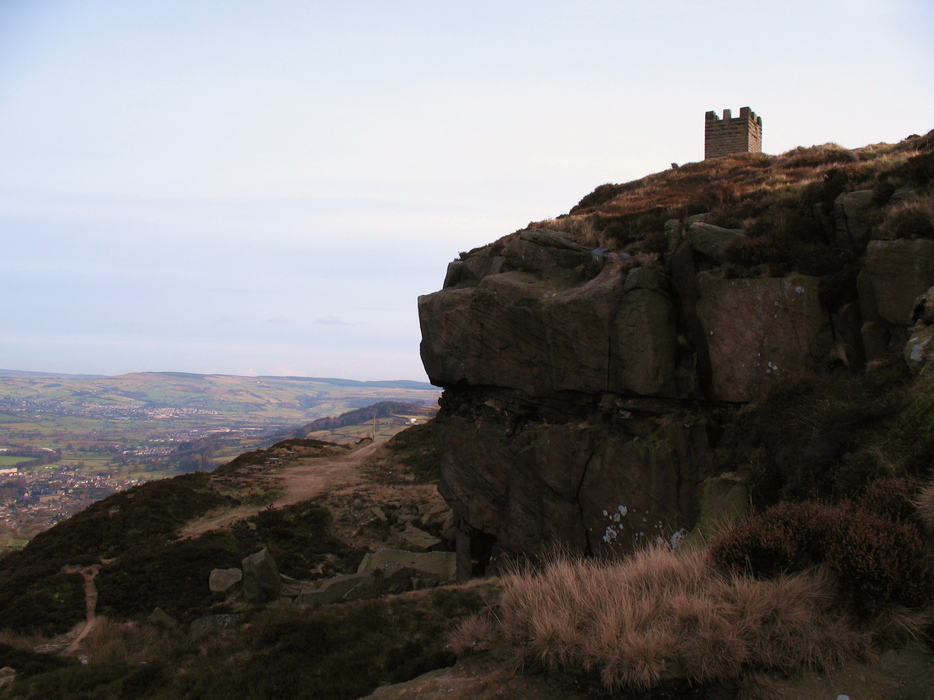
Rising to a height of approximately 400 meters, Cat Stone Hill is composed mainly of Millstone Grit, a coarse-grained sandstone that is characteristic of the region. The hill's unique formation is believed to have been shaped by glacial activity during the last ice age, resulting in its current feline-like appearance.

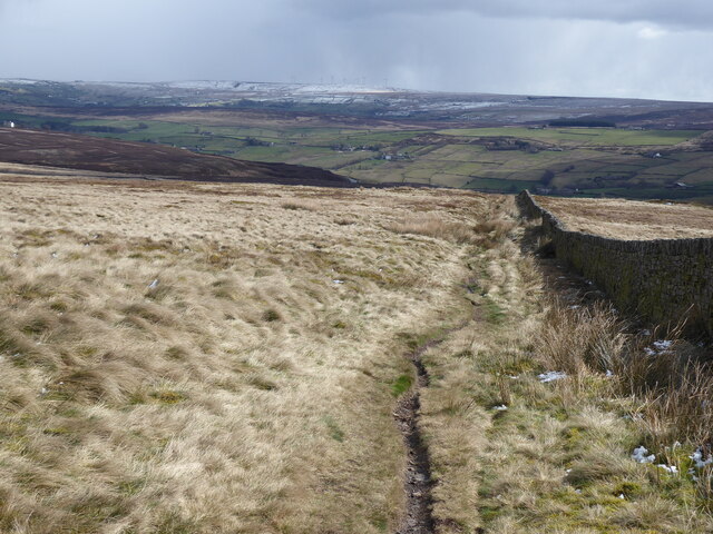
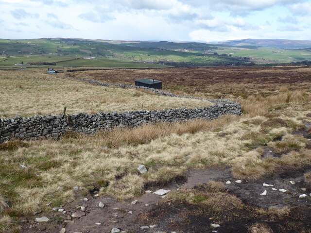
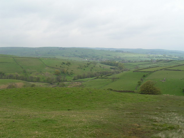
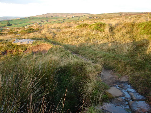
The summit of Cat Stone Hill provides panoramic vistas of the Yorkshire Dales, with rolling green hills, charming valleys, and picturesque villages dotting the landscape. On a clear day, it is possible to see as far as the famous Three Peaks – Ingleborough, Whernside, and Pen-y-ghent – adding to the hill's allure.

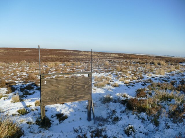
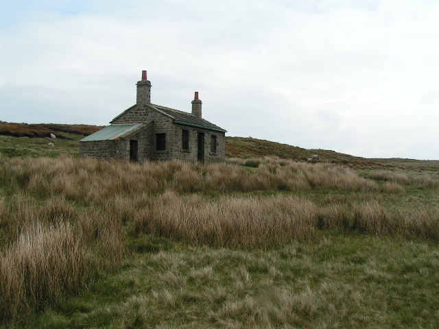
The area surrounding Cat Stone Hill is rich in biodiversity, and visitors may have the chance to spot various wildlife species, including birds of prey, sheep, and rabbits. The hill is also known for its diverse flora, with heather, grasses, and wildflowers adorning its slopes.

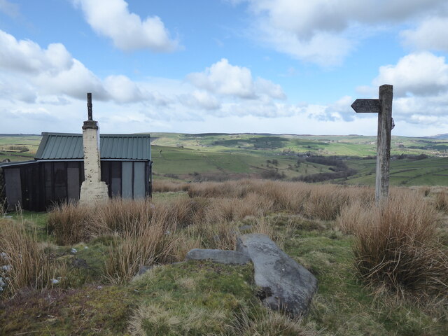
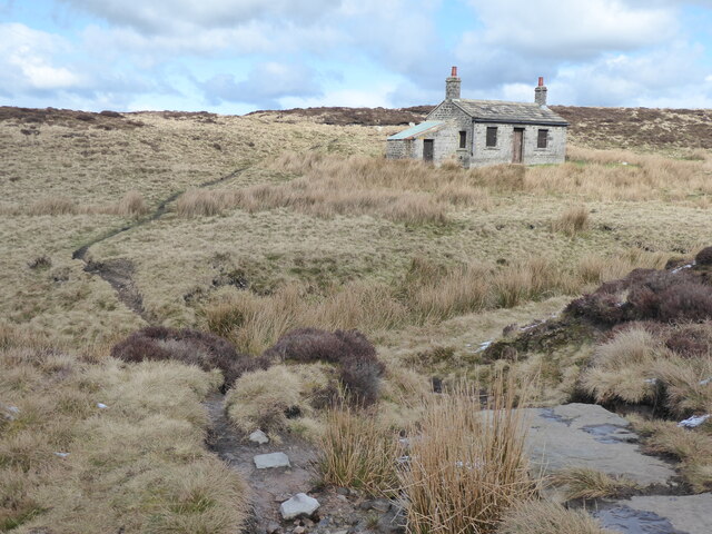
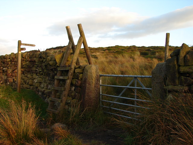
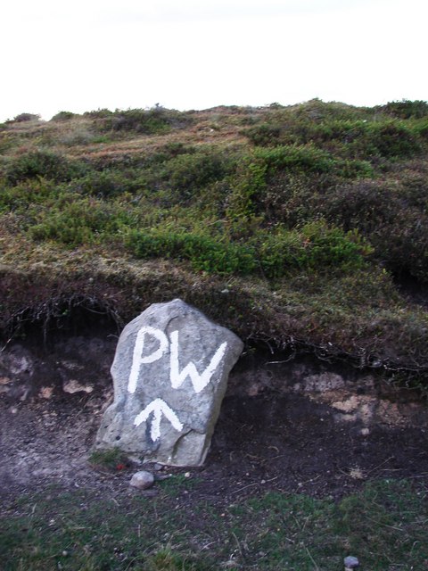
Access to Cat Stone Hill is relatively easy, with several footpaths leading to its summit. The hill attracts both seasoned hikers and casual walkers, offering an opportunity to explore the natural beauty of this corner of Yorkshire. Visitors are advised to wear appropriate footwear and bring plenty of water, as the ascent can be steep in certain sections.

Overall, Cat Stone Hill is a captivating natural landmark that showcases the beauty of Yorkshire's landscape and provides a rewarding experience for those who venture to its summit.

If you have any feedback on the listing, please let us know in the comments section below.

Cat Stone Hill Images

Images are sourced within 2km of 53.856507/-2.0421059 or Grid Reference SD9740. Thanks to Geograph Open Source API. All images are credited.

The Pennine Way near Old Bess Hill
The Pennine Way near Further Dean Hole
The Pennine Way near High End Lowe
The Pennine Way near Brown Hill
The Pennine Way near Cat Stone Hill
Cleared area at the head of a track Where a patch of heather has been cleared, it's usually just to encourage new growth that the birds can feed on. But this one is at the end of a vehicle track (beyond to the north-west is only a foot track to the grouse butts) so I presume it's been cleared as a parking area for SUVs.
Cleared area at the head of a track
Where a patch of heather has been cleared, it's usually just to encourage new growth that the birds can feed on. But this one is at the end of a vehicle track (beyond to the north-west is only a foot track to the grouse butts) so I presume it's been cleared as a parking area for SUVs.
Crystalline snow on Keighley Moor A macro photograph of snow covering a moorland track. The scale of the photo is probably about 5-10 centimetres across. I have rarely seen this form of snow, the formation of which must be related to the temperature when it fell and afterwards. See <a href="https://www.geograph.org.uk/photo/1742465">NO1585 : Large snow crystals on Sron nan Gabhar</a> for another contributor's similar photo, while the description at <a href="https://www.geograph.org.uk/photo/2188648">SY6989 : Frozen Leaf</a> explains the growth of ice crystals.
Crystalline snow on Keighley Moor
A macro photograph of snow covering a moorland track. The scale of the photo is probably about 5-10 centimetres across. I have rarely seen this form of snow, the formation of which must be related to the temperature when it fell and afterwards. See NO1585 : Large snow crystals on Sron nan Gabhar for another contributor's similar photo, while the description at SY6989 : Frozen Leaf explains the growth of ice crystals.
Grouse butt no.2 on Keighley Moor The GPS co-ordinates put this as near as makes no difference on the county boundary between West and North Yorkshire (right & left respectively).
Grouse butt no.2 on Keighley Moor
The GPS co-ordinates put this as near as makes no difference on the county boundary between West and North Yorkshire (right & left respectively).
Shooting Hut, Ickornshaw Moor This shooting hut is just in SD9640 - the sheep are probably in SD9641! The hut is known as the New Stone Hut - see <span class="nowrap"><a title="http://www.cowlingweb.co.uk/oldgallery/displayimage.asp?imageID=1743" rel="nofollow ugc noopener" href="http://www.cowlingweb.co.uk/oldgallery/displayimage.asp?imageID=1743">Link</a><img style="margin-left:2px;" alt="External link" title="External link - shift click to open in new window" src="https://s1.geograph.org.uk/img/external.png" width="10" height="10"/></span> for a picture of the grand opening in 1902. The lean-to appears to be a more modern addition.
Shooting Hut, Ickornshaw Moor
This shooting hut is just in SD9640 - the sheep are probably in SD9641! The hut is known as the New Stone Hut - see LinkExternal link for a picture of the grand opening in 1902. The lean-to appears to be a more modern addition.
View from Eller Hill Looking north from the Pennine Way
View from Eller Hill
Looking north from the Pennine Way
Brown Edge, Keighley Moor, W Yorks view NE from below Maw Stones Hill, with degraded burnt heather moor in the foreground.
Brown Edge, Keighley Moor, W Yorks
view NE from below Maw Stones Hill, with degraded burnt heather moor in the foreground.
Maw Stones Hill, Keighley Moor, W Yorks view N across heather moorland from West Yorkshire into North Yorkshire, with some of the flat maw stones on the right.
Maw Stones Hill, Keighley Moor, W Yorks
view N across heather moorland from West Yorkshire into North Yorkshire, with some of the flat maw stones on the right.
Pennine Way in Style
Sunset on Ickornshaw Moor Just a wonderful feeling. At one with God's wonderful creation! The hut is featured on this square, but I had to stand outside of it to get the whole view.
Sunset on Ickornshaw Moor
Just a wonderful feeling. At one with God's wonderful creation! The hut is featured on this square, but I had to stand outside of it to get the whole view.
View of Ickornshaw Moor What else is there to say!  Taken from near the hut.
View of Ickornshaw Moor
What else is there to say! Taken from near the hut.
Pennine Way near High End Lowe Nicely maintained footpath in this area, possibly due to the large amount of huts along the path.
Pennine Way near High End Lowe
Nicely maintained footpath in this area, possibly due to the large amount of huts along the path.
Towards Long Hill End Taken from the top of a steep rise at the top of the (rarely used) publi footpath at this point.  A tower is visible in the distance.
Towards Long Hill End
Taken from the top of a steep rise at the top of the (rarely used) publi footpath at this point. A tower is visible in the distance.
Stay on the Right Track The PW stands for the Pennine Way.  There are several painted PW's to be found along this route, as well as proper signs as the path is not always well defined.
Stay on the Right Track
The PW stands for the Pennine Way. There are several painted PW's to be found along this route, as well as proper signs as the path is not always well defined.
Show me another place!

Cat Stone Hill is located at Grid Ref: SD9740 (Lat: 53.856507, Lng: -2.0421059)

Division: West Riding

Administrative County: North Yorkshire

District: Craven

Police Authority: North Yorkshire

What 3 Words

///chainsaw.interlude.ended. Near Glusburn, North Yorkshire

Related Wikis

Watersheddles Reservoir

Watersheddles Reservoir is an upland artificial lake in Lancashire, England. The reservoir was opened in 1877 by the Keighley Corporation Water Works,...

The Hitching Stone

The Hitching Stone is a gritstone erratic block on Keighley Moor, North Yorkshire, near Earl Crag and the village of Cowling. It is very close to the...

Cowling, Craven

Cowling is a village, electoral division and civil parish in the Craven district of North Yorkshire, England. It is situated on the borders with the adjacent...

Wainman's Pinnacle

Wainman's Pinnacle, originally built as a folly (and still used as a folly), is a stone obelisk in Sutton-in-Craven, North Yorkshire. It tends to be referred...

Earl Crag

Earl Crag is a gritstone crag and climbing area in Craven, North Yorkshire, England. It is home to Lund's Tower, Wainman's Pinnacle, and The Hitching...

Middleton, Cowling

Middleton is a hamlet in the Craven district of North Yorkshire, England, part of the civil parish of Cowling. It is near the border with West Yorkshire...

Ponden Hall

Ponden Hall is a farmhouse near Stanbury in West Yorkshire, England. It is famous for reputedly being the inspiration for Thrushcross Grange, the home...

Scar Top

Scar Top is a farming hamlet near the tourist village of Haworth in the City of Bradford metropolitan borough, West Yorkshire in England. It is in the...

Nearby Amenities

Located within 500m of 53.856507,-2.0421059
Cairn: small
Lat/Long: 53.8605899/-2.0452539
Shelter
Roof: no
Lat/Long: 53.8578928/-2.0439906
Cairn: small
Lat/Long: 53.8586663/-2.0440415
The data included in this document is from www.openstreetmap.org. The data is made available under ODbL.

Have you been to Cat Stone Hill?

Leave your review of Cat Stone Hill below (or comments, questions and feedback).