Withens Hill

Hill, Mountain in Yorkshire

England

Withens Hill

Trig Point at Little Holder Stones Surprisingly, access across the moor from Stony Edge (above Warland Reservoir) was easier than expected to reach this trig point. I just staedy to the high ground where there was a faint path in places.
Trig Point at Little Holder Stones Credit: Colin Park

Withens Hill is a prominent landmark located in Yorkshire, England. Situated in the South Pennines, it is part of the larger Brontë Country, which is renowned for its stunning natural beauty and literary associations. Withens Hill is classified as a hill rather than a mountain, as it reaches an elevation of 422 meters (1,385 feet).

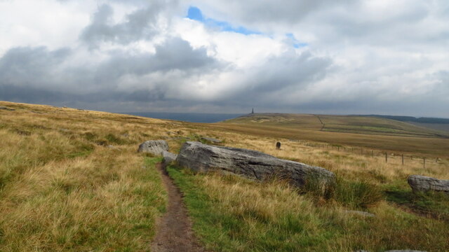
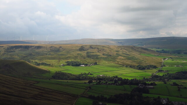
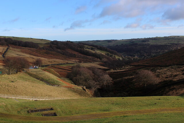
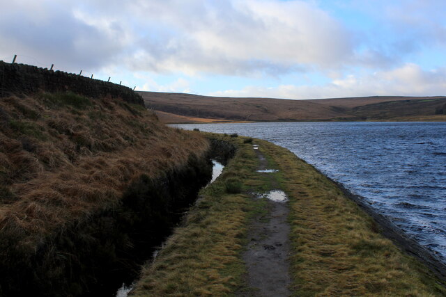
The hill is known for its distinctive shape, featuring a rounded summit and steep slopes covered in heather and grasses. It offers breathtaking panoramic views of the surrounding countryside, including the nearby towns of Haworth and Oxenhope. On a clear day, visitors can see as far as the Yorkshire Dales and the Peak District.

Withens Hill has historical significance, as it is believed to have inspired the landscape descriptions in the works of the famous Brontë sisters. The Brontë family lived in Haworth, a village at the foot of the hill, and it is thought that they often ventured up the hillside for walks and inspiration. The hill also features in Emily Brontë's novel "Wuthering Heights" as the setting for the fictional Wuthering Heights estate.

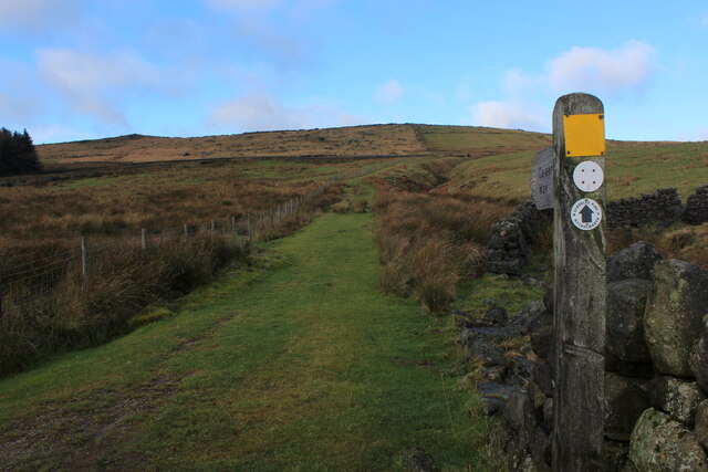
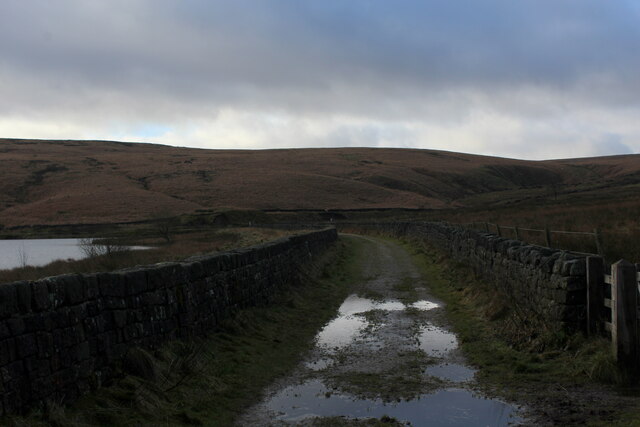
Today, Withens Hill attracts hikers, nature enthusiasts, and literary aficionados who wish to experience the beauty and literary heritage of the area. Several walking trails lead up to the summit, allowing visitors to immerse themselves in the picturesque Yorkshire countryside and connect with the Brontës' literary legacy.

If you have any feedback on the listing, please let us know in the comments section below.
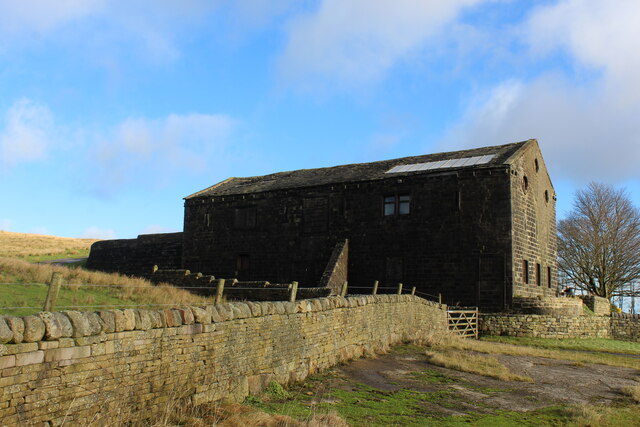
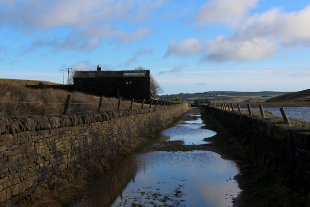
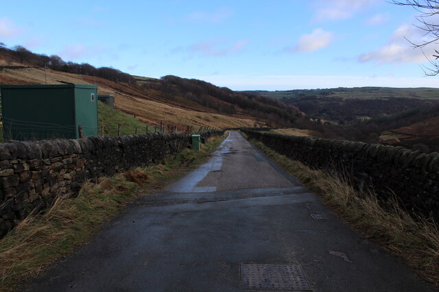
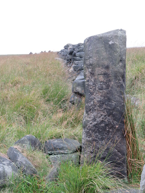
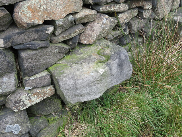
Withens Hill Images

Images are sourced within 2km of 53.705716/-2.0430147 or Grid Reference SD9723. Thanks to Geograph Open Source API. All images are credited.

Trig Point at Little Holder Stones Surprisingly, access across the moor from Stony Edge (above Warland Reservoir) was easier than expected to reach this trig point. I just staedy to the high ground where there was a faint path in places.
Trig Point at Little Holder Stones
Surprisingly, access across the moor from Stony Edge (above Warland Reservoir) was easier than expected to reach this trig point. I just staedy to the high ground where there was a faint path in places.
Holder Stones above Langfield Common These three rock outcrops stand out on this rather featureless barren moorland. My approach was from the trig point to the south and a faint path links the two locations. I continued north picking up a faint path but you do need to jump across the leat before joining the permissive path. It's easier done going north.
Holder Stones above Langfield Common
These three rock outcrops stand out on this rather featureless barren moorland. My approach was from the trig point to the south and a faint path links the two locations. I continued north picking up a faint path but you do need to jump across the leat before joining the permissive path. It's easier done going north.
Leat path between Holder Stones & Withens Clough Head
Pennine Way descending from Bald Scout Hill
Lumbutts from Stoodley Pike Monument
Chinook Helicopter passing close to Stoodley Pike Monument A close encounter!
Chinook Helicopter passing close to Stoodley Pike Monument
A close encounter!
Pennine Way at Doe Stones & view towards Edge End Moor
View towards Stoodley Pike Monument from Dick's Lane
Calderdale Way ascending away from Withens Clough Reservoir The long distance footpath initially heading north, before swinging west towards Withens Gate on the Pennine Way
Calderdale Way ascending away from Withens Clough Reservoir
The long distance footpath initially heading north, before swinging west towards Withens Gate on the Pennine Way
Withens New Road Track beside the western end of Withens Clough Reservoir as darkness closes in.
Withens New Road
Track beside the western end of Withens Clough Reservoir as darkness closes in.
Large Outbuilding beside Pasture House The outbuilding is larger than the farmhouse itself, which is concealed from view behind this bulky edifice.
The complex is located beside Withens Clough Reservoir, and seems to be the only sign of habitation in the vicinity.
The outbuilding appears to be a converted barn in need of some repair.
Passed by on the Calderdale Way long distance footpath.
Large Outbuilding beside Pasture House
The outbuilding is larger than the farmhouse itself, which is concealed from view behind this bulky edifice. The complex is located beside Withens Clough Reservoir, and seems to be the only sign of habitation in the vicinity. The outbuilding appears to be a converted barn in need of some repair. Passed by on the Calderdale Way long distance footpath.
Flooded New Withens Road Approaching Pasture House on the Calderdale Way long distance footpath beside Withens Clough Reservoir
Flooded New Withens Road
Approaching Pasture House on the Calderdale Way long distance footpath beside Withens Clough Reservoir
View from Atop the Dam Wall of Withens Clough Reservoir Looking down Withens Clough towards Cragg Vale
View from Atop the Dam Wall of Withens Clough Reservoir
Looking down Withens Clough towards Cragg Vale
Rudd Lane Access lane heading away from Withens Clough Reservoir towards Cragg Vale.
Adopted by the Calderdale Way long distance footpath.
Rudd Lane
Access lane heading away from Withens Clough Reservoir towards Cragg Vale. Adopted by the Calderdale Way long distance footpath.
Beside Withens Clough Reservoir
Old Boundary Marker in Stoodley Glen, Calderdale Township Boundary Marker above Stoodley Glen and south of Stoodley Lane. Formerly on the boundary of Langfield and Sowerby townships in Halifax parish. It marked the boundary of the Sowerby Ramble, a narrow strip of land along the Calder valley and up Stoodley Glen between Erringden and Stansfield townships and Erringden and Langfield township. Sowerby Ramble was part of Sowerby township but in 1850 it became part of Erringden township, later parish. In 1897 Langfield and Stansfield became part of Todmorden parish and in 1937 this part of Erringden parish also became part of Todmorden parish. 

Milestone Society National ID: YW_LANSOW02pb
Old Boundary Marker in Stoodley Glen, Calderdale
Township Boundary Marker above Stoodley Glen and south of Stoodley Lane. Formerly on the boundary of Langfield and Sowerby townships in Halifax parish. It marked the boundary of the Sowerby Ramble, a narrow strip of land along the Calder valley and up Stoodley Glen between Erringden and Stansfield townships and Erringden and Langfield township. Sowerby Ramble was part of Sowerby township but in 1850 it became part of Erringden township, later parish. In 1897 Langfield and Stansfield became part of Todmorden parish and in 1937 this part of Erringden parish also became part of Todmorden parish. Milestone Society National ID: YW_LANSOW02pb
Old Boundary Marker between Higher Moor and Sunderland Pasture in Hebden Royd parish Township Boundary Marker beside a track between Higher Moor and Sunderland Pasture. On the former boundary of the Sowerby Ramble between Erringden and Sowerby townships in Halifax parish but now entirely in Hebden Royd parish. Inscribed E for Erringden on its face and S for Sowerby on top.

Milestone Society National ID: YW_HEBR01pb
Old Boundary Marker between Higher Moor and Sunderland Pasture in Hebden Royd parish
Township Boundary Marker beside a track between Higher Moor and Sunderland Pasture. On the former boundary of the Sowerby Ramble between Erringden and Sowerby townships in Halifax parish but now entirely in Hebden Royd parish. Inscribed E for Erringden on its face and S for Sowerby on top. Milestone Society National ID: YW_HEBR01pb
Old Boundary Marker between Higher Moor and Sunderland Pasture in Hebden Royd parish Township Boundary Marker built into a wall adjacent to a stile between Higher Moor and Sunderland Pasture. On the former boundary of the Sowerby Ramble between Erringden and Sowerby townships in Halifax parish but now entirely in Hebden Royd parish. Inscribed S for Sowerby township.

Milestone Society National ID: YW_HEBR02pb
Old Boundary Marker between Higher Moor and Sunderland Pasture in Hebden Royd parish
Township Boundary Marker built into a wall adjacent to a stile between Higher Moor and Sunderland Pasture. On the former boundary of the Sowerby Ramble between Erringden and Sowerby townships in Halifax parish but now entirely in Hebden Royd parish. Inscribed S for Sowerby township. Milestone Society National ID: YW_HEBR02pb
Show me another place!

Withens Hill is located at Grid Ref: SD9723 (Lat: 53.705716, Lng: -2.0430147)

Division: West Riding

Unitary Authority: Calderdale

Police Authority: West Yorkshire

What 3 Words

///reserving.pouting.lion. Near Todmorden, West Yorkshire

Related Wikis

Stoodley Pike

Stoodley Pike is a 1,300-foot (400 m) hill in the south Pennines in West Yorkshire in northern England. It is noted for the 121-foot (37 m) Stoodley Pike...

Mankinholes

Mankinholes is a hamlet in the Metropolitan Borough of Calderdale, in West Yorkshire, England. It is situated in the Pennines and the nearest town is Todmorden...

Eastwood, West Yorkshire

Eastwood is a place within the civil parish of Todmorden and Metropolitan Borough of Calderdale, in West Yorkshire, England. It lies 8 miles (12.9 km)...

Eastwood (L&Y) railway station

Eastwood Railway Station served the village of Eastwood in the civil parish of Todmorden, West Yorkshire, England. The station opened with the line on...

Nearby Amenities

Located within 500m of 53.705716,-2.0430147
Barrier: stile
Material: stone
Note: Check west of junction
Stile: squeezer
Lat/Long: 53.7052378/-2.0361998
Barrier: stile
Material: stone
Source: survey;gps
Stile: squeezer
Lat/Long: 53.7047808/-2.0379278
Barrier: stile
Material: stone
Source: survey
Stile: squeezer
Lat/Long: 53.7045291/-2.0389839
Barrier: stile
Material: stone
Source: survey;gps
Stile: squeezer
Lat/Long: 53.7043775/-2.0396383
Fixme: longer than this?
Lat/Long: 53.7053301/-2.0360938
Barrier: stile
Lat/Long: 53.7060868/-2.0356555
Barrier: stile
Lat/Long: 53.7061612/-2.0354801
Withens Gate
Natural: saddle
Lat/Long: 53.7040916/-2.0494976
Barrier: stile
Material: wood
Source: survey;gps
Stile: stepover
Lat/Long: 53.7039838/-2.0418343
Barrier: stile
Material: wood
Source: survey;gps
Stile: stepover
Lat/Long: 53.7037591/-2.0424579
Barrier: stile
Material: wood
Note: stepover wood stile through squeezer
Source: survey;gps
Stile: stepover
Lat/Long: 53.7052363/-2.0362047
Barrier: stile
Material: stone
Source: survey;gps
Stile: squeezer
Lat/Long: 53.7050015/-2.0370385
Barrier: stile
Material: stone
Source: survey;gps
Stile: squeezer
Lat/Long: 53.7045883/-2.0386995
The data included in this document is from www.openstreetmap.org. The data is made available under ODbL.

Have you been to Withens Hill?

Leave your review of Withens Hill below (or comments, questions and feedback).