Barr Hill

Hill, Mountain in Aberdeenshire

Scotland

Barr Hill

Mill of Mundurno? Behind Premier Inn & restaurant bearing that name
Mill of Mundurno? Credit: Jim Smillie

Located in Aberdeenshire, Scotland, Barr Hill is a prominent hill that stands at an elevation of approximately 488 meters (1,601 feet). It is situated within the Cairngorms National Park, a protected area renowned for its stunning landscapes and rich biodiversity. Barr Hill is part of a range of hills known as the Mounth, which stretches from Glen Clova to the River Dee.

The hill offers breathtaking panoramic views of the surrounding countryside, including the Grampian Mountains, and is a popular destination for hikers, nature enthusiasts, and photographers. Its distinct shape, with a gentle slope on one side and steep cliffs on the other, adds to its allure.

Barr Hill is abundant in flora and fauna, with heather-covered slopes and patches of woodland providing habitats for various species of birds, mammals, and insects. It is not uncommon to spot red deer, mountain hares, and ptarmigans in the area.

Access to Barr Hill is possible through a network of well-marked hiking trails, with the most popular route starting from the nearby village of Tarland. The ascent is moderate, making it suitable for both experienced walkers and beginners, but proper hiking gear and navigation skills are recommended.

The hill's historical significance is also worth mentioning, as it is believed to have been a site of ancient settlements and ceremonial activities. Archaeological remains, including stone circles and cairns, have been discovered in the vicinity, providing insights into the area's past.

Overall, Barr Hill is a captivating natural landmark that showcases the beauty and diversity of the Scottish Highlands, offering visitors a chance to immerse themselves in its scenic splendor and rich cultural heritage.

If you have any feedback on the listing, please let us know in the comments section below.
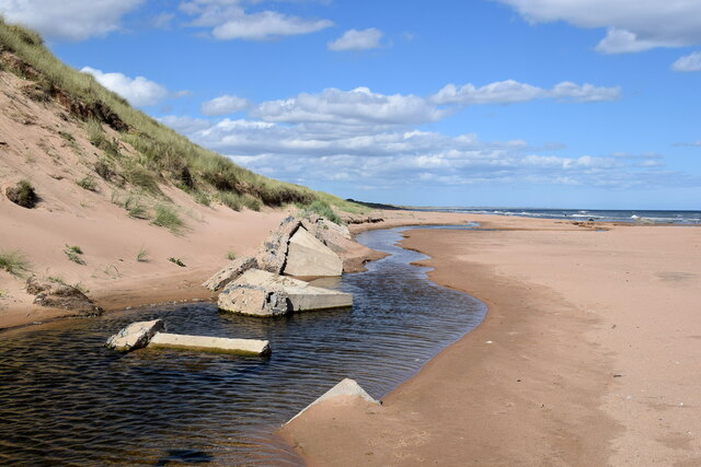
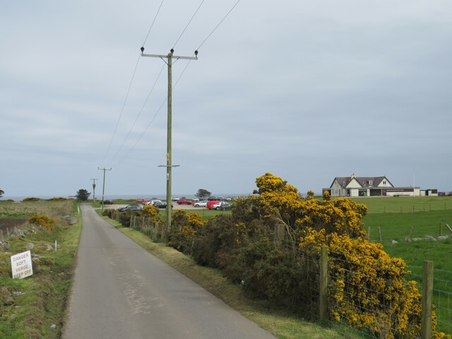
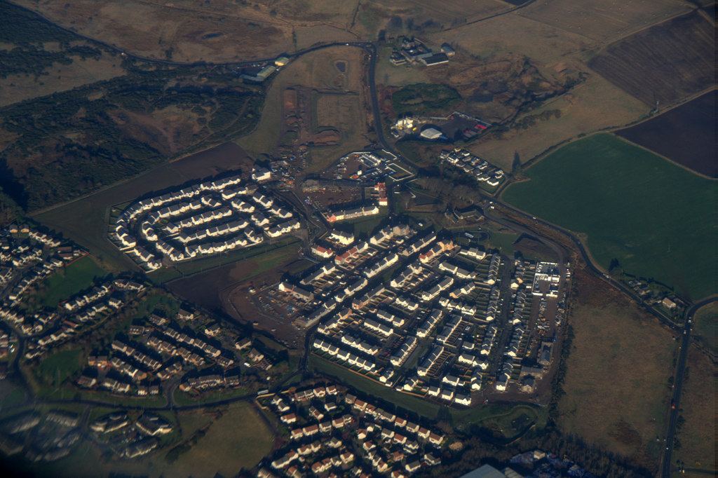
Barr Hill Images

Images are sourced within 2km of 57.208334/-2.0881809 or Grid Reference NJ9413. Thanks to Geograph Open Source API. All images are credited.

Mill of Mundurno? Behind Premier Inn & restaurant bearing that name
Mill of Mundurno?
Behind Premier Inn & restaurant bearing that name
View from Beer Garden Towards retail park on a grey Sunday morning
View from Beer Garden
Towards retail park on a grey Sunday morning
Premier Inn: Bridge of Don Mill of Mundurno restaurant on left
Premier Inn: Bridge of Don
Mill of Mundurno restaurant on left
Not such a black dog Black Dog rock has recently become encrusted with tiny barnacles with its true colour just showing on top of the head of the dog-shaped rock.   The prominent rock is part of the Belhelvie basic intrusion, being igneous bedrock formed between 485.4 and 443.8 million years ago during the Ordovician period.
Not such a black dog
Black Dog rock has recently become encrusted with tiny barnacles with its true colour just showing on top of the head of the dog-shaped rock. The prominent rock is part of the Belhelvie basic intrusion, being igneous bedrock formed between 485.4 and 443.8 million years ago during the Ordovician period.
Burn of Mundurno meets the sea The burn frequently changes course as it reaches the beach and it has recently cut into the adjacent sand dune and unearthed the remains of some buried tank traps.  The burn begins its journey to the sea at Corby Loch.  'Mundurno' means 'stony moor' according to Celtic Place-names in Aberdeenshire by John Milne.
Burn of Mundurno meets the sea
The burn frequently changes course as it reaches the beach and it has recently cut into the adjacent sand dune and unearthed the remains of some buried tank traps. The burn begins its journey to the sea at Corby Loch. 'Mundurno' means 'stony moor' according to Celtic Place-names in Aberdeenshire by John Milne.
Driveway through Balgownie Links, near Aberdeen A driveway through a golf course at Balgownie Links, on Scotland's North Sea Coast on the outskirts of Aberdeen.
Driveway through Balgownie Links, near Aberdeen
A driveway through a golf course at Balgownie Links, on Scotland's North Sea Coast on the outskirts of Aberdeen.
Driveway through Balgownie Links, near Aberdeen A driveway through a golf course at Balgownie Links, on Scotland's North Sea Coast near Aberdeen.
Driveway through Balgownie Links, near Aberdeen
A driveway through a golf course at Balgownie Links, on Scotland's North Sea Coast near Aberdeen.
Gorse bushes at Balgownie Links near Aberdeen A golf course driveway passing between gorse bushes at Balgownie Links, on the northern outskirts of Aberdeen.
Gorse bushes at Balgownie Links near Aberdeen
A golf course driveway passing between gorse bushes at Balgownie Links, on the northern outskirts of Aberdeen.
Murcar Links Golf Club, near Bridge of Don, Aberdeen The clubhouse at Murcar Links Golf Club, near Aberdeen on Scotland's North Sea coast.
Murcar Links Golf Club, near Bridge of Don, Aberdeen
The clubhouse at Murcar Links Golf Club, near Aberdeen on Scotland's North Sea coast.
Golf club access road near Bridge of Don, Aberdeen An access road leading to a golf club on Scotland's North Sea coast, close to Aberdeen.  The golf club's clubhouse is to the right of the image.

In the foreground, gorse bushes are flowering yellow.
Golf club access road near Bridge of Don, Aberdeen
An access road leading to a golf club on Scotland's North Sea coast, close to Aberdeen. The golf club's clubhouse is to the right of the image. In the foreground, gorse bushes are flowering yellow.
Golf club access road near Bridge of Don, Aberdeen An access driveway leading to a golf club on Balgownie Links, on Scotland's North Sea coast on the outskirts of Aberdeen.  The golf club's club house is visible to the right of the image.  In the foreground, gorse bushes are in flower along both sides of the driveway.
Golf club access road near Bridge of Don, Aberdeen
An access driveway leading to a golf club on Balgownie Links, on Scotland's North Sea coast on the outskirts of Aberdeen. The golf club's club house is visible to the right of the image. In the foreground, gorse bushes are in flower along both sides of the driveway.
Isolated house near Bridge of Don, Aberdeen An isolated house near Bridge of Don, on the northern outskirts of Aberdeen.
Isolated house near Bridge of Don, Aberdeen
An isolated house near Bridge of Don, on the northern outskirts of Aberdeen.
Berryhill Crescent, Bridge of Don, Aberdeen Berryhill Crescent is a recently-built road leading into an industrial estate at Bridge of Don, in the northern outskirts of Aberdeen on Scotland's North Sea coast.
Berryhill Crescent, Bridge of Don, Aberdeen
Berryhill Crescent is a recently-built road leading into an industrial estate at Bridge of Don, in the northern outskirts of Aberdeen on Scotland's North Sea coast.
Minor road at Bridge of Don, Aberdeen An un-named minor road at Bridge of Don, in the northern outskirts of Aberdeen on Scotland's North Sea coast.  The sea and an offshore wind farm can be seen in the distance.

The road leads to an isolated house and a golf club.
Minor road at Bridge of Don, Aberdeen
An un-named minor road at Bridge of Don, in the northern outskirts of Aberdeen on Scotland's North Sea coast. The sea and an offshore wind farm can be seen in the distance. The road leads to an isolated house and a golf club.
Berryhill Crescent, Bridge of Don, Aberdeen Berryhill Crescent is a recently-built road leading to an industrial estate at Bridge of Don, on the outskirts of Aberdeen on Scotland's North Sea coast.
Berryhill Crescent, Bridge of Don, Aberdeen
Berryhill Crescent is a recently-built road leading to an industrial estate at Bridge of Don, on the outskirts of Aberdeen on Scotland's North Sea coast.
Murcar Cottages at Bridge of Don, Aberdeen Murcar Cottages are situated on the northern outskirts of Aberdeen, on Scotland's North Sea coast.
Murcar Cottages at Bridge of Don, Aberdeen
Murcar Cottages are situated on the northern outskirts of Aberdeen, on Scotland's North Sea coast.
B999 road at Bridge of Don, Aberdeen A view of the B999 road at Bridge of Don, in the northern outskirts of Aberdeen.  The B999 begins at this point.
B999 road at Bridge of Don, Aberdeen
A view of the B999 road at Bridge of Don, in the northern outskirts of Aberdeen. The B999 begins at this point.
Bridge of Don Retail Park, Aberdeen Bridge of Don Retail Park is an out-of-town shopping development on the northern outskirts of Aberdeen.
Bridge of Don Retail Park, Aberdeen
Bridge of Don Retail Park is an out-of-town shopping development on the northern outskirts of Aberdeen.
Show me another place!

Barr Hill is located at Grid Ref: NJ9413 (Lat: 57.208334, Lng: -2.0881809)

Unitary Authority: City of Aberdeen

Police Authority: North East

What 3 Words

///pages.guesswork.locked. Near Balmedie, Aberdeenshire

Related Wikis

Dubford, Aberdeen

Dubford is a housing estate of approximately 550 homes, north of Denmore within the Bridge of Don suburb in the north of Aberdeen, Scotland. Dubford takes...

Murcar Links Golf Club

Murcar Links Golf Club is a golf club in northern Aberdeen, Scotland, to the north of the Royal Aberdeen Golf Club. The 18-hole, par 71, 6,516 yard course...

Hermes F.C.

Hermes Junior Football Club are a Scottish football club from Bridge of Don, an area of the city of Aberdeen. Founded in 1968 by pupils of Robert Gordon...

Blackdog

Blackdog is a hamlet approximately 2 miles north of the limits of the Aberdeen City council area in Scotland. The nearby area serves as a shooting ground...

Nearby Amenities

Located within 500m of 57.208334,-2.0881809
Traffic Calming: rumble_strip
Lat/Long: 57.2046079/-2.0870976
Mundurno
Name Gd: Am Monadh Dùrnach
Place: hamlet
Lat/Long: 57.2079135/-2.0934363
Power: pole
Lat/Long: 57.2045151/-2.0922508
Power: pole
Lat/Long: 57.2043633/-2.0913087
Power: pole
Lat/Long: 57.2041412/-2.0902652
Power: pole
Lat/Long: 57.203907/-2.0891546
Material: wood
Power: pole
Lat/Long: 57.2052827/-2.0859834
Material: wood
Power: pole
Lat/Long: 57.2048428/-2.086495
Material: wood
Power: pole
Lat/Long: 57.2044007/-2.0869741
Material: wood
Power: pole
Lat/Long: 57.204051/-2.0874187
Power: pole
Lat/Long: 57.2086815/-2.0956169
Power: pole
Lat/Long: 57.208543/-2.0948454
Power: pole
Lat/Long: 57.2084055/-2.094076
Power: pole
Lat/Long: 57.208256/-2.0931522
Power: pole
Lat/Long: 57.2080889/-2.0925309
Material: wood
Power: pole
Lat/Long: 57.2079129/-2.0918995
Material: wood
Power: pole
Lat/Long: 57.2081812/-2.0912031
Material: wood
Power: pole
Lat/Long: 57.2084649/-2.0904824
Material: wood
Power: pole
Lat/Long: 57.2087123/-2.0897779
Material: wood
Power: pole
Lat/Long: 57.2089916/-2.0890653
Material: wood
Power: pole
Lat/Long: 57.2092225/-2.0884643
Material: wood
Power: pole
Lat/Long: 57.2097173/-2.0871244
Material: wood
Power: pole
Lat/Long: 57.2101879/-2.086767
Material: wood
Power: pole
Lat/Long: 57.2107475/-2.0865011
Power: pole
Lat/Long: 57.2072422/-2.0957225
Power: pole
Lat/Long: 57.2072466/-2.0954484
Power: pole
Lat/Long: 57.2072356/-2.0939988
Power: pole
Lat/Long: 57.207218/-2.0925797
Traffic Calming: rumble_strip
Lat/Long: 57.2038501/-2.0879395
Traffic Calming: rumble_strip
Lat/Long: 57.2038811/-2.0879052
Traffic Calming: rumble_strip
Lat/Long: 57.2039125/-2.0878702
Traffic Calming: rumble_strip
Lat/Long: 57.203951/-2.0878275
Traffic Calming: rumble_strip
Lat/Long: 57.2039858/-2.0877888
Traffic Calming: rumble_strip
Lat/Long: 57.204022/-2.0877486
Traffic Calming: rumble_strip
Lat/Long: 57.2040598/-2.0877065
Traffic Calming: rumble_strip
Lat/Long: 57.2040952/-2.0876673
Traffic Calming: rumble_strip
Lat/Long: 57.2041333/-2.0876249
Traffic Calming: rumble_strip
Lat/Long: 57.2041697/-2.0875845
Traffic Calming: rumble_strip
Lat/Long: 57.2042073/-2.0875427
Traffic Calming: rumble_strip
Lat/Long: 57.2042443/-2.0875016
Traffic Calming: rumble_strip
Lat/Long: 57.2042847/-2.0874566
Traffic Calming: rumble_strip
Lat/Long: 57.2043233/-2.0874138
Traffic Calming: rumble_strip
Lat/Long: 57.2043628/-2.0873699
Traffic Calming: rumble_strip
Lat/Long: 57.2044011/-2.0873274
Traffic Calming: rumble_strip
Lat/Long: 57.2044405/-2.0872836
Traffic Calming: rumble_strip
Lat/Long: 57.2044826/-2.0872368
Traffic Calming: rumble_strip
Lat/Long: 57.2045221/-2.0871929
Traffic Calming: rumble_strip
Lat/Long: 57.2045689/-2.0871409
Traffic Calming: rumble_strip
Lat/Long: 57.20465/-2.0870477
Traffic Calming: rumble_strip
Lat/Long: 57.2046935/-2.086996
Traffic Calming: rumble_strip
Lat/Long: 57.20474/-2.0869407
Traffic Calming: rumble_strip
Lat/Long: 57.2047821/-2.0868908
Traffic Calming: rumble_strip
Lat/Long: 57.2048255/-2.0868392
Traffic Calming: rumble_strip
Lat/Long: 57.20487/-2.0867865
Traffic Calming: rumble_strip
Lat/Long: 57.2049157/-2.0867321
Traffic Calming: rumble_strip
Lat/Long: 57.2049625/-2.0866766
Traffic Calming: rumble_strip
Lat/Long: 57.2050068/-2.0866239
Traffic Calming: rumble_strip
Lat/Long: 57.2050526/-2.0865696
Traffic Calming: rumble_strip
Lat/Long: 57.2050996/-2.0865138
Traffic Calming: rumble_strip
Lat/Long: 57.2051507/-2.0864531
Traffic Calming: rumble_strip
Lat/Long: 57.2052011/-2.0863933
Traffic Calming: rumble_strip
Lat/Long: 57.2052525/-2.0863323
Traffic Calming: rumble_strip
Lat/Long: 57.2053036/-2.0862716
Traffic Calming: rumble_strip
Lat/Long: 57.2053641/-2.0861998
Traffic Calming: rumble_strip
Lat/Long: 57.2054221/-2.0861309
Traffic Calming: rumble_strip
Lat/Long: 57.2054781/-2.0860643
Traffic Calming: rumble_strip
Lat/Long: 57.2055375/-2.0859939
Traffic Calming: rumble_strip
Lat/Long: 57.2055946/-2.0859261
The data included in this document is from www.openstreetmap.org. The data is made available under ODbL.

Have you been to Barr Hill?

Leave your review of Barr Hill below (or comments, questions and feedback).