Middle Tongue
Hill, Mountain in Yorkshire Richmondshire
England
Middle Tongue

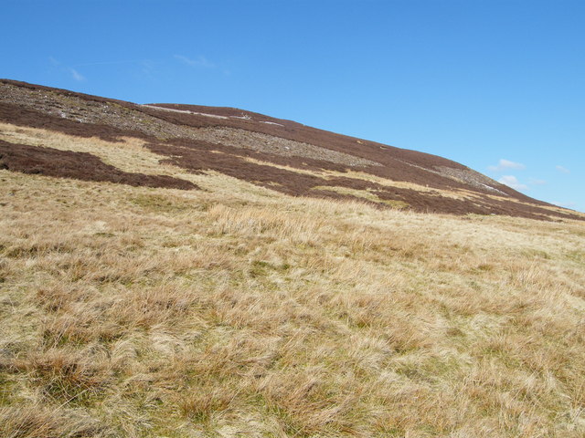
Middle Tongue is a prominent hill located in the county of Yorkshire, England. Rising to an elevation of approximately 453 meters (1,486 feet), it is considered one of the notable peaks in the region. Situated within the picturesque North York Moors National Park, Middle Tongue offers breathtaking panoramic views of the surrounding countryside.
Covered in lush greenery, the hill is predominantly made up of moorland, characterized by heather, grasses, and scattered patches of woodland. This diverse ecosystem supports a variety of wildlife, including birds, mammals, and insects, making it a haven for nature enthusiasts and birdwatchers.
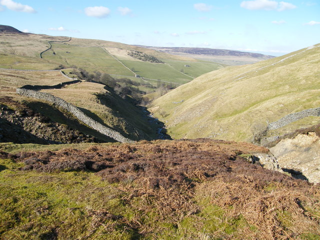
Middle Tongue is a popular destination for hikers and walkers, with several well-marked trails leading to its summit. One of the most popular routes is the Cleveland Way, a long-distance footpath that winds its way through the national park. The climb to the top can be challenging, but the rewarding vistas make it well worth the effort.
At the summit, visitors are greeted with a breathtaking view of the surrounding landscape, including the rolling hills, valleys, and villages that dot the countryside. On a clear day, it is even possible to catch a glimpse of the distant coastline of the North Sea.
For those seeking a tranquil escape from the hustle and bustle of everyday life, Middle Tongue offers a serene and remote setting, allowing visitors to immerse themselves in the natural beauty of the Yorkshire countryside.
If you have any feedback on the listing, please let us know in the comments section below.
Middle Tongue Images
Images are sourced within 2km of 54.355335/-2.0854228 or Grid Reference SD9495. Thanks to Geograph Open Source API. All images are credited.


![High Oxnop Recently renovated house [see my 2000 photograph] on the hillside above Oxnop Gill.](https://s1.geograph.org.uk/geophotos/02/57/70/2577097_2c47292d.jpg)


Middle Tongue is located at Grid Ref: SD9495 (Lat: 54.355335, Lng: -2.0854228)
Division: North Riding
Administrative County: North Yorkshire
District: Richmondshire
Police Authority: North Yorkshire
What 3 Words
///lightbulb.cello.contact. Near Leyburn, North Yorkshire
Nearby Locations
Related Wikis

Satron
Satron is a hamlet in Swaledale, North Yorkshire, England. It lies 0.6 miles (1 km) south west of Gunnerside on the opposite bank of the River Swale. It...

Ivelet
Ivelet is a hamlet in the Yorkshire Dales, North Yorkshire, England about a mile west of Gunnerside in Swaledale. Ivelet Bridge crosses the River Swale...

Gunnerside
Gunnerside is a village in North Yorkshire, England. It is situated in Swaledale, on the B6270 road, 3 miles (5 km) east of Muker and 6 miles (10 km) west...

Crackpot, North Yorkshire
Crackpot is a village in Swaledale, North Yorkshire, England. Its name derives from the Old English kraka (crow) and the Viking word pot (usually a pit...

Newbiggin, Askrigg
Newbiggin is a hamlet very close to Askrigg, North Yorkshire, England. Another Newbiggin is only about 7 miles (11 km) away. The hamlet consists of eight...

Low Row
Low Row is a village in Swaledale, in the Yorkshire Dales, North Yorkshire, England. It lies about 3 miles west of Reeth and is between Healaugh and Gunnerside...

Muker
Muker is a village and civil parish at the western end of Swaledale in North Yorkshire, England, within the Yorkshire Dales. The parish includes the hamlets...

Low Abbotside
Low Abbotside is a civil parish in the Richmondshire district of North Yorkshire, England. It is a rural parish on the north side of Wensleydale. There...
Related Videos
A Journey Through Swaledale: Tan Hill to Reeth
With an industrial heritage of coal and lead mining, Swaledale sits at the northwest tip of the Yorkshire Dales. With no disrespect ...
Maiden Castle, Swaledale. Wildcamp on the Fells.
Quick tab out to Maiden Castle in October 21. Surprisingly warm night. Up early for a brew and back home. Solitude and sunshine.
Have you been to Middle Tongue?
Leave your review of Middle Tongue below (or comments, questions and feedback).