Barham

Settlement in Kent Canterbury

England

Barham

South Barham Farm
South Barham Farm Credit: N Chadwick

Barham is a small village located in the county of Kent, England. Situated about 8 miles south-east of Canterbury, it falls within the district of Dover. With a population of just over 1,000 residents, Barham is known for its picturesque setting and charming rural character.

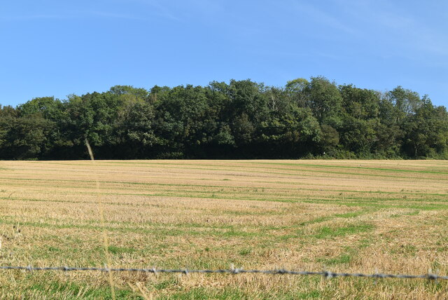
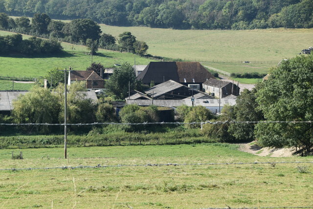
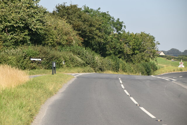
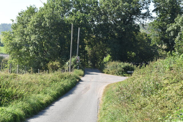
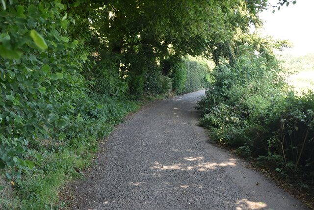
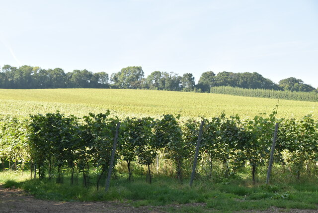
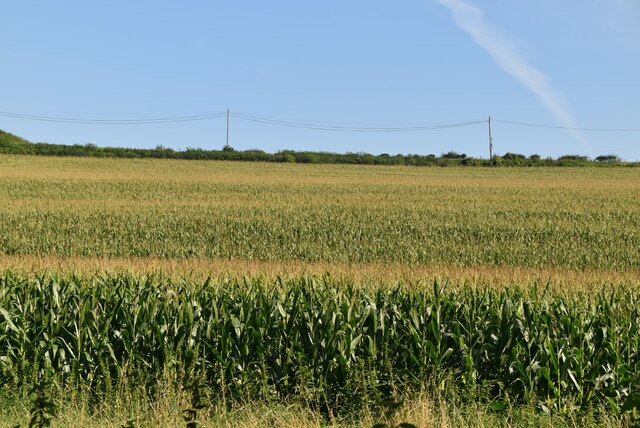
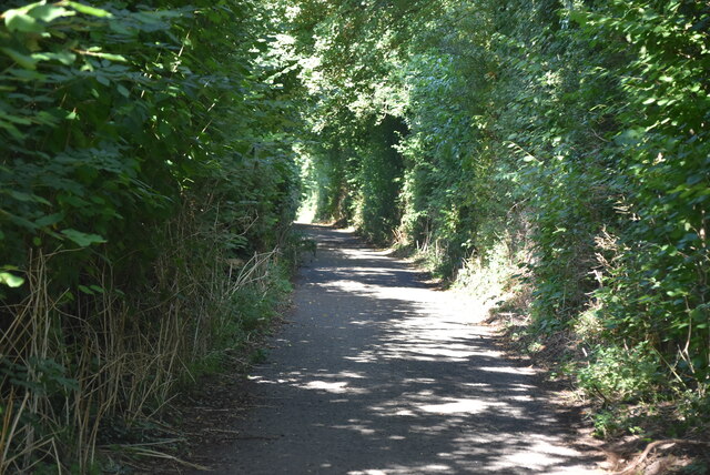
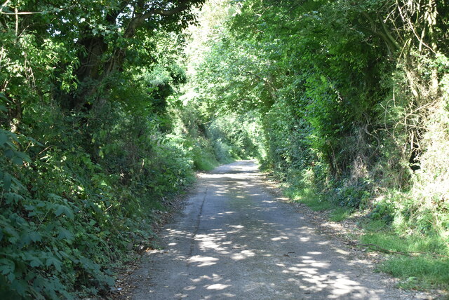
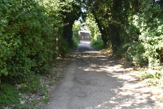
The village is surrounded by beautiful countryside, offering stunning views of the rolling hills and farmland. It is a popular destination for nature lovers and hikers, with several walking trails and paths that crisscross the area. The nearby Barham Downs provide ample opportunities for outdoor activities, such as cycling, horse riding, and birdwatching.

Barham features a range of amenities for its residents and visitors. The village has a primary school, a church, a village hall, and a local pub, which serves as a social hub for the community. There are also a few small businesses, including a post office and a convenience store, providing essential services.

The village has a rich history, with evidence of human habitation dating back to the Roman era. The nearby Barham Court, a Grade I listed building, is a notable historic site. It was once a manor house and is now a private residence. Other historical landmarks in the area include the medieval St. John the Baptist Church and several old cottages that showcase the traditional Kentish architectural style.

Overall, Barham offers a peaceful and idyllic setting, making it an attractive place for those seeking a rural lifestyle, while still being within reach of major towns and cities in Kent.

If you have any feedback on the listing, please let us know in the comments section below.

Barham Images

Images are sourced within 2km of 51.206915/1.157308 or Grid Reference TR2050. Thanks to Geograph Open Source API. All images are credited.

South Barham Farm
South Barham Farm
Breach Down
Breach Down
South Barham Farm
South Barham Farm
South Barham Farm
South Barham Farm
Elham Valley Rd
Elham Valley Rd
South Barham Hill
South Barham Hill
An old chalk pit
An old chalk pit
South Barham Rd
South Barham Rd
South Barham Rd
South Barham Rd
Farmland
Farmland
South Barham Rd
South Barham Rd
South Barham Road
South Barham Road
South Barham Rd
South Barham Rd
Heasland Barn Barham is a village in the Elham Valley about 6 miles SE of Canterbury.
Wikipedia: <span class="nowrap"><a title="https://en.wikipedia.org/wiki/Barham,_Kent" rel="nofollow ugc noopener" href="https://en.wikipedia.org/wiki/Barham,_Kent">Link</a><img style="margin-left:2px;" alt="External link" title="External link - shift click to open in new window" src="https://s1.geograph.org.uk/img/external.png" width="10" height="10"/></span>
Heasland Barn
Barham is a village in the Elham Valley about 6 miles SE of Canterbury. Wikipedia: LinkExternal link
Ford Cottage Barham is a village in the Elham Valley about 6 miles SE of Canterbury.
Wikipedia: <span class="nowrap"><a title="https://en.wikipedia.org/wiki/Barham,_Kent" rel="nofollow ugc noopener" href="https://en.wikipedia.org/wiki/Barham,_Kent">Link</a><img style="margin-left:2px;" alt="External link" title="External link - shift click to open in new window" src="https://s1.geograph.org.uk/img/external.png" width="10" height="10"/></span>
Ford Cottage
Barham is a village in the Elham Valley about 6 miles SE of Canterbury. Wikipedia: LinkExternal link
Lochee Villas Barham is a village in the Elham Valley about 6 miles SE of Canterbury.
Wikipedia: <span class="nowrap"><a title="https://en.wikipedia.org/wiki/Barham,_Kent" rel="nofollow ugc noopener" href="https://en.wikipedia.org/wiki/Barham,_Kent">Link</a><img style="margin-left:2px;" alt="External link" title="External link - shift click to open in new window" src="https://s1.geograph.org.uk/img/external.png" width="10" height="10"/></span>
Lochee Villas
Barham is a village in the Elham Valley about 6 miles SE of Canterbury. Wikipedia: LinkExternal link
Show me another place!

Barham is located at Grid Ref: TR2050 (Lat: 51.206915, Lng: 1.157308)

Administrative County: Kent

District: Canterbury

Police Authority: Kent

What 3 Words

///captures.veered.stub. Near Barham, Kent

Related Wikis

Barham, Kent

Barham is a village and civil parish in the City of Canterbury district of Kent, England. Barham village is approximately 6 miles (10 km) south-east from...

Barham railway station

Barham was a station on the Elham Valley Railway. It opened in 1887 and closed to passengers in 1940 and freight in 1947. == History == The station opened...

Heart's Delight, City of Canterbury

Heart's Delight is a settlement located near Barham in Kent, England. There is a similarly-known settlement near Sittingbourne in the Swale district of...

Black Mill, Barham

Black Mill or Barham Downs Mill was a smock mill at Barham, Kent, England which was accidentally burnt down in 1970 while under restoration. == History... ==

Nearby Amenities

Located within 500m of 51.206915,1.157308
Barham
Is In: Kent,England,UK
Place: village
Wikidata: Q1836548
Lat/Long: 51.2044715/1.1569061
Post Box
Collection Times: Mo-Fr 09:00; Sa 07:00
Operator: Royal Mail
Operator Wikidata: Q638098
Post Box Mounting: wall
Post Box Type: wall
Postal Code: CT4
Ref: CT4 178
Royal Cypher: GR
Royal Cypher Wikidata: Q33102273
Source: survey
Lat/Long: 51.2073311/1.1609282
Pub
The Duke of Cumberland
Addr City: Canterbury
Addr County: Kent
Addr Postcode: CT4 6NY
Addr Street: The Street
Addr Village: Barham
Fhrs Id: 1152898
Phone: +44 1227 831396
Source Addr Postcode: http://www.dukeofcumberland.co.uk/contacts.htm
Source Phone: Sign on side of building.
Source Website: Sign on side of building.
Website: https://www.dukeofcumberland.co.uk/
Lat/Long: 51.2073836/1.1588659
Crossing
Crossing: uncontrolled
Crossing Ref: zebra
Lat/Long: 51.206741/1.1573876
Post Box
Collection Times: Mo-Fr 17:00; Sa 11:30
Operator: Royal Mail
Operator Wikidata: Q638098
Post Box Mounting: metal_post
Post Box Type: lamp
Postal Code: CT4
Ref: CT4 250
Royal Cypher: EIIR
Royal Cypher Wikidata: Q33102113
Lat/Long: 51.2043817/1.1573262
Bicycle Parking
Bicycle Parking: stands
Capacity: 6
Covered: no
Sponsor: Spokes East Kent Cycle Campaign
Lat/Long: 51.2062026/1.1574189
Barham
Historic Railway: station
Railway: site
Source: npe
Wikidata: Q86757099
Lat/Long: 51.2038245/1.1550051
Bus Stop
Primary School
Naptan AtcoCode: 2400A043340A
Naptan Bearing: N
Naptan CommonName: Primary School
Naptan Indicator: adj
Naptan Landmark: Primary School
Naptan NaptanCode: kntdtpga
Naptan Street: Valley Road
Naptan Verified: no
Public Transport: platform
Ref: kntdtpga
Source: naptan_import
Source Date: 2018-08-20T11:49:00
Lat/Long: 51.206529/1.1572924
Townhall
Barham Village Hall
Addr City: Canterbury
Addr Place: Barham
Addr Postcode: CT4 6NX
Addr Street: Valley Road
Lat/Long: 51.2042923/1.1565928
Recycling
Recycling Cans: yes
Recycling Glass Bottles: yes
Lat/Long: 51.2043979/1.1573124
Bus Stop
Primary School
Bus: yes
Naptan AtcoCode: 240099594
Naptan Bearing: S
Naptan CommonName: Primary School
Naptan Indicator: opp
Naptan Landmark: Primary School
Naptan NaptanCode: kntgptwg
Naptan Street: Valley Road
Naptan Verified: no
Public Transport: platform
Ref: kntgptwg
Source: naptan_import
Source Date: 2018-08-20T11:51:00
Lat/Long: 51.2063874/1.1575405
Bus Stop
Brickfield Road
Local Ref: opp
Naptan AtcoCode: 2400A043310A
Naptan Bearing: N
Naptan BusStopType: MKD
Naptan CommonName: Brickfield Road
Naptan Indicator: opp
Naptan Landmark: Brickfield Road
Naptan NaptanCode: kntdtpdp
Naptan RevisionNumber: 4
Naptan Status: act
Naptan Street: Valley Road
Naptan Verified: no
Public Transport: platform
Ref: kntdtpdp
Source: naptan_import
Source Date: 2018-06-26
Lat/Long: 51.2024626/1.1569855
Bus Stop
The Grove
Bus: yes
Local Ref: adj
Naptan AtcoCode: 2400A043330A
Naptan Bearing: S
Naptan BusStopType: MKD
Naptan CommonName: The Grove
Naptan Indicator: adj
Naptan Landmark: The Grove
Naptan NaptanCode: kntdtpdw
Naptan RevisionNumber: 4
Naptan Status: act
Naptan Street: Valley Road
Naptan Verified: no
Public Transport: platform
Ref: kntdtpdw
Source: naptan_import
Source Date: 2018-06-26
Lat/Long: 51.2033816/1.1572632
Turning Circle
Lat/Long: 51.2049444/1.159262
Power: pole
Lat/Long: 51.2033614/1.1601046
Barrier: stile
Lat/Long: 51.2086752/1.1562054
Barrier: stile
Lat/Long: 51.2113192/1.1565005
Post Office
Barham Post Office
Addr City: Barham
Addr Postcode: CT4 6NX
Addr Street: Valley Road
Brand: Post Office
Brand Wikidata: Q1783168
Ref Pol Id: 131451
Lat/Long: 51.2041943/1.1570047
Barrier: stile
Lat/Long: 51.2099344/1.1572578
Barrier: stile
Source: visual_estimate
Lat/Long: 51.2110851/1.1554672
Tourism: viewpoint
Lat/Long: 51.2069491/1.1515125
Barham Village Green
Tourism: picnic_site
Lat/Long: 51.2066777/1.1579551
Generator Method: photovoltaic
Generator Orientation: 239
Generator Output Electricity: yes
Generator Solar Modules: 23
Generator Source: solar
Generator Type: solar_photovoltaic_panel
Location: roof
Power: generator
Lat/Long: 51.2109146/1.1543021
Generator Method: photovoltaic
Generator Orientation: 280
Generator Output Electricity: yes
Generator Solar Modules: 6
Generator Source: solar
Generator Type: solar_photovoltaic_panel
Location: roof
Power: generator
Lat/Long: 51.2038396/1.1558423
Generator Method: photovoltaic
Generator Orientation: 100
Generator Output Electricity: yes
Generator Solar Modules: 8
Generator Source: solar
Generator Type: solar_photovoltaic_panel
Location: roof
Power: generator
Lat/Long: 51.2038401/1.1559174
Generator Method: photovoltaic
Generator Orientation: 206
Generator Output Electricity: yes
Generator Solar Modules: 16
Generator Source: solar
Generator Type: solar_photovoltaic_panel
Location: roof
Power: generator
Lat/Long: 51.2028943/1.1578788
Generator Method: photovoltaic
Generator Orientation: 150
Generator Output Electricity: yes
Generator Solar Modules: 10
Generator Source: solar
Generator Type: solar_photovoltaic_panel
Location: roof
Power: generator
Lat/Long: 51.2109915/1.1544181
Generator Method: photovoltaic
Generator Orientation: 176
Generator Output Electricity: yes
Generator Solar Modules: 4
Generator Source: solar
Generator Type: solar_photovoltaic_panel
Location: roof
Power: generator
Lat/Long: 51.2063667/1.1553387
Generator Method: photovoltaic
Generator Orientation: 81
Generator Output Electricity: yes
Generator Solar Modules: 16
Generator Source: solar
Generator Type: solar_photovoltaic_panel
Location: roof
Power: generator
Lat/Long: 51.2030737/1.1567375
Generator Method: photovoltaic
Generator Orientation: 169
Generator Output Electricity: yes
Generator Source: solar
Generator Type: solar_photovoltaic_panel
Location: roof
Power: generator
Lat/Long: 51.2042484/1.1567563
Generator Method: photovoltaic
Generator Orientation: 190
Generator Output Electricity: yes
Generator Solar Modules: 9
Generator Source: solar
Generator Type: solar_photovoltaic_panel
Location: roof
Power: generator
Lat/Long: 51.2051441/1.1572887
Generator Method: photovoltaic
Generator Orientation: 190
Generator Output Electricity: yes
Generator Solar Modules: 7
Generator Source: solar
Generator Type: solar_photovoltaic_panel
Location: roof
Power: generator
Lat/Long: 51.2051592/1.1571687
Generator Method: photovoltaic
Generator Orientation: 251
Generator Output Electricity: yes
Generator Solar Modules: 10
Generator Source: solar
Generator Type: solar_photovoltaic_panel
Location: roof
Power: generator
Lat/Long: 51.2104071/1.1547714
Generator Method: photovoltaic
Generator Orientation: 150
Generator Output Electricity: yes
Generator Solar Modules: 6
Generator Source: solar
Generator Type: solar_photovoltaic_panel
Location: roof
Power: generator
Lat/Long: 51.2108663/1.1543832
Man Made: water_tap
Lat/Long: 51.2054743/1.1630815
Defibrillator
Access: yes
Defibrillator Location: Located in entrance archway
Emergency: defibrillator
Indoor: no
Lat/Long: 51.2065984/1.1619048
The data included in this document is from www.openstreetmap.org. The data is made available under ODbL.

Have you been to Barham?

Leave your review of Barham below (or comments, questions and feedback).