Ramsden Hill

Hill, Mountain in Lancashire

England

Ramsden Hill

Rough pasture and wood east of Shawforth
Rough pasture and wood east of Shawforth Credit: John H Darch

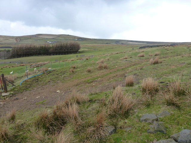
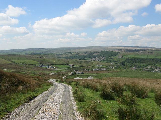
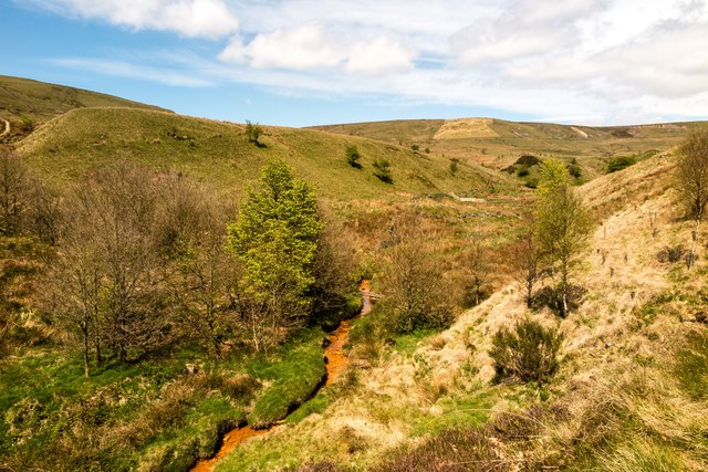
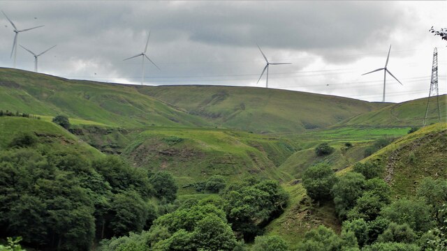
Ramsden Hill is a prominent hill located in Lancashire, England. Rising to an elevation of approximately 305 meters (1,000 feet), it offers breathtaking panoramic views of the surrounding countryside. Situated in the borough of Pendle, Ramsden Hill is part of the Pennines, a range of hills and mountains that runs through northern England.

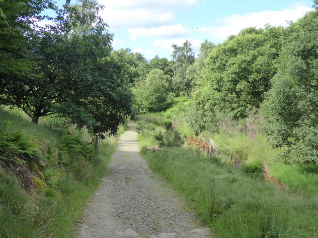
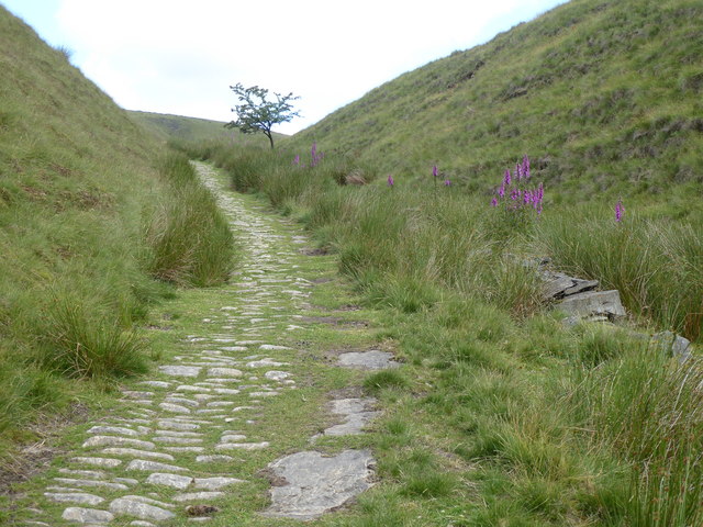
The hill is covered in lush green vegetation, with a diverse range of plant species, including heather, bracken, and various types of grasses. This makes it a popular destination for nature enthusiasts and hikers, who can explore the numerous footpaths and trails that crisscross the hillside.

Ramsden Hill is also home to a variety of wildlife, including rabbits, foxes, and a wide range of bird species. Birdwatchers often flock to the hill to catch a glimpse of rare and migratory birds that pass through the area.

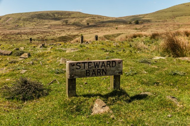
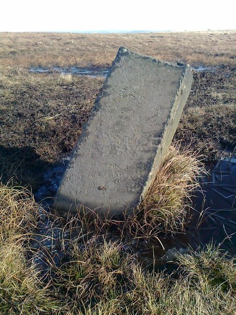
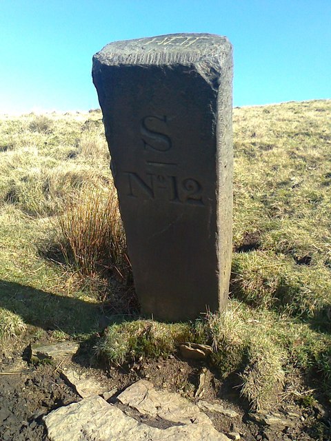
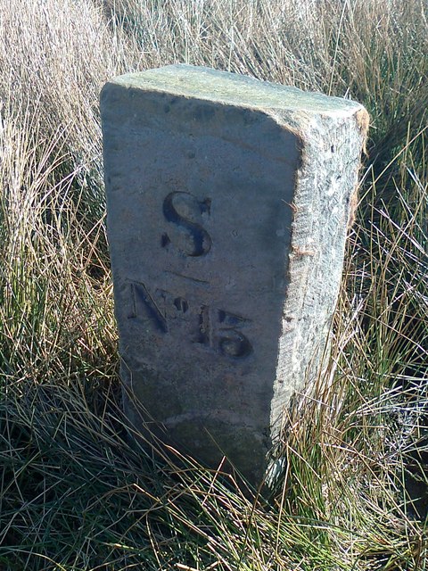
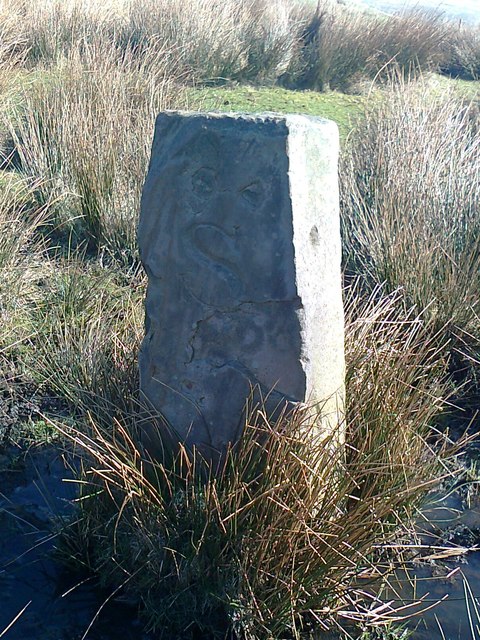
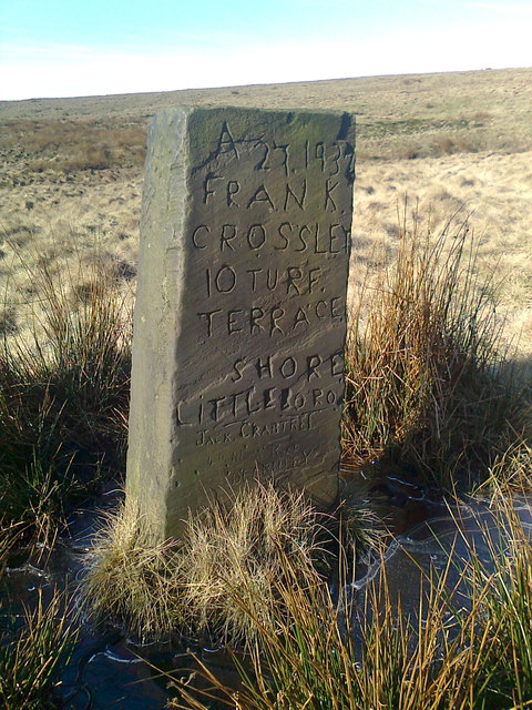
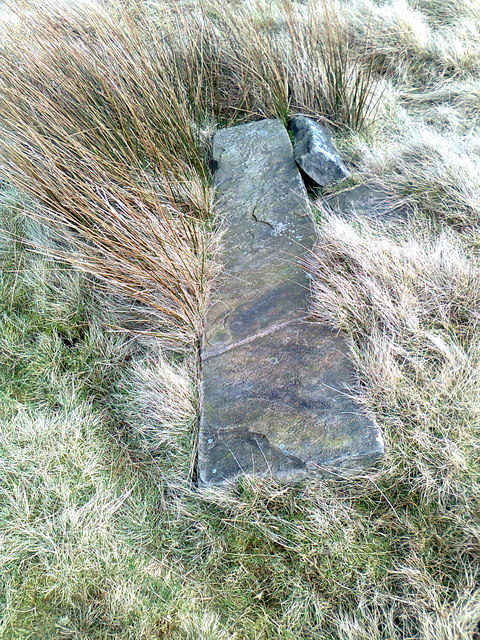
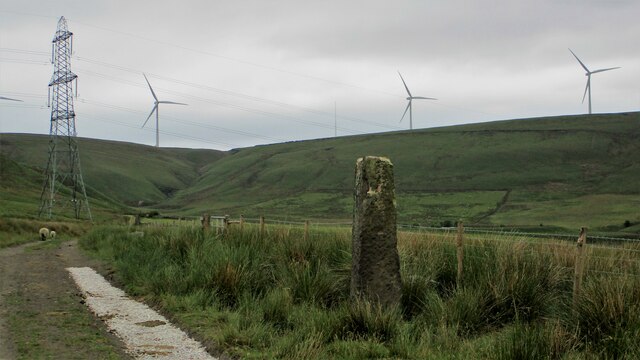
At the summit of Ramsden Hill, there is a small stone marker indicating the peak and providing information about the hill's history. The marker also affords visitors with stunning views of the surrounding Lancashire countryside, with rolling hills, picturesque valleys, and distant towns visible in the distance.

In addition to its natural beauty, Ramsden Hill has historical significance. It is believed that the hill was once used as a lookout point during the Anglo-Saxon period, providing strategic advantages for early settlers. Today, it serves as a place for locals and tourists alike to enjoy the tranquility and natural splendor of Lancashire's countryside.

If you have any feedback on the listing, please let us know in the comments section below.
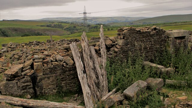
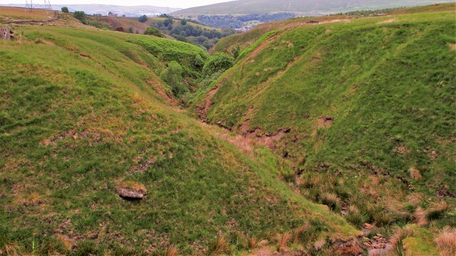
Ramsden Hill Images

Images are sourced within 2km of 53.681584/-2.1291208 or Grid Reference SD9120. Thanks to Geograph Open Source API. All images are credited.

Rough pasture and wood east of Shawforth
Vaccary Walling at Lower Trough
Descending to Shawforth from Knowsley
Steward Barn The remains of Steward Barn above Watergrove Reservoir.
Steward Barn
The remains of Steward Barn above Watergrove Reservoir.
Higher Slack Brook Higher Slack Brook above Watergrove Reservoir.
Higher Slack Brook
Higher Slack Brook above Watergrove Reservoir.
Old Boundary Marker on Stubley Cross Hill, Todmorden Parish Parish Boundary Marker in parish of Todmorden (Calderdale District), Stubley Cross Hill, 700m south east of Long Causeway Path.

Surveyed

Milestone Society National ID: YW_TODLIT03pb
Old Boundary Marker on Stubley Cross Hill, Todmorden Parish
Parish Boundary Marker in parish of Todmorden (Calderdale District), Stubley Cross Hill, 700m south east of Long Causeway Path. Surveyed Milestone Society National ID: YW_TODLIT03pb
The Pennine Bridleway Mary Towneley loop near Watergrove Reservoir
Old Boundary Marker Estate Boundary Marker on Brown Wardle Hill, on the west flank of Middle Hill. On the boundary of Whitworth and Wardle, now Whitworth and Rochdale. Inscribed S / ― / No 12 on its centre face.

Milestone Society National ID: LA_WHIWAR17em
Old Boundary Marker
Estate Boundary Marker on Brown Wardle Hill, on the west flank of Middle Hill. On the boundary of Whitworth and Wardle, now Whitworth and Rochdale. Inscribed S / ― / No 12 on its centre face. Milestone Society National ID: LA_WHIWAR17em
Old Boundary Marker Estate Boundary Marker on Brown Wardle Hill, on the west flank of Middle Hill. On the boundary of Whitworth and Wardle, now Whitworth and Rochdale. Inscribed S / ― / No 13 on its centre face.

Milestone Society National ID: LA_WHIWAR18em
Old Boundary Marker
Estate Boundary Marker on Brown Wardle Hill, on the west flank of Middle Hill. On the boundary of Whitworth and Wardle, now Whitworth and Rochdale. Inscribed S / ― / No 13 on its centre face. Milestone Society National ID: LA_WHIWAR18em
Old Boundary Marker Estate Boundary Marker on Brown Wardle Hill, 150 metres north of Middle Hill Quarries. On the boundary of Whitworth and Wardle, now Whitworth and Rochdale. Inscribed H and S on opposite faces.

Milestone Society National ID: LA_WHIWAR19em
Old Boundary Marker
Estate Boundary Marker on Brown Wardle Hill, 150 metres north of Middle Hill Quarries. On the boundary of Whitworth and Wardle, now Whitworth and Rochdale. Inscribed H and S on opposite faces. Milestone Society National ID: LA_WHIWAR19em
Old Boundary Marker east of Stubley Cross Hill Uninscribed Parish Boundary Marker east of Stubley Cross Hill. Plenty of 20C graffiti including the culprit's address! On the former boundary of Wuerdale and Wardle and Blatchinworth and Calderbrook townships in Rochdale parish, both separate parishes from 1866. From 1894 on the boundary of Wardle and Littleborough parishes. From 1974 an unparished area in Rochdale.

Milestone Society National ID: LA_WARLIT05pb
Old Boundary Marker east of Stubley Cross Hill
Uninscribed Parish Boundary Marker east of Stubley Cross Hill. Plenty of 20C graffiti including the culprit's address! On the former boundary of Wuerdale and Wardle and Blatchinworth and Calderbrook townships in Rochdale parish, both separate parishes from 1866. From 1894 on the boundary of Wardle and Littleborough parishes. From 1974 an unparished area in Rochdale. Milestone Society National ID: LA_WARLIT05pb
Old Boundary Marker Fallen and uninscribed Parish Boundary Marker at Stubley Cross Hill, 800 metres southeast of Long Causeway Path. On the former boundary of Walsden, West Riding and Shore, Lancashire; now Todmorden, Calderdale district and an unparished area of Rochdale district. 

Milestone Society National ID: YW_TODLIT02pb
Old Boundary Marker
Fallen and uninscribed Parish Boundary Marker at Stubley Cross Hill, 800 metres southeast of Long Causeway Path. On the former boundary of Walsden, West Riding and Shore, Lancashire; now Todmorden, Calderdale district and an unparished area of Rochdale district. Milestone Society National ID: YW_TODLIT02pb
White Slack Clough View from Strines Lane to the very steep sided Cloughs South of Ramsden Clough. White Slack Clough is the one on the left, the other is unnamed
White Slack Clough
View from Strines Lane to the very steep sided Cloughs South of Ramsden Clough. White Slack Clough is the one on the left, the other is unnamed
Jubilee & Bottoms Mills View North from Allescholes Road
Jubilee & Bottoms Mills
View North from Allescholes Road
Guide Stoop on White Slack Gate View past wayside marker stone to Horse Pasture Clough
Guide Stoop on White Slack Gate
View past wayside marker stone to Horse Pasture Clough
White Slack Remains A Grade II listed building on White Slack Gate
White Slack Remains
A Grade II listed building on White Slack Gate
Unnamed clough North of Cranberry Dam This clough joins with White Slack Clough towards Ramsden Wood
Unnamed clough North of Cranberry Dam
This clough joins with White Slack Clough towards Ramsden Wood
Show me another place!

Ramsden Hill is located at Grid Ref: SD9120 (Lat: 53.681584, Lng: -2.1291208)

Unitary Authority: Rochdale

Police Authority: Greater Manchester

What 3 Words

///notion.gears.ditching. Near Walsden, West Yorkshire

Related Wikis

Walsden railway station

Walsden railway station (; WOLZ-dən) serves the village of Walsden, Todmorden in West Yorkshire, England, on the edge of the Pennines. It is served by...

Walsden

Walsden (; WOLZ-dən) is a large village in the civil parish of Todmorden in the Metropolitan Borough of Calderdale, West Yorkshire, England. It was historically...

Shawforth

Shawforth ( SHAW-fərth) is a ward in the township of Whitworth within the Rossendale borough of Lancashire, England. It lies amongst the South Pennines...

Summit Tunnel

Summit Tunnel in England is one of the world's oldest railway tunnels. It was constructed between 1838 and 1841 by the Manchester and Leeds Railway Company...

Nearby Amenities

Located within 500m of 53.681584,-2.1291208
Rough Hill
Created By: Potlatch 0.4c
Natural: peak
Lat/Long: 53.6791814/-2.1347056
Generator Method: wind_turbine
Generator Output Electricity: yes
Generator Source: wind
Generator Type: horizontal_axis
Power: generator
Source: survey
Source Geometry: DigitalGlobe-Standard
Lat/Long: 53.6795773/-2.1285363
Generator Method: wind_turbine
Generator Output Electricity: yes
Generator Source: wind
Generator Type: horizontal_axis
Power: generator
Source: survey
Source Geometry: DigitalGlobe-Standard
Lat/Long: 53.6811659/-2.131358
The data included in this document is from www.openstreetmap.org. The data is made available under ODbL.

Have you been to Ramsden Hill?

Leave your review of Ramsden Hill below (or comments, questions and feedback).