Kelstedge

Settlement in Derbyshire North East Derbyshire

England

Kelstedge

Barley field by Lant Lane Part of the plateau of farmland between the Amber and Derwent valleys.
Barley field by Lant Lane Credit: Bill Boaden

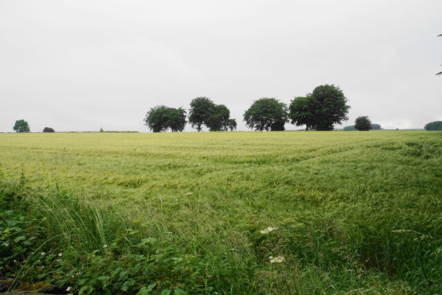
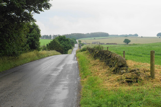
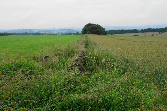
Kelstedge is a small village located in the county of Derbyshire, in the East Midlands region of England. Situated near the town of Ashover and just a few miles away from the Peak District National Park, Kelstedge benefits from its picturesque surroundings and access to beautiful natural landscapes.

The village itself is comprised of a handful of residential properties, with a population of approximately 200 residents. Kelstedge is known for its peaceful and tranquil atmosphere, making it an ideal place for those seeking a quieter lifestyle away from the hustle and bustle of city living.

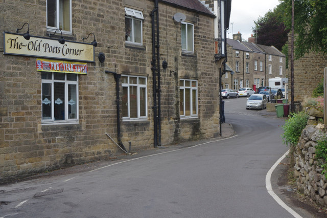
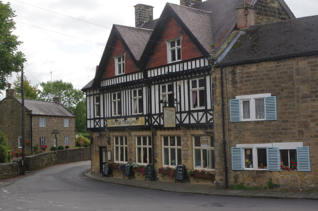
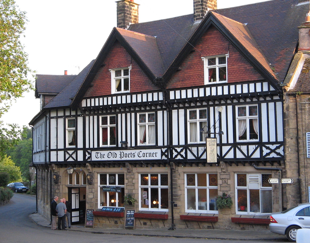
Despite its small size, Kelstedge offers a sense of community and a range of amenities. The village features a local pub, The Kelstedge Inn, where residents and visitors can enjoy traditional British cuisine and a selection of beverages. Additionally, there are several nearby shops and services available in Ashover, which provide for the everyday needs of the community.

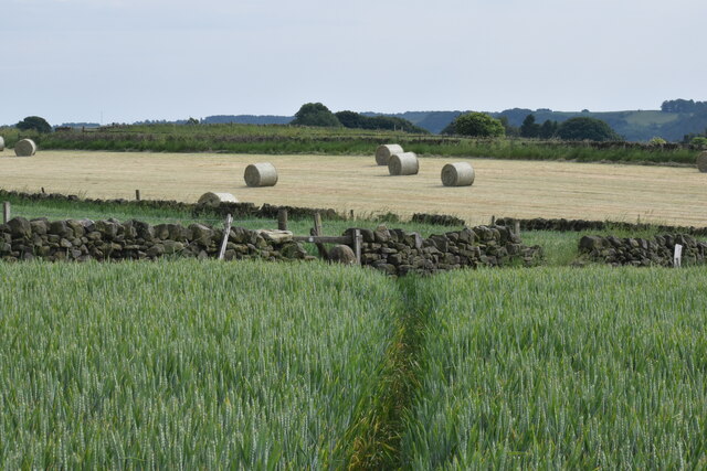
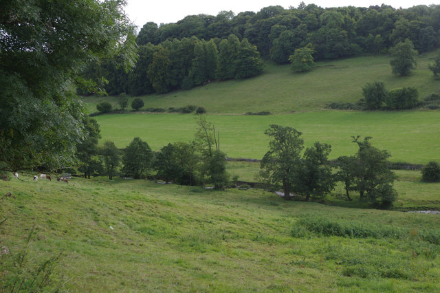
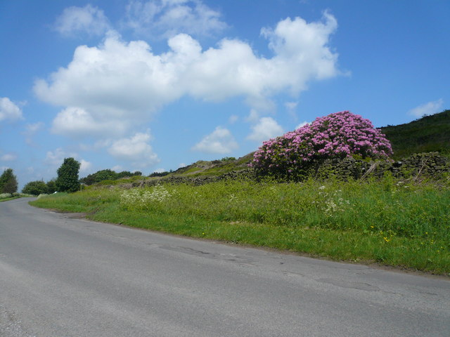
Kelstedge benefits from its proximity to the Peak District National Park, offering residents and visitors ample opportunities for outdoor activities such as hiking, cycling, and exploring the stunning countryside. The village is also well-connected to the surrounding areas, with good road links to nearby towns and cities, including Chesterfield and Matlock.

In summary, Kelstedge is a small and peaceful village in Derbyshire, characterized by its beautiful natural surroundings, a sense of community, and easy access to the stunning landscapes of the Peak District National Park.

If you have any feedback on the listing, please let us know in the comments section below.

Kelstedge Images

Images are sourced within 2km of 53.169784/-1.49658 or Grid Reference SK3363. Thanks to Geograph Open Source API. All images are credited.

Barley field by Lant Lane Part of the plateau of farmland between the Amber and Derwent valleys.
Barley field by Lant Lane
Part of the plateau of farmland between the Amber and Derwent valleys.
Passing place on Lant Lane The passing place is marked by the lines on the road, but the road is in fact not any wider here at all.
Passing place on Lant Lane
The passing place is marked by the lines on the road, but the road is in fact not any wider here at all.
Fields below Amber Hill The Amber valley can be seen to the right. The fields slope down towards the valley. Eddlestow Hall Farm is seen straight ahead.
Fields below Amber Hill
The Amber valley can be seen to the right. The fields slope down towards the valley. Eddlestow Hall Farm is seen straight ahead.
Fields below Amber Hill Looking down the side of the A632 as it descends into the Amber valley. Further away you can see it as it begins to climb again through the village of Kelstedge.
Fields below Amber Hill
Looking down the side of the A632 as it descends into the Amber valley. Further away you can see it as it begins to climb again through the village of Kelstedge.
Top Slack Farm Now the site of a children's nursery.
Top Slack Farm
Now the site of a children's nursery.
Holestone Gate Road A fairly narrow and bumpy road that cuts through from the A632 to the A615 to miss out Matlock, but it is mostly straight.
Holestone Gate Road
A fairly narrow and bumpy road that cuts through from the A632 to the A615 to miss out Matlock, but it is mostly straight.
Ramshackle barn off Holestone Gate Road Not in the best state but still providing useful service as a store of silage bales.
Ramshackle barn off Holestone Gate Road
Not in the best state but still providing useful service as a store of silage bales.
Field boundary below Holestone Gate Road Despite the poor weather, the Derwent valley can be seen in the background with Riber Castle overlooking it.
Field boundary below Holestone Gate Road
Despite the poor weather, the Derwent valley can be seen in the background with Riber Castle overlooking it.
Farm buildings at Old Engine Farm A farm off Holestone Gate Road.
Farm buildings at Old Engine Farm
A farm off Holestone Gate Road.
Farm track and a field of oats Looking from Holestone Gate Road up to the top of the ridge near Cocking Tor.
Farm track and a field of oats
Looking from Holestone Gate Road up to the top of the ridge near Cocking Tor.
Vernon Lane Bench Mark Found on the path along Vernon Lane
Vernon Lane Bench Mark
Found on the path along Vernon Lane
Ashover, All Saints
Ashover, All Saints
Footpath to Ashover Crossing a high plateau of arable land.
Footpath to Ashover
Crossing a high plateau of arable land.
The Amber valley As seen from Eastwood Lane on its descent from Littlemoor.
The Amber valley
As seen from Eastwood Lane on its descent from Littlemoor.
Village cricket at Ashover You get a good view from a passing footpath.
Village cricket at Ashover
You get a good view from a passing footpath.
The Old Poets Corner, Ashover This pub, which has its own brewery attached, proudly proclaims its award as CAMRA's Derbyshire pub of the year for 2015.
The Old Poets Corner, Ashover
This pub, which has its own brewery attached, proudly proclaims its award as CAMRA's Derbyshire pub of the year for 2015.
River Amber, Ashover The Amber rises in the hills to the north west of Ashover and flows 13 miles across Derbyshire to its confluence with the Derwent. It is seen here in its early stages near Ashover village.
River Amber, Ashover
The Amber rises in the hills to the north west of Ashover and flows 13 miles across Derbyshire to its confluence with the Derwent. It is seen here in its early stages near Ashover village.
The Old Poets Corner, Ashover This imposing pub in Ashover village is famed for the quality of its beer and has been named CAMRA's Derbyshire pub of the year for 2015. There is a brewery on the premises.
The Old Poets Corner, Ashover
This imposing pub in Ashover village is famed for the quality of its beer and has been named CAMRA's Derbyshire pub of the year for 2015. There is a brewery on the premises.
Show me another place!

Kelstedge is located at Grid Ref: SK3363 (Lat: 53.169784, Lng: -1.49658)

Administrative County: Derbyshire

District: North East Derbyshire

Police Authority: Derbyshire

What 3 Words

///modest.ethic.foresight. Near Tansley, Derbyshire

Related Wikis

Rattle, Derbyshire

Rattle is a hamlet in the English county of Derbyshire. It is part of the village of Ashover. This portion of the village was the centre of stocking...

Ashover Butts railway station

Ashover Butts railway station was a railway station serving the village of Ashover in Derbyshire, England. It was the terminus of the 1 ft 11+1⁄2 in (597...

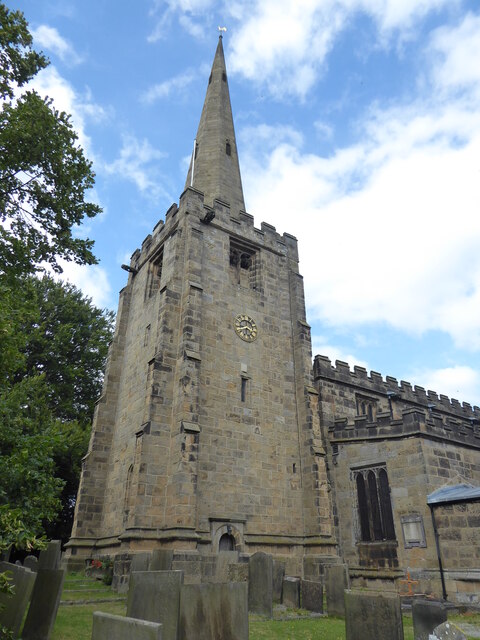
All Saints' Church, Ashover

All Saints’ Church, Ashover is a Grade I listed parish church in the Church of England in Ashover, Derbyshire. == History == The porch of the church dates...

Salter Lane railway station

Salter Lane railway station co-served the village of Ashover, Derbyshire, England, from 1925 to 1936 on the Ashover Light Railway. == History == The station...

Ashover

Ashover is a village and civil parish in the English county of Derbyshire. It is in the North East Derbyshire district of the county. The population of...

Alicehead

Alicehead is a small area of settlement in Derbyshire, England, 9 miles (14 km) south-west of Chesterfield. It consists of four farms and a cottage on...

Fallgate railway station

Fallgate railway station co-served the village of Milltown, Derbyshire, England, from 1925 to 1936 on the Ashover Light Railway. == History == The station...
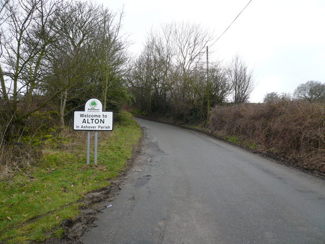
Alton, Derbyshire

Alton is a very small village in Derbyshire, England. Alton is in the civil parish of Ashover, and is around 2 miles away from Clay Cross although it is...

Nearby Amenities

Located within 500m of 53.169784,-1.49658
Kelstedge
Is In: Derbyshire, England, UK
Place: village
Wikidata: Q89402621
Lat/Long: 53.1703357/-1.494345
Post Box
Brand: Royal Mail
Brand Wikidata: Q638098
Brand Wikipedia: en:Royal Mail
Collection Times: Mo-Fr 09:00; Sa 07:00
Operator: Royal Mail
Operator Wikidata: Q638098
Post Box Type: lamp
Ref: S45 55
Royal Cypher: EIIR
Royal Cypher Wikidata: Q33102113
Lat/Long: 53.1700614/-1.4943399
Bus Stop
Kelstedge (Inn)
Bus: yes
Ele: 204.1641846
Naptan AtcoCode: 1000DKTC3026
Naptan NaptanCode: dbsdwdpw
Public Transport: platform
Lat/Long: 53.1702453/-1.4934998
Bench
Ele: 204.1641846
Lat/Long: 53.1702785/-1.4933921
Bus Stop
Bus: yes
Ele: 199.3575439
Public Transport: platform
Lat/Long: 53.1693853/-1.4920697
Bus Stop
Bus: yes
Ele: 195.0317383
Naptan AtcoCode: 1000DKAR3023
Naptan NaptanCode: dbsamwmg
Public Transport: platform
Lat/Long: 53.1691569/-1.4920394
Barrier: cycle_barrier
Lat/Long: 53.1694936/-1.495093
Ele: 183.7362061
Lat/Long: 53.1697782/-1.4902943
Ele: 184.6976318
Lat/Long: 53.1697251/-1.4904284
Ele: 183.4959717
Lat/Long: 53.1697196/-1.4903199
Ele: 205
Lat/Long: 53.1714177/-1.4967073
Bus Stop
Kelstedge (Inn)
Bus: yes
Ele: 201.0000000
Public Transport: platform
Lat/Long: 53.1705518/-1.4932583
Bench
Ele: 199.0000000
Lat/Long: 53.170624/-1.4933352
Cafe
Ramblers Rest
Source Name: Sign on road
Lat/Long: 53.1724221/-1.4921292
Marsh Green Farm Shop
Shop: farm
Source: View from N
Lat/Long: 53.1727955/-1.4918389
Barrier: horse_stile
Lat/Long: 53.1705785/-1.4992244
Defibrillator
Access: yes
Defibrillator Location: On outside wall. Available 24/7.
Emergency: defibrillator
Indoor: no
Lat/Long: 53.1702753/-1.4939543
Kelstedge (Inn)
Bus: yes
Public Transport: stop_position
Lat/Long: 53.1701563/-1.4934768
Kelstedge (Inn)
Bus: yes
Public Transport: stop_position
Lat/Long: 53.1705842/-1.493185
Bus Stop
Amberlane Farm
Bus: yes
Public Transport: platform
Lat/Long: 53.1661108/-1.4991367
Amberlane Farm
Bus: yes
Public Transport: stop_position
Lat/Long: 53.1660823/-1.4990513
Direction: 170
Generator Method: photovoltaic
Generator Output Electricity: yes
Generator Solar Modules: 16
Generator Source: solar
Generator Type: solar_photovoltaic_panel
Location: roof
Power: generator
Lat/Long: 53.1702489/-1.4937333
Direction: 170
Generator Method: photovoltaic
Generator Output Electricity: yes
Generator Solar Modules: 10
Generator Source: solar
Generator Type: solar_photovoltaic_panel
Location: roof
Power: generator
Lat/Long: 53.1702992/-1.4939521
Direction: 190
Generator Method: photovoltaic
Generator Output Electricity: yes
Generator Solar Modules: 3
Generator Source: solar
Generator Type: solar_photovoltaic_panel
Location: roof
Power: generator
Lat/Long: 53.1703956/-1.4962059
Generator Method: photovoltaic
Generator Output Electricity: yes
Generator Solar Modules: 13
Generator Source: solar
Generator Type: solar_photovoltaic_panel
Location: roof
Power: generator
Lat/Long: 53.1704375/-1.4963843
Barrier: stile
Material: stone
Source: survey;gps
Stile: squeezer
Lat/Long: 53.1697454/-1.4902971
Give Way
Direction: backward
Lat/Long: 53.1700548/-1.4945879
Give Way
Direction: backward
Lat/Long: 53.1701562/-1.4943138
Give Way
Direction: forward
Lat/Long: 53.1702625/-1.4929469
Give Way
Direction: forward
Lat/Long: 53.1707329/-1.4937909
Give Way
Direction: backward
Lat/Long: 53.170861/-1.493513
The data included in this document is from www.openstreetmap.org. The data is made available under ODbL.

Have you been to Kelstedge?

Leave your review of Kelstedge below (or comments, questions and feedback).