Eddlestow Wood

Wood, Forest in Derbyshire North East Derbyshire

England

Eddlestow Wood

Barley field by Lant Lane Part of the plateau of farmland between the Amber and Derwent valleys.
Barley field by Lant Lane Credit: Bill Boaden

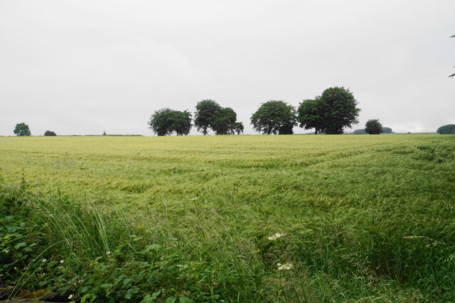
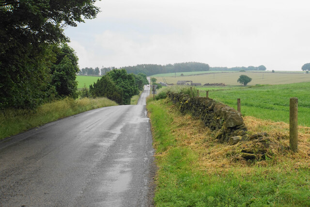
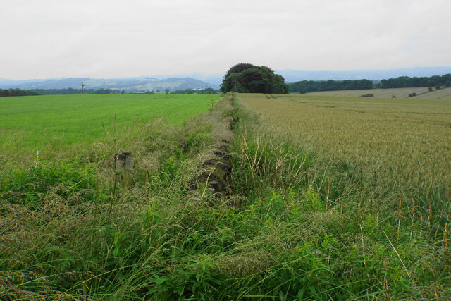
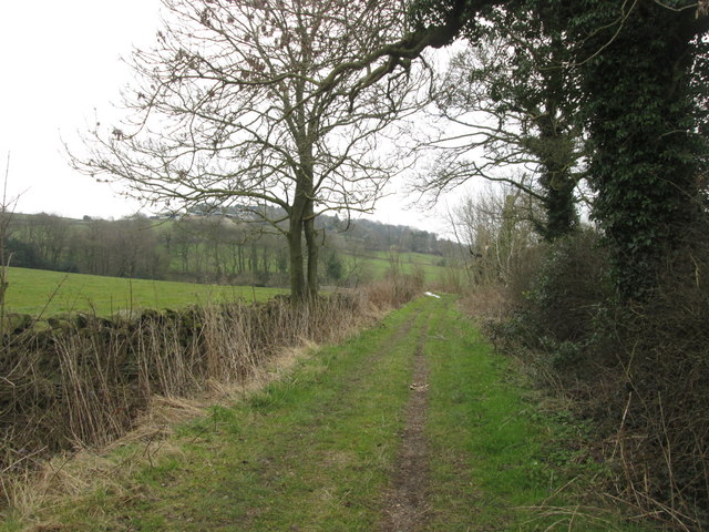
Eddlestow Wood is a picturesque forest located in Derbyshire, England. With its lush greenery and tranquil atmosphere, it has become a popular destination for nature enthusiasts and hikers alike. Covering an area of approximately 100 acres, the wood boasts a diverse range of trees, including oak, beech, and ash, creating a rich and varied ecosystem.

As visitors step into Eddlestow Wood, they are greeted by a network of well-maintained footpaths that wind their way through the dense foliage. The woodland floor is carpeted with a vibrant display of wildflowers, adding a splash of color to the surroundings. The air is filled with the sweet scent of pine and the melodic chirping of birds, making it a haven for birdwatching enthusiasts.

One of the highlights of Eddlestow Wood is its abundance of wildlife. Deer can often be spotted grazing in the open meadows, while squirrels nimbly dart through the trees, gathering food for the winter months. The forest is also home to a variety of bird species, including woodpeckers, owls, and thrushes.

For those seeking a peaceful retreat, Eddlestow Wood offers several designated picnic areas, providing the perfect spot to relax and enjoy a packed lunch amidst the tranquil surroundings. Additionally, the wood is equipped with visitor facilities such as toilets and ample parking, ensuring a comfortable experience for all.

Overall, with its scenic beauty, diverse flora and fauna, and convenient amenities, Eddlestow Wood is an idyllic destination for nature lovers looking to immerse themselves in the natural wonders of Derbyshire.

If you have any feedback on the listing, please let us know in the comments section below.

Eddlestow Wood Images

Images are sourced within 2km of 53.171036/-1.5061725 or Grid Reference SK3363. Thanks to Geograph Open Source API. All images are credited.

Barley field by Lant Lane Part of the plateau of farmland between the Amber and Derwent valleys.
Barley field by Lant Lane
Part of the plateau of farmland between the Amber and Derwent valleys.
Passing place on Lant Lane The passing place is marked by the lines on the road, but the road is in fact not any wider here at all.
Passing place on Lant Lane
The passing place is marked by the lines on the road, but the road is in fact not any wider here at all.
Fields below Amber Hill The Amber valley can be seen to the right. The fields slope down towards the valley. Eddlestow Hall Farm is seen straight ahead.
Fields below Amber Hill
The Amber valley can be seen to the right. The fields slope down towards the valley. Eddlestow Hall Farm is seen straight ahead.
Fields below Amber Hill Looking down the side of the A632 as it descends into the Amber valley. Further away you can see it as it begins to climb again through the village of Kelstedge.
Fields below Amber Hill
Looking down the side of the A632 as it descends into the Amber valley. Further away you can see it as it begins to climb again through the village of Kelstedge.
Top Slack Farm Now the site of a children's nursery.
Top Slack Farm
Now the site of a children's nursery.
Holestone Gate Road A fairly narrow and bumpy road that cuts through from the A632 to the A615 to miss out Matlock, but it is mostly straight.
Holestone Gate Road
A fairly narrow and bumpy road that cuts through from the A632 to the A615 to miss out Matlock, but it is mostly straight.
Ramshackle barn off Holestone Gate Road Not in the best state but still providing useful service as a store of silage bales.
Ramshackle barn off Holestone Gate Road
Not in the best state but still providing useful service as a store of silage bales.
Field boundary below Holestone Gate Road Despite the poor weather, the Derwent valley can be seen in the background with Riber Castle overlooking it.
Field boundary below Holestone Gate Road
Despite the poor weather, the Derwent valley can be seen in the background with Riber Castle overlooking it.
Vernon Lane Bench Mark Found on the path along Vernon Lane
Vernon Lane Bench Mark
Found on the path along Vernon Lane
Ashover, All Saints
Ashover, All Saints
Footpath to Ashover Crossing a high plateau of arable land.
Footpath to Ashover
Crossing a high plateau of arable land.
Old Guide Stone by Wirestone Lane, Darley Dale Moorland Guidestoop by the UC road, in parish of Darley Dale (Derbyshire Dales District), Jaggers Lane junction with Wirestone Lane, on the verge at crossroads, North East side of road. An earlier photograph can be found here <a title="https://www.geograph.org.uk/photo/6102216" href="https://www.geograph.org.uk/photo/6102216">Link</a>.

Inscription reads:-
: ASHBURN / ROAD / {hand->} : : ALFRETON / ROAD / {hand->} / WINSTER / ROAD / {<-hand}: : CHESTE= / =RFIELD / ROAD / {hand->} :

Surveyed

Milestone Society National ID: DE_XDAR03
Old Guide Stone by Wirestone Lane, Darley Dale
Moorland Guidestoop by the UC road, in parish of Darley Dale (Derbyshire Dales District), Jaggers Lane junction with Wirestone Lane, on the verge at crossroads, North East side of road. An earlier photograph can be found here Link. Inscription reads:- : ASHBURN / ROAD / {hand->} : : ALFRETON / ROAD / {hand->} / WINSTER / ROAD / {<-hand}: : CHESTE= / =RFIELD / ROAD / {hand->} : Surveyed Milestone Society National ID: DE_XDAR03
The Old Poets Corner, Ashover This pub, which has its own brewery attached, proudly proclaims its award as CAMRA&amp;#039;s Derbyshire pub of the year for 2015.
The Old Poets Corner, Ashover
This pub, which has its own brewery attached, proudly proclaims its award as CAMRA's Derbyshire pub of the year for 2015.
The Old Poets Corner, Ashover This imposing pub in Ashover village is famed for the quality of its beer and has been named CAMRA&amp;#039;s Derbyshire pub of the year for 2015. There is a brewery on the premises.
The Old Poets Corner, Ashover
This imposing pub in Ashover village is famed for the quality of its beer and has been named CAMRA's Derbyshire pub of the year for 2015. There is a brewery on the premises.
View to an old farm building at Greenend
On Gin Lane near Goss Hall
The Kelstedge public house
Byway towards Marsh Green
Show me another place!

Eddlestow Wood is located at Grid Ref: SK3363 (Lat: 53.171036, Lng: -1.5061725)

Administrative County: Derbyshire

District: North East Derbyshire

Police Authority: Derbyshire

What 3 Words

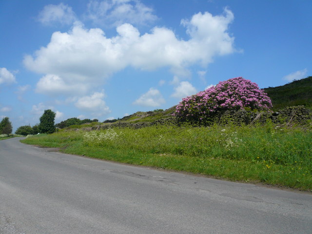
///kiosk.comedians.crunching. Near Tansley, Derbyshire

Related Wikis

Ashover Butts railway station

Ashover Butts railway station was a railway station serving the village of Ashover in Derbyshire, England. It was the terminus of the 1 ft 11+1⁄2 in (597...

Rattle, Derbyshire

Rattle is a hamlet in the English county of Derbyshire. It is part of the village of Ashover. This portion of the village was the centre of stocking...

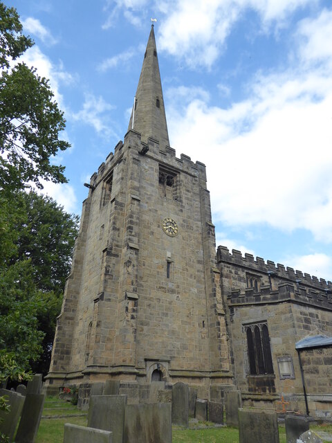
All Saints' Church, Ashover

All Saints’ Church, Ashover is a Grade I listed parish church in the Church of England in Ashover, Derbyshire. == History == The porch of the church dates...

Salter Lane railway station

Salter Lane railway station co-served the village of Ashover, Derbyshire, England, from 1925 to 1936 on the Ashover Light Railway. == History == The station...

Alicehead

Alicehead is a small area of settlement in Derbyshire, England, 9 miles (14 km) south-west of Chesterfield. It consists of four farms and a cottage on...

Ashover

Ashover is a village and civil parish in the English county of Derbyshire. It is in the North East Derbyshire district of the county. The population of...

Fallgate railway station

Fallgate railway station co-served the village of Milltown, Derbyshire, England, from 1925 to 1936 on the Ashover Light Railway. == History == The station...
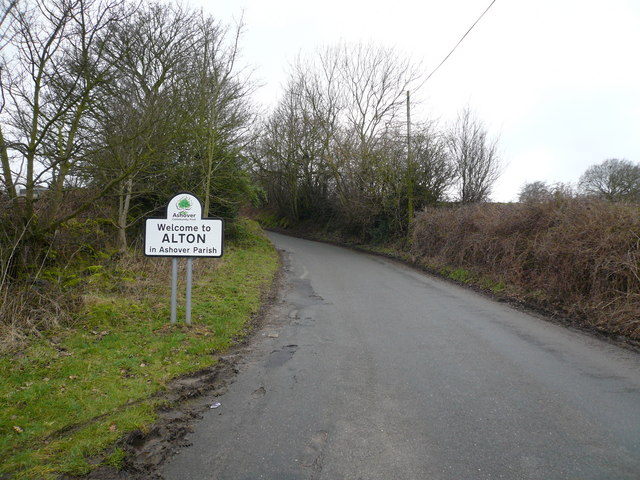
Alton, Derbyshire

Alton is a very small village in Derbyshire, England. Alton is in the civil parish of Ashover, and is around 2 miles away from Clay Cross although it is...

Nearby Amenities

Located within 500m of 53.171036,-1.5061725
Ford: yes
Lat/Long: 53.1721507/-1.50374
Barrier: stile
Foot: yes
Steps: 2
Stile: stepover
Lat/Long: 53.1745985/-1.5055503
Barrier: stile
Foot: yes
Steps: 1
Stile: stepover
Lat/Long: 53.1746811/-1.5063152
Barrier: stile
Foot: yes
Steps: 1
Stile: stepover
Lat/Long: 53.1744497/-1.5075716
Barrier: stile
Steps: 2
Stile: stepover
Lat/Long: 53.1750368/-1.5072467
Barrier: stile
Foot: yes
Steps: 2
Stile: wall
Lat/Long: 53.1744563/-1.5076786
Barrier: stile
Foot: yes
Steps: 3
Stile: wall
Lat/Long: 53.1745504/-1.5083927
Barrier: stile
Foot: yes
Steps: 2
Stile: stepover
Lat/Long: 53.1748512/-1.5089729
Barrier: stile
Ele: 202.4818115
Material: stone
Steps: 2
Stile: stepover
Lat/Long: 53.1739812/-1.5014642
Barrier: stile
Ele: 203.2027588
Stile: squeezer
Lat/Long: 53.1741121/-1.5013167
Barrier: horse_stile
Lat/Long: 53.1705785/-1.4992244
The data included in this document is from www.openstreetmap.org. The data is made available under ODbL.

Have you been to Eddlestow Wood?

Leave your review of Eddlestow Wood below (or comments, questions and feedback).