Haddon Hill

Hill, Mountain in Northumberland

England

Haddon Hill

Standing Stones west of White Hill These are the same standing stones as are shown at <a title="https://www.geograph.org.uk/photo/3153964" href="https://www.geograph.org.uk/photo/3153964">Link</a> when Andrew Curtis passed this way in September 2012 although taken from a different angle. Since then the plantation in the background has suffered quite some damage as a consequence of Storm Arwen which caused widespread devastation in November 2021. The damage caused by the storm was compounded by the fact that "sustained winds with gusts in excess of 90 mph were, unusually, from the north-east, affecting trees that do not normally have to yield to those winds." For a selection of detailed free to download walking routes in the area visit <span class="nowrap"><a title="www.cheviotwalks.co.uk" rel="nofollow ugc noopener" href="http://www.cheviotwalks.co.uk">Link</a><img style="margin-left:2px;" alt="External link" title="External link - shift click to open in new window" src="https://s1.geograph.org.uk/img/external.png" width="10" height="10"/></span>
Standing Stones west of White Hill Credit: Geoff Holland

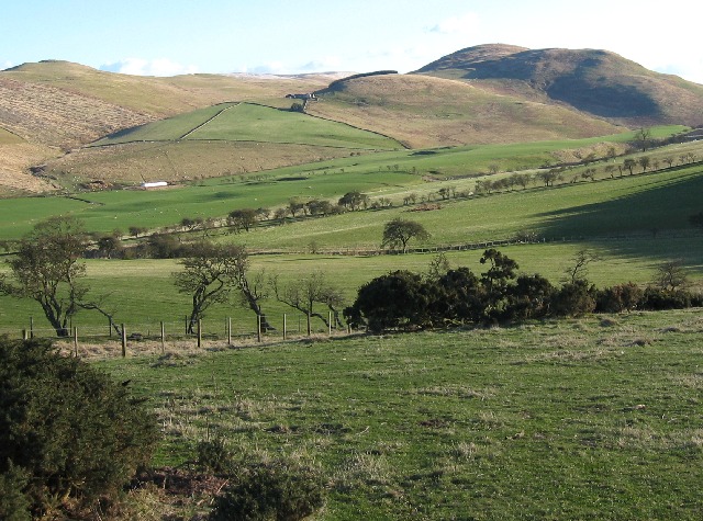
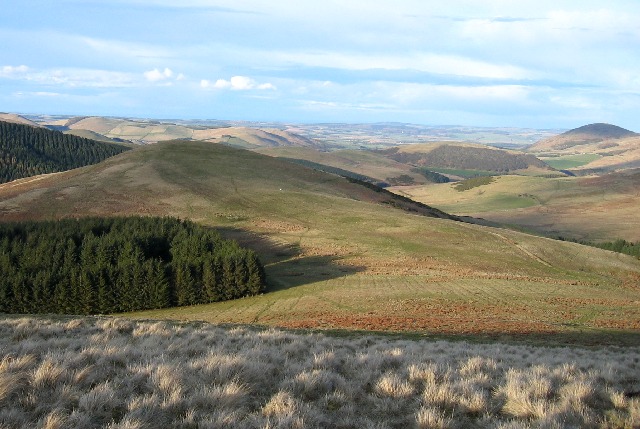
Haddon Hill is a prominent hill located in the county of Northumberland, England. Situated within the North Pennines Area of Outstanding Natural Beauty, it offers stunning panoramic views of the surrounding countryside. Rising to an elevation of approximately 516 meters (1,693 feet), it is considered one of Northumberland's highest points.

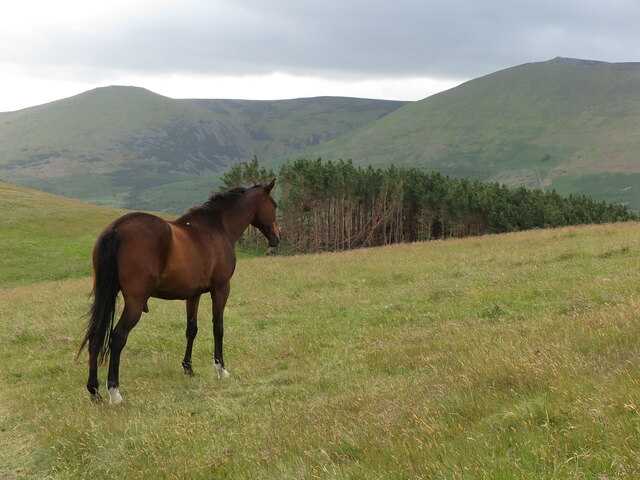
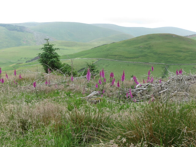
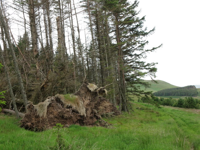
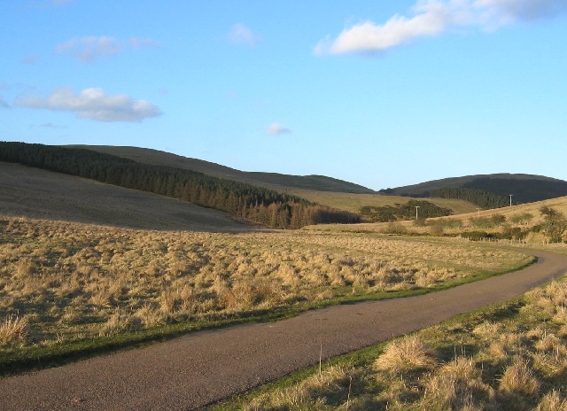
The hill is characterized by its rugged and rocky terrain, making it a popular destination for hikers and nature enthusiasts. The landscape is predominantly covered with heather moorland, providing a unique and picturesque setting. Haddon Hill is also home to a diverse range of flora and fauna, including grouse, curlew, and various species of wildflowers.

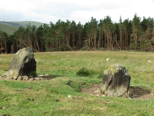
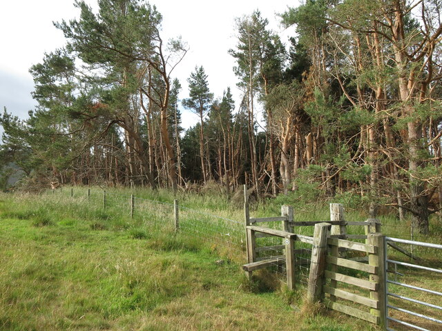
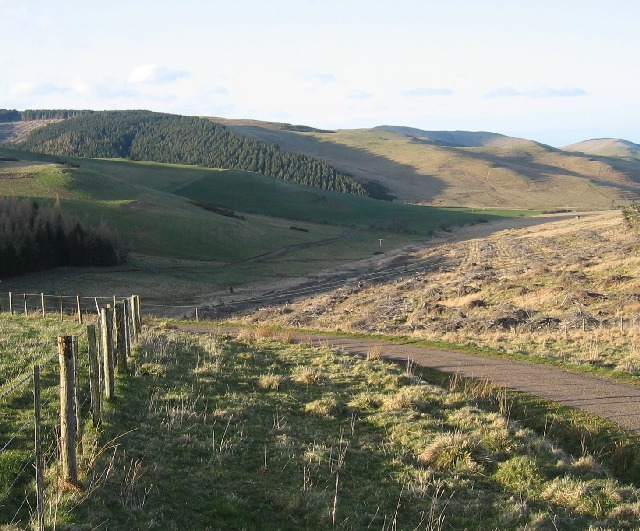
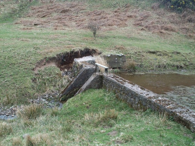
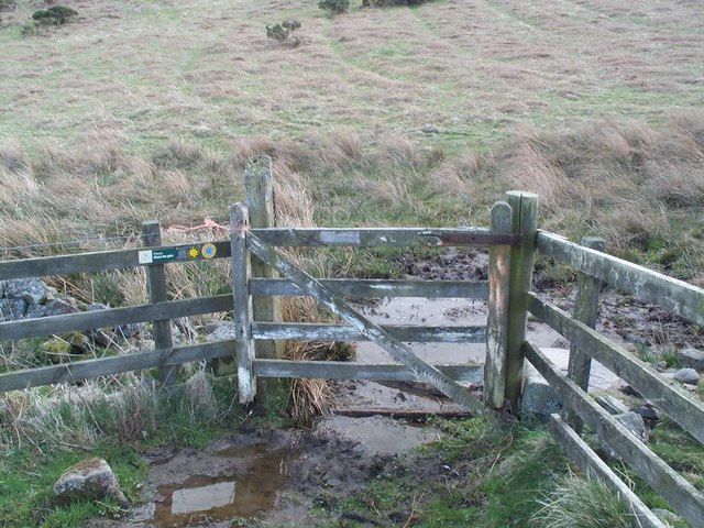
The hill is easily accessible, with several footpaths and trails leading to its summit. These paths cater to all levels of walkers, from casual strollers to experienced hikers. Along the way, visitors may encounter remnants of the area's mining history, such as abandoned lead mines and spoil heaps.

At the top of Haddon Hill, visitors are rewarded with breathtaking views of the Northumberland countryside. On a clear day, it is possible to see as far as the North Sea coast, the Cheviot Hills, and even the distant Scottish mountains. The hill's summit is also an ideal spot for picnics, offering a tranquil setting to relax and soak in the natural beauty.

Haddon Hill is a true gem of Northumberland, offering a unique blend of natural beauty, recreational opportunities, and historical significance. Whether you are an avid hiker or simply seeking a peaceful escape, this hill is certainly worth a visit.

If you have any feedback on the listing, please let us know in the comments section below.
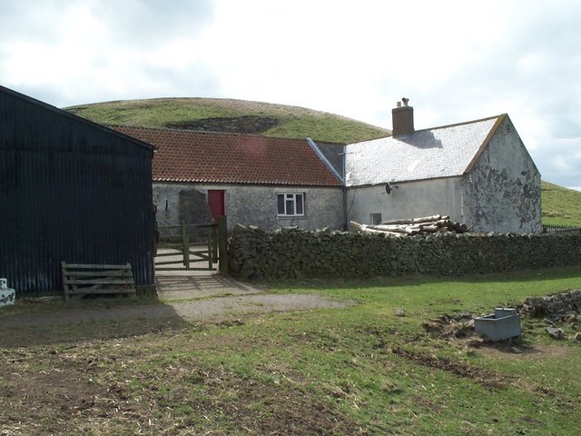
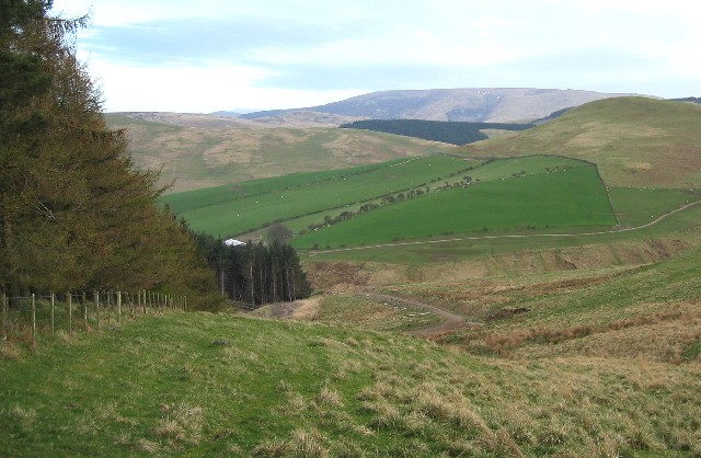
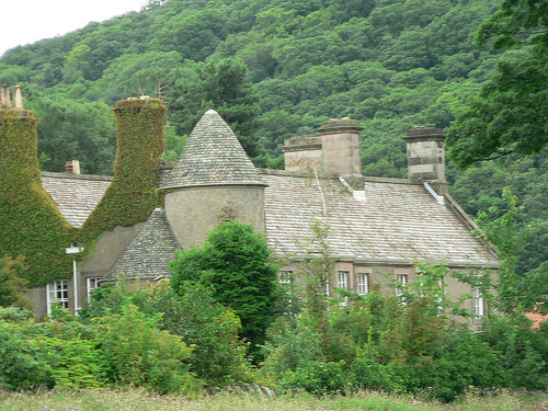
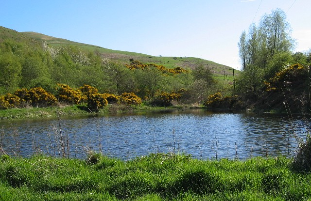
Haddon Hill Images

Images are sourced within 2km of 55.5566/-2.2034389 or Grid Reference NT8729. Thanks to Geograph Open Source API. All images are credited.

Standing Stones west of White Hill These are the same standing stones as are shown at <a title="https://www.geograph.org.uk/photo/3153964" href="https://www.geograph.org.uk/photo/3153964">Link</a> when Andrew Curtis passed this way in September 2012 although taken from a different angle. Since then the plantation in the background has suffered quite some damage as a consequence of Storm Arwen which caused widespread devastation in November 2021. The damage caused by the storm was compounded by the fact that "sustained winds with gusts in excess of 90 mph were, unusually, from the north-east, affecting trees that do not normally have to yield to those winds." For a selection of detailed free to download walking routes in the area visit <span class="nowrap"><a title="www.cheviotwalks.co.uk" rel="nofollow ugc noopener" href="http://www.cheviotwalks.co.uk">Link</a><img style="margin-left:2px;" alt="External link" title="External link - shift click to open in new window" src="https://s1.geograph.org.uk/img/external.png" width="10" height="10"/></span>
Standing Stones west of White Hill
These are the same standing stones as are shown at Link when Andrew Curtis passed this way in September 2012 although taken from a different angle. Since then the plantation in the background has suffered quite some damage as a consequence of Storm Arwen which caused widespread devastation in November 2021. The damage caused by the storm was compounded by the fact that "sustained winds with gusts in excess of 90 mph were, unusually, from the north-east, affecting trees that do not normally have to yield to those winds." For a selection of detailed free to download walking routes in the area visit LinkExternal link
Plantation south west of White Hill This photo shows some of the devastation to this plantation caused by Storm Arwen in November 2021. The damage caused by the storm was compounded by the fact that "sustained winds with gusts in excess of 90 mph were, unusually, from the north-east, affecting trees that do not normally have to yield to those winds." This edge of the plantation faces directly north east and can be seen from afar at <a title="https://www.geograph.org.uk/photo/7212718" href="https://www.geograph.org.uk/photo/7212718">Link</a>. For a selection of detailed free to download walking routes in the area visit <span class="nowrap"><a title="www.cheviotwalks.co.uk" rel="nofollow ugc noopener" href="http://www.cheviotwalks.co.uk">Link</a><img style="margin-left:2px;" alt="External link" title="External link - shift click to open in new window" src="https://s1.geograph.org.uk/img/external.png" width="10" height="10"/></span>
Plantation south west of White Hill
This photo shows some of the devastation to this plantation caused by Storm Arwen in November 2021. The damage caused by the storm was compounded by the fact that "sustained winds with gusts in excess of 90 mph were, unusually, from the north-east, affecting trees that do not normally have to yield to those winds." This edge of the plantation faces directly north east and can be seen from afar at Link. For a selection of detailed free to download walking routes in the area visit LinkExternal link
Horse near White Hill There were two horses standing close to the route of the local Hillfort's Trail as I climbed away from the nearby plantation. They showed no interest in me as I cautiously passed between them. This one was, it seems, too interested in enjoying the fine view towards Easter and Wester Tors. For a selection of detailed free to download walking routes in the area visit <span class="nowrap"><a title="www.cheviotwalks.co.uk" rel="nofollow ugc noopener" href="http://www.cheviotwalks.co.uk">Link</a><img style="margin-left:2px;" alt="External link" title="External link - shift click to open in new window" src="https://s1.geograph.org.uk/img/external.png" width="10" height="10"/></span>
Horse near White Hill
There were two horses standing close to the route of the local Hillfort's Trail as I climbed away from the nearby plantation. They showed no interest in me as I cautiously passed between them. This one was, it seems, too interested in enjoying the fine view towards Easter and Wester Tors. For a selection of detailed free to download walking routes in the area visit LinkExternal link
Foxgloves, Plantation north of Elsdonburn This plantation has been partially felled thus allowing foxgloves and other wild flowers to flourish. The hill in the middle distance is Ell's Knowe the summit of which is shown at <a title="https://www.geograph.org.uk/photo/5686724" href="https://www.geograph.org.uk/photo/5686724">Link</a>. For a selection of detailed free to download walking routes in the area visit <span class="nowrap"><a title="www.cheviotwalks.co.uk" rel="nofollow ugc noopener" href="http://www.cheviotwalks.co.uk">Link</a><img style="margin-left:2px;" alt="External link" title="External link - shift click to open in new window" src="https://s1.geograph.org.uk/img/external.png" width="10" height="10"/></span>
Foxgloves, Plantation north of Elsdonburn
This plantation has been partially felled thus allowing foxgloves and other wild flowers to flourish. The hill in the middle distance is Ell's Knowe the summit of which is shown at Link. For a selection of detailed free to download walking routes in the area visit LinkExternal link
Permissive Footpath near Haddon Hill The twin indentations to the extreme right of the plantation mark the route of a Permissive Footpath which forms part of the local Hillfort's Trail. This photo also shows some of the devastation to the plantation caused by Storm Arwen in November 2021. The damage caused by the storm was compounded by the fact that "sustained winds with gusts in excess of 90 mph were, unusually, from the north-east, affecting trees that do not normally have to yield to those winds." For a selection of detailed free to download walking routes in the area visit <span class="nowrap"><a title="www.cheviotwalks.co.uk" rel="nofollow ugc noopener" href="http://www.cheviotwalks.co.uk">Link</a><img style="margin-left:2px;" alt="External link" title="External link - shift click to open in new window" src="https://s1.geograph.org.uk/img/external.png" width="10" height="10"/></span>
Permissive Footpath near Haddon Hill
The twin indentations to the extreme right of the plantation mark the route of a Permissive Footpath which forms part of the local Hillfort's Trail. This photo also shows some of the devastation to the plantation caused by Storm Arwen in November 2021. The damage caused by the storm was compounded by the fact that "sustained winds with gusts in excess of 90 mph were, unusually, from the north-east, affecting trees that do not normally have to yield to those winds." For a selection of detailed free to download walking routes in the area visit LinkExternal link
Cairn, Coldsmouth Hill There are three cairns on the summit of Coldsmouth Hill and which are relatively modern additions to the landscape. However, they distract the attention away from the remains of two large Bronze Age burial cairns which have occupied this place for nigh on 3,000 years, and a 1929 excavation of this, the northern most cairn, uncovered cremated bone, a flint knife and a bronze dagger. In the background, from left to right, lie Yeavering Bell, Easter Tor and Wester Tor. For a selection of detailed free to download walking routes in the area visit <span class="nowrap"><a title="www.cheviotwalks.co.uk" rel="nofollow ugc noopener" href="http://www.cheviotwalks.co.uk">Link</a><img style="margin-left:2px;" alt="External link" title="External link - shift click to open in new window" src="https://s1.geograph.org.uk/img/external.png" width="10" height="10"/></span>
Cairn, Coldsmouth Hill
There are three cairns on the summit of Coldsmouth Hill and which are relatively modern additions to the landscape. However, they distract the attention away from the remains of two large Bronze Age burial cairns which have occupied this place for nigh on 3,000 years, and a 1929 excavation of this, the northern most cairn, uncovered cremated bone, a flint knife and a bronze dagger. In the background, from left to right, lie Yeavering Bell, Easter Tor and Wester Tor. For a selection of detailed free to download walking routes in the area visit LinkExternal link
Upper Kilham valley This grid square takes up the first half of the picture, beyond is Coldsmouth Hill (right skyline)
Upper Kilham valley
This grid square takes up the first half of the picture, beyond is Coldsmouth Hill (right skyline)
Hetha Valley Following the road out from Trowupburn.
Hetha Valley
Following the road out from Trowupburn.
Elsdon Valley The road follows the Elsdon Burn into College Valley.
Elsdon Valley
The road follows the Elsdon Burn into College Valley.
High Pasture Looking ENE from the northern slopes of Madam Law. The hill immediately in front (just out of grid square) is Ell's Knowe. Yeavering Bell is the distant hill on the right skyline.
High Pasture
Looking ENE from the northern slopes of Madam Law. The hill immediately in front (just out of grid square) is Ell's Knowe. Yeavering Bell is the distant hill on the right skyline.
Dam in the burn This dam appears to have no purpose but is there in the valley upstream from Westnewton and The Straw - it is just beside the track of Kirknewton Bridleway No. 6
Dam in the burn
This dam appears to have no purpose but is there in the valley upstream from Westnewton and The Straw - it is just beside the track of Kirknewton Bridleway No. 6
Which way to go? If you reach this point on Kirknewton Bridleway No 6, you come to this branch in the track. To the left you can see a waymark post but if you go up the left branch and follow the track indicated, you end up nowhere. It is simply a farmer's track when managing his sheep. To the right you should see a line of walking poles which we inserted to show the correct track. We are trying to get this corrected. The location is called Mid Hill with the summit just off to the left.
Which way to go?
If you reach this point on Kirknewton Bridleway No 6, you come to this branch in the track. To the left you can see a waymark post but if you go up the left branch and follow the track indicated, you end up nowhere. It is simply a farmer's track when managing his sheep. To the right you should see a line of walking poles which we inserted to show the correct track. We are trying to get this corrected. The location is called Mid Hill with the summit just off to the left.
Watch the bog! Insignificant wicket gate - or is it. This lies on the boundary between Kirknewton and Kilham parishes (and if you didn't know it, at parish boundaries, all footpaths and bridleway are renumbered to the parish they are in) So here the Kirknewton public footpath No. 5 ends and Kilham public footpath No. 4 continues on. However Kirknewton Bridleway No. 6 also ends here and there is no ongoing bridleway, so what you are to do with your horse here, other than returning from whence you came, no-one knows.
Watch the bog!
Insignificant wicket gate - or is it. This lies on the boundary between Kirknewton and Kilham parishes (and if you didn't know it, at parish boundaries, all footpaths and bridleway are renumbered to the parish they are in) So here the Kirknewton public footpath No. 5 ends and Kilham public footpath No. 4 continues on. However Kirknewton Bridleway No. 6 also ends here and there is no ongoing bridleway, so what you are to do with your horse here, other than returning from whence you came, no-one knows.
Fox Covert Why this stile exists, we do not know. Kilham public footpath No. 4 comes past the post on the far right of picture and the waymark can be seen on the post, but the footpath does not cross the fence into the woods and so why the stile is there is a mystery. Maybe it is intended for beaters during the pheasant shooting season. The trees in the background are part of Fox Covert.
Fox Covert
Why this stile exists, we do not know. Kilham public footpath No. 4 comes past the post on the far right of picture and the waymark can be seen on the post, but the footpath does not cross the fence into the woods and so why the stile is there is a mystery. Maybe it is intended for beaters during the pheasant shooting season. The trees in the background are part of Fox Covert.
Elsdonburn Shank Farm buildings at Elsdonburn Shank
Elsdonburn Shank
Farm buildings at Elsdonburn Shank
Elsdonburn Looking SE towards the Cheviot.
Elsdonburn
Looking SE towards the Cheviot.
Ring Chesters Also known as "Elsdon Burn Camp". This hilltop was once the site of an Iron Age hill fort. Although not shown on this image the hilltop has much evidence of ancient earth works.
Ring Chesters
Also known as "Elsdon Burn Camp". This hilltop was once the site of an Iron Age hill fort. Although not shown on this image the hilltop has much evidence of ancient earth works.
Coldsmouth Hill The two Cairns are believed to be the burial site of a Bronze Age king and Queen.
<span class="nowrap"><a title="http://www.keystothepast.info/durhamcc/K2P.nsf/K2PDetail?readform&PRN=N595" rel="nofollow ugc noopener" href="http://www.keystothepast.info/durhamcc/K2P.nsf/K2PDetail?readform&PRN=N595">Link</a><img style="margin-left:2px;" alt="External link" title="External link - shift click to open in new window" src="https://s1.geograph.org.uk/img/external.png" width="10" height="10"/></span>
Coldsmouth Hill
The two Cairns are believed to be the burial site of a Bronze Age king and Queen. LinkExternal link
Show me another place!

Haddon Hill is located at Grid Ref: NT8729 (Lat: 55.5566, Lng: -2.2034389)

Unitary Authority: Northumberland

Police Authority: Northumbria

What 3 Words

///ignore.hydrant.people. Near Kirknewton, Northumberland

Nearby Locations

Haddon Hill Black Bog

Related Wikis

College Valley

The College Valley is one of five cuttings into the Cheviot Hills. The valley is owned by College Valley Estates which in turn is funded by a trust created...

Hethpool House

Hethpool House is an Edwardian house in Hethpool, in the civil parish of Kirknewton, near Wooler, Northumberland, England which has Grade II listed building...

Kilham, Northumberland

Kilham is a hamlet and civil parish in the English county of Northumberland, located 8.0 miles (12.9 km) west of Wooler, 12.0 miles (19.3 km) east of Kelso...

Westnewton, Northumberland

Westnewton is a small hamlet comprising around 8 houses and a manse to the west of the village of Kirknewton, in the civil parish of Kirknewton, in the...

Nearby Amenities

Located within 500m of 55.5566,-2.2034389
Black Bog
Place: locality
Lat/Long: 55.5555489/-2.1965703
Haddon Hill
Place: locality
Lat/Long: 55.5554715/-2.2082108
The data included in this document is from www.openstreetmap.org. The data is made available under ODbL.

Have you been to Haddon Hill?

Leave your review of Haddon Hill below (or comments, questions and feedback).