Thomas Gill Hill

Hill, Mountain in Yorkshire Richmondshire

England

Thomas Gill Hill

Lambing pen, High Brown Hill The area fenced off appears to be a sheepfold and lambing pen.
Lambing pen, High Brown Hill Credit: Maigheach-gheal

Thomas Gill Hill is a prominent natural landmark located in the county of Yorkshire in Northern England. It is a picturesque hill and mountain combination that offers breathtaking views and attracts visitors from all over the region.

Situated within the North York Moors National Park, Thomas Gill Hill stands at an elevation of approximately 450 meters above sea level. Its location within this designated protected area ensures that the hill remains unspoiled and offers a tranquil setting for nature enthusiasts.

The hill is characterized by its rugged terrain, which is covered in heather, grasses, and scattered rocks. This creates a visually striking landscape that changes with the seasons, from vibrant purple hues during the blooming heather season to golden tones in autumn.

Thomas Gill Hill is a popular destination for hikers, walkers, and outdoor enthusiasts due to its challenging but rewarding trails. The hill offers a range of routes catering to different levels of fitness and experience, allowing visitors to explore its beauty at their own pace.

At the summit of Thomas Gill Hill, visitors are rewarded with panoramic views of the surrounding countryside, including rolling hills, deep valleys, and distant villages. On clear days, it is even possible to see as far as the North Sea coast.

Overall, Thomas Gill Hill is a remarkable natural feature within Yorkshire, offering an opportunity to connect with nature, enjoy stunning views, and experience the rugged beauty of the North York Moors National Park.

If you have any feedback on the listing, please let us know in the comments section below.

Thomas Gill Hill Images

Images are sourced within 2km of 54.440904/-2.1979103 or Grid Reference NY8705. Thanks to Geograph Open Source API. All images are credited.

Lambing pen, High Brown Hill The area fenced off appears to be a sheepfold and lambing pen.
Lambing pen, High Brown Hill
The area fenced off appears to be a sheepfold and lambing pen.
Goods wagon, West Stones Dale The wagon appears in good condition and seems to be secure.
Goods wagon, West Stones Dale
The wagon appears in good condition and seems to be secure.
Bridleway, West Stones Dale The bridleway crosses open moorland and it will soon join the Pennine Way.
Bridleway, West Stones Dale
The bridleway crosses open moorland and it will soon join the Pennine Way.
Shelter and sheep on Stonesdale Moor
Thomas Gill Waterfall After meeting up with Tongue Gill, Thomas Gill flows through a narrow ravine the south side of which is very shaley and unstable.
This is a fine waterfall. A footpath from Tan Hill to Ravenseat follows the southern edge.
Thomas Gill Waterfall
After meeting up with Tongue Gill, Thomas Gill flows through a narrow ravine the south side of which is very shaley and unstable. This is a fine waterfall. A footpath from Tan Hill to Ravenseat follows the southern edge.
Round Hill The summit cairn of Round Hill on the bleak moorland North of Ravenseat in North Yorkshire.
Round Hill
The summit cairn of Round Hill on the bleak moorland North of Ravenseat in North Yorkshire.
Startindale Gill A gill in West Stonesdale.
Startindale Gill
A gill in West Stonesdale.
Startindale Gill
Startindale Gill
On Tanhill Moss Looking across Stoonedale Beck to the scar of Thomas Gill (<a href="https://www.geograph.org.uk/gridref/NY8805">NY8805</a>).
On Tanhill Moss
Looking across Stoonedale Beck to the scar of Thomas Gill (NY8805).
Ravenseat farm. Along the Coast to Coast walk.
Ravenseat farm.
Along the Coast to Coast walk.
West Stones Dale Looking north with Stonesdale Beck in the valley to the right of the road.
West Stones Dale
Looking north with Stonesdale Beck in the valley to the right of the road.
Road Bridge in West Stones Dale Quite an ornate stone bridge spanning Lad Gill, a tributary of Stonesdale Beck.
Road Bridge in West Stones Dale
Quite an ornate stone bridge spanning Lad Gill, a tributary of Stonesdale Beck.
Autoboof on Stonesdale Beck It's always good to get a run in on a stream that is so rarely in condition that it isn't in any guidebook. Despite the apparent utter comprehensiveness of the recently issued Canoe and Kayak Guide to NorthWest England, Stonesdale Beck isn't in it, though the nearby Whitsundale Beck is, so we were ecstatic to find not only enough water, but also brilliant sunshine for our day of ditch-bashing in Swaledale and started here with a put-in from the road a short way upstream. This is the second drop, the first being more of a slide, whilst this is more of a ledge drop, which automatically provides the paddler with a boof into the large pool below.
Autoboof on Stonesdale Beck
It's always good to get a run in on a stream that is so rarely in condition that it isn't in any guidebook. Despite the apparent utter comprehensiveness of the recently issued Canoe and Kayak Guide to NorthWest England, Stonesdale Beck isn't in it, though the nearby Whitsundale Beck is, so we were ecstatic to find not only enough water, but also brilliant sunshine for our day of ditch-bashing in Swaledale and started here with a put-in from the road a short way upstream. This is the second drop, the first being more of a slide, whilst this is more of a ledge drop, which automatically provides the paddler with a boof into the large pool below.
West Stonesdale Engine Shaft This shaft was sunk in the 19th Century, in an attempt to locate the powerful lead vein worked in the upper reaches of Gunnerside Gill. It was unwatered by an hydraulic engine (similar to a steam engine but using high pressure water) which was contained in this building. The water raised by the engine and also its exhaust, was led to the stream via a short adit. The shaft is flooded to near the collar and the engine house is in a parlous state of repair.
West Stonesdale Engine Shaft
This shaft was sunk in the 19th Century, in an attempt to locate the powerful lead vein worked in the upper reaches of Gunnerside Gill. It was unwatered by an hydraulic engine (similar to a steam engine but using high pressure water) which was contained in this building. The water raised by the engine and also its exhaust, was led to the stream via a short adit. The shaft is flooded to near the collar and the engine house is in a parlous state of repair.
Waterfall, Graining Scar Heavy rain turns a mere trickle into a spectacular sight at the water plunges 40 ft over Graining Scar.
Waterfall, Graining Scar
Heavy rain turns a mere trickle into a spectacular sight at the water plunges 40 ft over Graining Scar.
Waterfall Graining Scars A spectacular sight after wet weather this fall drops 30 ft over Graining Scars.
Waterfall Graining Scars
A spectacular sight after wet weather this fall drops 30 ft over Graining Scars.
Crossing Lad gill Along the Pennine way.
Crossing Lad gill
Along the Pennine way.
The lane to Tan Hill
Show me another place!

Thomas Gill Hill is located at Grid Ref: NY8705 (Lat: 54.440904, Lng: -2.1979103)

Division: North Riding

Administrative County: North Yorkshire

District: Richmondshire

Police Authority: North Yorkshire

What 3 Words

///sticking.expiring.point. Near Kirkby Stephen, Cumbria

Nearby Locations

Thomas Gill Hill Tongue

Related Wikis

Tan Hill, North Yorkshire

Tan Hill (NY896067) is a high point on the Pennine Way in the Richmondshire district of North Yorkshire, England. It lies north of Keld in the civil parish...
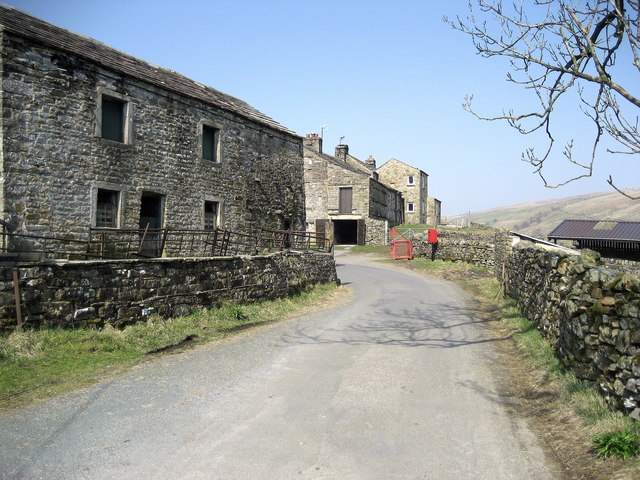
West Stonesdale

West Stonesdale is a hamlet in the Yorkshire Dales, North Yorkshire, England. The secluded village is near Keld to the south, Tan Hill to the north and...
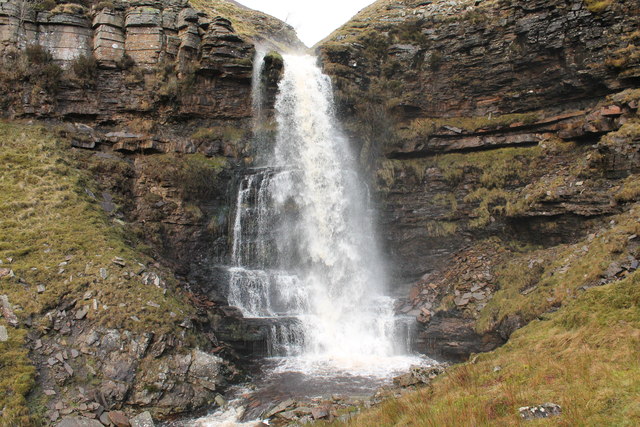
Wain Wath Force

Wain Wath Force is a waterfall on the River Swale in the Yorkshire Dales National Park, North Yorkshire, England. The falls are at grid reference NY883015...

Birkdale, North Yorkshire

Birkdale (sometimes written out as Birk Dale) is a dale in the Yorkshire Dales National Park, in North Yorkshire, England. It lies at the far western end...

Nearby Amenities

Located within 500m of 54.440904,-2.1979103
Thomas Gill Hill
Ele: 543
Natural: peak
Note: elevation estimated from contours
Lat/Long: 54.4404512/-2.1974285
Robert's Seat
Natural: peak
Lat/Long: 54.4364975/-2.1985252
The data included in this document is from www.openstreetmap.org. The data is made available under ODbL.

Have you been to Thomas Gill Hill?

Leave your review of Thomas Gill Hill below (or comments, questions and feedback).