Barfrestone

Settlement in Kent Dover

England

Barfrestone

Shepherdswell: 'Long Lane Cottage'
Shepherdswell: 'Long Lane Cottage' Credit: Michael Garlick

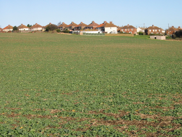
Barfrestone is a picturesque village located in the county of Kent, England. Situated approximately 7 miles south of Canterbury, it falls within the district of Dover. The village is nestled amidst the rolling countryside of the Kent Downs, an Area of Outstanding Natural Beauty.

Characterized by its quintessential charm, Barfrestone boasts a small population of around 200 residents. The village is known for its idyllic rural setting, with panoramic views of the surrounding fields and woodlands. It is a popular destination for nature enthusiasts and hikers, who can explore the numerous walking trails that crisscross the area.

At the heart of Barfrestone lies the Grade I listed Church of St. Nicholas, a Norman building dating back to the 12th century. This architectural gem features remarkable medieval wall paintings and intricately carved stone details, attracting visitors from near and far.

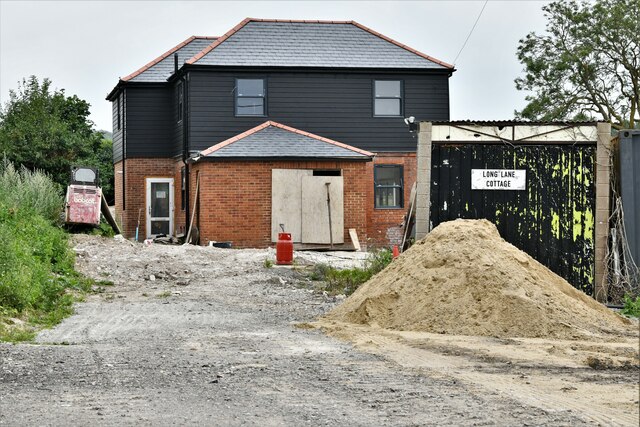
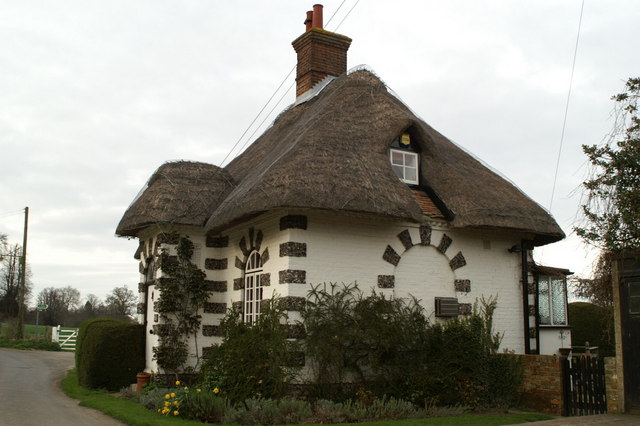
Barfrestone is also home to a number of historic houses, including Barfrestone Court, a Grade II listed manor house that dates back to the 16th century. The village maintains its traditional character with a mix of charming cottages, thatched roofs, and well-tended gardens.

Although small in size, Barfrestone benefits from a strong sense of community. The village hosts various events throughout the year, including a summer fete and a Christmas fair, fostering a close-knit atmosphere among its residents.

Overall, Barfrestone offers a tranquil and scenic retreat, making it an appealing destination for those seeking a peaceful countryside experience in the heart of Kent.

If you have any feedback on the listing, please let us know in the comments section below.

Barfrestone Images

Images are sourced within 2km of 51.206681/1.23983 or Grid Reference TR2650. Thanks to Geograph Open Source API. All images are credited.

Shepherdswell: 'Long Lane Cottage'
Shepherdswell: Farm track
The East Kent Railway at Eythorne The East Kent Light Railway was constructed between 1911 and 1917 to serve the Kent Coalfields. It opened on 16th October 1916 and closed to passenger traffic on 30th October 1948. Shepherdswell was the location of the engine shed and works, and a large number of sidings. The next station along the line was Eythorne  and the station reopened as part of the East Kent Railway in 1993. See <span class="nowrap"><a title="http://www.eastkentrailway.co.uk" rel="nofollow ugc noopener" href="http://www.eastkentrailway.co.uk">Link</a><img style="margin-left:2px;" alt="External link" title="External link - shift click to open in new window" src="https://s1.geograph.org.uk/img/external.png" width="10" height="10"/></span>

This is looking back towards Shepherdswell.
The East Kent Railway at Eythorne
The East Kent Light Railway was constructed between 1911 and 1917 to serve the Kent Coalfields. It opened on 16th October 1916 and closed to passenger traffic on 30th October 1948. Shepherdswell was the location of the engine shed and works, and a large number of sidings. The next station along the line was Eythorne and the station reopened as part of the East Kent Railway in 1993. See LinkExternal link This is looking back towards Shepherdswell.
The East Kent Railway at Eythorne The East Kent Light Railway was constructed between 1911 and 1917 to serve the Kent Coalfields. It opened on 16th October 1916 and closed to passenger traffic on 30th October 1948. Shepherdswell was the location of the engine shed and works, and a large number of sidings. The next station along the line was Eythorne  and the station reopened as part of the East Kent Railway in 1993. See <span class="nowrap"><a title="http://www.eastkentrailway.co.uk" rel="nofollow ugc noopener" href="http://www.eastkentrailway.co.uk">Link</a><img style="margin-left:2px;" alt="External link" title="External link - shift click to open in new window" src="https://s1.geograph.org.uk/img/external.png" width="10" height="10"/></span>

This is looking down the line beyond the level crossing at Shooters Hill. A little way down the line was a branch to Tilmanstone Colliery.
The East Kent Railway at Eythorne
The East Kent Light Railway was constructed between 1911 and 1917 to serve the Kent Coalfields. It opened on 16th October 1916 and closed to passenger traffic on 30th October 1948. Shepherdswell was the location of the engine shed and works, and a large number of sidings. The next station along the line was Eythorne and the station reopened as part of the East Kent Railway in 1993. See LinkExternal link This is looking down the line beyond the level crossing at Shooters Hill. A little way down the line was a branch to Tilmanstone Colliery.
The signal box at Eythorne station The East Kent Light Railway was constructed between 1911 and 1917 to serve the Kent Coalfields. It opened on 16th October 1916 and closed to passenger traffic on 30th October 1948. Shepherdswell was the location of the engine shed and works, and a large number of sidings. The next station along the line was Eythorne  and the station reopened as part of the East Kent Railway in 1993. See <span class="nowrap"><a title="http://www.eastkentrailway.co.uk" rel="nofollow ugc noopener" href="http://www.eastkentrailway.co.uk">Link</a><img style="margin-left:2px;" alt="External link" title="External link - shift click to open in new window" src="https://s1.geograph.org.uk/img/external.png" width="10" height="10"/></span>

The signal box was originally at Selling near Canterbury - see <span class="nowrap"><a title="https://eastkentrailway.co.uk/portfolio/eythorne-station/" rel="nofollow ugc noopener" href="https://eastkentrailway.co.uk/portfolio/eythorne-station/">Link</a><img style="margin-left:2px;" alt="External link" title="External link - shift click to open in new window" src="https://s1.geograph.org.uk/img/external.png" width="10" height="10"/></span>  The original control panel came with the signal box - see <a title="https://www.geograph.org.uk/photo/7171348" href="https://www.geograph.org.uk/photo/7171348">Link</a>
The signal box at Eythorne station
The East Kent Light Railway was constructed between 1911 and 1917 to serve the Kent Coalfields. It opened on 16th October 1916 and closed to passenger traffic on 30th October 1948. Shepherdswell was the location of the engine shed and works, and a large number of sidings. The next station along the line was Eythorne and the station reopened as part of the East Kent Railway in 1993. See LinkExternal link The signal box was originally at Selling near Canterbury - see LinkExternal link The original control panel came with the signal box - see Link
The signal box at Eythorne station The East Kent Light Railway was constructed between 1911 and 1917 to serve the Kent Coalfields. It opened on 16th October 1916 and closed to passenger traffic on 30th October 1948. Shepherdswell was the location of the engine shed and works, and a large number of sidings. The next station along the line was Eythorne  and the station reopened as part of the East Kent Railway in 1993. See <span class="nowrap"><a title="http://www.eastkentrailway.co.uk" rel="nofollow ugc noopener" href="http://www.eastkentrailway.co.uk">Link</a><img style="margin-left:2px;" alt="External link" title="External link - shift click to open in new window" src="https://s1.geograph.org.uk/img/external.png" width="10" height="10"/></span>

The signal box was originally at Selling near Canterbury - see <span class="nowrap"><a title="https://eastkentrailway.co.uk/portfolio/eythorne-station/" rel="nofollow ugc noopener" href="https://eastkentrailway.co.uk/portfolio/eythorne-station/">Link</a><img style="margin-left:2px;" alt="External link" title="External link - shift click to open in new window" src="https://s1.geograph.org.uk/img/external.png" width="10" height="10"/></span>  The original control panel came with the signal box - see <a title="https://www.geograph.org.uk/photo/7171348" href="https://www.geograph.org.uk/photo/7171348">Link</a>  A train from Shepherdswell has just pulled in.
The signal box at Eythorne station
The East Kent Light Railway was constructed between 1911 and 1917 to serve the Kent Coalfields. It opened on 16th October 1916 and closed to passenger traffic on 30th October 1948. Shepherdswell was the location of the engine shed and works, and a large number of sidings. The next station along the line was Eythorne and the station reopened as part of the East Kent Railway in 1993. See LinkExternal link The signal box was originally at Selling near Canterbury - see LinkExternal link The original control panel came with the signal box - see Link A train from Shepherdswell has just pulled in.
Colliery headstock at Eythorne station The East Kent Light Railway was constructed between 1911 and 1917 to serve the Kent Coalfields. It opened on 16th October 1916 and closed to passenger traffic on 30th October 1948. Shepherdswell was the location of the engine shed and works, and a large number of sidings. The next station along the line was Eythorne  and the station reopened as part of the East Kent Railway in 1993. See <span class="nowrap"><a title="http://www.eastkentrailway.co.uk" rel="nofollow ugc noopener" href="http://www.eastkentrailway.co.uk">Link</a><img style="margin-left:2px;" alt="External link" title="External link - shift click to open in new window" src="https://s1.geograph.org.uk/img/external.png" width="10" height="10"/></span>

The colliery headstock seen here was originally made as part of the stage scenery for the theatre production of 'Brassed Off'. After the last performance this part of the scenery was donated to the East Kent Railway and was rebuilt and moved into position here. See <a title="https://www.geograph.org.uk/photo/7165266" href="https://www.geograph.org.uk/photo/7165266">Link</a>  for the information board.
Colliery headstock at Eythorne station
The East Kent Light Railway was constructed between 1911 and 1917 to serve the Kent Coalfields. It opened on 16th October 1916 and closed to passenger traffic on 30th October 1948. Shepherdswell was the location of the engine shed and works, and a large number of sidings. The next station along the line was Eythorne and the station reopened as part of the East Kent Railway in 1993. See LinkExternal link The colliery headstock seen here was originally made as part of the stage scenery for the theatre production of 'Brassed Off'. After the last performance this part of the scenery was donated to the East Kent Railway and was rebuilt and moved into position here. See Link for the information board.
Information board at Eythorne station This is the information about the colliery headstock at Eythorne station - see <a title="https://www.geograph.org.uk/photo/7165264" href="https://www.geograph.org.uk/photo/7165264">Link</a>
Information board at Eythorne station
This is the information about the colliery headstock at Eythorne station - see Link
The panel in the signal box at Eythorne The East Kent Light Railway was constructed between 1911 and 1917 to serve the Kent Coalfields. It opened on 16th October 1916 and closed to passenger traffic on 30th October 1948. Shepherdswell was the location of the engine shed and works, and a large number of sidings. The next station along the line was Eythorne  and the station reopened as part of the East Kent Railway in 1993. See <span class="nowrap"><a title="http://www.eastkentrailway.co.uk" rel="nofollow ugc noopener" href="http://www.eastkentrailway.co.uk">Link</a><img style="margin-left:2px;" alt="External link" title="External link - shift click to open in new window" src="https://s1.geograph.org.uk/img/external.png" width="10" height="10"/></span>

The signal box was originally at Selling near Canterbury - see <span class="nowrap"><a title="https://eastkentrailway.co.uk/portfolio/eythorne-station/" rel="nofollow ugc noopener" href="https://eastkentrailway.co.uk/portfolio/eythorne-station/">Link</a><img style="margin-left:2px;" alt="External link" title="External link - shift click to open in new window" src="https://s1.geograph.org.uk/img/external.png" width="10" height="10"/></span>  This is the control panel brought from Selling with the signal box.
The panel in the signal box at Eythorne
The East Kent Light Railway was constructed between 1911 and 1917 to serve the Kent Coalfields. It opened on 16th October 1916 and closed to passenger traffic on 30th October 1948. Shepherdswell was the location of the engine shed and works, and a large number of sidings. The next station along the line was Eythorne and the station reopened as part of the East Kent Railway in 1993. See LinkExternal link The signal box was originally at Selling near Canterbury - see LinkExternal link This is the control panel brought from Selling with the signal box.
Our Lady’s Flats, Church Hill This was <a href="https://www.geograph.org.uk/photo/6546527">TR2749 : Our Lady’s Flats, Church Hill</a> during the building’s conversion from a chapel to a house. The name plate has been removed; it is resting against the wall near to the road.
Our Lady’s Flats, Church Hill
This was TR2749 : Our Lady’s Flats, Church Hill during the building’s conversion from a chapel to a house. The name plate has been removed; it is resting against the wall near to the road.
Bus Stop at Lower Eythorne Bus stop on Shooters Hill, Lower Eythorne.
Bus Stop at Lower Eythorne
Bus stop on Shooters Hill, Lower Eythorne.
Gap in the fence The gap between the gate and a storage container adjacent to the East Kent Railway car park appears at first glance to reveal a section of double track main line railway.  However the short lengths of well ballasted track behind the fence are isolated and only used for training railway personnel.
The ‘uneven ground’ sign warns of the unstable ballast slope beyond the gate.
Gap in the fence
The gap between the gate and a storage container adjacent to the East Kent Railway car park appears at first glance to reveal a section of double track main line railway. However the short lengths of well ballasted track behind the fence are isolated and only used for training railway personnel. The ‘uneven ground’ sign warns of the unstable ballast slope beyond the gate.
Eythorne Level Crossing The East Kent Railway crosses Shooters Hill at Lower Eythorne by this level crossing.  Normal passenger services on the East Kent Railway terminate at Eythorne Station to the southwest of the crossing.  The track to the northeast of the crossing which formerly served Tilmanstone Colliery continues for approximately 625m to just short of a former bridge over Wigmore Lane; it is partly used for the storage of rolling stock.
Eythorne Level Crossing
The East Kent Railway crosses Shooters Hill at Lower Eythorne by this level crossing. Normal passenger services on the East Kent Railway terminate at Eythorne Station to the southwest of the crossing. The track to the northeast of the crossing which formerly served Tilmanstone Colliery continues for approximately 625m to just short of a former bridge over Wigmore Lane; it is partly used for the storage of rolling stock.
The East Kent Railway at Eythorne This section of the East Kent Railway east of Eythorne Level Crossing is not used for passenger services and formerly served Tilmanstone Colliery; it continues for approximately 625m to just short of a former bridge over Wigmore Lane and is partly used for the storage of rolling stock.
This location was formerly a junction, the main line to Richborough Port continuing straight ahead where the bushes are growing.
The East Kent Railway at Eythorne
This section of the East Kent Railway east of Eythorne Level Crossing is not used for passenger services and formerly served Tilmanstone Colliery; it continues for approximately 625m to just short of a former bridge over Wigmore Lane and is partly used for the storage of rolling stock. This location was formerly a junction, the main line to Richborough Port continuing straight ahead where the bushes are growing.
Spare sleepers Incongruously placed beside a lawn and seating at Eythorne Station on the East Kent Railway are these concrete railway sleepers with cast iron 2 bolt chairs affixed.  They appear to have been there for a considerable time and there is an old railway signal ladder balanced on top.
Spare sleepers
Incongruously placed beside a lawn and seating at Eythorne Station on the East Kent Railway are these concrete railway sleepers with cast iron 2 bolt chairs affixed. They appear to have been there for a considerable time and there is an old railway signal ladder balanced on top.
Guilford Colliery Junction This former railway junction is on the East Kent Railway southwest of Eythorne Station.
The main line to Shepherdswell curves off to the right, the branch to Guilford Colliery followed the tree lined embankment in the background.
The Guilford Colliery Branch opened in October 1912 to serve the colliery which was being developed.  The colliery was abandoned before it had produced any coal and the Branch closed on the 14th July 1937.  The track was reinstated at the north end of the Branch briefly during the Second World War and used for stabling rail mounted guns.
Guilford Colliery Junction
This former railway junction is on the East Kent Railway southwest of Eythorne Station. The main line to Shepherdswell curves off to the right, the branch to Guilford Colliery followed the tree lined embankment in the background. The Guilford Colliery Branch opened in October 1912 to serve the colliery which was being developed. The colliery was abandoned before it had produced any coal and the Branch closed on the 14th July 1937. The track was reinstated at the north end of the Branch briefly during the Second World War and used for stabling rail mounted guns.
Show me another place!

Barfrestone is located at Grid Ref: TR2650 (Lat: 51.206681, Lng: 1.23983)

Administrative County: Kent

District: Dover

Police Authority: Kent

What 3 Words

///megawatt.rail.indulgent. Near Eythorne, Kent

Related Wikis

Barfrestone

Barfrestone is a village and (as Barfreston) a former civil parish, now in the parish of Eythorne, in the Dover district, in east Kent, England. It is...

Frogham, Kent

Frogham is a hamlet in the Dover District of East Kent, England, between Canterbury and Dover. It is located between the former coal mining village of...

Elvington, Kent

Elvington is a small pit village on a ridge in between Canterbury and Dover in the county of Kent in Southeast England. Located near Eythorne , Elvington...

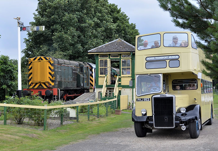
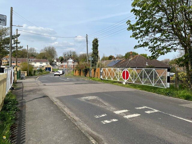
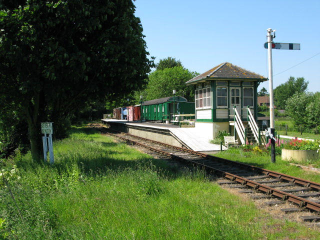
East Kent Railway (heritage)

The East Kent Railway (EKR) is a heritage railway in Kent, England. It is located at Shepherdswell station on the London and Chatham to Dover mainline...

Eythorne railway station

Eythorne railway station is a station on the East Kent Railway. Originally a station on the East Kent Light Railway, It opened on 16 October 1916 but closed...

Tilmanstone Colliery Halt railway station

Tilmanstone Colliery Halt was a station on the East Kent Light Railway. It opened on 16 October 1916 and was renamed Elvington in 1925. It closed to passenger...

Snowdown railway station

Snowdown railway station is on the Dover branch of the Chatham Main Line in England, and serves the hamlet of Snowdown, Kent. It is 69 miles 60 chains...

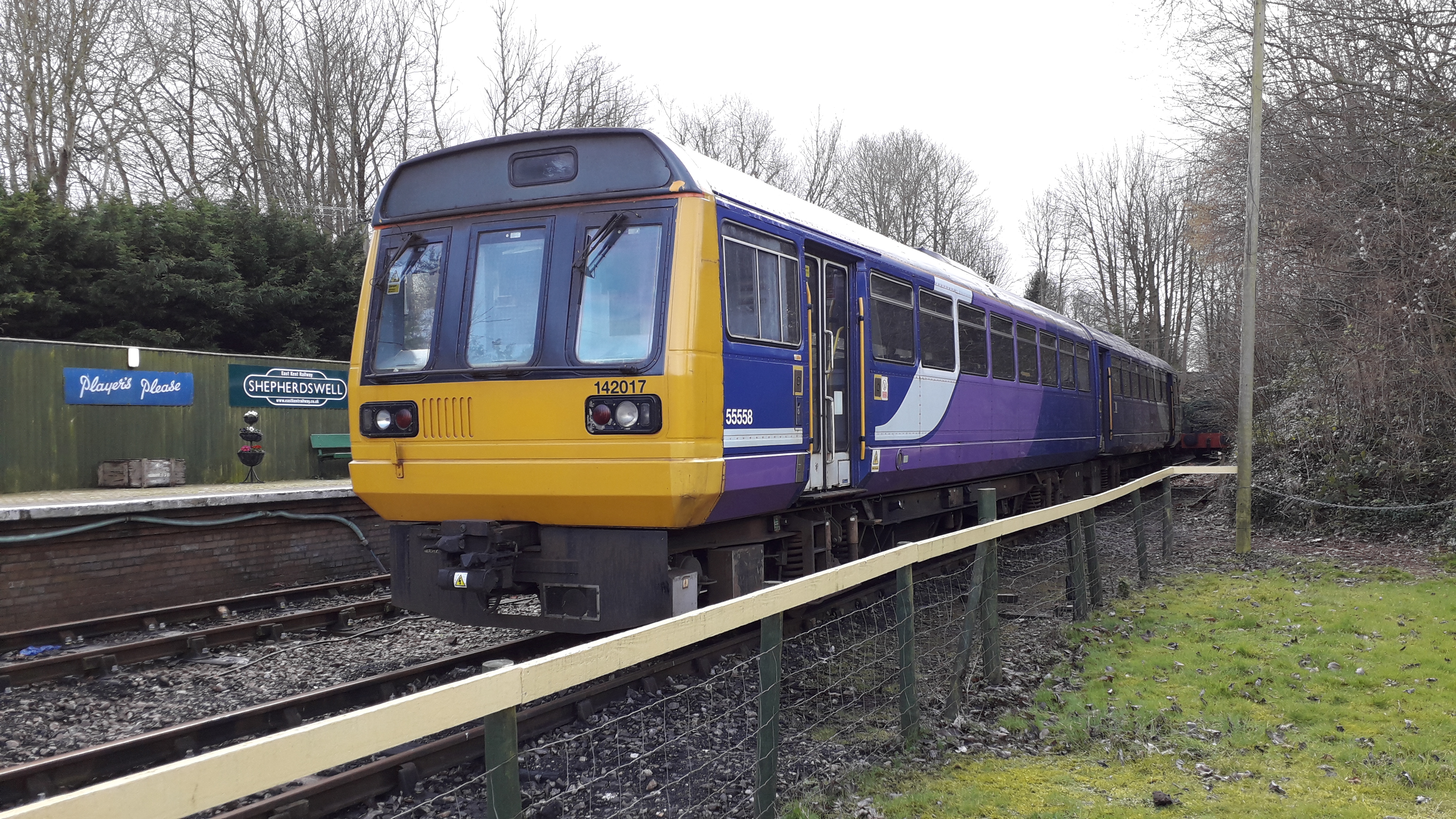
Shepherdswell railway station (EKLR)

Shepherdswell railway station is a station on the East Kent Railway. The southern terminus of the East Kent Light Railway, It opened on 16 October 1916...

Related Videos

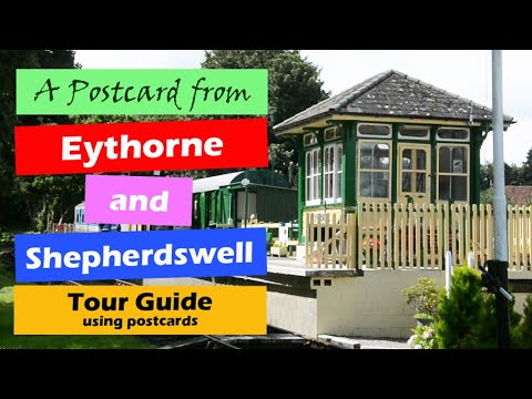
Eythorne & Shepherdswell Light Railway EKR, a Walking History Tour Guide Using Postcards Kent UK

Eythorne & Shepherdswell EKR, Light, East Kent Railway, UK, A walking history tour guide of Eythorne & Shepherdswell EKR ...

Episode 1 - Thinking about Bob

My first video diary as we enter 2020 and I begin seriously thinking about my Bob Graham fell running challenge.

Welcome to the East Kent Railway

The East Kent Railway is a fun day out for all the family with activities to keep children and grown-ups entertained. There is ...

Nearby Amenities

Located within 500m of 51.206681,1.23983
Barfrestone
Alt Name: Barfreston
Is In: Kent, England, UK
Place: hamlet
Wikidata: Q2884452
Lat/Long: 51.205906/1.2397056
Post Box
Brand: Royal Mail
Brand Wikidata: Q638098
Collection Times: Mo-Fr 16:30; Sa 10:00
Operator: Royal Mail
Operator Wikidata: Q638098
Post Box Mounting: wall
Post Box Type: lamp
Postal Code: CT15
Ref: CT15 33
Royal Cypher: EIIR
Royal Cypher Wikidata: Q33102113
Source: survey
Lat/Long: 51.2059599/1.2396062
Power: pole
Lat/Long: 51.2088675/1.2369424
Power: pole
Lat/Long: 51.209133/1.2338847
Power: pole
Lat/Long: 51.2090104/1.2353921
Power: pole
Lat/Long: 51.2082328/1.2371259
Bus Stop
Barfrestone Road
Fixme: Can somebody confirm is there is a bus stop here? If yes, can they set naptan:verified to yes.
Flag: no
Naptan AtcoCode: 2400A043460A
Naptan Bearing: E
Naptan BusStopType: CUS
Naptan CommonName: Barfrestone Road
Naptan Indicator: E-bound
Naptan Landmark: Church
Naptan NaptanCode: kntdtpjt
Naptan Street: Barfrestone Road
Naptan Verified: no
Public Transport: platform
Ref: kntdtpjt
Source: NAPTAN
Source Date: 2018-04-11T12:29:00
Lat/Long: 51.2056539/1.2389363
Bus Stop
Barfrestone Road
Fixme: Can somebody confirm is there is a bus stop here? If yes, can they set naptan:verified to yes.
Flag: no
Naptan AtcoCode: 2400103837
Naptan Bearing: W
Naptan BusStopType: CUS
Naptan CommonName: Barfrestone Road
Naptan Indicator: W-bound
Naptan Landmark: Church
Naptan NaptanCode: kntjmjpw
Naptan Street: Barfrestone Road
Naptan Verified: no
Public Transport: platform
Ref: kntjmjpw
Source: NAPTAN
Source Date: 2018-04-11T12:30:00
Lat/Long: 51.2055313/1.2391425
Telephone
Advertising: board
Booth: K6
Covered: booth
Man Made: telephone_box
Lat/Long: 51.2058177/1.2405761
Defibrillator
Access: yes
Defibrillator Location: At side of southern end of Pie Factory Road, mounted on a white board
Emergency: defibrillator
Indoor: no
Lat/Long: 51.2069737/1.2360504
The data included in this document is from www.openstreetmap.org. The data is made available under ODbL.

Have you been to Barfrestone?

Leave your review of Barfrestone below (or comments, questions and feedback).