Barbers Hill

Hill, Mountain in Yorkshire Ribble Valley

England

Barbers Hill

Bentha Hill Fields
Bentha Hill Fields Credit: Anthony Parkes

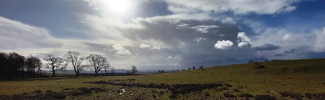
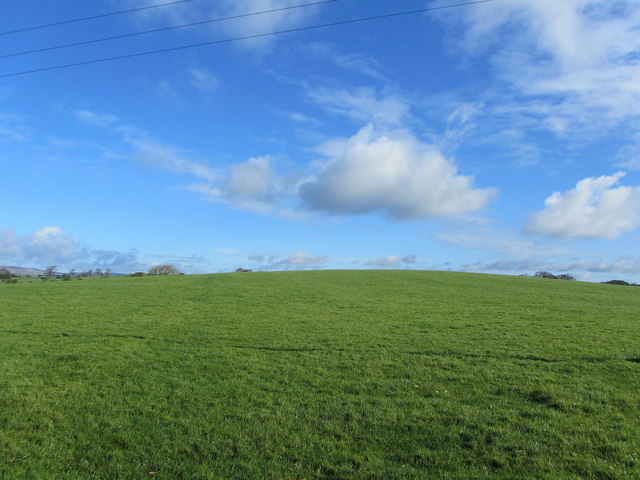
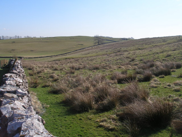
Barbers Hill, located in the picturesque region of Yorkshire, is a prominent hill that offers breathtaking views and an array of outdoor activities. Rising to an elevation of approximately 420 meters (1,378 feet), it is classified as a hill rather than a mountain due to its lower stature in comparison to the nearby mountains of the region.

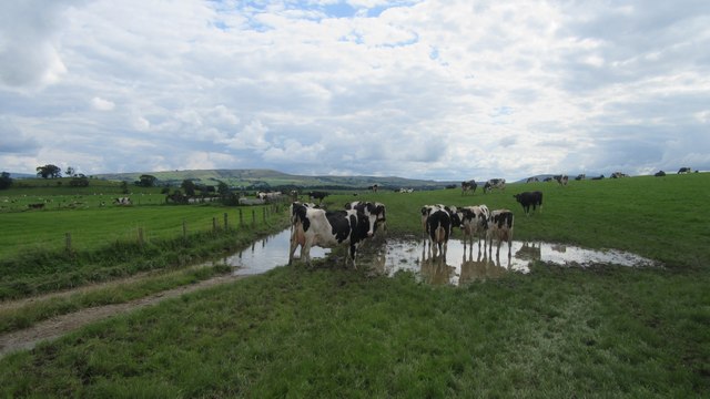
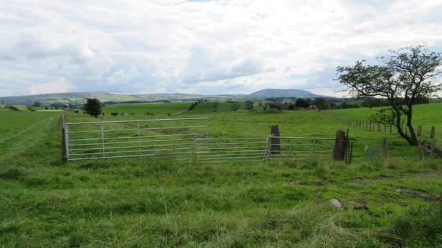
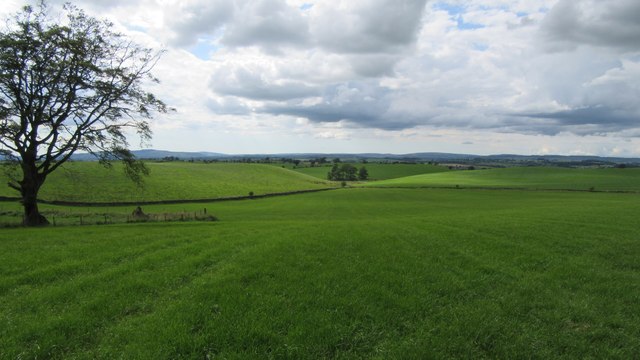
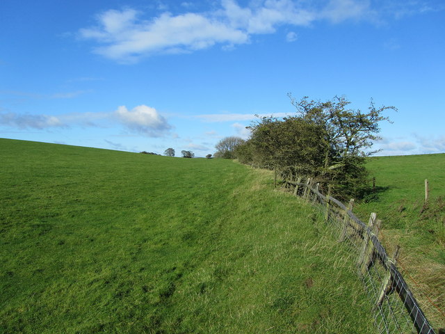
The hill is well-known for its lush greenery and diverse wildlife, attracting nature enthusiasts and hikers from near and far. Its slopes are covered with a variety of vegetation, including heather, grasses, and wildflowers, creating a vibrant and picturesque landscape. The hill is also home to various species of birds, making it an ideal spot for birdwatchers.

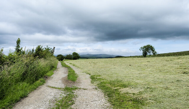
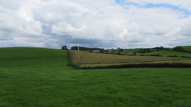
Hiking trails crisscross the hill, providing visitors with opportunities to explore its scenic beauty. The trails vary in difficulty, catering to both novice and experienced hikers. As one ascends the hill, they are rewarded with panoramic views of the surrounding countryside, including the rolling hills, valleys, and nearby towns.

Barbers Hill is also a popular spot for paragliding and hang gliding. Its elevated location and favorable wind conditions make it an exhilarating destination for aerial sports enthusiasts. The hill attracts thrill-seekers who enjoy the adrenaline rush of soaring through the skies while taking in the stunning vistas below.

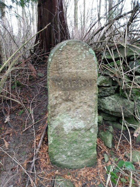
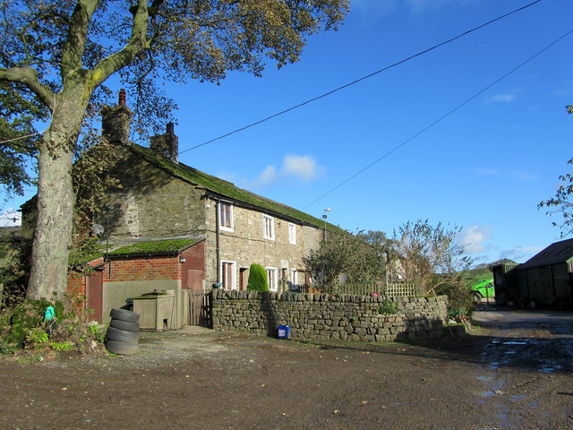
Additionally, the hill has historical significance, with remnants of ancient settlements and burial mounds discovered in its vicinity. These archaeological findings provide insights into the region's rich past and add an extra layer of intrigue for history buffs.

Overall, Barbers Hill in Yorkshire is a captivating destination that offers a perfect blend of natural beauty, outdoor adventures, and cultural heritage.

If you have any feedback on the listing, please let us know in the comments section below.
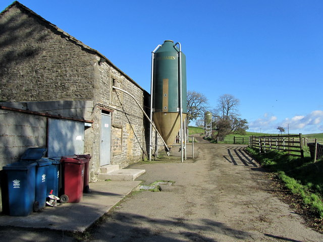
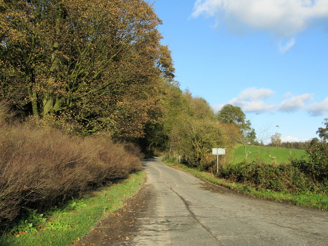
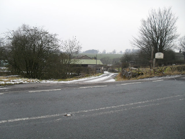
Barbers Hill Images

Images are sourced within 2km of 53.961301/-2.2089494 or Grid Reference SD8651. Thanks to Geograph Open Source API. All images are credited.

Bentha Hill Fields
Bentha Hill Fields
Farm road at field edge A fairly crude, hard-surfaced road at the edge of a field of cut grass, north of the location at Hill Hey.
Farm road at field edge
A fairly crude, hard-surfaced road at the edge of a field of cut grass, north of the location at Hill Hey.
Old Boundary Marker on the edge of Tosber Wood Parish Boundary Marker on the edge of Tosber Wood to the rear of a drainage ditch on the west side of an unnamed road 500 metres northeast of its junction with the A59. On the boundary of Martons Both, Horton and Bracewell parishes. All were formerly in The West Riding but since 1974 the stone has been on the border of Lancashire and North Yorkshire. Bracewell combined with Brogden parish Bracewell and Brogden parish in 1987. Grade II Listed details <span class="nowrap"><a title="https://historicengland.org.uk/listing/the-list/list-entry/1317724" rel="nofollow ugc noopener" href="https://historicengland.org.uk/listing/the-list/list-entry/1317724">Link</a><img style="margin-left:2px;" alt="External link" title="External link - shift click to open in new window" src="https://s1.geograph.org.uk/img/external.png" width="10" height="10"/></span>.

Milestone Society National ID: YW_MART01pb
Old Boundary Marker on the edge of Tosber Wood
Parish Boundary Marker on the edge of Tosber Wood to the rear of a drainage ditch on the west side of an unnamed road 500 metres northeast of its junction with the A59. On the boundary of Martons Both, Horton and Bracewell parishes. All were formerly in The West Riding but since 1974 the stone has been on the border of Lancashire and North Yorkshire. Bracewell combined with Brogden parish Bracewell and Brogden parish in 1987. Grade II Listed details LinkExternal link. Milestone Society National ID: YW_MART01pb
Public footpath East of Horton Looking East at public footpath crossing fields between Horton and Pasture House Farm.
Public footpath East of Horton
Looking East at public footpath crossing fields between Horton and Pasture House Farm.
Cows on Bridleway / footpath junction Looking South back towards footpath / bridleway junction near Horton
Cows on Bridleway / footpath junction
Looking South back towards footpath / bridleway junction near Horton
Gates tied across bridleway Looking South West down bridleway with tied gates across
Gates tied across bridleway
Looking South West down bridleway with tied gates across
Small copse on bridleway Looking West along bridleway at small copse West of Horton Pasture farm
Small copse on bridleway
Looking West along bridleway at small copse West of Horton Pasture farm
Railway Bridge at Nappa The A682 Gisburn/Long Preston Road at the scattered community of Nappa as it is crossed by a railway bridge.  It carries a mineral line that connects Clitheroe to Hellifield.
Railway Bridge at Nappa
The A682 Gisburn/Long Preston Road at the scattered community of Nappa as it is crossed by a railway bridge. It carries a mineral line that connects Clitheroe to Hellifield.
White Hill Small drumlin off Knot Lane
White Hill
Small drumlin off Knot Lane
Boundary Fence between White and Hoober Hill Fence follows the saddle between the two drumlins of White Hill and Hoober Hill
Boundary Fence between White and Hoober Hill
Fence follows the saddle between the two drumlins of White Hill and Hoober Hill
Hoober Farmhouse at the foot of Hoober Hill
Hoober
Farmhouse at the foot of Hoober Hill
Unofficial Dump by Hoober Plantation Rather unsightly refuse encountered on a country walk
Unofficial Dump by Hoober Plantation
Rather unsightly refuse encountered on a country walk
Approaching Varley Field The farmyard appears abandoned, although the farmhouse is still occupied
Approaching Varley Field
The farmyard appears abandoned, although the farmhouse is still occupied
Track between Varley Field and Lower Paradise Muddy track connecting two farming operations - one now appearing to be abandoned
Track between Varley Field and Lower Paradise
Muddy track connecting two farming operations - one now appearing to be abandoned
Yorsdale Outbuildings attached to Lower Paradise Farm
Yorsdale
Outbuildings attached to Lower Paradise Farm
Lane on Bentha Hill Signposted to Bank Newton, this lane has just left the A59 at Bentha Hill
Lane on Bentha Hill
Signposted to Bank Newton, this lane has just left the A59 at Bentha Hill
Nappa Manor Farm entrance
Footpath below Flambers Hill Not much on the ground.   Flambers Hill rises to the right
Footpath below Flambers Hill
Not much on the ground. Flambers Hill rises to the right
Show me another place!

Barbers Hill is located at Grid Ref: SD8651 (Lat: 53.961301, Lng: -2.2089494)

Division: West Riding

Administrative County: Lancashire

District: Ribble Valley

Police Authority: Lancashire

What 3 Words

///under.prospered.decimals. Near Hellifield, North Yorkshire

Related Wikis

Horton, Lancashire

Horton, historically known as Horton-in-Craven, is a village and a civil parish in the Ribble Valley district of the English county of Lancashire (historically...

Nappa, North Yorkshire

Nappa is a hamlet in the civil parish of Hellifield, in North Yorkshire, England. It is on the A682 road and 6 miles (9.7 km) north-west of Barnoldswick...

A59 road

The A59 is a major road in England which is around 109 miles (175 km) long and runs from Wallasey, Merseyside to York, North Yorkshire. The alignment formed...

Gledstone Hall

Gledstone Hall is a 20th-century country house in West Marton, near Skipton, North Yorkshire, England. Designed by Edwin Lutyens it stands in a 12-hectare...

Newsholme, Lancashire

Newsholme is a small village and civil parish in the Ribble Valley, Lancashire, England, but lies within the historic West Riding of Yorkshire. According...

Newsholme railway station

Newsholme railway station was a railway station that served the small village of Newsholme in Lancashire. It was built by the Lancashire and Yorkshire...

Swinden

Swinden is a village in the civil parish of Hellifield, in North Yorkshire, England. It is near Halton West and Nappa and about 7 miles north of Barnoldswick...

Martons Both

Martons Both is a civil parish in the Craven district of North Yorkshire, England. The civil parish is formed by the villages of East Marton and West Marton...

Nearby Amenities

Located within 500m of 53.961301,-2.2089494
Barbers Hill
Natural: peak
Source: OS 1:25k
Lat/Long: 53.9617215/-2.2105262
Place: farm
Lat/Long: 53.9609279/-2.2036398
The data included in this document is from www.openstreetmap.org. The data is made available under ODbL.

Have you been to Barbers Hill?

Leave your review of Barbers Hill below (or comments, questions and feedback).