Broad Stone Rigg

Hill, Mountain in Yorkshire

England

Broad Stone Rigg

Lune Head Stone Circle
Lune Head Stone Circle Credit: Anthony Parkes

Broad Stone Rigg is a prominent hill located in the Yorkshire Dales National Park, in the county of Yorkshire, England. It is situated near the village of Grassington and stands at an elevation of approximately 456 meters (1,496 feet) above sea level.

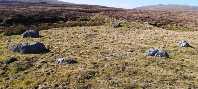
The hill is characterized by its distinctive flat top, which is covered in heather and grass, providing a picturesque view of the surrounding countryside. The summit of Broad Stone Rigg offers panoramic vistas of the rolling hills and valleys of the Yorkshire Dales, making it a popular destination for hikers, walkers, and nature enthusiasts.

The hill is composed mainly of millstone grit, a type of sandstone that is common in the region. Its geology and rugged terrain have resulted in the formation of several deep scars and gullies on its slopes, adding to its natural beauty and appeal.

Broad Stone Rigg is part of a larger network of walking trails and footpaths, making it easily accessible to visitors who wish to explore the area. The hill is often included in hiking routes, such as the Grassington Circular Walk, which offers a challenging yet rewarding trek through the picturesque Yorkshire countryside.

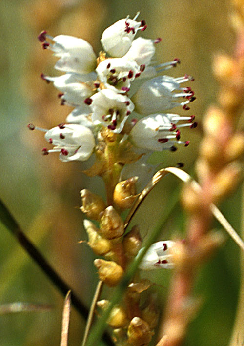
In addition to its natural beauty, Broad Stone Rigg is also home to a variety of wildlife, including birds such as curlews, lapwings, and golden plovers. The hill is also known for its rich flora, with heather, bilberry, and cotton grass being common sights during the summer months.

Overall, Broad Stone Rigg offers a stunning and immersive experience of the Yorkshire Dales, combining breathtaking views, diverse wildlife, and a sense of tranquility that attracts visitors from near and far.

If you have any feedback on the listing, please let us know in the comments section below.

Broad Stone Rigg Images

Images are sourced within 2km of 54.567326/-2.2119786 or Grid Reference NY8619. Thanks to Geograph Open Source API. All images are credited.

Lune Head Stone Circle
Old milepost On the B6276 just north of the bridge over the River Lune at Grains o' th' Beck is this late 19C/early 20C metal post set up by the North Riding County Council when this area was in that Riding.  In 1974 it came under the jurisdiction of Co. Durham.  The post is opposite the farm.  The legends are - On the left-hand-side, BROUGH/7/MILE/arrow pointing to right.  On the right-hand-side, MIDDLETON/7¼/MILES/arrow to left.   On the top, NORTH RIDING OF /YORKSHIRE with a rose emblem.  The foundry name is inside the back left-hand-side,  F Mattison & Co./ Bedale.   It is Grade II listed 1310435.
Old milepost
On the B6276 just north of the bridge over the River Lune at Grains o' th' Beck is this late 19C/early 20C metal post set up by the North Riding County Council when this area was in that Riding. In 1974 it came under the jurisdiction of Co. Durham. The post is opposite the farm. The legends are - On the left-hand-side, BROUGH/7/MILE/arrow pointing to right. On the right-hand-side, MIDDLETON/7¼/MILES/arrow to left. On the top, NORTH RIDING OF /YORKSHIRE with a rose emblem. The foundry name is inside the back left-hand-side, F Mattison & Co./ Bedale. It is Grade II listed 1310435.
Old milepost Looking towards Middleton-in-Teesdale this shows the milepost at Grains o' th' Beck in its setting.   Some of the verge has been dug out to reveal more of the legends.   This milepost is pictured on P 35 of the 2002 Shire book 'Milestones' by Mervyn Benford.   Then it had much more paint with the remnants of DCC painted on the bevel.   Grade II listed 1310435.
Old milepost
Looking towards Middleton-in-Teesdale this shows the milepost at Grains o' th' Beck in its setting. Some of the verge has been dug out to reveal more of the legends. This milepost is pictured on P 35 of the 2002 Shire book 'Milestones' by Mervyn Benford. Then it had much more paint with the remnants of DCC painted on the bevel. Grade II listed 1310435.
Fence with gate on Pind Hill Pind Hill is a minor feature in the desolation of the moorland along the Cumbria/County Durham boundary; the fence line now marks that boundary which was previously the Westmorland/Yorkshire boundary. The boundary stone standing close to the gate is numbered C16 and is one of a series, every stone being cut with its own number; not all remain visible but most are though they might be toppled or partly sunken into the ground. Most stones have just their deeply cut number to show but the stone on Pind Hill has a capital C too - its significance is not known. See also <a title="https://www.geograph.org.uk/photo/4239663" href="https://www.geograph.org.uk/photo/4239663">Link</a>
Fence with gate on Pind Hill
Pind Hill is a minor feature in the desolation of the moorland along the Cumbria/County Durham boundary; the fence line now marks that boundary which was previously the Westmorland/Yorkshire boundary. The boundary stone standing close to the gate is numbered C16 and is one of a series, every stone being cut with its own number; not all remain visible but most are though they might be toppled or partly sunken into the ground. Most stones have just their deeply cut number to show but the stone on Pind Hill has a capital C too - its significance is not known. See also Link
Old Boundary Marker on Stainmore Common Estate Boundary Marker beside a wire fence on Stainmore Common 1840 metres southeast of the B6276 towards Pind Hill. Inscribed 31. On the boundary of Stainmore parish, Westmorland, now Cumbria, and Lunedale parish, North Riding, now County Durham.

Milestone Society National ID: WE_CBDM031em
Old Boundary Marker on Stainmore Common
Estate Boundary Marker beside a wire fence on Stainmore Common 1840 metres southeast of the B6276 towards Pind Hill. Inscribed 31. On the boundary of Stainmore parish, Westmorland, now Cumbria, and Lunedale parish, North Riding, now County Durham. Milestone Society National ID: WE_CBDM031em
Old Boundary Marker on Stainmore Common Estate Boundary Marker beside a wire fence on Stainmore Common 1900 metres southeast of the B6276 towards Pind Hill. Inscribed 30. On the boundary of Stainmore parish, Westmorland, now Cumbria, and Lunedale parish, North Riding, now County Durham.

Milestone Society National ID: WE_CBDM030em
Old Boundary Marker on Stainmore Common
Estate Boundary Marker beside a wire fence on Stainmore Common 1900 metres southeast of the B6276 towards Pind Hill. Inscribed 30. On the boundary of Stainmore parish, Westmorland, now Cumbria, and Lunedale parish, North Riding, now County Durham. Milestone Society National ID: WE_CBDM030em
Old Boundary Marker on Stainmore Common Estate Boundary Marker on Pind Hill, Stainmore Common, beside a wire fence. On the boundary of Stainmore parish, Westmorland, now Cumbria, and Hunderthwaite, Lunedale and Mikleton parishes, North Riding, now County Durham. Inscribed C / 16. See also <a title="https://www.geograph.org.uk/photo/6592046" href="https://www.geograph.org.uk/photo/6592046">Link</a> and <a title="https://www.geograph.org.uk/photo/4253005" href="https://www.geograph.org.uk/photo/4253005">Link</a>.

Milestone Society National ID: WE_CBDM016em
Old Boundary Marker on Stainmore Common
Estate Boundary Marker on Pind Hill, Stainmore Common, beside a wire fence. On the boundary of Stainmore parish, Westmorland, now Cumbria, and Hunderthwaite, Lunedale and Mikleton parishes, North Riding, now County Durham. Inscribed C / 16. See also Link and Link. Milestone Society National ID: WE_CBDM016em
Old Boundary Marker on Stainmore Common Boundary Marker on Stainmore Common, beside a wire fence 25 metres northwest of Pind Hill. On the boundary of Stainmore parish, Westmorland, now Cumbria, and Lunedale parish, North Riding, now County Durham. Inscribed but unreadable and not one of the numbered WE_CBDM series.

Milestone Society National ID: WE_STALUN01bm
Old Boundary Marker on Stainmore Common
Boundary Marker on Stainmore Common, beside a wire fence 25 metres northwest of Pind Hill. On the boundary of Stainmore parish, Westmorland, now Cumbria, and Lunedale parish, North Riding, now County Durham. Inscribed but unreadable and not one of the numbered WE_CBDM series. Milestone Society National ID: WE_STALUN01bm
Old Boundary Marker on Stainmore Common Estate Boundary Marker on Stainmore Common, beside a wire fence 170 metres northwest of Pind Hill. On the boundary of Stainmore parish, Westmorland, now Cumbria, and Lunedale parish, North Riding, now County Durham. Inscribed 17.

Milestone Society National ID: WE_CBDM017em
Old Boundary Marker on Stainmore Common
Estate Boundary Marker on Stainmore Common, beside a wire fence 170 metres northwest of Pind Hill. On the boundary of Stainmore parish, Westmorland, now Cumbria, and Lunedale parish, North Riding, now County Durham. Inscribed 17. Milestone Society National ID: WE_CBDM017em
Old Boundary Marker on Stainmore Common Estate Boundary Marker on Stainmore Common, beside a wire fence 290 metres northwest of Pind Hill. On the boundary of Stainmore parish, Westmorland, now Cumbria, and Lunedale parish, North Riding, now County Durham. Inscribed 18.

Milestone Society National ID: WE_CBDM018em
Old Boundary Marker on Stainmore Common
Estate Boundary Marker on Stainmore Common, beside a wire fence 290 metres northwest of Pind Hill. On the boundary of Stainmore parish, Westmorland, now Cumbria, and Lunedale parish, North Riding, now County Durham. Inscribed 18. Milestone Society National ID: WE_CBDM018em
Old Boundary Marker on Stainmore Common Estate Boundary Marker on Stainmore Common, beside a wire fence 470 metres northwest of Pind Hill. On the boundary of Stainmore parish, Westmorland, now Cumbria, and Lunedale parish, North Riding, now County Durham. Inscribed 19.

Milestone Society National ID: WE_CBDM019em
Old Boundary Marker on Stainmore Common
Estate Boundary Marker on Stainmore Common, beside a wire fence 470 metres northwest of Pind Hill. On the boundary of Stainmore parish, Westmorland, now Cumbria, and Lunedale parish, North Riding, now County Durham. Inscribed 19. Milestone Society National ID: WE_CBDM019em
Old Boundary Marker on Stainmore Common Estate Boundary Marker on Stainmore Common, beside a wire fence 660 metres northwest of Pind Hill. On the boundary of Stainmore parish, Westmorland, now Cumbria, and Lunedale parish, North Riding, now County Durham. Inscribed 20.

Milestone Society National ID: WE_CBDM020em
Old Boundary Marker on Stainmore Common
Estate Boundary Marker on Stainmore Common, beside a wire fence 660 metres northwest of Pind Hill. On the boundary of Stainmore parish, Westmorland, now Cumbria, and Lunedale parish, North Riding, now County Durham. Inscribed 20. Milestone Society National ID: WE_CBDM020em
Old Boundary Marker on Stainmore Common Estate Boundary Marker on Stainmore Common, beside a wire fence 850 metres northwest of Pind Hill. On the boundary of Stainmore parish, Westmorland, now Cumbria, and Lunedale parish, North Riding, now County Durham. Inscribed 21.

Milestone Society National ID: WE_CBDM021em
Old Boundary Marker on Stainmore Common
Estate Boundary Marker on Stainmore Common, beside a wire fence 850 metres northwest of Pind Hill. On the boundary of Stainmore parish, Westmorland, now Cumbria, and Lunedale parish, North Riding, now County Durham. Inscribed 21. Milestone Society National ID: WE_CBDM021em
Old Boundary Marker on Stainmore Common Estate Boundary Marker on Stainmore Common, beside a wire fence 1000 metres northwest of Pind Hill. On the boundary of Stainmore parish, Westmorland, now Cumbria, and Lunedale parish, North Riding, now County Durham. Inscribed 22.

Milestone Society National ID: WE_CBDM022em
Old Boundary Marker on Stainmore Common
Estate Boundary Marker on Stainmore Common, beside a wire fence 1000 metres northwest of Pind Hill. On the boundary of Stainmore parish, Westmorland, now Cumbria, and Lunedale parish, North Riding, now County Durham. Inscribed 22. Milestone Society National ID: WE_CBDM022em
Old Boundary Marker on Stainmore Common Estate Boundary Marker on Stainmore Common, beside a wire fence 1200 metres northwest of Pind Hill. On the boundary of Stainmore parish, Westmorland, now Cumbria, and Lunedale parish, North Riding, now County Durham. Inscribed 23.

Milestone Society National ID: WE_CBDM023em
Old Boundary Marker on Stainmore Common
Estate Boundary Marker on Stainmore Common, beside a wire fence 1200 metres northwest of Pind Hill. On the boundary of Stainmore parish, Westmorland, now Cumbria, and Lunedale parish, North Riding, now County Durham. Inscribed 23. Milestone Society National ID: WE_CBDM023em
Old Boundary Marker on Stainmore Common Estate Boundary Marker on Stainmore Common, beside a wire fence 1390 metres northwest of Pind Hill. On the boundary of Stainmore parish, Westmorland, now Cumbria, and Lunedale parish, North Riding, now County Durham. Inscribed 24.

Milestone Society National ID: WE_CBDM024em
Old Boundary Marker on Stainmore Common
Estate Boundary Marker on Stainmore Common, beside a wire fence 1390 metres northwest of Pind Hill. On the boundary of Stainmore parish, Westmorland, now Cumbria, and Lunedale parish, North Riding, now County Durham. Inscribed 24. Milestone Society National ID: WE_CBDM024em
Old Boundary Marker on Stainmore Common Estate Boundary Marker on Stainmore Common, beside a wire fence 1580 metres northwest of Pind Hill. On the boundary of Stainmore parish, Westmorland, now Cumbria, and Lunedale parish, North Riding, now County Durham. Inscribed 25.

Milestone Society National ID: WE_CBDM025em
Old Boundary Marker on Stainmore Common
Estate Boundary Marker on Stainmore Common, beside a wire fence 1580 metres northwest of Pind Hill. On the boundary of Stainmore parish, Westmorland, now Cumbria, and Lunedale parish, North Riding, now County Durham. Inscribed 25. Milestone Society National ID: WE_CBDM025em
Old Boundary Marker on Stainmore Common Estate Boundary Marker on Stainmore Common, beside a wire fence 1670 metres northwest of Pind Hill. On the boundary of Stainmore parish, Westmorland, now Cumbria, and Lunedale parish, North Riding, now County Durham. Inscribed 26.

Milestone Society National ID: WE_CBDM026em
Old Boundary Marker on Stainmore Common
Estate Boundary Marker on Stainmore Common, beside a wire fence 1670 metres northwest of Pind Hill. On the boundary of Stainmore parish, Westmorland, now Cumbria, and Lunedale parish, North Riding, now County Durham. Inscribed 26. Milestone Society National ID: WE_CBDM026em
Show me another place!

Broad Stone Rigg is located at Grid Ref: NY8619 (Lat: 54.567326, Lng: -2.2119786)

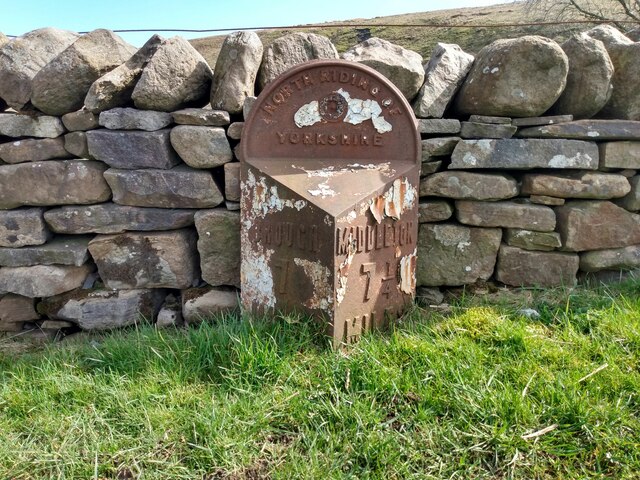
Division: North Riding

Unitary Authority: County Durham

Police Authority: Durham

What 3 Words

///unearthly.lakes.mission. Near Holwick, Co. Durham

Nearby Locations

High Bout Broad Stone Rigg

Related Wikis

Foster's Hush

Foster's Hush is a Site of Special Scientific Interest in the Teesdale district of west County Durham, England. It is located in the valley of Lune Head...

Grains o' th' Beck Meadows

Grains o' th' Beck Meadows is a Site of Special Scientific Interest in the Teesdale district of south-west County Durham, England. It consists of three...

Lune Forest

Lune Forest is a Site of Special Scientific Interest covering an extensive area of moorland in the Teesdale district of west Durham, England. In the north...

Lunedale

Lunedale is the dale, or valley, of the River Lune, on the east side of the Pennines in England, west of Middleton-in-Teesdale. Its principal settlements...

Close House Mine

Close House Mine is a Site of Special Scientific Interest in the Teesdale district of west County Durham, England. It is a working opencast mine located...

Battle of Stainmore

The Battle of Stainmore was probably fought between the Earldom of Bernicia, led by Oswulf, and the forces of the last Norse king of Jórvík (York), Eric...

A66 road

The A66 is a major road in Northern England, which in part follows the course of the Roman road from Scotch Corner to Penrith. It runs from east of Middlesbrough...
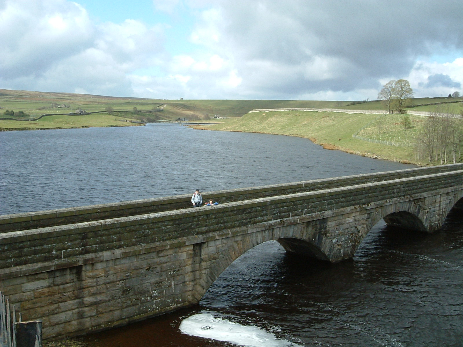
Selset Reservoir

Selset Reservoir is a reservoir in County Durham, England. It is situated in Lunedale which is a side valley of the River Tees, about 5 miles (8 km) west...

Have you been to Broad Stone Rigg?

Leave your review of Broad Stone Rigg below (or comments, questions and feedback).