Latchly Hill

Hill, Mountain in Roxburghshire

Scotland

Latchly Hill

Gate, Steer Rig This gate connects Scotland with England and lies adjacent to the route of the Pennine Way. The hills in the background (England) are, from left to right, Great Hetha, Yeavering Bell, Easter Tor, Wester Tor and Hare Law. For a selection of detailed free to download walking routes in the area visit <span class="nowrap"><a title="www.cheviotwalks.co.uk" rel="nofollow ugc noopener" href="http://www.cheviotwalks.co.uk">Link</a><img style="margin-left:2px;" alt="External link" title="External link - shift click to open in new window" src="https://s1.geograph.org.uk/img/external.png" width="10" height="10"/></span>
Gate, Steer Rig Credit: Geoff Holland

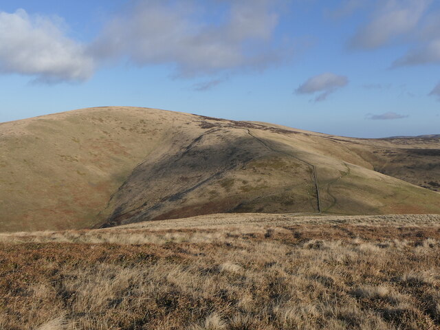
Latchly Hill, located in Roxburghshire, is a prominent hill/mountain in the southern part of Scotland. With an elevation of approximately 390 meters (1,280 feet), it offers stunning views of the surrounding countryside. Situated near the village of Lilliesleaf, Latchly Hill is a popular destination for hikers, nature enthusiasts, and photographers.

The hill is characterized by its gently sloping sides, covered in a mix of grasses, heather, and scattered trees. The terrain is relatively easy to navigate, making it suitable for walkers of all levels of experience. Several well-marked trails crisscross the hill, offering visitors the opportunity to explore its diverse flora and fauna.

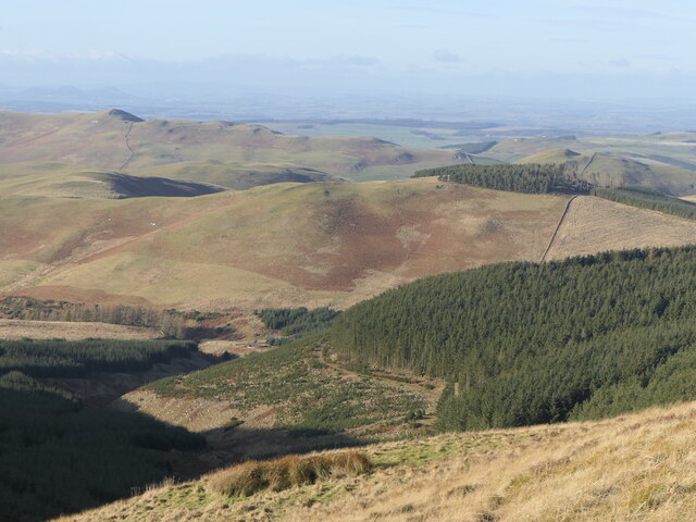
At the summit of Latchly Hill, visitors are rewarded with breathtaking panoramic views of the rolling hills and valleys that define Roxburghshire. On clear days, it is even possible to catch a glimpse of the distant Cheviot Hills to the south.

In addition to its natural beauty, Latchly Hill also has historical significance. It is believed that the hill was once used as a lookout point during conflicts between Scotland and England. Remnants of ancient fortifications can still be seen, adding an element of intrigue to the site.

Overall, Latchly Hill is a picturesque and accessible destination for outdoor enthusiasts seeking a peaceful escape in the heart of Roxburghshire. Its combination of natural beauty, historical interest, and scenic views make it a must-visit location for anyone exploring the region.

If you have any feedback on the listing, please let us know in the comments section below.
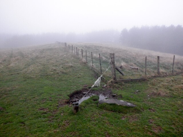
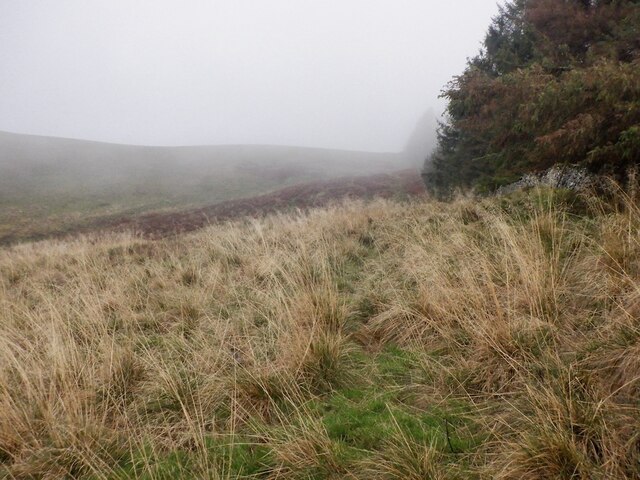
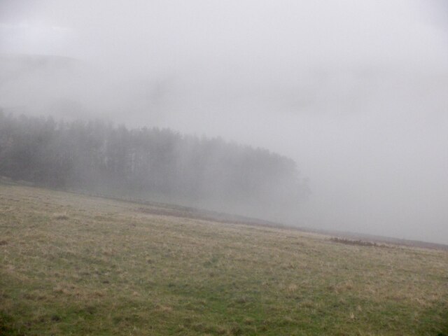
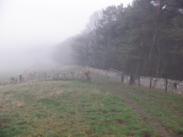
Latchly Hill Images

Images are sourced within 2km of 55.514957/-2.2450935 or Grid Reference NT8424. Thanks to Geograph Open Source API. All images are credited.

Gate, Steer Rig This gate connects Scotland with England and lies adjacent to the route of the Pennine Way. The hills in the background (England) are, from left to right, Great Hetha, Yeavering Bell, Easter Tor, Wester Tor and Hare Law. For a selection of detailed free to download walking routes in the area visit <span class="nowrap"><a title="www.cheviotwalks.co.uk" rel="nofollow ugc noopener" href="http://www.cheviotwalks.co.uk">Link</a><img style="margin-left:2px;" alt="External link" title="External link - shift click to open in new window" src="https://s1.geograph.org.uk/img/external.png" width="10" height="10"/></span>
Gate, Steer Rig
This gate connects Scotland with England and lies adjacent to the route of the Pennine Way. The hills in the background (England) are, from left to right, Great Hetha, Yeavering Bell, Easter Tor, Wester Tor and Hare Law. For a selection of detailed free to download walking routes in the area visit LinkExternal link
English/Scottish Border, Steer Rig The fence marks the border between England (left) and Scotland (right) whilst the track is the route of the Pennine Way. The hill right of centre is The Curr (Scotland) whilst the one left of centre is Black Hag (England). For a selection of detailed free to download walking routes in the area visit <span class="nowrap"><a title="www.cheviotwalks.co.uk" rel="nofollow ugc noopener" href="http://www.cheviotwalks.co.uk">Link</a><img style="margin-left:2px;" alt="External link" title="External link - shift click to open in new window" src="https://s1.geograph.org.uk/img/external.png" width="10" height="10"/></span>
English/Scottish Border, Steer Rig
The fence marks the border between England (left) and Scotland (right) whilst the track is the route of the Pennine Way. The hill right of centre is The Curr (Scotland) whilst the one left of centre is Black Hag (England). For a selection of detailed free to download walking routes in the area visit LinkExternal link
Wall and Fence, Steerrig Knowe The wall and fence tumble down towards the head of the Halter Burn before climbing the slopes of Latchly Hill seen slightly right of centre. For a selection of detailed free to download walking routes in the area visit <span class="nowrap"><a title="www.cheviotwalks.co.uk" rel="nofollow ugc noopener" href="http://www.cheviotwalks.co.uk">Link</a><img style="margin-left:2px;" alt="External link" title="External link - shift click to open in new window" src="https://s1.geograph.org.uk/img/external.png" width="10" height="10"/></span>
Wall and Fence, Steerrig Knowe
The wall and fence tumble down towards the head of the Halter Burn before climbing the slopes of Latchly Hill seen slightly right of centre. For a selection of detailed free to download walking routes in the area visit LinkExternal link
Summit of Black Hag The fence post marks the 549 metre top of Black Hag with The Schil dominant in the background. The same fence post looking in a different direction is shown at <a title="https://www.geograph.org.uk/photo/6553035" href="https://www.geograph.org.uk/photo/6553035">Link</a>. For a selection of detailed free to download walking routes in the area visit <span class="nowrap"><a title="www.cheviotwalks.co.uk" rel="nofollow ugc noopener" href="http://www.cheviotwalks.co.uk">Link</a><img style="margin-left:2px;" alt="External link" title="External link - shift click to open in new window" src="https://s1.geograph.org.uk/img/external.png" width="10" height="10"/></span>
Summit of Black Hag
The fence post marks the 549 metre top of Black Hag with The Schil dominant in the background. The same fence post looking in a different direction is shown at Link. For a selection of detailed free to download walking routes in the area visit LinkExternal link
Fence corner, Black Hill There is a block of windthrown forestry in the mist.
Fence corner, Black Hill
There is a block of windthrown forestry in the mist.
Windthrow, Black Hill A year after the storm that felled many trees.
Windthrow, Black Hill
A year after the storm that felled many trees.
Black Hill Looking out of the windthrow from the summit.
Black Hill
Looking out of the windthrow from the summit.
Woodland edge, Black Hill The woodland is badly windthrown.
Woodland edge, Black Hill
The woodland is badly windthrown.
Rough grazing on Black Hill
Kaim Rig Just above the arable land near Clifton.
Kaim Rig
Just above the arable land near Clifton.
The Curr View from Blackdean Curr.
The Curr
View from Blackdean Curr.
Plantation at the head of Atton Burn The north side of this wood has suffered some windthrow.
Plantation at the head of Atton Burn
The north side of this wood has suffered some windthrow.
Quadbike track on The Curr
Fence, The Curr
Fence, The Curr
Summit, The Curr
Summit, The Curr
Eastward view from The Curr
Fence junction, The Curr
Show me another place!

Latchly Hill is located at Grid Ref: NT8424 (Lat: 55.514957, Lng: -2.2450935)

Unitary Authority: The Scottish Borders

Police Authority: The Lothians and Scottish Borders

What 3 Words

///inhaler.punctual.decimal. Near Kirknewton, Northumberland

Nearby Locations

Latchly Hill

Related Wikis

Yetholm

Yetholm is the parish that contained the villages of Kirk Yetholm and Town Yetholm in the east of the former county of Roxburghshire, nowadays in the Scottish...

Kirk Yetholm

Kirk Yetholm ('kirk yet-ham') is a village in the Scottish Borders region of Scotland, 8 miles (13 kilometres) southeast of Kelso and less than 1 mile...

Town Yetholm

Town Yetholm ('town yet-ham') is a small village in the Scottish Borders in the valley of the Bowmont Water opposite Kirk Yetholm. The town colours are...

Mowhaugh

Mowhaugh is a hamlet and farm steading near the Calroust Burn and the Bowmont Water, near Morebattle, in the Scottish Borders area of Scotland, and in...

College Valley

The College Valley is one of five cuttings into the Cheviot Hills. The valley is owned by College Valley Estates which in turn is funded by a trust created...

Yetholm Loch

Yetholm Loch is a loch near Kelso, in the Scottish Borders area of Scotland, in the former Roxburghshire.There was a tower on an island in Yetholm Loch...

Hethpool House

Hethpool House is an Edwardian house in Hethpool, in the civil parish of Kirknewton, near Wooler, Northumberland, England which has Grade II listed building...

Newton Tors

The Newton Tors are large, free-standing residual masses (rock outcrop) that form the western rim of the Great Moor which runs from the market town of...

Nearby Amenities

Located within 500m of 55.514957,-2.2450935
Latchly Hill
Ele: 403
Natural: peak
Lat/Long: 55.5163986/-2.2483865
The data included in this document is from www.openstreetmap.org. The data is made available under ODbL.

Have you been to Latchly Hill?

Leave your review of Latchly Hill below (or comments, questions and feedback).