Barford St John

Settlement in Oxfordshire Cherwell

England

Barford St John

Restricted Byway Restricted Byway to Iron Down Hill
Restricted Byway Credit: Shaun Ferguson

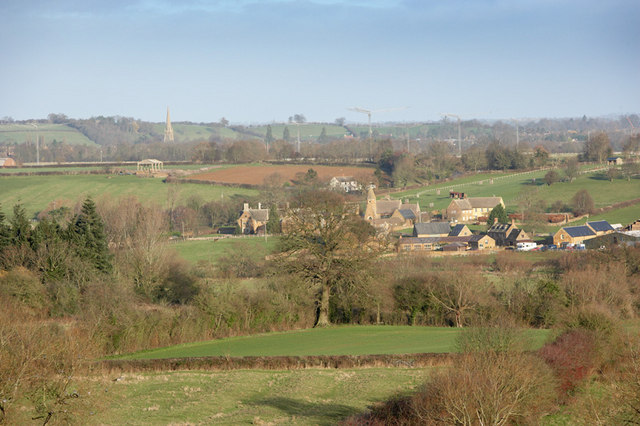
Barford St John is a picturesque village located in the county of Oxfordshire, England. Situated approximately 6 miles south of the market town of Banbury, it is nestled in the rolling hills of the Cotswolds, offering breathtaking views and a tranquil atmosphere. The village is home to a population of around 400 residents.

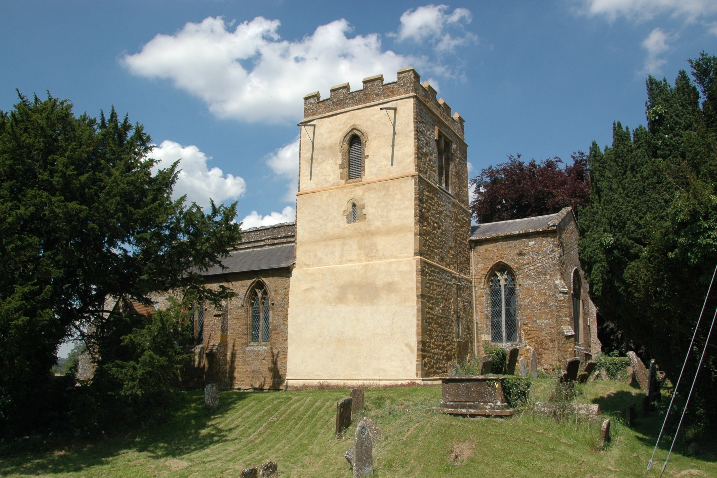
Dating back to the medieval period, Barford St John is steeped in history, with many of its buildings showcasing traditional Cotswold stone architecture. St Mary's Church, a Grade I listed building, stands proudly in the heart of the village and is a prominent landmark. The village also boasts a village hall, a primary school, and a friendly community pub.

Surrounded by beautiful countryside, Barford St John offers ample opportunities for outdoor enthusiasts. The nearby areas provide a variety of walking and cycling routes, allowing visitors to explore the scenic landscape and enjoy the fresh air. The village also benefits from its proximity to the renowned Cotswolds Area of Outstanding Natural Beauty, offering even more opportunities for outdoor pursuits.

Despite its rural setting, Barford St John is conveniently located near major transport links. The M40 motorway is easily accessible, providing quick connections to Oxford, London, and Birmingham. The village also benefits from regular bus services to nearby towns.

With its idyllic setting, rich history, and close-knit community, Barford St John is a charming village that offers a peaceful retreat for residents and visitors alike.

If you have any feedback on the listing, please let us know in the comments section below.

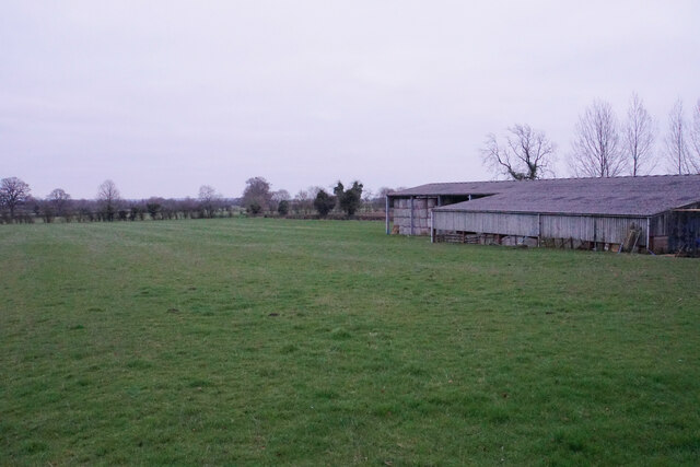
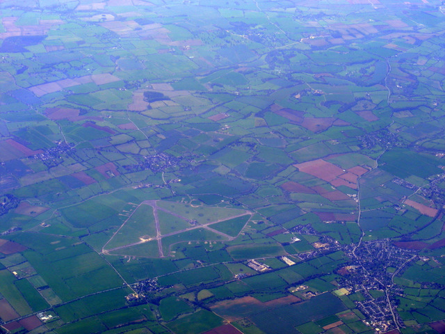
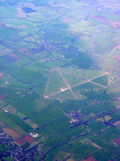
Barford St John Images

Images are sourced within 2km of 51.995065/-1.363847 or Grid Reference SP4333. Thanks to Geograph Open Source API. All images are credited.

Restricted Byway Restricted Byway to Iron Down Hill
Restricted Byway
Restricted Byway to Iron Down Hill
Restricted Byway Restricted Byway nearing Iron Down Hill
Restricted Byway
Restricted Byway nearing Iron Down Hill
Barford St John Church
Barford St Michael Church
Golby Road New housing extending southwards from Bloxham.
Golby Road
New housing extending southwards from Bloxham.
Entrance drive to Bloxham Mill Bloxham Mill is a business centre, offering workspace for small businesses. To the left is a pre-existing footpath which has been resurfaced.
Entrance drive to Bloxham Mill
Bloxham Mill is a business centre, offering workspace for small businesses. To the left is a pre-existing footpath which has been resurfaced.
Farm building by Barford Road Flat farmland by Bloxham Mill viewed at dusk on a dull day.
Farm building by Barford Road
Flat farmland by Bloxham Mill viewed at dusk on a dull day.
RAF Barford St John from the air Still in use, but not as an airfield. Click on this <span class="nowrap"><a title="http://en.wikipedia.org/wiki/RAF_Barford_St_John" rel="nofollow ugc noopener" href="http://en.wikipedia.org/wiki/RAF_Barford_St_John">Link</a><img style="margin-left:2px;" alt="External link" title="External link - shift click to open in new window" src="https://s1.geograph.org.uk/img/external.png" width="10" height="10"/></span> to go to the wikipedia article about the base. Viewed from a Heathrow bound flight from Glasgow.

See also <a href="https://www.geograph.org.uk/photo/2355944">SP4434 : RAF Barford St John from the air</a>.
RAF Barford St John from the air
Still in use, but not as an airfield. Click on this LinkExternal link to go to the wikipedia article about the base. Viewed from a Heathrow bound flight from Glasgow. See also SP4434 : RAF Barford St John from the air.
RAF Barford St John from the air Still in use, but not as an airfield. Click on this <span class="nowrap"><a title="http://en.wikipedia.org/wiki/RAF_Barford_St_John" rel="nofollow ugc noopener" href="http://en.wikipedia.org/wiki/RAF_Barford_St_John">Link</a><img style="margin-left:2px;" alt="External link" title="External link - shift click to open in new window" src="https://s1.geograph.org.uk/img/external.png" width="10" height="10"/></span> to go to the wikipedia article about the base. Viewed from a Heathrow bound flight from Glasgow.

See also <a href="https://www.geograph.org.uk/photo/2355941">SP4434 : RAF Barford St John from the air</a>.
RAF Barford St John from the air
Still in use, but not as an airfield. Click on this LinkExternal link to go to the wikipedia article about the base. Viewed from a Heathrow bound flight from Glasgow. See also SP4434 : RAF Barford St John from the air.
Hay Bales near Little Barford Mill The old mill is a grade II listed building. The Rivere Swere is on the right.
Hay Bales near Little Barford Mill
The old mill is a grade II listed building. The Rivere Swere is on the right.
Barford St John Church in background. Staddle stone in foreground.
Barford St John
Church in background. Staddle stone in foreground.
Ridge & furrow at Hempton Ridge & Furrow in fields west of Hempton
Ridge & furrow at Hempton
Ridge & Furrow in fields west of Hempton
Barford Road from Bloxham
Bloxham Road to Barford St John
Bloxham Road into Barford St John
Bloxham Road out of Barford St John
Bloxham Road into Barford St Michael The bridge crosses the River Swere.
Bloxham Road into Barford St Michael
The bridge crosses the River Swere.
Hempton Road out of Barford St Michael
Show me another place!

Barford St John is located at Grid Ref: SP4333 (Lat: 51.995065, Lng: -1.363847)

Administrative County: Oxfordshire

District: Cherwell

Police Authority: Thames Valley

What 3 Words

///acrobatic.overlaid.calms. Near Bloxham, Oxfordshire

Nearby Locations

Barford St John

Related Wikis

Barford St John

Barford St. John is a small village and former civil parish, now in the parish of Barford St. John and St. Michael, in the Cherwell district, in the county...

Barford St. John and St. Michael

Barford St John and St Michael is a civil parish in the Cherwell district of Oxfordshire, England. It includes the adjacent villages of Barford St. Michael...

Woodworm Records

Woodworm Records was a record label created in 1979 to enable the British folk-rock band Fairport Convention to release their album Farewell, Farewell...

Barford St Michael

Barford St Michael is a village and former civil parish, now in the parish of Barford St. John and St. Michael, in the Cherwell district, in the county...

RAF Barford St John

Royal Air Force Barford St John or more simply RAF Barford St John is a Royal Air Force station just north of the village of Barford St. John, Oxfordshire...

Hempton, Oxfordshire

Hempton is a village in Deddington civil parish about 5 miles (8 km) south of Banbury in Oxfordshire. Hempton is on the B4031 road between Deddington...

St Peter ad Vincula, South Newington

The Parish Church of Saint Peter ad Vincula, South Newington is the Church of England parish church of South Newington, a village about 5 miles (8 km)...

Milton, Cherwell

Milton is a village and civil parish about 2.5 miles (4 km) south of Banbury in Oxfordshire, on the Milton road between the villages of Adderbury and Bloxham...

Nearby Amenities

Located within 500m of 51.995065,-1.363847
Barford St John
Created By: Potlatch 0.9c
Place: hamlet
Wikidata: Q4860516
Lat/Long: 51.9953989/-1.3628449
Bus Stop
Mead Road
Bus: yes
Naptan AtcoCode: 340000074CNR
Naptan Bearing: N
Naptan BusStopType: CUS
Naptan CommonName: Mead Road
Naptan Indicator: Corner
Naptan Landmark: Church
Naptan NaptanCode: oxfamtdt
Naptan Street: Mead Road
Naptan Verified: no
Public Transport: platform
Source: naptan_import
Lat/Long: 51.9952089/-1.3638143
Bus Stop
Mead Road
Bus: yes
Naptan AtcoCode: 340000074OPP
Naptan Bearing: S
Naptan BusStopType: CUS
Naptan CommonName: Mead Road
Naptan Indicator: Opposite
Naptan Landmark: Church
Naptan NaptanCode: oxfamtdp
Naptan Street: Mead Road
Naptan Verified: no
Public Transport: platform
Source: naptan_import
Lat/Long: 51.9952083/-1.3636977
Bus Stop
Summer Ley
Bus: yes
Naptan AtcoCode: 340000075CNR
Naptan Bearing: S
Naptan BusStopType: CUS
Naptan CommonName: Summer Ley
Naptan Indicator: Corner
Naptan Landmark: Summer Ley
Naptan NaptanCode: oxfamtdm
Naptan Street: The Rock
Naptan Verified: no
Public Transport: platform
Source: naptan_import
Lat/Long: 51.9910068/-1.3648787
Bus Stop
Summer Ley
Bus: yes
Naptan AtcoCode: 340000075OPP
Naptan Bearing: N
Naptan BusStopType: CUS
Naptan CommonName: Summer Ley
Naptan Indicator: Opposite
Naptan Landmark: Summer Ley
Naptan NaptanCode: oxfamtdj
Naptan Street: The Rock
Naptan Verified: no
Public Transport: platform
Source: naptan_import
Lat/Long: 51.9912417/-1.3650793
Man Made: tower
Lat/Long: 51.9992356/-1.36372
Man Made: tower
Lat/Long: 51.9988335/-1.3609594
Power: pole
Lat/Long: 51.9930975/-1.3649648
Power: pole
Lat/Long: 51.993215/-1.3664489
Power: pole
Lat/Long: 51.9932757/-1.3674934
Power: pole
Lat/Long: 51.9933933/-1.3690401
Power: pole
Lat/Long: 51.9934995/-1.370596
Power: pole
Lat/Long: 51.9936929/-1.3644066
Power: pole
Lat/Long: 51.9942994/-1.3638421
Power: pole
Lat/Long: 51.9946941/-1.3625444
Power: pole
Lat/Long: 51.9948235/-1.3617227
Power: pole
Lat/Long: 51.9983892/-1.3675746
Power: pole
Lat/Long: 51.9977575/-1.3667273
Power: pole
Lat/Long: 51.9969304/-1.3655442
Power: pole
Lat/Long: 51.9962584/-1.3646185
Power: pole
Lat/Long: 51.9967332/-1.3637143
Power: pole
Lat/Long: 51.9957786/-1.3655064
Power: pole
Lat/Long: 51.9954467/-1.3659877
Power: pole
Lat/Long: 51.995184/-1.3665669
Power: pole
Lat/Long: 51.9947476/-1.3673464
The data included in this document is from www.openstreetmap.org. The data is made available under ODbL.

Have you been to Barford St John?

Leave your review of Barford St John below (or comments, questions and feedback).