Barford St Martin

Settlement in Wiltshire

England

Barford St Martin

Benchmark on Manor Farm This cut mark can be found on the former farm buildings, now used by small businesses, part way up the byway heading to Old Shaftesbury Drove. See <a href="https://www.geograph.org.uk/photo/2738588">SU0730 : Up the byway</a> for a wider view, and for more information on the mark visit <span class="nowrap"><a title="http://www.bench-marks.org.uk/bm40606" rel="nofollow ugc noopener" href="http://www.bench-marks.org.uk/bm40606">Link</a><img style="margin-left:2px;" alt="External link" title="External link - shift click to open in new window" src="https://s1.geograph.org.uk/img/external.png" width="10" height="10"/></span> .
Benchmark on Manor Farm Credit: Jonathan Kington

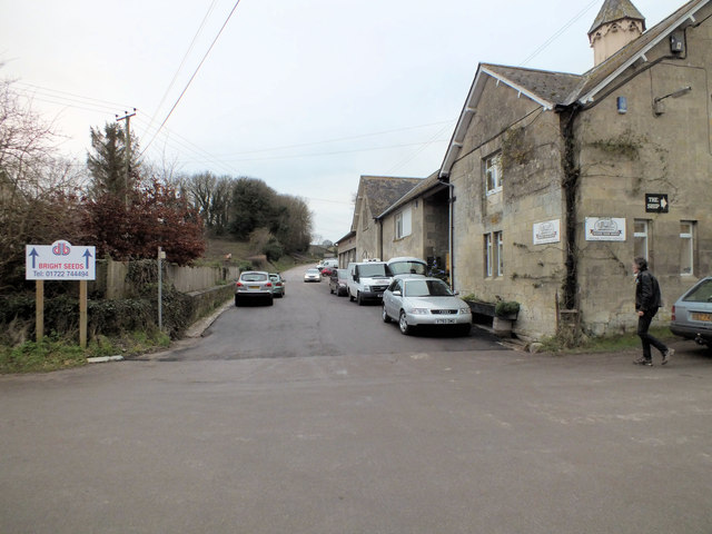
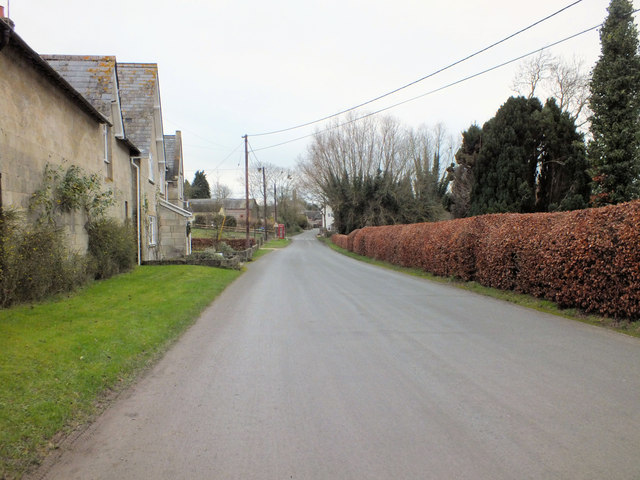
Barford St Martin is a charming village located in the county of Wiltshire, England. Situated approximately five miles west of the market town of Wilton, it is nestled in the picturesque Nadder Valley. The village is surrounded by beautiful countryside, offering residents and visitors a tranquil and idyllic setting.

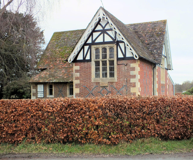
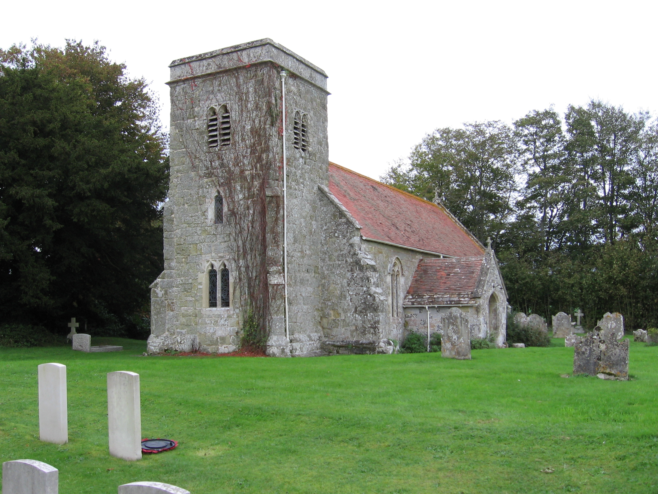
The history of Barford St Martin dates back to the Roman times, with evidence of a Roman villa found in the area. The village itself has a rich history, with the Church of St Martin being a notable landmark. This Grade I listed parish church dates back to the 13th century and features stunning medieval architecture.

The village is home to a close-knit community, with a population of around 500 residents. It boasts a range of amenities, including a village hall, a primary school, and a traditional pub, The Barford Inn. The pub is a popular spot for locals and visitors alike, serving delicious food and offering a warm and friendly atmosphere.

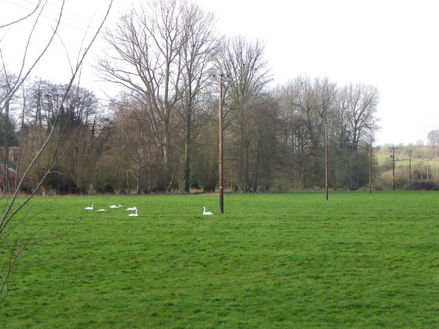
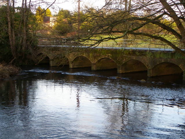
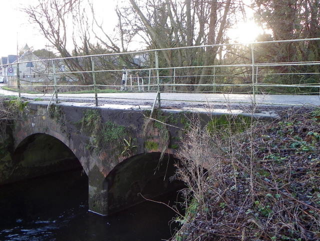
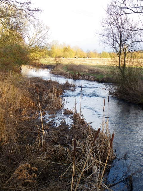
Nature enthusiasts will delight in the surrounding countryside, which provides ample opportunities for hiking, cycling, and enjoying the great outdoors. The River Nadder runs nearby, offering a peaceful spot for fishing or picnicking.

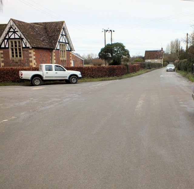
Barford St Martin is well-connected to nearby towns and cities, with regular bus services providing easy access to Salisbury and other surrounding areas. The village is also conveniently located near major road networks, making it accessible by car.

Overall, Barford St Martin offers a peaceful and picturesque setting, combined with a strong sense of community and a rich historical heritage. It is a true gem in the heart of Wiltshire.

If you have any feedback on the listing, please let us know in the comments section below.

Barford St Martin Images

Images are sourced within 2km of 51.081991/-1.919633 or Grid Reference SU0531. Thanks to Geograph Open Source API. All images are credited.

Benchmark on Manor Farm This cut mark can be found on the former farm buildings, now used by small businesses, part way up the byway heading to Old Shaftesbury Drove. See <a href="https://www.geograph.org.uk/photo/2738588">SU0730 : Up the byway</a> for a wider view, and for more information on the mark visit <span class="nowrap"><a title="http://www.bench-marks.org.uk/bm40606" rel="nofollow ugc noopener" href="http://www.bench-marks.org.uk/bm40606">Link</a><img style="margin-left:2px;" alt="External link" title="External link - shift click to open in new window" src="https://s1.geograph.org.uk/img/external.png" width="10" height="10"/></span> .
Benchmark on Manor Farm
This cut mark can be found on the former farm buildings, now used by small businesses, part way up the byway heading to Old Shaftesbury Drove. See SU0730 : Up the byway for a wider view, and for more information on the mark visit LinkExternal link .
Up the byway Looking up the byway that leads from Burcombe, up the hill past Manor Farm, to the Old Shaftesbury Drove. On the right is Manor Farm Meats, a local butcher producing their own meat (see <a href="https://www.geograph.org.uk/photo/331394">SU0730 : Manor Farm Meats, Burcombe</a> by Trish Steel). There is a benchmark on the building wall just behind the white van, see <a href="https://www.geograph.org.uk/photo/2738575">SU0730 : Benchmark on Manor Farm</a>.
Up the byway
Looking up the byway that leads from Burcombe, up the hill past Manor Farm, to the Old Shaftesbury Drove. On the right is Manor Farm Meats, a local butcher producing their own meat (see SU0730 : Manor Farm Meats, Burcombe by Trish Steel). There is a benchmark on the building wall just behind the white van, see SU0730 : Benchmark on Manor Farm.
Through the village Looking along Burcombe village as the road heads towards the A30, Manor Farm is on the left.
Through the village
Looking along Burcombe village as the road heads towards the A30, Manor Farm is on the left.
To Wilton Looking along the road through South Burcombe on its way to Wilton. <a href="https://www.geograph.org.uk/photo/2738662">SU0730 : Burcombe Village Hall</a> is on the left.
To Wilton
Looking along the road through South Burcombe on its way to Wilton. SU0730 : Burcombe Village Hall is on the left.
Burcombe Village Hall Formerly a Victorian school, the village hall has recently gone through extensive renovation and modernisation.
Burcombe Village Hall
Formerly a Victorian school, the village hall has recently gone through extensive renovation and modernisation.
Swans, Burcombe Swans resting in a meadow field on the Nadder floodplain.

The three species wintering in Britain are all protected, the most familiar being he mis-named mute swan, which not only makes a musical whistling sound with its wings while flying, but also utters a variety of grunts and hisses.  The mute swan is a resident breeder in Britain, nesting in inland lakes and  rivers and moving only very short distances in winter.  Like all swans, the mute is highly aggressive and territorial during the breeding season, using its bright white plumage for advertisement and chasing away any intruder that ventures near its large nest.
Swans, Burcombe
Swans resting in a meadow field on the Nadder floodplain. The three species wintering in Britain are all protected, the most familiar being he mis-named mute swan, which not only makes a musical whistling sound with its wings while flying, but also utters a variety of grunts and hisses. The mute swan is a resident breeder in Britain, nesting in inland lakes and rivers and moving only very short distances in winter. Like all swans, the mute is highly aggressive and territorial during the breeding season, using its bright white plumage for advertisement and chasing away any intruder that ventures near its large nest.
The Church of St John the Baptist, Burcombe Looking towards the squat church from the minor road that leaves the A30 opposite the church.
The Church of St John the Baptist, Burcombe
Looking towards the squat church from the minor road that leaves the A30 opposite the church.
River Nadder, Burcombe The river rises at Donhead St Mary and flows for 22 miles before joining the Wylye near Salisbury.
River Nadder, Burcombe
The river rises at Donhead St Mary and flows for 22 miles before joining the Wylye near Salisbury.
Bridge, Burcombe The road bridge over the river takes cars from the village to the A30.

Growing on the bridge are spleenworts, harts tongue and liverworts.
Bridge, Burcombe
The road bridge over the river takes cars from the village to the A30. Growing on the bridge are spleenworts, harts tongue and liverworts.
River Nadder, Burcombe The river rises at Donhead St Mary and flows for 22 miles before joining the Wylye near Salisbury.
River Nadder, Burcombe
The river rises at Donhead St Mary and flows for 22 miles before joining the Wylye near Salisbury.
Priory Farm, North Burcombe Several of the farm buildings at Priory Farm stand beside the A30.
Priory Farm, North Burcombe
Several of the farm buildings at Priory Farm stand beside the A30.
Bench Mark, Priory Farm The Ordnance Survey bench mark is to be found on the north wall of the farm buildings at Priory Farm.  For a view of the building <a href="https://www.geograph.org.uk/photo/2862552">SU0731 : Priory Farm, North Burcombe</a> and for further information on the cut mark and others in the area <span class="nowrap"><a title="http://www.bench-marks.org.uk/bm42132" rel="nofollow ugc noopener" href="http://www.bench-marks.org.uk/bm42132">Link</a><img style="margin-left:2px;" alt="External link" title="External link - shift click to open in new window" src="https://s1.geograph.org.uk/img/external.png" width="10" height="10"/></span>
Bench Mark, Priory Farm
The Ordnance Survey bench mark is to be found on the north wall of the farm buildings at Priory Farm. For a view of the building SU0731 : Priory Farm, North Burcombe and for further information on the cut mark and others in the area LinkExternal link
Public footpath, Burcombe
The Orange Way in Wiltshire (120) The route dips into a valley and climbs up again.
The Orange Way in Wiltshire (120)
The route dips into a valley and climbs up again.
The Orange Way in Wiltshire (121) A bridleway crosses here and the view stretches ahead for a long way.
The Orange Way in Wiltshire (121)
A bridleway crosses here and the view stretches ahead for a long way.
The Orange Way in Wiltshire (122) The byway continues past a joining bridleway.
The Orange Way in Wiltshire (122)
The byway continues past a joining bridleway.
The Orange Way in Wiltshire (123) Here's a confusing junction of ways at the end of a lane.
The Orange Way in Wiltshire (123)
Here's a confusing junction of ways at the end of a lane.
The Orange Way in Wiltshire (124) This is somewhat monotonous.
The Orange Way in Wiltshire (124)
This is somewhat monotonous.
Show me another place!

Barford St Martin is located at Grid Ref: SU0531 (Lat: 51.081991, Lng: -1.919633)

Unitary Authority: Wiltshire

Police Authority: Wiltshire

What 3 Words

///coping.stow.cutaway. Near Wilton, Wiltshire

Related Wikis

Barford St Martin

Barford St Martin is a village and civil parish in Wiltshire, England, about 2.5 miles (4 km) west of Wilton, around the junction of the A30 and the B3089...

Burcombe

Burcombe is a village in the civil parish of Burcombe Without, in Wiltshire, England. The village is about 4.5 miles (7 km) west of Salisbury city centre...

Burcombe Down

Burcombe Down (grid reference SU064295) is an area of chalk grassland situated on a north-facing scarp slope to the south of Burcombe in Wiltshire, England...

Baverstock

Baverstock is a small village and former civil parish, now in the parish of Dinton, in Wiltshire, England, about 7 miles (11 km) west of Salisbury. The...

Nearby Amenities

Located within 500m of 51.081991,-1.919633
Barford St Martin
Place: village
Lat/Long: 51.0831355/-1.9217327
Historic: milestone
Lat/Long: 51.078473/-1.919091
Bicycle Parking
Bicycle Parking: wall_loops
Capacity: 3
Covered: no
Lat/Long: 51.0821781/-1.919674
Historic: milestone
Note: Looks relatively new!
Lat/Long: 51.0817916/-1.9191972
Entrance: yes
Lat/Long: 51.0817692/-1.920911
Noexit: yes
Lat/Long: 51.0823644/-1.9227751
Leisure: picnic_table
Lat/Long: 51.0820864/-1.9196421
Leisure: picnic_table
Lat/Long: 51.0820739/-1.919676
Leisure: picnic_table
Lat/Long: 51.0821071/-1.9196132
Kindergarten
First Friends Day Nursery
Lat/Long: 51.0822965/-1.921734
Historic: wayside_cross
Religion: christian
Lat/Long: 51.0819856/-1.920915
Leisure: picnic_table
Lat/Long: 51.0824028/-1.9198027
Leisure: picnic_table
Lat/Long: 51.0824259/-1.9198985
Leisure: picnic_table
Lat/Long: 51.0824463/-1.9197806
Leisure: picnic_table
Lat/Long: 51.0824852/-1.9198145
Entrance: yes
Lat/Long: 51.0823415/-1.9218559
Fixme: continue
Lat/Long: 51.0840642/-1.9223484
Restaurant
Reservation: yes
Lat/Long: 51.0823138/-1.9198447
Internet Access: yes
Tourism: guest_house
Lat/Long: 51.0823021/-1.9195886
Pub
Real Ale: yes
Lat/Long: 51.0822776/-1.9197133
Post Box
Operator: Royal Mail
Post Box Type: lamp
Ref: SP3 259
Royal Cypher: EIIR
Royal Cypher Wikidata: Q33102113
Lat/Long: 51.0820497/-1.9199893
The data included in this document is from www.openstreetmap.org. The data is made available under ODbL.

Have you been to Barford St Martin?

Leave your review of Barford St Martin below (or comments, questions and feedback).