Barford

Settlement in Norfolk South Norfolk

England

Barford

Barnham Broom: Pylons
Barnham Broom: Pylons Credit: Michael Garlick

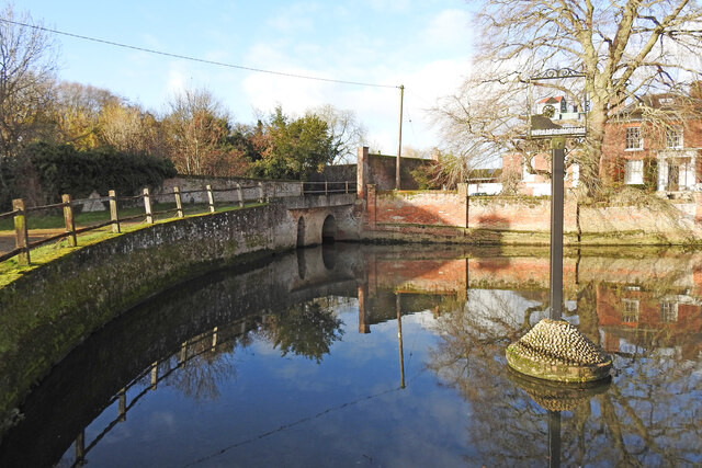
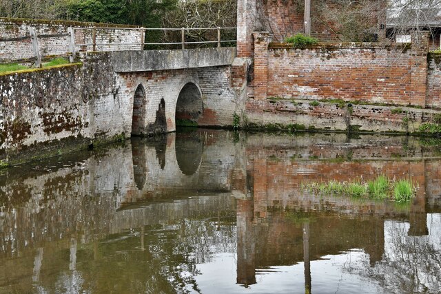
Barford is a small village located in the county of Norfolk, England. Situated approximately 10 miles northwest of the city of Norwich, it is positioned along the River Yare, which flows through the village, adding to its scenic charm. With a population of around 500 residents, Barford maintains a close-knit community atmosphere.

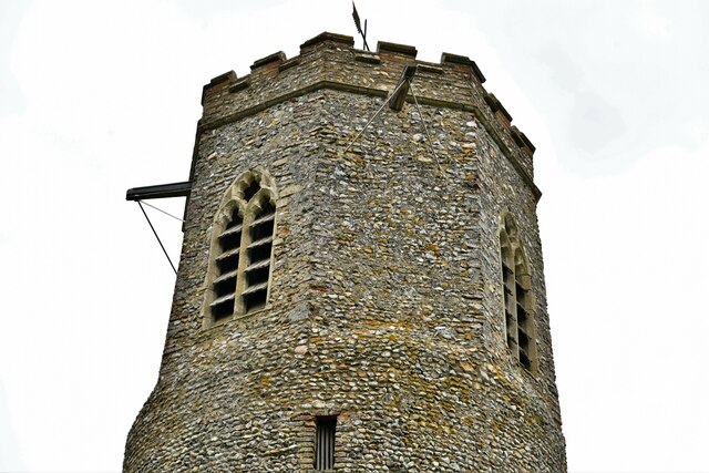
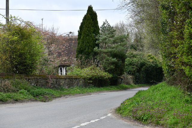
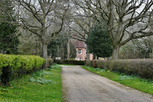
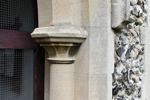
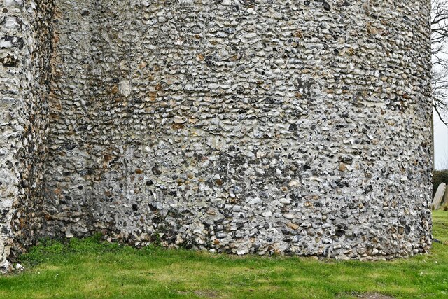
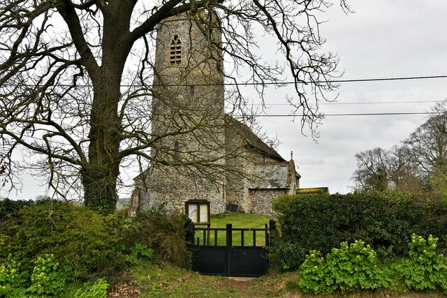
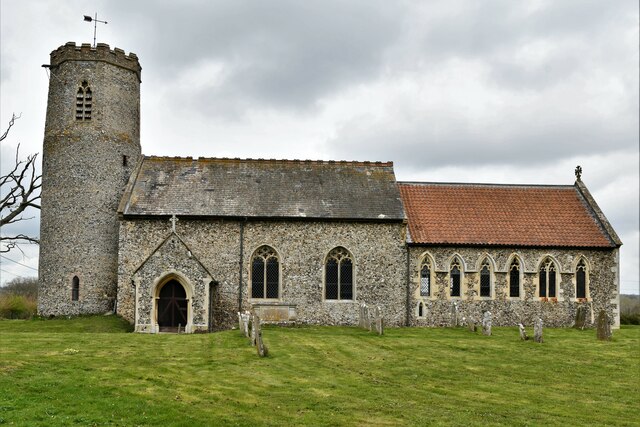
The village boasts a rich history, evident in its architecture and landmarks. The ancient All Saints Church, dating back to the 12th century, stands as a significant historical and architectural gem. Surrounding the village, the Norfolk countryside offers picturesque views, with rolling green fields and charming rural landscapes.

Despite its small size, Barford offers a range of amenities to cater to its residents' needs. These include a primary school, a village hall, and a local pub, which serves as a popular meeting place for locals and visitors alike. Additionally, the village is well-connected to nearby towns and cities, benefiting from good transport links.

Barford is also known for its vibrant community events, such as the annual Barford Festival, which brings together locals and visitors for a day of music, food, and entertainment. The village's proximity to Norwich allows residents easy access to a wider range of amenities, including shopping centers, restaurants, and cultural attractions.

Overall, Barford, Norfolk, offers a peaceful and picturesque setting, ideal for those seeking a tranquil village lifestyle while remaining close to the amenities and conveniences of a larger town.

If you have any feedback on the listing, please let us know in the comments section below.

Barford Images

Images are sourced within 2km of 52.626108/1.1196515 or Grid Reference TG1107. Thanks to Geograph Open Source API. All images are credited.

Barnham Broom: Pylons
Barnham Broom: Track at Hollandshill Farm
The millpond at Wramplingham The mill which originally stood left on the left of the scene, (the lower part of the mill's wall still standing) and the tail race exiting from under the arches into this millpond. The mill was demolished in 1945. 
A semblance of the mill as it was, can be seen on the village sign <a href="https://www.geograph.org.uk/photo/6693890">TG1106 : Wramplingham village sign</a>
The millpond at Wramplingham
The mill which originally stood left on the left of the scene, (the lower part of the mill's wall still standing) and the tail race exiting from under the arches into this millpond. The mill was demolished in 1945. A semblance of the mill as it was, can be seen on the village sign TG1106 : Wramplingham village sign
Great Melton: Crossroads
Wramplingham: Entering the village from the north
Wramplingham: The mill pond
Wramplingham: Village sign situated in the mill pond
Wramplingham: The mill pond, village sign and River House
Wramplingham: The Mill House
Wramplingham, St. Peter and St. Paul's Church: Round tower with a polygonal top
Great Melton, Landlow Lane: The Old School
Great Melton, The Old Rectory
Wramplingham, St. Peter and St. Paul's Church: The chancel southern aspect
Wramplingham, St. Peter and St. Paul's Church: South porch right capital
Wramplingham, St. Peter and St. Paul's Church: Round tower base detail
Wramplingham, St. Peter and St. Paul's Church: Western aspect
Wramplingham, St. Peter and St. Paul's Church: Southern aspect
Wramplingham, St. Peter and St. Paul's Church: A small area of daffodils
Show me another place!

Barford is located at Grid Ref: TG1107 (Lat: 52.626108, Lng: 1.1196515)

Administrative County: Norfolk

District: South Norfolk

Police Authority: Norfolk

What 3 Words

///spice.sneezed.conspired. Near Hethersett, Norfolk
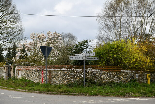
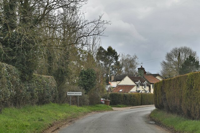
Nearby Locations

Barford

Related Wikis

Barford, Norfolk

Barford is a village and civil parish in the English county of Norfolk, situated some 4 miles (6 km) north of Wymondham and 8 miles (13 km) west of Norwich...

River Tiffey

The River Tiffey is a small river in Norfolk, England and a tributary of the River Yare. It rises near Hethel and passes through Wymondham before flowing...
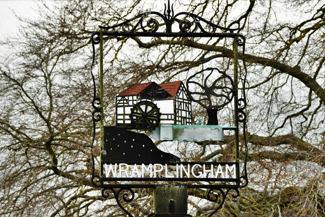
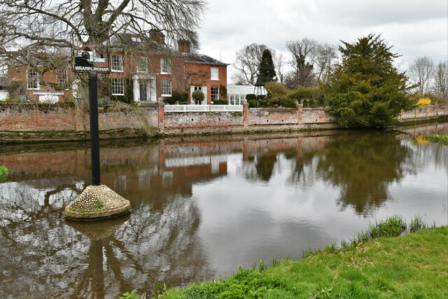
Wramplingham

Wramplingham is a village and civil parish in the English county of Norfolk. It is situated on the River Tiffey some 4 miles (6.4 km) north of Wymondham...

Marlingford and Colton

Marlingford and Colton, formerly Marlingford is a civil parish in the English county of Norfolk, made from the villages of Colton and Marlingford. It covers...

Colton, Norfolk

Colton is a village and former civil parish, 8 miles (13 km) west of Norwich, now in the parish of Marlingford and Colton, in the South Norfolk district...

Marlingford

Marlingford is a village and former civil parish, 6 miles (9.7 km) west of Norwich, now in the parish of Marlingford and Colton, in the South Norfolk district...

Great Melton

Great Melton is a civil parish in the English county of Norfolk. It covers an area of 10.24 km2 (3.95 sq mi) and had a population of 148 in 59 households...

Carleton Forehoe

Carleton Forehoe is a village and former civil parish 9 miles (14 km) west of Norwich, now in the parish of Kimberley, in the South Norfolk district, in...

Nearby Amenities

Located within 500m of 52.626108,1.1196515
village hall, adj
Naptan AtcoCode: 2900B051
Naptan Bearing: NW
Naptan BusStopType: CUS
Naptan CommonName: village hall
Naptan Indicator: adj
Naptan Landmark: village hall
Naptan Locality: Barford
Naptan NaptanCode: nfoadpdj
Naptan ShortCommonName: village hall
Naptan Street: Chapel Street
Naptan Verified: no
Source: naptan_import
Lat/Long: 52.6260641/1.1202676
Bus Stop
Bus Shelter, adj
Naptan AtcoCode: 2900B052
Naptan Bearing: NW
Naptan CommonName: Bus Shelter
Naptan Indicator: adj
Naptan Locality: Barford
Naptan NaptanCode: nfoadpdm
Naptan Street: Watton Road
Naptan Verified: no
Source: naptan_import
Lat/Long: 52.6233331/1.1198392
Bus Stop
village hall, opp
Bench: no
Bin: no
Lit: no
Naptan AtcoCode: 2900B053
Naptan Bearing: SE
Naptan CommonName: village hall
Naptan Indicator: opp
Naptan Landmark: village hall
Naptan Locality: Barford
Naptan NaptanCode: nfoadpdp
Naptan ShortCommonName: village hall
Naptan Street: Chapel Street
Naptan Verified: no
Shelter: no
Source: naptan_import
Tactile Paving: no
Lat/Long: 52.6260024/1.1202509
Bus Stop
Bus Shelter, opp
Naptan AtcoCode: 2900B054
Naptan Bearing: SE
Naptan CommonName: Bus Shelter
Naptan Indicator: opp
Naptan Locality: Barford
Naptan NaptanCode: nfoadpdt
Naptan Street: Watton Road
Naptan Verified: no
Source: naptan_import
Lat/Long: 52.6233445/1.1200912
Orchard Close, adj
Naptan AtcoCode: 2900B055
Naptan Bearing: NE
Naptan BusStopType: CUS
Naptan CommonName: Orchard Close
Naptan Indicator: adj
Naptan Landmark: Orchard Close
Naptan Locality: Barford
Naptan NaptanCode: nfoadpdw
Naptan ShortCommonName: Orchard Cl
Naptan Street: Chapel Street
Naptan Verified: no
Source: naptan_import
Lat/Long: 52.6264883/1.1253548
Orchard Close, opp
Naptan AtcoCode: 2900B056
Naptan Bearing: SW
Naptan BusStopType: CUS
Naptan CommonName: Orchard Close
Naptan Indicator: opp
Naptan Landmark: Orchard Close
Naptan Locality: Barford
Naptan NaptanCode: nfoadpga
Naptan ShortCommonName: Orchard Cl
Naptan Street: Chapel Street
Naptan Verified: no
Source: naptan_import
Lat/Long: 52.6264321/1.1254395
Bus Stop
opp Hall, opp
Naptan AtcoCode: 2900B058
Naptan Bearing: S
Naptan CommonName: opp Hall
Naptan Indicator: opp
Naptan Landmark: Hall entrance
Naptan Locality: Barford
Naptan NaptanCode: nfogpjgj
Naptan ShortCommonName: Hall
Naptan Street: Cock Street
Source: naptan_import;survey
Lat/Long: 52.625657/1.1197096
Barford
Place: village
Wikidata: Q1919339
Wikipedia: en:Barford, Norfolk
Lat/Long: 52.6248676/1.1214802
Turning Circle
Lat/Long: 52.6237476/1.1247161
Barrier: stile
Foot: yes
Lat/Long: 52.623974/1.125376
Barrier: stile
Foot: yes
Lat/Long: 52.6246519/1.1262224
Turning Circle
Lat/Long: 52.6238209/1.1223547
Turning Circle
Lat/Long: 52.6268942/1.1247832
Grit Bin
Colour: yellow
Lat/Long: 52.6275055/1.1133101
Waste Basket
Waste: dog_excrement
Lat/Long: 52.6275165/1.1133027
Post Box
Collection Times: Mo-Fr 09:00; Sa 07:00
Operator: Royal Mail
Post Box Mounting: pier
Post Box Type: lamp
Ref: NR9 917D
Royal Cypher: EIIR
Royal Cypher Wikidata: Q33102113
Lat/Long: 52.6261735/1.1238349
Traffic Calming: bump
Lat/Long: 52.623026/1.1209857
Traffic Calming: bump
Lat/Long: 52.6228341/1.1214531
Milestone
Colour: white
Distance Hingham: 7 mi
Distance Norwich: 7 mi
Distance Watton: 14 mi
Material: stone
Lat/Long: 52.6226587/1.121614
Barford
Colour: black
Inscription: AD 700
Man Made: village_sign
Material: metal
Old Name: Barley Ford
Lat/Long: 52.6260072/1.1198339
Give Way
Lat/Long: 52.6261015/1.1196961
Give Way
Lat/Long: 52.6227246/1.1216368
Entrance: main
Lat/Long: 52.6262406/1.1199256
Barrier: swing_gate
Lat/Long: 52.6263285/1.1204951
Defibrillator
Defibrillator Location: On exterior wall of Barford & Wramplingham Village Hall, to the right of the main entrance.
Emergency: defibrillator
Indoor: no
Ref GB The Circuit: 037D0641-7259-49FF-B6FC-ADDE0160EF1D
Lat/Long: 52.6262135/1.1200218
Telephone
Addr Postcode: NR9 4AY
Addr Street: Chapel Street
Addr Village: Barford
Booth: KX100
Covered: booth
Phone: +44 1603 759611
Lat/Long: 52.6260888/1.120343
Post Box
Collection Times: Mo-Fr 16:45; Sa 10:30
Post Box Mounting: building
Post Box Type: wall
Ref: NR9 922
Royal Cypher: VR
Royal Cypher Wikidata: Q33102356
Lat/Long: 52.6243269/1.1193788
Bus Stop
Lat/Long: 52.6257548/1.1195972
Addr Housenumber: 2
Addr Street: Clarkes Close
Addr Village: Barford
Lat/Long: 52.6263606/1.1237525
Give Way
Lat/Long: 52.6235367/1.1193786
Power: pole
Lat/Long: 52.6226742/1.1162744
Power: pole
Lat/Long: 52.6222598/1.1172098
Power: pole
Lat/Long: 52.6216272/1.1202796
Power: pole
Transformer: distribution
Lat/Long: 52.6229477/1.1203359
The data included in this document is from www.openstreetmap.org. The data is made available under ODbL.

Have you been to Barford?

Leave your review of Barford below (or comments, questions and feedback).