Bidcombe Hill

Hill, Mountain in Wiltshire

England

Bidcombe Hill

Horningham : Road A road heads through the countryside.
Horningham : Road Credit: Lewis Clarke

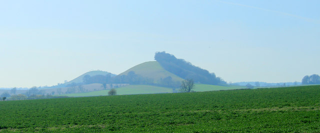
Bidcombe Hill is a prominent natural landmark situated in the county of Wiltshire, England. With an elevation of 244 meters (800 feet), it is classified as a hill rather than a mountain, but its commanding presence and scenic views make it a popular destination for locals and visitors alike.

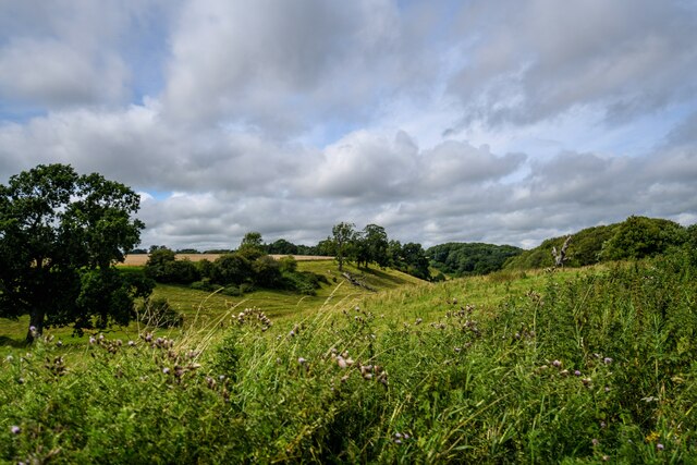
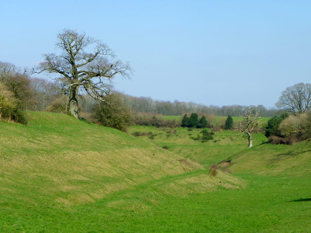
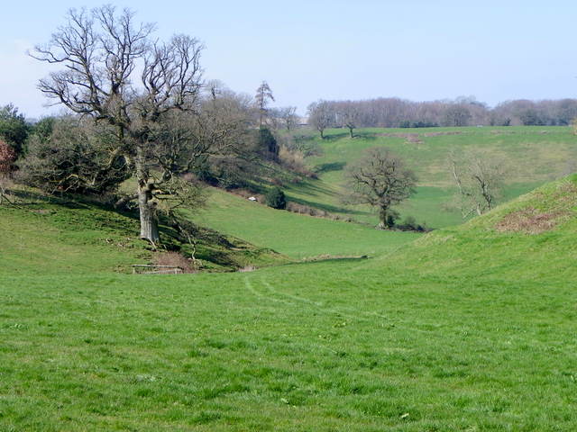
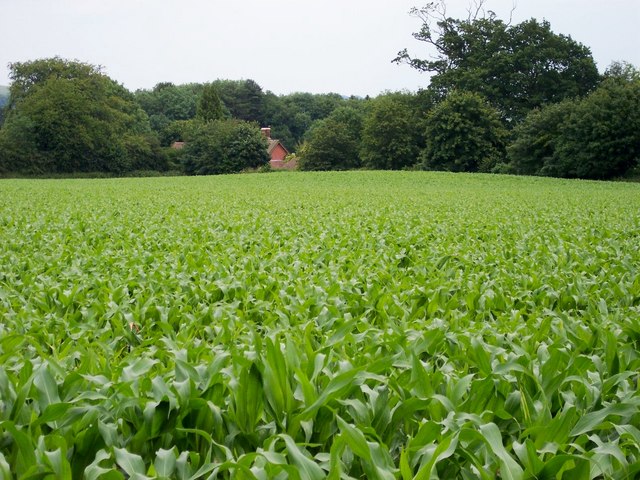
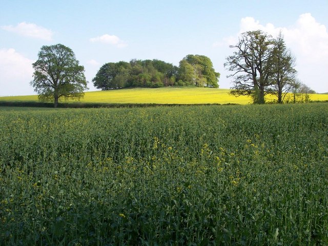
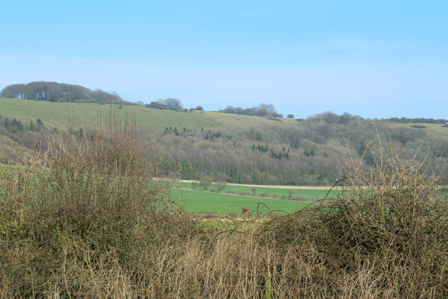
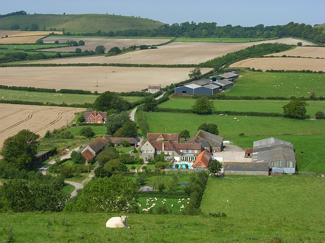
Located approximately 4 kilometers (2.5 miles) south of the market town of Devizes, Bidcombe Hill is part of the North Wessex Downs Area of Outstanding Natural Beauty. It is primarily composed of chalk, typical of the region's geology, and is covered in lush grasslands and scattered with patches of woodland.

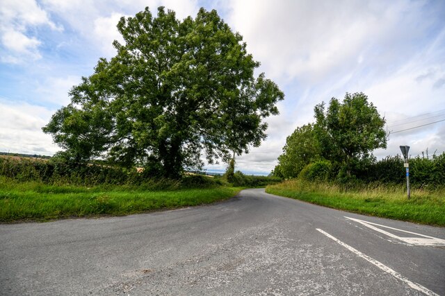
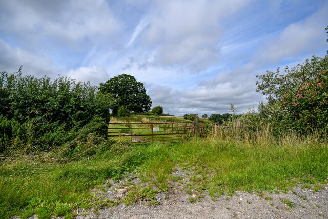
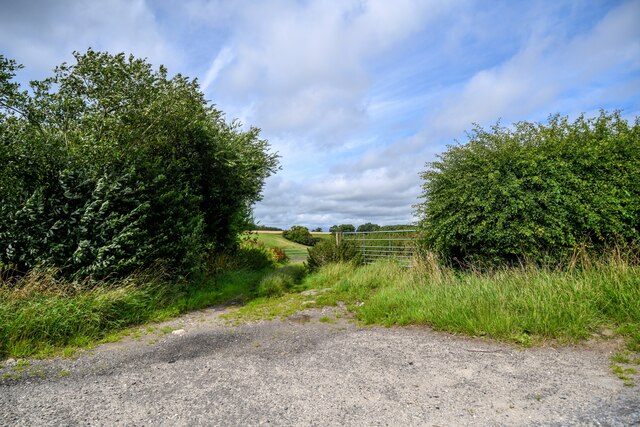
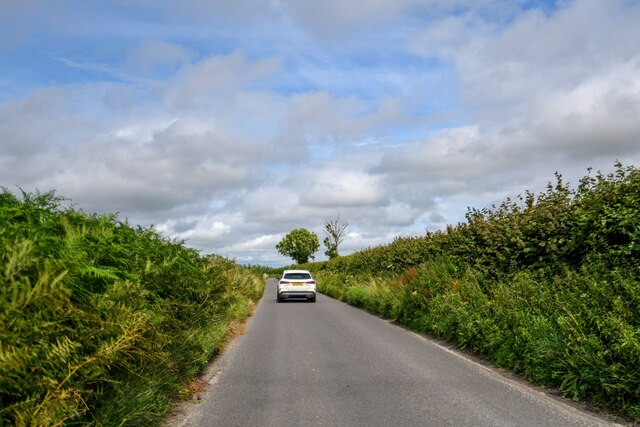
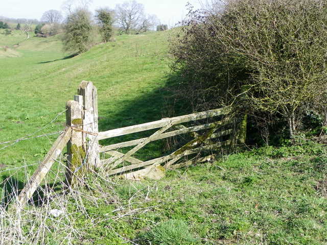
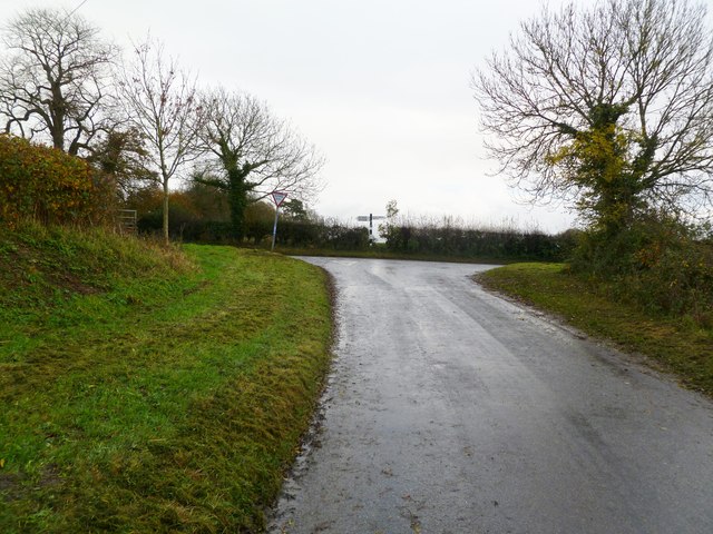
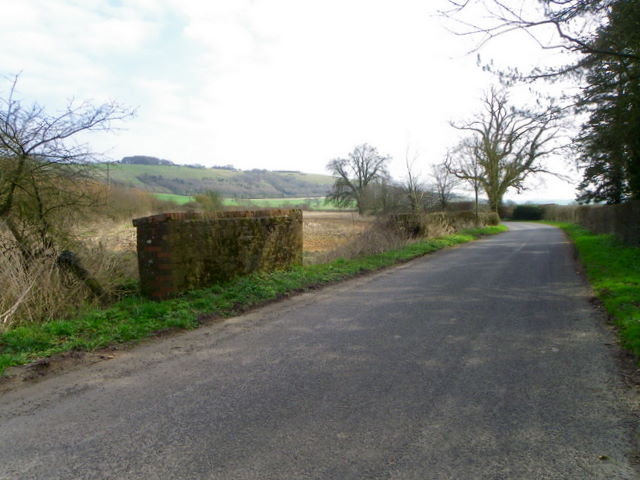
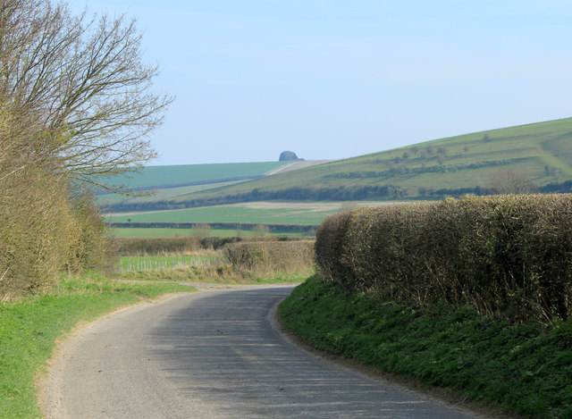
The hill is accessible via several footpaths and bridleways, making it a beloved spot for outdoor enthusiasts and walkers. The panoramic views from its summit are breathtaking, offering sweeping vistas of the surrounding countryside, including the Vale of Pewsey, Salisbury Plain, and the Pewsey Downs.

Bidcombe Hill is also known for its historical significance. On its slopes, there are remnants of ancient earthworks, including a hillfort believed to date back to the Iron Age. These archaeological features add a layer of intrigue and enchantment to the landscape, enticing history enthusiasts and archaeology buffs.

The hill is teeming with biodiversity, hosting a variety of flora and fauna. Rare wildflowers, such as the chalk milkwort and the pyramidal orchid, can be found here, along with several species of butterflies and birds, including the skylark and the kestrel.

Overall, Bidcombe Hill is a picturesque and historically significant hill in Wiltshire, offering stunning views, a rich natural environment, and a glimpse into the region's ancient past.

If you have any feedback on the listing, please let us know in the comments section below.

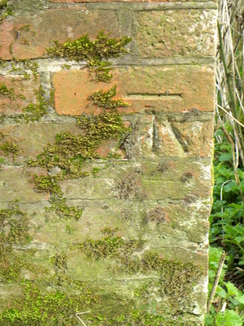
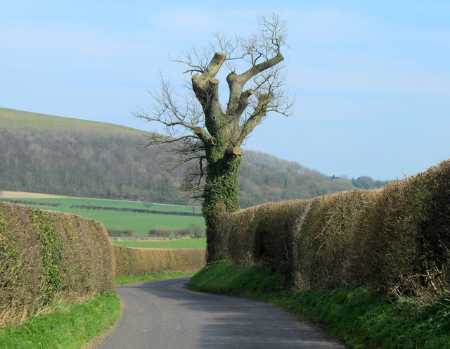
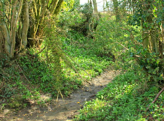
Bidcombe Hill Images

Images are sourced within 2km of 51.15162/-2.24954 or Grid Reference ST8239. Thanks to Geograph Open Source API. All images are credited.

Horningham : Road A road heads through the countryside.
Horningham : Road
A road heads through the countryside.
Horningham : Grassy Field Looking beyond the gate and into the field.
Horningham : Grassy Field
Looking beyond the gate and into the field.
Horningsham : Field Entrance Gates provide entry to the field.
Horningsham : Field Entrance
Gates provide entry to the field.
Horningsham : Countryside Scenery Looking across hillsides and green fields.
Horningsham : Countryside Scenery
Looking across hillsides and green fields.
Horningsham : Road Looking along country lane.
Horningsham : Road
Looking along country lane.
Gate near Baycliffe Farm The gate, looking rather worse for wear, gives access to a large downland field.
Gate near Baycliffe Farm
The gate, looking rather worse for wear, gives access to a large downland field.
Dry valley near Baycliffe Farm A small dry valley where there are several large dead trees.
Dry valley near Baycliffe Farm
A small dry valley where there are several large dead trees.
Dry valley near Horningsham A small dry valley with several large dead trees.
Dry valley near Horningsham
A small dry valley with several large dead trees.
Field Mound Looking ESE across a field of corn adjacent to Kingston Lane, Maiden Bradley. The mound can be seen rising in the distance covered in corn.

Besides this mound there are also two tumuli within the village boundary at Maiden Bradley. One is a Bronze Age bowl barrow in the corner of a cereal field next to Church Street back gardens. The other is fenced off and supports a clump of trees at the edge of a grazing field behind Bradley Cottage, Church Street.
Field Mound
Looking ESE across a field of corn adjacent to Kingston Lane, Maiden Bradley. The mound can be seen rising in the distance covered in corn. Besides this mound there are also two tumuli within the village boundary at Maiden Bradley. One is a Bronze Age bowl barrow in the corner of a cereal field next to Church Street back gardens. The other is fenced off and supports a clump of trees at the edge of a grazing field behind Bradley Cottage, Church Street.
Brimble Hill Clump Looking SE in Bradley Park, near Bradley House. Part of a permissory path system called Duke's Walk <span class="nowrap"><a title="http://cwr.defra.gov.uk/DisplayImage.aspx?Type=Mapboard&IFN=453060024.pdf," rel="nofollow ugc noopener" href="http://cwr.defra.gov.uk/DisplayImage.aspx?Type=Mapboard&IFN=453060024.pdf,">Link</a><img style="margin-left:2px;" alt="External link" title="External link - shift click to open in new window" src="https://s1.geograph.org.uk/img/external.png" width="10" height="10"/></span> which now appears to have been decommissioned.

'Brimble Hill was called Bremelhil brech in 1407 and the meaning seems to be Bramble Hill.' <span class="nowrap"><a title="http://history.wiltshire.gov.uk/community/getfaq.php?id=183" rel="nofollow ugc noopener" href="http://history.wiltshire.gov.uk/community/getfaq.php?id=183">Link</a><img style="margin-left:2px;" alt="External link" title="External link - shift click to open in new window" src="https://s1.geograph.org.uk/img/external.png" width="10" height="10"/></span>

The clump has rough grave marker stones <span class="nowrap"><a title="http://www.btinternet.com/~JIM.DOWNES1/images/CLUMP.jpg" rel="nofollow ugc noopener" href="http://www.btinternet.com/~JIM.DOWNES1/images/CLUMP.jpg">Link</a><img style="margin-left:2px;" alt="External link" title="External link - shift click to open in new window" src="https://s1.geograph.org.uk/img/external.png" width="10" height="10"/></span>  where Algernon Seymour, 15th Duke of Somerset and his wife Susan were buried. 

'He died s.p. 22 October 1923 at Maiden Bradley and was buried there 25 October at Brimble Hill Clump aged 77. Will proved £684,923 gross, £289,960 net. His widow, who was a Dame Grand Cross of the Order of St. John of Jerusalem, died 30 January 1936 and was buried 4 February at Brimble Hill.' <span class="nowrap"><a title="http://wc.rootsweb.ancestry.com/cgi-bin/igm.cgi?op=GET&db=utzing&id=I093979" rel="nofollow ugc noopener" href="http://wc.rootsweb.ancestry.com/cgi-bin/igm.cgi?op=GET&db=utzing&id=I093979">Link</a><img style="margin-left:2px;" alt="External link" title="External link - shift click to open in new window" src="https://s1.geograph.org.uk/img/external.png" width="10" height="10"/></span>

(For full story about the graves and locale description visit my Maiden Bradley village site on this <span class="nowrap"><a title="https://sites.google.com/site/maidenbradley/maiden-bradley-times/duke-s-grave" rel="nofollow ugc noopener" href="https://sites.google.com/site/maidenbradley/maiden-bradley-times/duke-s-grave">Link</a><img style="margin-left:2px;" alt="External link" title="External link - shift click to open in new window" src="https://s1.geograph.org.uk/img/external.png" width="10" height="10"/></span> )
Brimble Hill Clump
Looking SE in Bradley Park, near Bradley House. Part of a permissory path system called Duke's Walk LinkExternal link which now appears to have been decommissioned. 'Brimble Hill was called Bremelhil brech in 1407 and the meaning seems to be Bramble Hill.' LinkExternal link The clump has rough grave marker stones LinkExternal link where Algernon Seymour, 15th Duke of Somerset and his wife Susan were buried. 'He died s.p. 22 October 1923 at Maiden Bradley and was buried there 25 October at Brimble Hill Clump aged 77. Will proved £684,923 gross, £289,960 net. His widow, who was a Dame Grand Cross of the Order of St. John of Jerusalem, died 30 January 1936 and was buried 4 February at Brimble Hill.' LinkExternal link (For full story about the graves and locale description visit my Maiden Bradley village site on this LinkExternal link )
Maiden Bradley, T junction Coming on the minor road from Horningsham; left, to Warminster and Shaftesbury; right, to Maiden Bradley and Frome.
Maiden Bradley, T junction
Coming on the minor road from Horningsham; left, to Warminster and Shaftesbury; right, to Maiden Bradley and Frome.
Bridge near Maiden Bradley The small bridge over a drain is on Kingston Lane.  There is an Ordnance Survey bench mark on the parapet.
Bridge near Maiden Bradley
The small bridge over a drain is on Kingston Lane. There is an Ordnance Survey bench mark on the parapet.
Bench Mark, Kingston Lane The Ordnance Survey bench mark is on the east end of the north parapet to the bridge on Kingston Lane.  For a view of the bridge <a href="https://www.geograph.org.uk/photo/2862604">ST8138 : Bridge near Maiden Bradley</a> and for further information on the cut mark and others in the area <span class="nowrap"><a title="http://www.bench-marks.org.uk/bm42137" rel="nofollow ugc noopener" href="http://www.bench-marks.org.uk/bm42137">Link</a><img style="margin-left:2px;" alt="External link" title="External link - shift click to open in new window" src="https://s1.geograph.org.uk/img/external.png" width="10" height="10"/></span>
Bench Mark, Kingston Lane
The Ordnance Survey bench mark is on the east end of the north parapet to the bridge on Kingston Lane. For a view of the bridge ST8138 : Bridge near Maiden Bradley and for further information on the cut mark and others in the area LinkExternal link
2012 : An old oak tree, nicely pruned As well as improving safety for passers by on the road this treatment helps preserve the life of the tree. Already 300 to 400 years old, given the absence of lightning strikes, road widening, etc. it could last another 400 or 500 years.
Brimsdown Hill is in the background, the road continues to Kingston Deverill.
2012 : An old oak tree, nicely pruned
As well as improving safety for passers by on the road this treatment helps preserve the life of the tree. Already 300 to 400 years old, given the absence of lightning strikes, road widening, etc. it could last another 400 or 500 years. Brimsdown Hill is in the background, the road continues to Kingston Deverill.
2012 : A winterbourne or winterborne A winterborne or winterbourne is a stream or river that is dry during the summer months, here is an excellent example, though this year it is dry in the middle of March.
2012 : A winterbourne or winterborne
A winterborne or winterbourne is a stream or river that is dry during the summer months, here is an excellent example, though this year it is dry in the middle of March.
2012 : Looking west from Kingston Lane The road to Kingston Deverill. 
Across a large pasture to Little Knoll <a href="https://www.geograph.org.uk/gridref/ST8037">ST8037</a>, Little Knoll Wood struggles to stay on top.
Behind is Long Knoll, seen end on from the east and for once taking an inferior role.
2012 : Looking west from Kingston Lane
The road to Kingston Deverill. Across a large pasture to Little Knoll ST8037, Little Knoll Wood struggles to stay on top. Behind is Long Knoll, seen end on from the east and for once taking an inferior role.
2012 : Kingston Lane near Dairy Farm Heading east to Kingston Deverill along the upper Wylye Valley. 
The clump of trees on the hilltop is the end if a long plantation seen end on at the top of King's Hill.
2012 : Kingston Lane near Dairy Farm
Heading east to Kingston Deverill along the upper Wylye Valley. The clump of trees on the hilltop is the end if a long plantation seen end on at the top of King's Hill.
2012 : East along the bottom of Brimsdown Hill Not to be confused with Brims Down which is about two miles to the east.
Marcombe Wood is at the foot of the hill.
2012 : East along the bottom of Brimsdown Hill
Not to be confused with Brims Down which is about two miles to the east. Marcombe Wood is at the foot of the hill.
Show me another place!

Bidcombe Hill is located at Grid Ref: ST8239 (Lat: 51.15162, Lng: -2.24954)

Unitary Authority: Wiltshire

Police Authority: Wiltshire

What 3 Words

///butchers.cycled.ultra. Near Kilmington, Wiltshire

Related Wikis

Brimsdown Hill

Brimsdown Hill (grid reference ST821391) is a 193.7 hectare biological Site of Special Scientific Interest in Wiltshire, notified in 1951. It is situated...

Bradley House, Wiltshire

Bradley House, or Maiden Bradley House, is a country house in the village of Maiden Bradley, Wiltshire, England, between the great country estates of Stourhead...

Maiden Bradley

Maiden Bradley is a village in south-west Wiltshire, England, about 6 miles (10 km) south-west of Warminster and bordering the county of Somerset. The...

Horningsham

Horningsham is a small village and civil parish in Wiltshire, England, on the county border with Somerset. The village lies about 4 miles (6 km) southwest...

Kingston Deverill

Kingston Deverill is a village and civil parish in Wiltshire, England. Its nearest towns are Mere, about 3+1⁄2 miles (6 km) to the southwest, and Warminster...

Maiden Bradley Priory

Maiden Bradley Priory was a priory in Wiltshire, England. It was founded as a leper colony in 1164, and in 1189 was handed over to the Augustinian order...

Monkton Deverill

Monkton Deverill (anciently known as East Monkton) is a village and former civil parish, now in the parish of Kingston Deverill, in Wiltshire, England...

Brixton Deverill

Brixton Deverill is a small village and civil parish about 4 miles (6.4 km) south of Warminster in Wiltshire, England. The parish is in the Deverill Valley...

Related Videos

Driving in the Area of natural beauty (AONB) | British Countryside | England UK

"Music: www.bensound.com" | "Royalty Free Music from Bensound".

The Bath Arms Warminster room tour

Please like and subscribe to the Channel.

Off road mountain bike timelapse around Longleat UK

Taking in Horningsham, Longbridge Deverill and Shearwater Lake. 16 miles around mostly bridle paths. Couple of pub stops ...

Nearby Amenities

Located within 500m of 51.15162,-2.24954
Brimsdown Hill
Ele: 284
Natural: peak
Wikidata: Q4968148
Wikipedia: en:Brimsdown Hill
Lat/Long: 51.1519679/-2.254772
The data included in this document is from www.openstreetmap.org. The data is made available under ODbL.

Have you been to Bidcombe Hill?

Leave your review of Bidcombe Hill below (or comments, questions and feedback).