Bidcombe Wood

Wood, Forest in Wiltshire

England

Bidcombe Wood

Horningham : Grassy Field Looking beyond the gate and into the field.
Horningham : Grassy Field Credit: Lewis Clarke

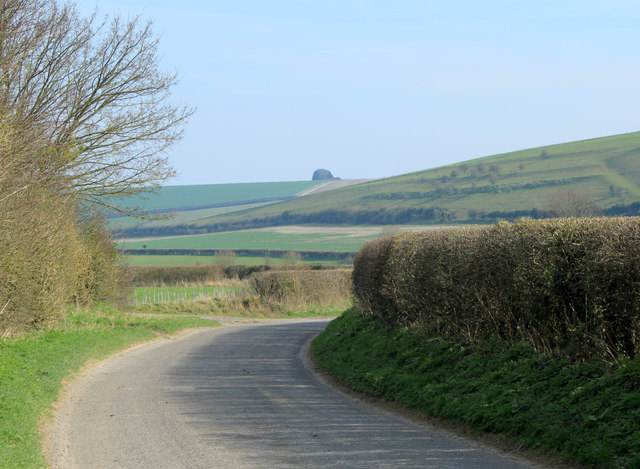
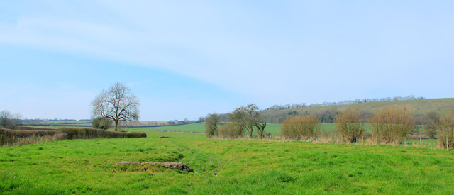
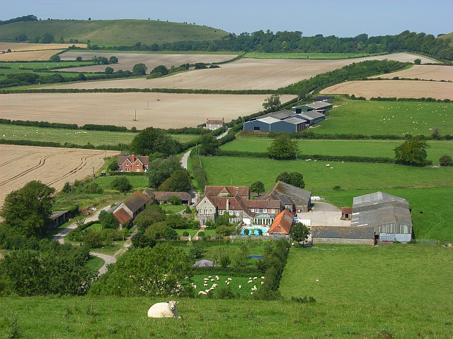
Bidcombe Wood is a picturesque woodland located in the county of Wiltshire, England. Covering an area of approximately 100 hectares, this ancient forest is renowned for its natural beauty and diverse ecosystem. The wood is situated on the edge of the village of Bidcombe and is easily accessible by foot or bicycle.

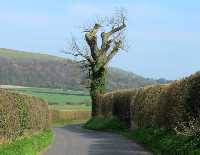
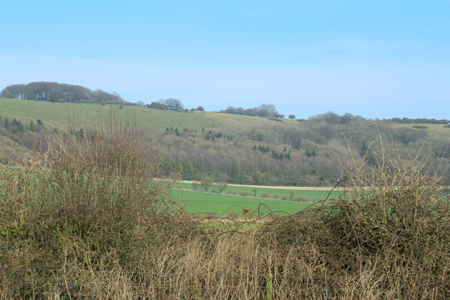
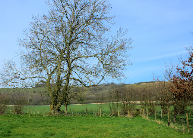
Bidcombe Wood is predominantly composed of mixed deciduous trees, including oak, beech, and ash, creating a rich tapestry of colors throughout the year. The woodland's ancient origins are evident in the presence of several veteran trees, some of which are estimated to be over three centuries old. These ancient trees provide important habitats for a wide variety of wildlife, including birds, bats, and insects.

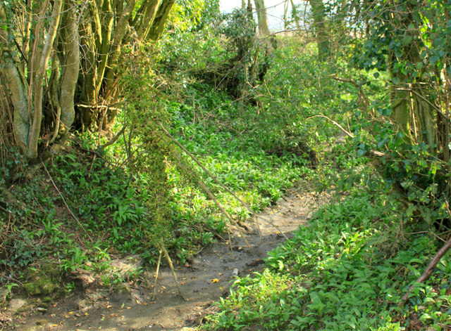
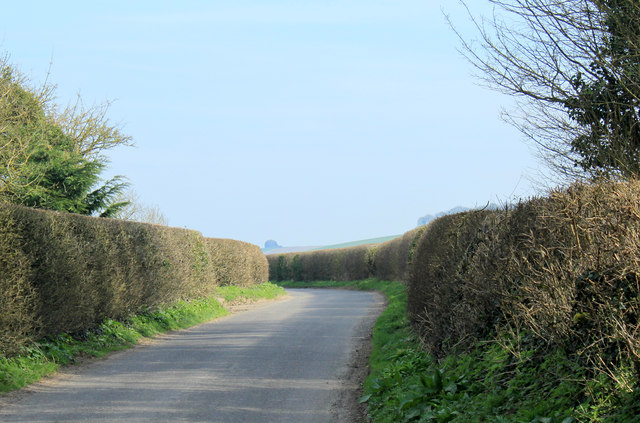
The forest is crisscrossed by a network of well-maintained footpaths and trails, allowing visitors to explore the wood at their own pace. Nature enthusiasts can enjoy leisurely walks, birdwatching, and even spot some of the elusive deer that inhabit the area. The wood also features a small pond, adding to its natural charm.

Managed by the local authorities, Bidcombe Wood is actively conserved and protected. Conservation efforts include selective tree thinning and the creation of glades to encourage the growth of wildflowers and support a diverse range of plant species. The wood is also an important educational resource, regularly hosting school visits and nature workshops to promote environmental awareness and understanding.

Overall, Bidcombe Wood offers a tranquil and enchanting escape into nature, providing a haven for both wildlife and visitors alike.

If you have any feedback on the listing, please let us know in the comments section below.

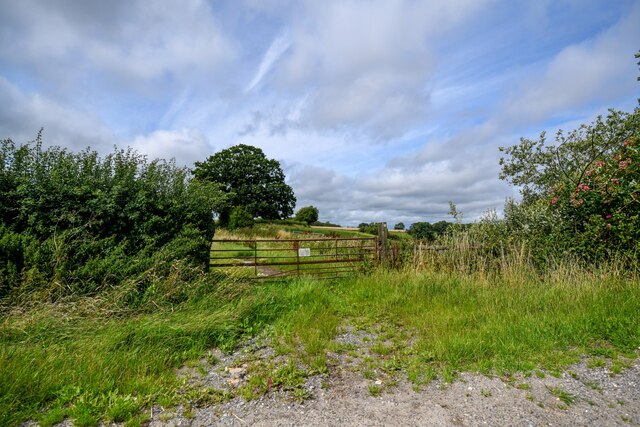
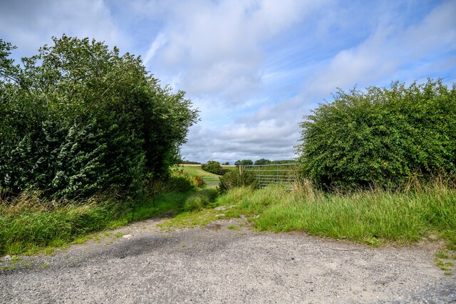
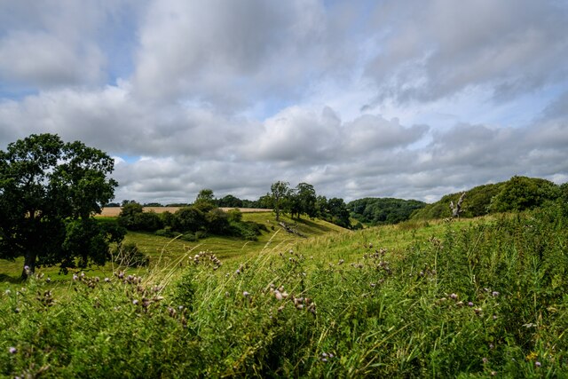
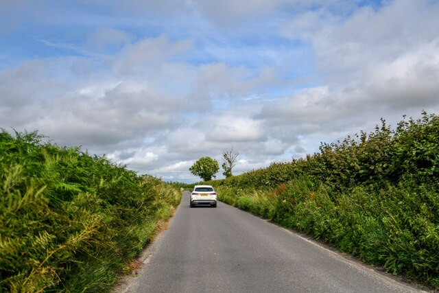
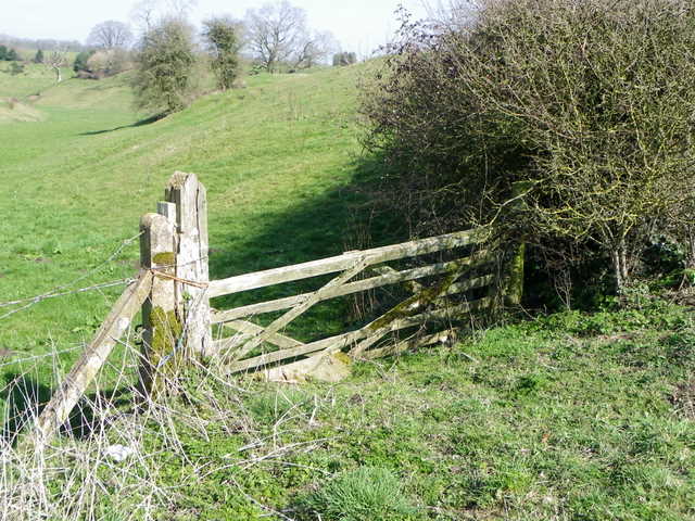
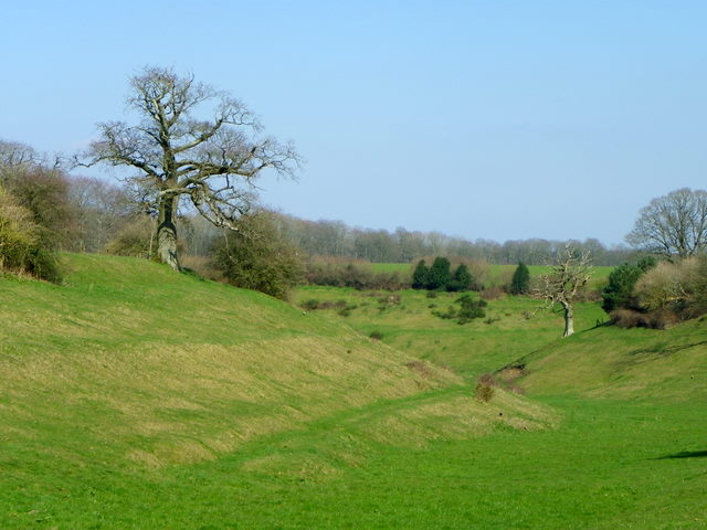
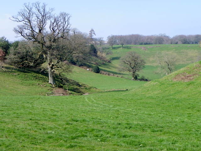
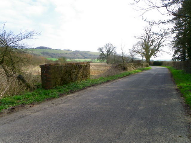
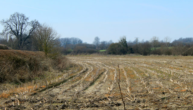
Bidcombe Wood Images

Images are sourced within 2km of 51.1543/-2.2454079 or Grid Reference ST8239. Thanks to Geograph Open Source API. All images are credited.

Horningham : Grassy Field Looking beyond the gate and into the field.
Horningham : Grassy Field
Looking beyond the gate and into the field.
Horningsham : Field Entrance Gates provide entry to the field.
Horningsham : Field Entrance
Gates provide entry to the field.
Horningsham : Countryside Scenery Looking across hillsides and green fields.
Horningsham : Countryside Scenery
Looking across hillsides and green fields.
Horningsham : Road Looking along country lane.
Horningsham : Road
Looking along country lane.
Gate near Baycliffe Farm The gate, looking rather worse for wear, gives access to a large downland field.
Gate near Baycliffe Farm
The gate, looking rather worse for wear, gives access to a large downland field.
Dry valley near Baycliffe Farm A small dry valley where there are several large dead trees.
Dry valley near Baycliffe Farm
A small dry valley where there are several large dead trees.
Dry valley near Horningsham A small dry valley with several large dead trees.
Dry valley near Horningsham
A small dry valley with several large dead trees.
Bridge near Maiden Bradley The small bridge over a drain is on Kingston Lane.  There is an Ordnance Survey bench mark on the parapet.
Bridge near Maiden Bradley
The small bridge over a drain is on Kingston Lane. There is an Ordnance Survey bench mark on the parapet.
Bench Mark, Kingston Lane The Ordnance Survey bench mark is on the east end of the north parapet to the bridge on Kingston Lane.  For a view of the bridge <a href="https://www.geograph.org.uk/photo/2862604">ST8138 : Bridge near Maiden Bradley</a> and for further information on the cut mark and others in the area <span class="nowrap"><a title="http://www.bench-marks.org.uk/bm42137" rel="nofollow ugc noopener" href="http://www.bench-marks.org.uk/bm42137">Link</a><img style="margin-left:2px;" alt="External link" title="External link - shift click to open in new window" src="https://s1.geograph.org.uk/img/external.png" width="10" height="10"/></span>
Bench Mark, Kingston Lane
The Ordnance Survey bench mark is on the east end of the north parapet to the bridge on Kingston Lane. For a view of the bridge ST8138 : Bridge near Maiden Bradley and for further information on the cut mark and others in the area LinkExternal link
2012 : An old oak tree, nicely pruned As well as improving safety for passers by on the road this treatment helps preserve the life of the tree. Already 300 to 400 years old, given the absence of lightning strikes, road widening, etc. it could last another 400 or 500 years.
Brimsdown Hill is in the background, the road continues to Kingston Deverill.
2012 : An old oak tree, nicely pruned
As well as improving safety for passers by on the road this treatment helps preserve the life of the tree. Already 300 to 400 years old, given the absence of lightning strikes, road widening, etc. it could last another 400 or 500 years. Brimsdown Hill is in the background, the road continues to Kingston Deverill.
2012 : A winterbourne or winterborne A winterborne or winterbourne is a stream or river that is dry during the summer months, here is an excellent example, though this year it is dry in the middle of March.
2012 : A winterbourne or winterborne
A winterborne or winterbourne is a stream or river that is dry during the summer months, here is an excellent example, though this year it is dry in the middle of March.
2012 : Looking west from Kingston Lane The road to Kingston Deverill. 
Across a large pasture to Little Knoll <a href="https://www.geograph.org.uk/gridref/ST8037">ST8037</a>, Little Knoll Wood struggles to stay on top.
Behind is Long Knoll, seen end on from the east and for once taking an inferior role.
2012 : Looking west from Kingston Lane
The road to Kingston Deverill. Across a large pasture to Little Knoll ST8037, Little Knoll Wood struggles to stay on top. Behind is Long Knoll, seen end on from the east and for once taking an inferior role.
2012 : Kingston Lane near Dairy Farm Heading east to Kingston Deverill along the upper Wylye Valley. 
The clump of trees on the hilltop is the end if a long plantation seen end on at the top of King's Hill.
2012 : Kingston Lane near Dairy Farm
Heading east to Kingston Deverill along the upper Wylye Valley. The clump of trees on the hilltop is the end if a long plantation seen end on at the top of King's Hill.
2012 : East along the bottom of Brimsdown Hill Not to be confused with Brims Down which is about two miles to the east.
Marcombe Wood is at the foot of the hill.
2012 : East along the bottom of Brimsdown Hill
Not to be confused with Brims Down which is about two miles to the east. Marcombe Wood is at the foot of the hill.
2012 : Maize field, four months after harvesting A scene only the farmer could love.
Maize is one of the last crops to be brought in.
2012 : Maize field, four months after harvesting
A scene only the farmer could love. Maize is one of the last crops to be brought in.
2012 : An oak tree of many winters A good few summers as well, from the base of the trunk one would think well over 600. Seems to have been coppiced at some time early in its life giving it extra years.
Holcombe Hole is in the hill behind with Bidcombe Down at the top.
2012 : An oak tree of many winters
A good few summers as well, from the base of the trunk one would think well over 600. Seems to have been coppiced at some time early in its life giving it extra years. Holcombe Hole is in the hill behind with Bidcombe Down at the top.
2012 : North west from the road from Kingston Deverill To Maiden Bradley.
Brimsdown Hill is to the right.
2012 : North west from the road from Kingston Deverill
To Maiden Bradley. Brimsdown Hill is to the right.
2012 : Trimmed hedgerows on the road to Kingston Deverill
Show me another place!

Bidcombe Wood is located at Grid Ref: ST8239 (Lat: 51.1543, Lng: -2.2454079)

Unitary Authority: Wiltshire

Police Authority: Wiltshire

What 3 Words

///airfields.sardine.obligated. Near Kilmington, Wiltshire

Related Wikis

Brimsdown Hill

Brimsdown Hill (grid reference ST821391) is a 193.7 hectare biological Site of Special Scientific Interest in Wiltshire, notified in 1951. It is situated...

Bradley House, Wiltshire

Bradley House, or Maiden Bradley House, is a country house in the village of Maiden Bradley, Wiltshire, England, between the great country estates of Stourhead...

Horningsham

Horningsham is a small village and civil parish in Wiltshire, England, on the county border with Somerset. The village lies about 4 miles (6 km) southwest...

Maiden Bradley

Maiden Bradley is a village in south-west Wiltshire, England, about 6 miles (10 km) south-west of Warminster and bordering the county of Somerset. The...

Kingston Deverill

Kingston Deverill is a village and civil parish in Wiltshire, England. Its nearest towns are Mere, about 3+1⁄2 miles (6 km) to the southwest, and Warminster...

Maiden Bradley Priory

Maiden Bradley Priory was a priory in Wiltshire, England. It was founded as a leper colony in 1164, and in 1189 was handed over to the Augustinian order...

Monkton Deverill

Monkton Deverill (anciently known as East Monkton) is a village and former civil parish, now in the parish of Kingston Deverill, in Wiltshire, England...

Brixton Deverill

Brixton Deverill is a small village and civil parish about 4 miles (6.4 km) south of Warminster in Wiltshire, England. The parish is in the Deverill Valley...

Nearby Amenities

Located within 500m of 51.1543,-2.2454079
Bidcombe Hill
Ele: 265
Natural: peak
Lat/Long: 51.1537055/-2.2398833
The data included in this document is from www.openstreetmap.org. The data is made available under ODbL.

Have you been to Bidcombe Wood?

Leave your review of Bidcombe Wood below (or comments, questions and feedback).