Bareppa

Settlement in Cornwall

England

Bareppa

Pool with cow and gorilla In deepest Cornwall it is a bit of a surprise to come across a cow and a gorilla perched on a little island in a pool - but there they were. We only stumbled across them because our SatNav has a penchant for tiny lanes!
Pool with cow and gorilla Credit: Rob Farrow

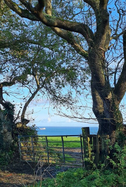
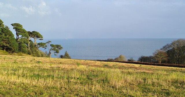
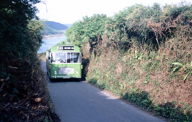
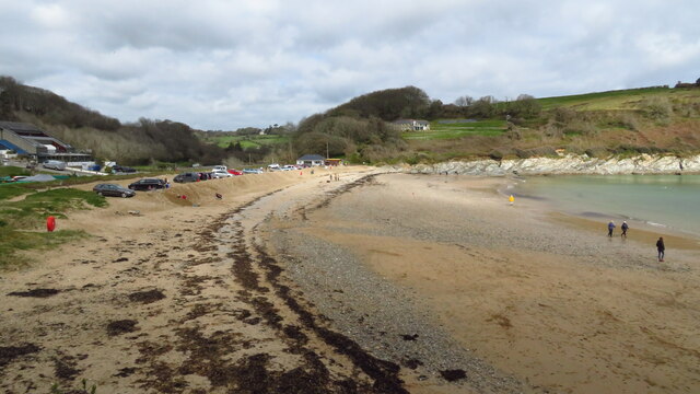
Bareppa is a small coastal village located in the county of Cornwall, in southern England. Situated on the rugged and picturesque coastline, it offers stunning views of the Atlantic Ocean and is known for its natural beauty. With a population of around 500 residents, Bareppa maintains a close-knit community atmosphere.

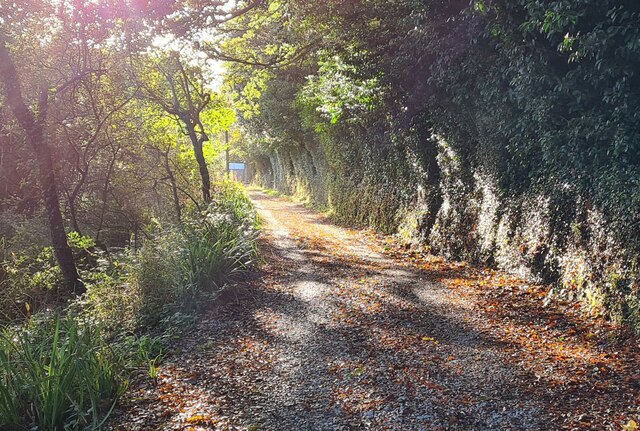
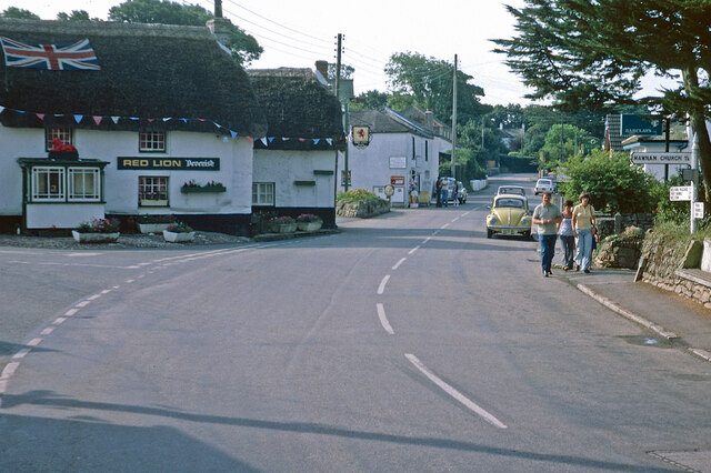
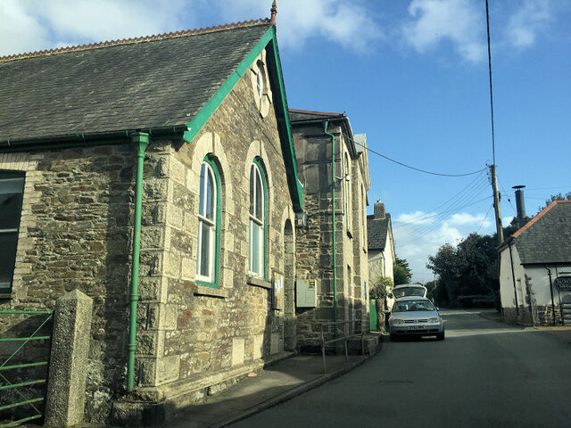
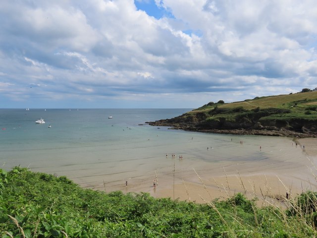
The village is characterized by its charming, traditional cottages made of local stone, giving it a quaint and timeless feel. The narrow streets are lined with colorful flowers and there is a sense of tranquility that envelops the area. The nearby cliffs and coves are popular spots for outdoor activities such as hiking, birdwatching, and exploring rock pools.

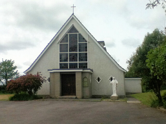
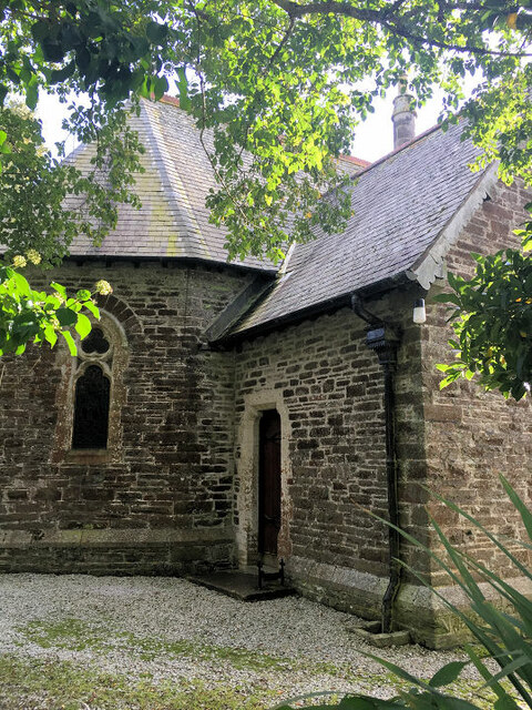
Bareppa is also known for its rich history and cultural heritage. The village boasts a historic church dating back to the 12th century, which is a significant architectural landmark. The local museum showcases artifacts and exhibits that depict the region's maritime past, highlighting its connections to fishing and smuggling.

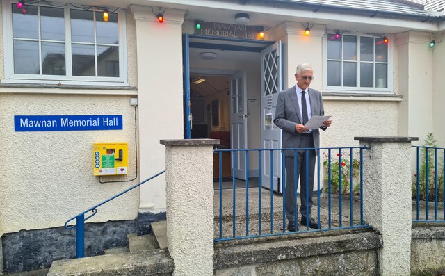
Despite its small size, Bareppa offers a range of amenities to its residents and visitors. There are a handful of cozy pubs and restaurants serving traditional Cornish cuisine, as well as a few local shops and boutiques. The village also hosts a yearly summer fair, attracting tourists from nearby towns and cities.

Overall, Bareppa is a hidden gem along the Cornish coast, offering a peaceful retreat for those seeking natural beauty, history, and a sense of community.

If you have any feedback on the listing, please let us know in the comments section below.

Bareppa Images

Images are sourced within 2km of 50.125595/-5.104009 or Grid Reference SW7829. Thanks to Geograph Open Source API. All images are credited.

Pool with cow and gorilla In deepest Cornwall it is a bit of a surprise to come across a cow and a gorilla perched on a little island in a pool - but there they were. We only stumbled across them because our SatNav has a penchant for tiny lanes!
Pool with cow and gorilla
In deepest Cornwall it is a bit of a surprise to come across a cow and a gorilla perched on a little island in a pool - but there they were. We only stumbled across them because our SatNav has a penchant for tiny lanes!
Field gate at Meudon Farm
Autumn afternoon sun on the track in the valley at Maenporth
Field lying fallow at Chenhalls This field has often been used for the growing of daffodils - see <a href="https://www.geograph.org.uk/photo/4325828">SW7828 : Rows of daffodils at Chenhalls</a>.
Field lying fallow at Chenhalls
This field has often been used for the growing of daffodils - see SW7828 : Rows of daffodils at Chenhalls.
The Proclamation of the Accession of His Majesty King Charles III at 6.00pm on Sunday 11th November 2022 in Mawnan Smith Declared by the Chairman of Mawnan Parish Council on the steps of the Great War Memorial Hall.
The Proclamation of the Accession of His Majesty King Charles III at 6.00pm on Sunday 11th November 2022 in Mawnan Smith
Declared by the Chairman of Mawnan Parish Council on the steps of the Great War Memorial Hall.
Western National bus on Maenporth Road Western National bus drivers would have been well used to steering full sized vehicles along narrow Cornish lanes - and usually did so at a brisk pace. Cars and pedestrians were well advised to just get out of the way and here the photographer has had to more or less bury himself in the hedgerow to avoid a Bristol RE storming up the hill from Maenporth beach. In 1977 the 564 ran this way three times a day as a summer only variant of the main service between Falmouth and Helford Passage. The bus itself, ATA764L, would have been about five years old at the time and remained with Western National until 1986 when it was sold to Chase of Chasetown in Staffordshire; it subsequently moved on to Express Motors of Bontnewydd before being scrapped following an accident in 1990.
Western National bus on Maenporth Road
Western National bus drivers would have been well used to steering full sized vehicles along narrow Cornish lanes - and usually did so at a brisk pace. Cars and pedestrians were well advised to just get out of the way and here the photographer has had to more or less bury himself in the hedgerow to avoid a Bristol RE storming up the hill from Maenporth beach. In 1977 the 564 ran this way three times a day as a summer only variant of the main service between Falmouth and Helford Passage. The bus itself, ATA764L, would have been about five years old at the time and remained with Western National until 1986 when it was sold to Chase of Chasetown in Staffordshire; it subsequently moved on to Express Motors of Bontnewydd before being scrapped following an accident in 1990.
Mawnan Smith The centre of this Cornish village is dominated by its thatched pub, the Red Lion. Here in the summer of 1977 it was decorated with a union flag and bunting to celebrate the silver jubilee of Queen Elizabeth II. Devenish owned a large estate of west Cornwall pubs in the 1970s - the beers were brewed at Redruth - but the company no longer exists. The road ahead through the village leads to Helford Passage. Note the Barclays Bank sign on the right of the picture; it seems hard to believe now, in an age when banks are closing branches in quite large towns, that they once had a presence in such rural places.
Mawnan Smith
The centre of this Cornish village is dominated by its thatched pub, the Red Lion. Here in the summer of 1977 it was decorated with a union flag and bunting to celebrate the silver jubilee of Queen Elizabeth II. Devenish owned a large estate of west Cornwall pubs in the 1970s - the beers were brewed at Redruth - but the company no longer exists. The road ahead through the village leads to Helford Passage. Note the Barclays Bank sign on the right of the picture; it seems hard to believe now, in an age when banks are closing branches in quite large towns, that they once had a presence in such rural places.
Beach at Maenporth near Falmouth
St. Edward the Confessor church
St Michael's Church
St Michael's Church
Mawnan Methodist Church
View along the coast from Rosemullion Head
Maenporth Beach
Maenporth Beach
Daffodil field at Penwarne These may be being grown for bulbs, when the flowers are allowed to blossom and die to build up the bulb. When grown for the flower market the daffodils are picked in tight bud, with no yellow showing at all.  This year very cold weather at the beginning of the year delayed the development of the plants and then a spell of warm weather in mid February brought them all on together, causing problems for the farmers owing to a glut and also  a shortage of pickers - that may be the case here.
Daffodil field at Penwarne
These may be being grown for bulbs, when the flowers are allowed to blossom and die to build up the bulb. When grown for the flower market the daffodils are picked in tight bud, with no yellow showing at all. This year very cold weather at the beginning of the year delayed the development of the plants and then a spell of warm weather in mid February brought them all on together, causing problems for the farmers owing to a glut and also a shortage of pickers - that may be the case here.
Small Daffodil field at Penwarne For an explanation see <a href="https://www.geograph.org.uk/photo/2308998">SW7630 : Daffodil field at Penwarne</a>.
Small Daffodil field at Penwarne
For an explanation see SW7630 : Daffodil field at Penwarne.
Daffodils at Penwarne In <a href="https://www.geograph.org.uk/photo/2309008">SW7630 : Small Daffodil field at Penwarne</a>. Daffodils are a very widely grown crop is southwest Cornwall these days.  These will not be destined for the flower market because they are in full flower - for an explanation see <a href="https://www.geograph.org.uk/photo/2308998">SW7630 : Daffodil field at Penwarne</a>.
Daffodils at Penwarne
In SW7630 : Small Daffodil field at Penwarne. Daffodils are a very widely grown crop is southwest Cornwall these days. These will not be destined for the flower market because they are in full flower - for an explanation see SW7630 : Daffodil field at Penwarne.
Small daffodil field at Penwarne Through the trees can be seen the house in Tony Atkin's picture <a href="https://www.geograph.org.uk/photo/163016">SW7730 : Penwarne Road</a>.
Small daffodil field at Penwarne
Through the trees can be seen the house in Tony Atkin's picture SW7730 : Penwarne Road.
Small Daffodil field at Penwarne Viewed from the footpath which crosses this field and the next and then ends, leading nowhere.
Small Daffodil field at Penwarne
Viewed from the footpath which crosses this field and the next and then ends, leading nowhere.
Show me another place!

Bareppa is located at Grid Ref: SW7829 (Lat: 50.125595, Lng: -5.104009)

Unitary Authority: Cornwall

Police Authority: Devon and Cornwall

What 3 Words

///dust.chairs.combining. Near Falmouth, Cornwall

Nearby Locations

Bareppa

Related Wikis

Bareppa

Bareppa is a hamlet in west Cornwall, England, United Kingdom, three miles (5 km) southwest of Falmouth. It is in the civil parish of Mawnan. == References... ==

Carlidnack

Carlidnack (or Carlinack) is a hamlet in the parish of Mawnan, Cornwall, England. Carlidnack lies 2.7 miles (4.3 km) south-west of Falmouth on a road...

Maenporth

Maenporth (Cornish: Meyn Borth, meaning stones cove) is a cove and beach in west Cornwall, England. It is situated approximately two miles (3 km) south...
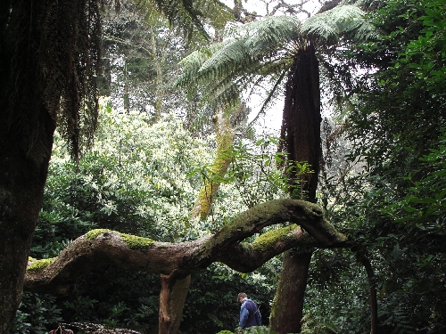
Penjerrick Garden

Penjerrick Garden -- often referred to as "Cornwall's true jungle garden"—lies between Budock Water and Mawnan Smith, near Falmouth, United Kingdom. Established...

Nearby Amenities

Located within 500m of 50.125595,-5.104009
Bareppa
Is In: Cornwall, England, UK
Is In Country: England
Is In Country Code: GB
Is In County: Cornwall
Place: hamlet
Source: npe
Wikidata: Q4860461
Lat/Long: 50.1259599/-5.1055822
Rosemerryn
Place: farm
Lat/Long: 50.1287/-5.1026817
Barrier: stile
Material: stone
Source: survey;gps
Stile: ladder
Lat/Long: 50.1269038/-5.1061303
Barrier: stile
Material: stone
Source: survey;gps
Stile: ladder
Lat/Long: 50.1236096/-5.1000238
Power: pole
Lat/Long: 50.1229487/-5.1021114
Power: pole
Lat/Long: 50.1236564/-5.1023997
Power: pole
Lat/Long: 50.1242557/-5.1026452
Power: pole
Lat/Long: 50.1257423/-5.1032634
Power: pole
Lat/Long: 50.1279605/-5.1041633
Power: pole
Lat/Long: 50.1299765/-5.1050095
Power: pole
Lat/Long: 50.1258626/-5.1047534
Power: pole
Lat/Long: 50.1258128/-5.1033559
Power: pole
Lat/Long: 50.1211439/-5.1030234
Power: pole
Lat/Long: 50.1223494/-5.1027069
Power: pole
Lat/Long: 50.1235962/-5.102216
Post Box
Brand: Royal Mail
Brand Wikidata: Q638098
Collection Times: Mo-Fr 09:00; Sa 07:00; Su off
Drive Through: no
Operator: Royal Mail
Operator Wikidata: Q638098
Post Box Mounting: pier
Post Box Type: lamp
Ref: TR11 82D
Royal Cypher: EIIR
Royal Cypher Wikidata: Q33102113
Source: survey;streetlevel imagery;aerial imagery
Lat/Long: 50.122511/-5.1079123
The data included in this document is from www.openstreetmap.org. The data is made available under ODbL.

Have you been to Bareppa?

Leave your review of Bareppa below (or comments, questions and feedback).