Earton Hill

Hill, Mountain in Lancashire Ribble Valley

England

Earton Hill

Lane Head Barn
Lane Head Barn Credit: Anthony Parkes

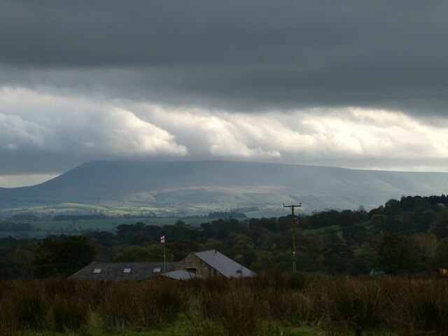
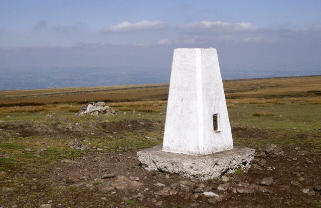
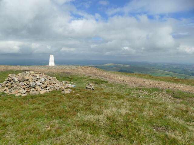
Earton Hill is a prominent natural feature located in the county of Lancashire, England. Situated in the northwestern part of the county, it is classified as a hill rather than a mountain, reaching an elevation of 316 meters (1,037 feet) above sea level. The hill is part of the larger Pennine range, which stretches across northern England.

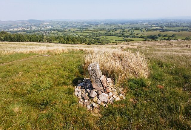
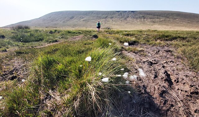
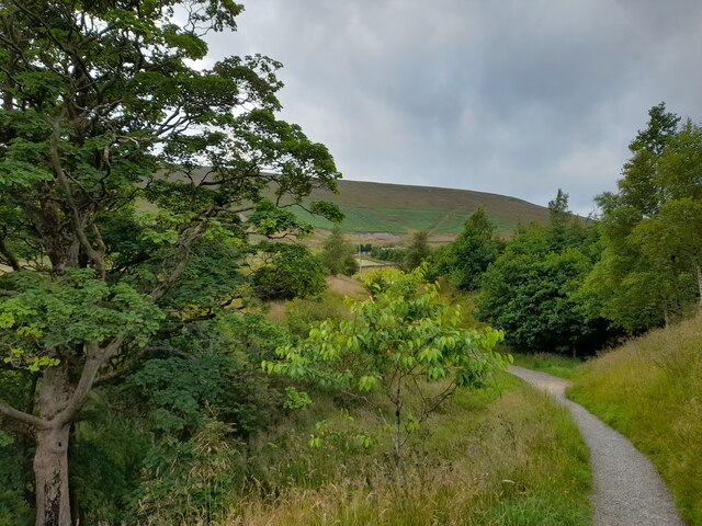
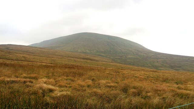
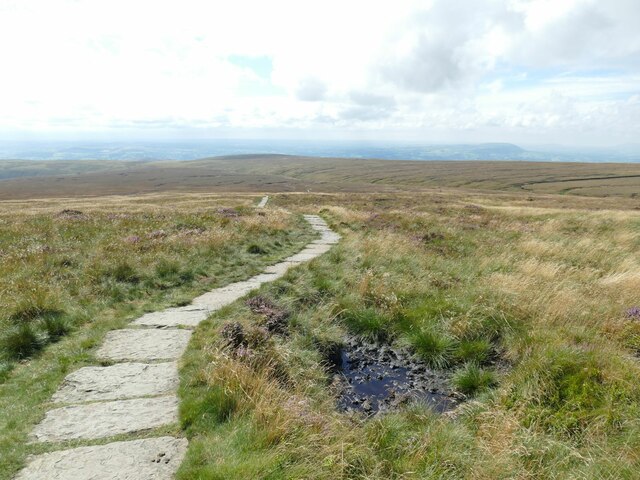
Earton Hill is characterized by its gentle slopes and rolling landscape. It is covered in lush greenery, with grasses, shrubs, and scattered trees dotting its surface. The hill offers stunning panoramic views of the surrounding countryside, providing visitors with a picturesque vantage point to admire the beauty of the Lancashire region.

Due to its accessible location and relatively easy hiking trails, Earton Hill attracts both locals and tourists who enjoy outdoor activities such as walking, hiking, and picnicking. The hill is also popular among nature enthusiasts, as it serves as a habitat for various species of plants and wildlife. The presence of birds, including songbirds and birds of prey, adds to the charm of the area.

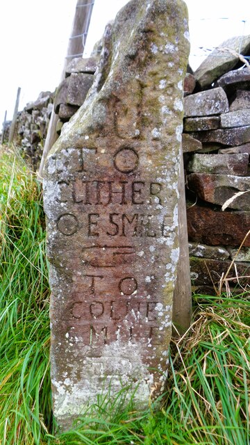
Earton Hill is steeped in history and folklore, with tales of ancient settlements and mythical creatures associated with the site. The hill has been a subject of interest for archaeologists, who have unearthed artifacts and remains from prehistoric and Roman times in the surrounding areas.

Overall, Earton Hill in Lancashire offers a serene and picturesque escape for nature lovers, history enthusiasts, and those seeking tranquility amidst the rolling landscapes of northern England.

If you have any feedback on the listing, please let us know in the comments section below.

Earton Hill Images

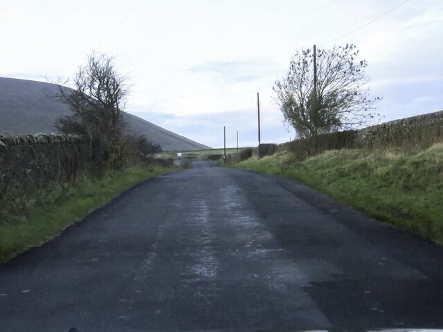
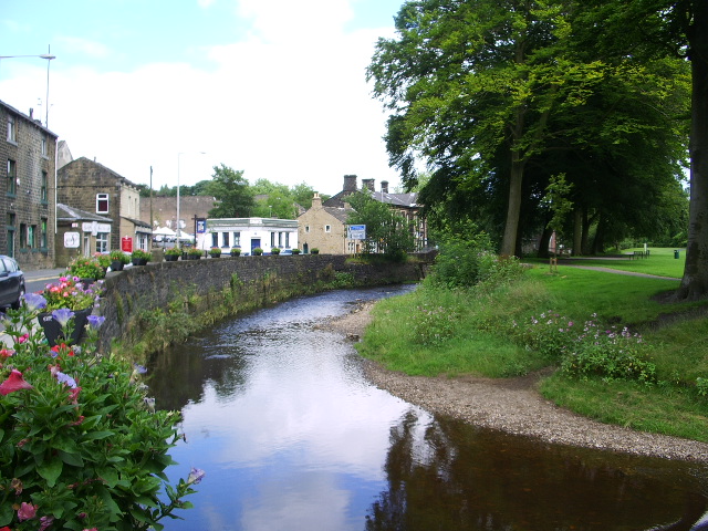
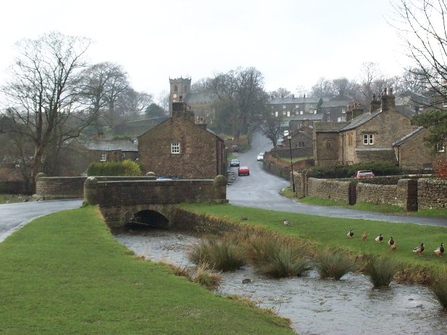
Images are sourced within 2km of 53.882591/-2.2852118 or Grid Reference SD8142. Thanks to Geograph Open Source API. All images are credited.

Lane Head Barn
Lane Head Barn
Way Marker Stones on lower slopes of Pendle Hill
Footpath on Downham Moor
A Glimpse of Pendle Hill On the footpath from Barley and a glimpse of Pendle Hill is had through the trees.
A Glimpse of Pendle Hill
On the footpath from Barley and a glimpse of Pendle Hill is had through the trees.
On Pendle Hill A pause to admire the view on the way up Pendle Hill.
On Pendle Hill
A pause to admire the view on the way up Pendle Hill.
Top of the Ogden Valley Greenway, Pendle Hill Looking out towards the Ogden Valley Greenway and, beyond, the Ribble Estuary.
Top of the Ogden Valley Greenway, Pendle Hill
Looking out towards the Ogden Valley Greenway and, beyond, the Ribble Estuary.
Stormclouds over Pendle Hill Pendle View Farm <a href="https://www.geograph.org.uk/gridref/SD7754">SD7754</a> (Shown on the map as Cracoe Hill Farm) in the foreground.
Stormclouds over Pendle Hill
Pendle View Farm SD7754 (Shown on the map as Cracoe Hill Farm) in the foreground.
Pendle Hill Pendle Hill at 557m (1,827 feet) is something of a Lancashire icon, steeped in folklore and history. The 17th century seems to have been a particularly busy period here with the Pendle witch trials in 1612, Richard Towneley's barometer experiment in 1661 and George Fox's vision of many souls coming to Christ in 1652. Of those the witch trials are perhaps the best known. Ten men and two women living in the immediate area were accused of commiting murder by witchcraft. Ten were found guilty and executed. Towneley, together with Henry Power, used the newly invented barometer to measure air pressure at different altitudes on the hill which led to an understanding of the relationship between air density and pressure.  Finally, George Fox's vision at this spot was an important event in the establishment of the Society of Friends (Quakers). 

Note how the area around the pillar has been eroded away by its many visitors. More recent pictures show how this problem has been addressed: <a href="https://www.geograph.org.uk/photo/3864654">SD8041 : Trig Point on Pendle Hill</a>.
Pendle Hill
Pendle Hill at 557m (1,827 feet) is something of a Lancashire icon, steeped in folklore and history. The 17th century seems to have been a particularly busy period here with the Pendle witch trials in 1612, Richard Towneley's barometer experiment in 1661 and George Fox's vision of many souls coming to Christ in 1652. Of those the witch trials are perhaps the best known. Ten men and two women living in the immediate area were accused of commiting murder by witchcraft. Ten were found guilty and executed. Towneley, together with Henry Power, used the newly invented barometer to measure air pressure at different altitudes on the hill which led to an understanding of the relationship between air density and pressure. Finally, George Fox's vision at this spot was an important event in the establishment of the Society of Friends (Quakers). Note how the area around the pillar has been eroded away by its many visitors. More recent pictures show how this problem has been addressed: SD8041 : Trig Point on Pendle Hill.
Old Guide Stone At Four Lanes End where the Clitheroe to Colne route intersects the Burnley to Gisburn route
Old Guide Stone
At Four Lanes End where the Clitheroe to Colne route intersects the Burnley to Gisburn route
Pendle Big End View from Four Lane Ends
Pendle Big End
View from Four Lane Ends
Pendle Side Farm The farm has an extensive shelter belt to the north.
Pendle Side Farm
The farm has an extensive shelter belt to the north.
Pendle House Farm Not as isolated as most farms at this altitude, being right by the Pendle Way. But they were capitalising on it by advertising ice cream for sale.
Pendle House Farm
Not as isolated as most farms at this altitude, being right by the Pendle Way. But they were capitalising on it by advertising ice cream for sale.
The Big End of Pendle This is where the tough ascent starts. It's over 200m of ascent to the top from this point above Pendle House farm. There are two options beyond the end of the wall on the right: straight up the hill (the official right of way) at a gradient of 1:2 or steeper, or bear right and follow the Pendle Way up the hill at an angle - still quite steep (about 1:4) but most people choose this option.
The Big End of Pendle
This is where the tough ascent starts. It's over 200m of ascent to the top from this point above Pendle House farm. There are two options beyond the end of the wall on the right: straight up the hill (the official right of way) at a gradient of 1:2 or steeper, or bear right and follow the Pendle Way up the hill at an angle - still quite steep (about 1:4) but most people choose this option.
Along the ridge of Pendle A stone-surfaced section of the Pendle Way approaching the summit.
Along the ridge of Pendle
A stone-surfaced section of the Pendle Way approaching the summit.
The summit of Pendle A triangulation pillar marks the summit. This wasn't the clearest of days, but you could just about make out Ingleborough 34km to the north.
The summit of Pendle
A triangulation pillar marks the summit. This wasn't the clearest of days, but you could just about make out Ingleborough 34km to the north.
Cairn at the summit of Pendle A triangulation pillar marks the summit. This wasn't the clearest of days, but you could just about make out Ingleborough 34km to the north.
Cairn at the summit of Pendle
A triangulation pillar marks the summit. This wasn't the clearest of days, but you could just about make out Ingleborough 34km to the north.
Causeway below the summit of Pendle The western flank of the hill is on a much gentler gradient than the eastern escarpment, leading to boggier ground. The well-worn path down towards Clitheroe has been paved with gritstone flags to prevent erosion and make the walker's life easier.
Causeway below the summit of Pendle
The western flank of the hill is on a much gentler gradient than the eastern escarpment, leading to boggier ground. The well-worn path down towards Clitheroe has been paved with gritstone flags to prevent erosion and make the walker's life easier.
Barley Lane Pendle Hill is in the background.
Barley Lane
Pendle Hill is in the background.
Show me another place!

Earton Hill is located at Grid Ref: SD8142 (Lat: 53.882591, Lng: -2.2852118)

Administrative County: Lancashire

District: Ribble Valley

Police Authority: Lancashire

What 3 Words

///reckons.merge.spades. Near Chatburn, Lancashire

Related Wikis

Twiston

Twiston is a village and a civil parish in the Ribble Valley District, in the English county of Lancashire. It is near the town of Clitheroe and the village...

Pendle Hill

Pendle Hill is in the east of Lancashire, England, near the towns of Burnley, Nelson, Colne, Brierfield, Clitheroe and Padiham. Its summit is 557 metres...

Black Moss Reservoirs

Upper and Lower Black Moss Reservoirs are reservoirs close to the village of Barley, in the Borough of Pendle, close to the market town of Burnley, England...

Barley-with-Wheatley Booth

Barley-with-Wheatley Booth is a civil parish in the Pendle district of Lancashire, England. It has a population of 298, and contains the village of Barley...

Pendle Water

Pendle Water is a minor river in Lancashire, England. Rising on Pendle Hill, Pendle Water cuts a deep valley between Barley Moor and Spence Hill, where...

Barley, Lancashire

Barley is a village in the borough of Pendle, in Lancashire, England. It is in the civil parish of Barley-with-Wheatley Booth. The village lies between...

Rimington

Rimington is a rural village and civil parish in the Ribble Valley, Lancashire, England. The population of the civil parish was 382 at the 2001 Census...

Downham, Lancashire

Downham is a village and civil parish in Lancashire, England. It is in the Ribble Valley district and at the United Kingdom 2001 census had a population...

Nearby Amenities

Located within 500m of 53.882591,-2.2852118
Barrier: cattle_grid
Ele: 264.97
Lat/Long: 53.885667/-2.2841336
Barrier: cattle_grid
Ele: 310.1486816
Lat/Long: 53.8804488/-2.2814092
Barrier: stile
Ele: 236.6085205
Lat/Long: 53.8864988/-2.2876882
Barrier: stile
Ele: 249.1053467
Lat/Long: 53.8850317/-2.2873534
Barrier: stile
Ele: 251.9893799
Lat/Long: 53.8846624/-2.2869157
The data included in this document is from www.openstreetmap.org. The data is made available under ODbL.

Have you been to Earton Hill?

Leave your review of Earton Hill below (or comments, questions and feedback).