Pendle Bridge Wood

Wood, Forest in Lancashire Ribble Valley

England

Pendle Bridge Wood

The Lane to Clay House
The Lane to Clay House Credit: Anthony Parkes

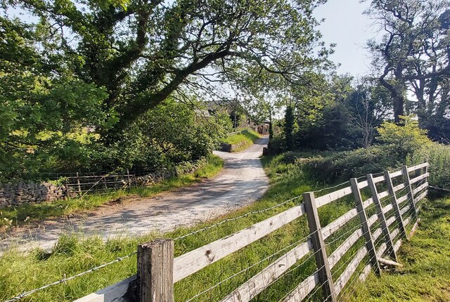
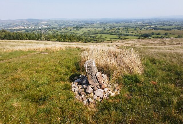
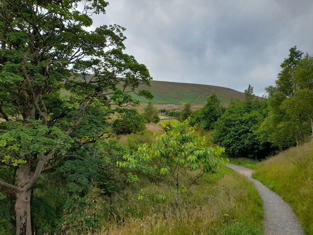
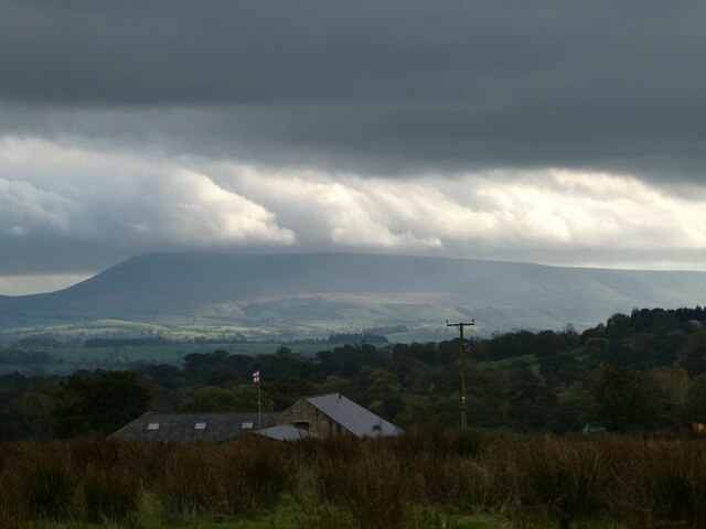
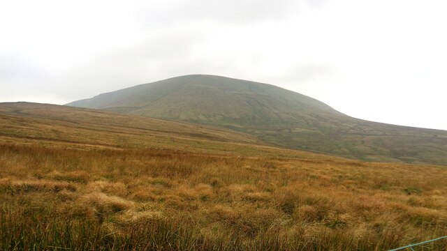
Pendle Bridge Wood is a picturesque woodland located in the county of Lancashire, England. Spanning over an area of approximately 100 acres, it is a popular destination for nature enthusiasts and walkers alike. The wood is situated near the village of Barley, at the foot of Pendle Hill, which is known for its historical significance and stunning natural beauty.

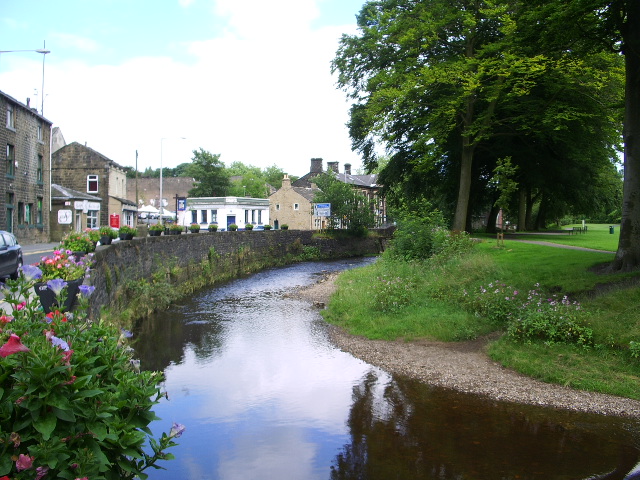
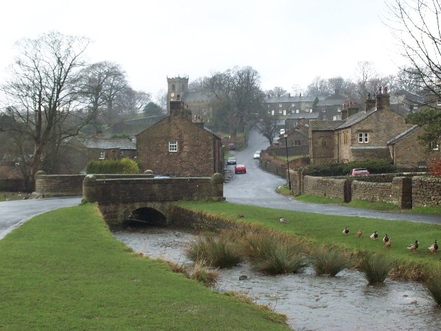
Pendle Bridge Wood is characterized by its diverse range of trees, including oak, birch, and beech, which create a dense and vibrant canopy overhead. The woodland floor is adorned with an array of wildflowers, such as bluebells and primroses, adding to its enchanting atmosphere. The presence of a meandering river further enhances the charm of this woodland, providing a peaceful soundtrack to visitors.

The wood is home to a variety of wildlife, making it an ideal spot for birdwatching and animal spotting. Visitors may catch a glimpse of red squirrels, roe deer, and a wide range of bird species, including woodpeckers and tawny owls. The tranquil surroundings make it an excellent place for nature photography or simply enjoying a serene walk with family and friends.

Pendle Bridge Wood is easily accessible, with well-maintained footpaths and trails throughout. The wood is also located near other attractions, such as the Pendle Heritage Centre and Pendle Hill, offering visitors a chance to immerse themselves in the rich history and natural beauty of the area. Whether it's for a leisurely stroll, a picnic, or a day of exploration, Pendle Bridge Wood offers a tranquil and captivating experience for all who visit.

If you have any feedback on the listing, please let us know in the comments section below.

Pendle Bridge Wood Images

Images are sourced within 2km of 53.881512/-2.2891748 or Grid Reference SD8142. Thanks to Geograph Open Source API. All images are credited.

The Lane to Clay House
Lane Head Barn
Lane Head Barn
Way Marker Stones on lower slopes of Pendle Hill
Footpath on Downham Moor
Dry Stone Wall on Pendle Hill
A Glimpse of Pendle Hill On the footpath from Barley and a glimpse of Pendle Hill is had through the trees.
A Glimpse of Pendle Hill
On the footpath from Barley and a glimpse of Pendle Hill is had through the trees.
On Pendle Hill A pause to admire the view on the way up Pendle Hill.
On Pendle Hill
A pause to admire the view on the way up Pendle Hill.
Eastern Escarpment, Pendle Hill Looking up at the escarpment on the eastern side of Pendle Hill.
Eastern Escarpment, Pendle Hill
Looking up at the escarpment on the eastern side of Pendle Hill.
Top of the Ogden Valley Greenway, Pendle Hill Looking out towards the Ogden Valley Greenway and, beyond, the Ribble Estuary.
Top of the Ogden Valley Greenway, Pendle Hill
Looking out towards the Ogden Valley Greenway and, beyond, the Ribble Estuary.
Stormclouds over Pendle Hill Pendle View Farm <a href="https://www.geograph.org.uk/gridref/SD7754">SD7754</a> (Shown on the map as Cracoe Hill Farm) in the foreground.
Stormclouds over Pendle Hill
Pendle View Farm SD7754 (Shown on the map as Cracoe Hill Farm) in the foreground.
Pendle Hill Pendle Hill at 557m (1,827 feet) is something of a Lancashire icon, steeped in folklore and history. The 17th century seems to have been a particularly busy period here with the Pendle witch trials in 1612, Richard Towneley's barometer experiment in 1661 and George Fox's vision of many souls coming to Christ in 1652. Of those the witch trials are perhaps the best known. Ten men and two women living in the immediate area were accused of commiting murder by witchcraft. Ten were found guilty and executed. Towneley, together with Henry Power, used the newly invented barometer to measure air pressure at different altitudes on the hill which led to an understanding of the relationship between air density and pressure.  Finally, George Fox's vision at this spot was an important event in the establishment of the Society of Friends (Quakers). 

Note how the area around the pillar has been eroded away by its many visitors. More recent pictures show how this problem has been addressed: <a href="https://www.geograph.org.uk/photo/3864654">SD8041 : Trig Point on Pendle Hill</a>.
Pendle Hill
Pendle Hill at 557m (1,827 feet) is something of a Lancashire icon, steeped in folklore and history. The 17th century seems to have been a particularly busy period here with the Pendle witch trials in 1612, Richard Towneley's barometer experiment in 1661 and George Fox's vision of many souls coming to Christ in 1652. Of those the witch trials are perhaps the best known. Ten men and two women living in the immediate area were accused of commiting murder by witchcraft. Ten were found guilty and executed. Towneley, together with Henry Power, used the newly invented barometer to measure air pressure at different altitudes on the hill which led to an understanding of the relationship between air density and pressure. Finally, George Fox's vision at this spot was an important event in the establishment of the Society of Friends (Quakers). Note how the area around the pillar has been eroded away by its many visitors. More recent pictures show how this problem has been addressed: SD8041 : Trig Point on Pendle Hill.
Old Guide Stone At Four Lanes End where the Clitheroe to Colne route intersects the Burnley to Gisburn route
Old Guide Stone
At Four Lanes End where the Clitheroe to Colne route intersects the Burnley to Gisburn route
Pendle Big End View from Four Lane Ends
Pendle Big End
View from Four Lane Ends
Work on power lines above Brown House With four vans parked here, and a generator and welfare cabin in the field behind the photographer, this must have been a significant job.
Work on power lines above Brown House
With four vans parked here, and a generator and welfare cabin in the field behind the photographer, this must have been a significant job.
Pendle Side Farm The farm has an extensive shelter belt to the north.
Pendle Side Farm
The farm has an extensive shelter belt to the north.
Pendle House Farm Not as isolated as most farms at this altitude, being right by the Pendle Way. But they were capitalising on it by advertising ice cream for sale.
Pendle House Farm
Not as isolated as most farms at this altitude, being right by the Pendle Way. But they were capitalising on it by advertising ice cream for sale.
The Big End of Pendle This is where the tough ascent starts. It's over 200m of ascent to the top from this point above Pendle House farm. There are two options beyond the end of the wall on the right: straight up the hill (the official right of way) at a gradient of 1:2 or steeper, or bear right and follow the Pendle Way up the hill at an angle - still quite steep (about 1:4) but most people choose this option.
The Big End of Pendle
This is where the tough ascent starts. It's over 200m of ascent to the top from this point above Pendle House farm. There are two options beyond the end of the wall on the right: straight up the hill (the official right of way) at a gradient of 1:2 or steeper, or bear right and follow the Pendle Way up the hill at an angle - still quite steep (about 1:4) but most people choose this option.
Along the ridge of Pendle A stone-surfaced section of the Pendle Way approaching the summit.
Along the ridge of Pendle
A stone-surfaced section of the Pendle Way approaching the summit.
Show me another place!

Pendle Bridge Wood is located at Grid Ref: SD8142 (Lat: 53.881512, Lng: -2.2891748)

Administrative County: Lancashire

District: Ribble Valley

Police Authority: Lancashire

What 3 Words

///mops.lollipop.feasting. Near Chatburn, Lancashire

Related Wikis

Twiston

Twiston is a village and a civil parish in the Ribble Valley District, in the English county of Lancashire. It is near the town of Clitheroe and the village...
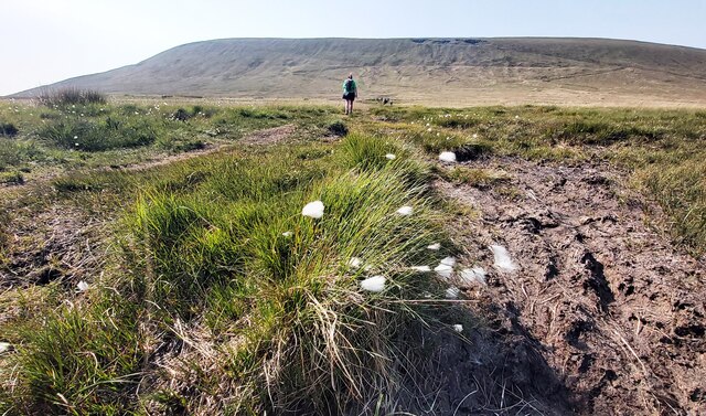
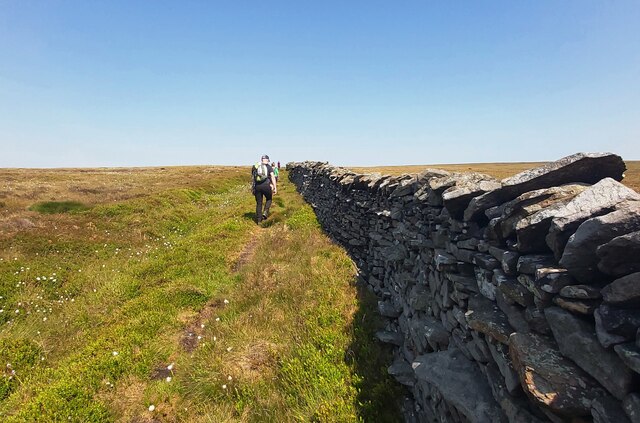
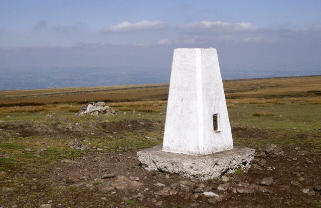
Pendle Hill

Pendle Hill is in the east of Lancashire, England, near the towns of Burnley, Nelson, Colne, Brierfield, Clitheroe and Padiham. Its summit is 557 metres...

Black Moss Reservoirs

Upper and Lower Black Moss Reservoirs are reservoirs close to the village of Barley, in the Borough of Pendle, close to the market town of Burnley, England...

Pendle Water

Pendle Water is a minor river in Lancashire, England. Rising on Pendle Hill, Pendle Water cuts a deep valley between Barley Moor and Spence Hill, where...

Barley-with-Wheatley Booth

Barley-with-Wheatley Booth is a civil parish in the Pendle district of Lancashire, England. It has a population of 298, and contains the village of Barley...

Barley, Lancashire

Barley is a village in the borough of Pendle, in Lancashire, England. It is in the civil parish of Barley-with-Wheatley Booth. The village lies between...

Downham, Lancashire

Downham is a village and civil parish in Lancashire, England. It is in the Ribble Valley district and at the United Kingdom 2001 census had a population...

Ogden Reservoirs

Upper and Lower Ogden Reservoirs are half a mile to the west of the village of Barley, in the Borough of Pendle, England. They supply drinking water to...

Nearby Amenities

Located within 500m of 53.881512,-2.2891748
Barrier: stile
Ele: 249.1053467
Lat/Long: 53.8850317/-2.2873534
Barrier: stile
Ele: 251.9893799
Lat/Long: 53.8846624/-2.2869157
The data included in this document is from www.openstreetmap.org. The data is made available under ODbL.

Have you been to Pendle Bridge Wood?

Leave your review of Pendle Bridge Wood below (or comments, questions and feedback).