Craik Moor

Hill, Mountain in Roxburghshire

Scotland

Craik Moor

Cheviot feral goat kid on Blackbrough Hill A loose herd of approximately 30 Cheviot feral goats including 10 kids were encountered from Blackbrough Hill to Heatherhope Reservoir, this being a shot of one of the more obliging youngsters.

This photograph was taken during the Coronavirus (COVID-19) pandemic of 2020/21/22.
Cheviot feral goat kid on Blackbrough Hill Credit: James T M Towill

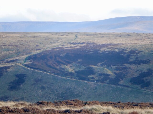
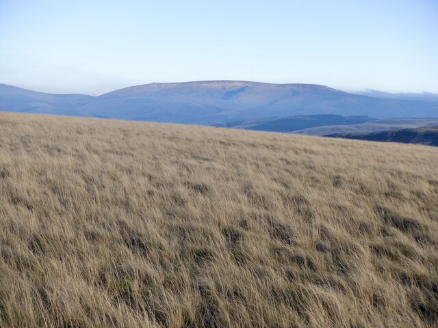
Craik Moor is a prominent hill located in the county of Roxburghshire, Scotland. Situated in the Southern Uplands, it forms part of the scenic landscape of the Scottish Borders region. With an elevation of approximately 365 meters (1,198 feet), Craik Moor offers breathtaking views from its summit.

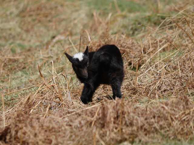
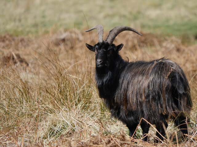
Covered in heather and low-lying vegetation, the hill is a haven for wildlife enthusiasts and nature lovers. The moorland is home to a variety of bird species, including red grouse, curlews, and lapwings. Visitors can often spot these birds soaring above or nesting in the heath.

The hill is accessible via well-marked trails that wind through the surrounding countryside. These paths provide opportunities for walkers and hikers of all levels to explore the area and enjoy the natural beauty of Craik Moor. On a clear day, the summit offers panoramic vistas of the rolling hills, verdant valleys, and nearby lochs, such as Loch Eddy.

Craik Moor also holds historical significance as it was once home to Iron Age settlements. Archaeological remains, including hut circles and burial cairns, can still be found scattered across the hillside, offering glimpses into the area's ancient past.

Whether it's for a leisurely stroll, birdwatching, or immersing oneself in the region's history, Craik Moor provides a captivating experience for visitors seeking tranquility and natural beauty in Roxburghshire.

If you have any feedback on the listing, please let us know in the comments section below.

Craik Moor Images

Images are sourced within 2km of 55.464785/-2.3003738 or Grid Reference NT8119. Thanks to Geograph Open Source API. All images are credited.

Cheviot feral goat kid on Blackbrough Hill A loose herd of approximately 30 Cheviot feral goats including 10 kids were encountered from Blackbrough Hill to Heatherhope Reservoir, this being a shot of one of the more obliging youngsters.

This photograph was taken during the Coronavirus (COVID-19) pandemic of 2020/21/22.
Cheviot feral goat kid on Blackbrough Hill
A loose herd of approximately 30 Cheviot feral goats including 10 kids were encountered from Blackbrough Hill to Heatherhope Reservoir, this being a shot of one of the more obliging youngsters. This photograph was taken during the Coronavirus (COVID-19) pandemic of 2020/21/22.
Cheviot feral goat by the Heatherhope Burn A loose herd of approximately 30 Cheviot feral goats including 10 kids were encountered from Blackbrough Hill to Heatherhope Reservoir, this being a shot of one of the more obliging billy goats.

This photograph was taken during the Coronavirus (COVID-19) pandemic of 2020/21/22.
Cheviot feral goat by the Heatherhope Burn
A loose herd of approximately 30 Cheviot feral goats including 10 kids were encountered from Blackbrough Hill to Heatherhope Reservoir, this being a shot of one of the more obliging billy goats. This photograph was taken during the Coronavirus (COVID-19) pandemic of 2020/21/22.
View to The Schill The border ridge beyond See Few as seen from Windy Law. Clear here but to the south the ridge was holding back a lot of cloud formed by a south easterly. It was astonishingly warm.
View to The Schill
The border ridge beyond See Few as seen from Windy Law. Clear here but to the south the ridge was holding back a lot of cloud formed by a south easterly. It was astonishingly warm.
The Street Climb over Craik Moor.
The Street
Climb over Craik Moor.
Berry Hills Craik Moor, Cheviot Hills.
Berry Hills
Craik Moor, Cheviot Hills.
Craik Moor The Street follows a fence dividing grass from heather.
Craik Moor
The Street follows a fence dividing grass from heather.
Cairn, Berry Hills Some stones from the antiquity have been used to form a more recent cairn.
Cairn, Berry Hills
Some stones from the antiquity have been used to form a more recent cairn.
The Street
The Street
Head of Cribs Hope Scree lined deep defile off Craik Moor.
Head of Cribs Hope
Scree lined deep defile off Craik Moor.
Blackbrough Hill A steep flank of a spur which carries a very striking hill fort.
Blackbrough Hill
A steep flank of a spur which carries a very striking hill fort.
Cloud over the Cheviot Hills The main ridge is holding back a mass of fog and cloud on a southeasterly. There were similar conditions at the time in the Lammermuir Hills. It was also very warm. 
View over the shoulder of Blackbrough Hill from Berry Hills.
Cloud over the Cheviot Hills
The main ridge is holding back a mass of fog and cloud on a southeasterly. There were similar conditions at the time in the Lammermuir Hills. It was also very warm. View over the shoulder of Blackbrough Hill from Berry Hills.
The Street, Craik Moor
Blackbrough Hill The neck between the fort and Craik Moor - the only side not defended by steep slopes.
Blackbrough Hill
The neck between the fort and Craik Moor - the only side not defended by steep slopes.
Calroust Common The Street, an old drove road crosses Calroust Common.
Calroust Common
The Street, an old drove road crosses Calroust Common.
A fence on Craik Moor View to The Cheviot.
A fence on Craik Moor
View to The Cheviot.
Track on Craik Moor Linking the summit easily to The Street.
Track on Craik Moor
Linking the summit easily to The Street.
Grass on Craik Moor Quite a lot of pheasants here, possibly fewer later on as gunfire was heard about an hour later. The Cheviot is in the background.
Grass on Craik Moor
Quite a lot of pheasants here, possibly fewer later on as gunfire was heard about an hour later. The Cheviot is in the background.
Show me another place!

Craik Moor is located at Grid Ref: NT8119 (Lat: 55.464785, Lng: -2.3003738)

Unitary Authority: The Scottish Borders

Police Authority: The Lothians and Scottish Borders

What 3 Words

///lingering.economics.nowadays. Near Kirknewton, Northumberland

Related Wikis

Mowhaugh

Mowhaugh is a hamlet and farm steading near the Calroust Burn and the Bowmont Water, near Morebattle, in the Scottish Borders area of Scotland, and in...

Hownam

Hownam or Hounam is a small village and parish situated 8 miles east of Jedburgh in the Scottish Borders area of Scotland, near the Anglo-Scottish border...

Windy Gyle

Windy Gyle is a mountain in the Cheviot Hills range, on the border between England and Scotland. Like the other hills in the area, it is rounded and grass...

Morebattle

Morebattle is a village in the Scottish Borders area of Scotland, on the B6401, seven miles south of Kelso, Scottish Borders, beside the Kale Water, a...

Nearby Amenities

Located within 500m of 55.464785,-2.3003738
Natural: peak
Lat/Long: 55.4649217/-2.2998407
The data included in this document is from www.openstreetmap.org. The data is made available under ODbL.

Have you been to Craik Moor?

Leave your review of Craik Moor below (or comments, questions and feedback).