Black Hillock

Hill, Mountain in Aberdeenshire

Scotland

Black Hillock

Minor road heading to Fyvie Minor road heading south-west towards Fyvie from Monkshill, with the Mother Tap of Bennachie just visible on the horizon.
Minor road heading to Fyvie Credit: Scott Cormie

Black Hillock is a prominent hill located in Aberdeenshire, Scotland. Standing at an elevation of approximately 1,132 feet (345 meters), it is considered to be one of the notable landmarks in the region. The hill is situated near the village of Banchory-Devenick, about 7 miles (11 kilometers) south of the city of Aberdeen.

Black Hillock is a popular destination for outdoor enthusiasts and hikers due to its picturesque surroundings and panoramic views. The hill is characterized by its gentle slopes and a relatively easy ascent, making it accessible for people of various fitness levels. It offers a range of walking trails that cater to both novices and experienced hikers, providing opportunities to explore the diverse flora and fauna of the area.

The summit of Black Hillock offers breathtaking vistas of the surrounding countryside, with sweeping views of the North Sea and the nearby city of Aberdeen. On clear days, it is even possible to catch a glimpse of the Cairngorms National Park to the west.

In addition to its natural beauty, Black Hillock has historical significance. It is believed to have been a site of ancient settlements, with archaeological evidence suggesting human activity in the area dating back thousands of years. The hill is also associated with several local legends and folklore, adding to its allure.

Overall, Black Hillock in Aberdeenshire is a captivating destination that combines natural beauty, historical intrigue, and outdoor adventure, making it a must-visit location for those exploring the region.

If you have any feedback on the listing, please let us know in the comments section below.

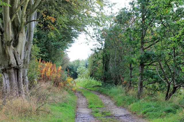
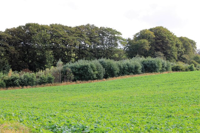
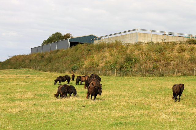
Black Hillock Images

Images are sourced within 2km of 57.428054/-2.3470269 or Grid Reference NJ7937. Thanks to Geograph Open Source API. All images are credited.

Minor road heading to Fyvie Minor road heading south-west towards Fyvie from Monkshill, with the Mother Tap of Bennachie just visible on the horizon.
Minor road heading to Fyvie
Minor road heading south-west towards Fyvie from Monkshill, with the Mother Tap of Bennachie just visible on the horizon.
Copse at Denhill Copse obscuring Denhill Farm, viewed from the roadside to the south-east.
Copse at Denhill
Copse obscuring Denhill Farm, viewed from the roadside to the south-east.
Tyre marks in stubble field Evidence of vehicles in a stubble field near Denhill.
Tyre marks in stubble field
Evidence of vehicles in a stubble field near Denhill.
Rows of bales Bales arranged in rows west of Banks Farm.
Rows of bales
Bales arranged in rows west of Banks Farm.
Give Way to the A947 Approaching the A957 at Newbigging at the end of the unclassified St Johns Wells road.
Give Way to the A947
Approaching the A957 at Newbigging at the end of the unclassified St Johns Wells road.
Winding Road The slightly twisting unclassified road between Newbiggin and Slateheugh shaded by trees.
Winding Road
The slightly twisting unclassified road between Newbiggin and Slateheugh shaded by trees.
Slateheugh through Trees Slateheugh or Slatehaugh in some records was a farm of some 120acres although it was only one storey high. Nearby are other indications of slate working, quarries, Slate Pot in the Ythan and the Den of Slateheugh. Whether the waterwheel came with the farm or not is not recorded.
Slateheugh through Trees
Slateheugh or Slatehaugh in some records was a farm of some 120acres although it was only one storey high. Nearby are other indications of slate working, quarries, Slate Pot in the Ythan and the Den of Slateheugh. Whether the waterwheel came with the farm or not is not recorded.
Den of Slateheugh Running from the farm of Slateheugh to Andewsford the Den has the Burn of Slateheugh as its base.
Den of Slateheugh
Running from the farm of Slateheugh to Andewsford the Den has the Burn of Slateheugh as its base.
Path to the Den A tree lined path leading to the Den of Easter Crichie.
Path to the Den
A tree lined path leading to the Den of Easter Crichie.
Crops by the Den A field by the Den of Easter Crichie.
Crops by the Den
A field by the Den of Easter Crichie.
Ardlogie Farmland Farmland across the Ythan valley near Craigie Dot and East Ardlogie.
Ardlogie Farmland
Farmland across the Ythan valley near Craigie Dot and East Ardlogie.
Den of Crichie The Den with its burn and a windturbine in the region of Denhill farm behind.
Den of Crichie
The Den with its burn and a windturbine in the region of Denhill farm behind.
Crichie Burn The relatively small burn of Crichie as it flows out of the Den to the bridge soon to join the Ythan.
Crichie Burn
The relatively small burn of Crichie as it flows out of the Den to the bridge soon to join the Ythan.
Ythan passes Mill Water The Ythan flowing downstream; the Mill Water joins it just by the second bend of the meander.
Ythan passes Mill Water
The Ythan flowing downstream; the Mill Water joins it just by the second bend of the meander.
River Ythan The Ythan flowing downstream to make a turn north by St. John's well.
River Ythan
The Ythan flowing downstream to make a turn north by St. John's well.
St. John's Ponies Ponies by the farm of St.John's Well.
St. John's Ponies
Ponies by the farm of St.John's Well.
Denhill Farm Denhill with its shelterbelt of trees.
Denhill Farm
Denhill with its shelterbelt of trees.
Denhill Turbine A wind turbine by Denhill Farm, judging by the previous photos in this area this is a fairly recent addition.
Denhill Turbine
A wind turbine by Denhill Farm, judging by the previous photos in this area this is a fairly recent addition.
Show me another place!

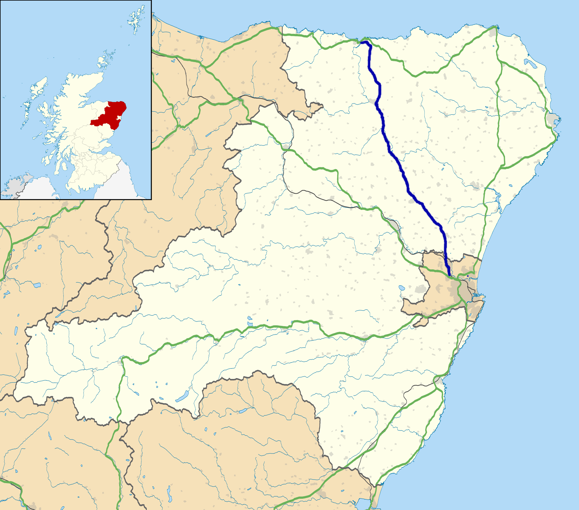
Black Hillock is located at Grid Ref: NJ7937 (Lat: 57.428054, Lng: -2.3470269)

Unitary Authority: Aberdeenshire

Police Authority: North East

What 3 Words

///instilled.searched.curly. Near Rothienorman, Aberdeenshire

Related Wikis

Woodhead, Aberdeenshire

Woodhead of Fyvie, often simply called "Woodhead", is an inland hamlet in Formartine, Aberdeenshire, Scotland, that lies to the east of Fyvie near the...

Backhill

Backhill is a rural area near Woodhead of Fyvie in Aberdeenshire, Scotland. == References ==

A947 road

The A947 is a single-carriageway road in Scotland that links Aberdeen to Banff via several towns in Aberdeenshire, including Newmachar, Oldmeldrum, Fyvie...

Fyvie

Fyvie is a village in the Formartine area of Aberdeenshire, Scotland. == Geography == Fyvie lies alongside the River Ythan and is on the A947 road. �...

Have you been to Black Hillock?

Leave your review of Black Hillock below (or comments, questions and feedback).